webshop.nl
Categorieën
  Sluiten

Meer Borch

Wegenkaart - landkaart USA Interstate | Borch

0
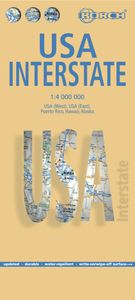
Mooie, overzichtelijke wegenkaart van de snelwegen in Amerika. Handig als je grote afstanden in het land moet afleggen.   Our soft-laminated folded map of the USA in the 9th edition shows: USA West, USA East, Hawaiian Islands, Puerto Rico each 1:4 000 000, Alaska 1:8 000 000, USA administrative & time zones. Borch Maps are easy to fold, durable and...

Webshops met dit product

Webshop
Bezorging
Prijs

Anderen bekeken ook

Wegenkaart - landkaart USA Interstate | Borch
Mooie, overzichtelijke wegenkaart van de snelwegen in Amerika. Handig als je grote afstanden in het land moet afleggen.   Our soft-laminated folded map of the USA in the 9th edition shows: USA West, USA East, Hawaiian Islands, Puerto Rico each 1:4 000 000, Alaska 1:8 000 000, USA administrative & time zones. Borch Maps are easy to fold, durable and water-repellent with a wipeable surface. Borch Maps show hotels, museums, monuments, markets, public transport, top sights and points of interest, useful statistics, conversion charts for temperatures, weights and measurements, climate charts showing temperatures, sunshine hours, precipitation and humidity, overview maps, time zones, and much more...   "Get your motor running, head out on the highway"! The Interstate highway system (officially the "Dwight D. Eisenhower National System of Interstate and Defense Highways") authorized by the Federal Aid Highway Act of 1956 and supported by former US President Eisenhower who had been impressed b…
11,50
Wegenkaart - landkaart Southwest-USA - Zuidwest USA | Borch
Mooie geplasticieerde kaart van het Zuidwesten van de USA. Deze kaart biedt een goed overzicht van het land met detailkaarten.   Our soft-laminated folded map of the American Southwest shows: American Southwest 1:3 000 000, Phoenix 1:20 000, San Francisco Bay Area 1:400 000, San Francisco 1:15 000, Greater Los Angeles 1:250 000, San Diego 1:125 000, San Diego Downtown 1:25 000, Las Vegas - The Strip 1:22 000, Grand Canyon National Park 1:250 000, USA administrative & time zones. Borch Maps show hotels, museums, monuments, markets, public transport, top sights and points of interest, useful statistics, conversion charts for temperatures, weights and measurements, climate charts showing temperatures, sunshine hours, precipitation and humidity, overview maps, time zones, and much more...   From the panoramas of San Francisco and the buzz of megametropolis Los Angeles to the charm of San Diego on the Mexican border - the Californian coast boasts sun, beautiful beaches, stunning scenery and…
11,50
Wegenkaart - landkaart Noordoost USA - Northeast USA | Borch
Mooie geplasticieerde kaart van het Noordoosten van de USA. Deze kaart biedt een goed overzicht van het land met detailkaarten.   Our soft-laminated folded map of Northeast-USA - New York & Great Lakes shows: Northeast USA 1:3 000 000, Greater Boston 1:1 000 000, Central East Coast 1:1 000 000, Boston 1: 14 000, New York City 1:20 000, Washington DC 1:15 000, USA administrative & time zones. Borch maps are easy to fold, durable and water-repellent with a wipeable surface. Borch Maps show hotels, museums, monuments, markets, public transport, top sights and points of interest, useful statistics, conversion charts for temperatures, weights and measurements, climate charts showing temperatures, sunshine hours, precipitation and humidity, overview maps, time zones, and much more...   From Philadelphia's Independence Park to Boston's Freedom Trail, New York's Federal Hall to Washington's Capitol Hill, from the Potomac to the "honeymooners' paradise" of Niagara Falls, New England and the mid…
11,50
Wegenkaart - landkaart Noordwest USA - Northwest USA | Borch
Mooie geplasticieerde kaart van het Noordwesten van de USA. Deze kaart biedt een goed overzicht van het land met detailkaarten. Our soft-laminated map of USA Northwest - USA 1 includes: Pacific Northwest 1:3 000 000, San Francisco 1:15 000, San Francisco Bay Area 1:400 000, San Francisco & Region 1:1 000 000, Seattle 1:13 000 and Greater Seattle 1:350 000, Seattle & Region 1:1 000 000,  Portland 1:20 000, Denver & Region 1:1 000 000, Salt Lake City & Region 1:1 000 000, Yellowstone National Park 1:1 000 000, USA administrative & time zones, interesting statistics, conversion chart for temperatures, weights and measures, climate chart with temperatures, sunshine hours, precipitation and humidity and much more.   The beautiful landscape of Oregon and Washington includes rugged coastline, mountain ranges, lakes, rivers, rich farmland and burgeoning wine country, as well as the magnificent cities of Portland and Seattle with their bustling cosmopolitan flair. While Seattle is renowned as t…
11,50
Wegenkaart - landkaart India Noord | Borch
Mooie geplasticieerde kaart van het noorden van India. Deze kaart biedt een goed overzicht van het land met detailkaarten.   Our soft-laminated folded map of India North shows: India North 1:3 000 000, Delhi 1:30 000, Mumbai 1:30 000, Kolkata 1:30 000, Jaipur 1:30 000, Agra 1:30 000, Varanasi 1:30 000, Amritsar 1:30 000, Jodhpur 1:30 000, Udaipur 1:30 000, Bodhgaya 1:15 000 and India administrative and time zones. Borch maps are easy to fold, durable and water-repellent with a wipeable surface. Borch Maps show hotels, museums, monuments, markets, public transport, top sights and points of interest, useful statistics, conversion charts for temperatures, weights and measurements, climate charts showing temperatures, sunshine hours, precipitation and humidity, overview maps, time zones, and much more...   Northern India is bordered by Pakistan to the west, China, Nepal and Bhutan to the north, and Bangladesh and Myanmar to the east. Hindi and English are the two official languages. After …
11,50
Wegenkaart - landkaart Chile - Chili | Borch
Mooie geplasticieerde kaart van Chili. Deze kaart biedt een goed overzicht van het land met detailkaarten. Our soft-laminated folded map of Chile shows: Northern Chile, Central Chile, Southern Chile & Patagonia 1:2 000 000, Torres del Paine National Park 1:240 000, Robinson Crusoe Island 1:200 000, Easter Island (Rapa Nui) 1:160 000, Punta Arenas, Antofagasta, Iquique 1:15 000, Valparaiso 1:10 000, Arica 1:16 000, La Serena 1:13 000, Vina del Mar 1:22 000, Santiago 1:20 000 and Chile administrative & time zones. Borch Maps are easy to fold, durable and water-repellent with a wipeable surface. Borch Maps show hotels, museums, monuments, markets, public transport, top sights and points of interest, useful statistics, conversion charts for temperatures, weights and measurements, climate charts showing temperatures, sunshine hours, precipitation and humidity, overview maps, time zones, and much more...   The Republic of Chile is a long and narrow coastal strip on the western side of the So…
11,50

Klanten-reviews van Wegenkaart - landkaart USA Interstate | Borch

Er zijn nog geen beoordelingen voor dit productBen jij de eerste die een review plaatst?

Meer over Wegenkaart - landkaart USA Interstate | Borch

Productomschrijving

Mooie, overzichtelijke wegenkaart van de snelwegen in Amerika. Handig als je grote afstanden in het land moet afleggen.   Our soft-laminated folded map of the USA in the 9th edition shows: USA West, USA East, Hawaiian Islands, Puerto Rico each 1:4 000 000, Alaska 1:8 000 000, USA administrative & time zones. Borch Maps are easy to fold, durable and water-repellent with a wipeable surface. Borch Maps show hotels, museums, monuments, markets, public transport, top sights and points of interest, useful statistics, conversion charts for temperatures, weights and measurements, climate charts showing temperatures, sunshine hours, precipitation and humidity, overview maps, time zones, and much more...   "Get your motor running, head out on the highway"! The Interstate highway system (officially the "Dwight D. Eisenhower National System of Interstate and Defense Highways") authorized by the Federal Aid Highway Act of 1956 and supported by former US President Eisenhower who had been impressed by the German Autobahn system, is a network of roadways interconnecting the nation. It was originally intended as part of a national defense system by which goods and arms could be transported cross-country in case of a national emergency. Today the nearly 47 thousand miles (75,000 kilometers) of road are mostly used by vacationers, tourists and commuters. Nowadays it would be unthinkable to get by without the Interstate. From shore to shore, from border to border, the Interstate connects the whole country.

Productspecificaties

Artikelnummer(s)
Brand
Borch
Webshop.nl maakt gebruik van cookies. Ga je verder op onze website, ga dan akkoord met het plaatsen van cookies en de verwerking van deze data door ons en vermelde partners.