webshop.nl
Categorieën
  Sluiten

Meer ITMB

Wegenkaart - landkaart USA Florida & Deep South | ITMB

0
Florida has been unavailable for far too long! We wanted to improve the area of coverage while converting the artwork to a GIS-based digital data base, so the area of coverage now includes Georgia, Alabama, part of Mississippi, and most of the Carolinas. This would be an excellent map to use on the way south (or north) along I-95 or I-85 through At...

Webshops met dit product

Webshop
Bezorging
Prijs

Anderen bekeken ook

Wegenkaart - landkaart USA Florida & Deep South | ITMB
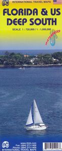
Florida has been unavailable for far too long! We wanted to improve the area of coverage while converting the artwork to a GIS-based digital data base, so the area of coverage now includes Georgia, Alabama, part of Mississippi, and most of the Carolinas. This would be an excellent map to use on the way south (or north) along I-95 or I-85 through Atlanta or Augusta and south to the Gulf Coast. The Panhandle of Florida is on the same side of the sheet, with the second side being devoted to Florida south to the Keys. There isn't enough space to show many insets; just the Orlando area and a Florida map showing population by counties. Another innovation we have introduced is to print the map on waterproof paper, for durability as well as for use as an umbrella during sudden downpours! Legend Includes: Road by classification, motorway, two land road, railway with station, waterway and much more...   Deep South, schaal 1: 1000000 Florida schaal 1: 720000
13,95
Wegenkaart - landkaart South Pacific Cruising & Samoa | ITMB
Een overzichtskaart van de zuidelijke Stille Oceaan met de cruise routes tussen de verschillende eilanden aangegeven. Op de achterzijde een overzichtskaart van Samoa This is a new venture for ITMB. Cruising is a rapidly-growing segment of the travel industry, experiencing double-digit growth rates annually. Obviously, this is a thriving market. In conjunction with several cruise ship lines, we have prepared a map of the South Pacific Ocean, which extends southwards from Hawai'i to the southern tip of New Zealand and eastwards from central Australia/Papua New Guinea to the Pitcairn Islands. Thus, it does not include the popular South East Asia and China coast routes. We think this has to change at a time when 25,000,000 people are travelling by cruise ships. At the same time, we must keep coverage area relevant for those end users of the artwork. Even at 1:12M, most of the area covered is water, with island countries such as Fiji, Tonga, Kiribati, Tahiti, and the Cook Islands being visi…
13,95
Wegenkaart - landkaart USA South - Atlantic States | ITMB
Een degelijke kaart met aanduidingen van o.a. nationale parken, vliegveld, benzinepomp, dirt-roads van de Oosttkust van de USA van Philadelphia tot Florida  . Als overzichtskaart goed te gebruiken. We call the map the Atlantic States guardedly for obvious reasons. First, the northeastern Atlantic States are missing and second, Florida's Caribbean coastline is included. Also, to cover an area so long, we had to go further inland than 'just' the coast, so all of Pennsylvania and West Virginia are included. The area of coverage of side A is Philadelphia/Pittsburg south to Augusta and Charleston. Side B continues south to the southernmost portion of Florida and west to Panama City. Inset maps of Orlando and Miami are included on this side as well. Both road and rail connections are shown, and distances between communities shown. Places of touristic interest are included, albeit suitable to the scale. An extensive place name index is included.  Legend Includes: Roads by classification, Rive…
13,95
Wegenkaart - landkaart Australia South & Northern Territory | ITMB
Australia was one of the first countries ITMB published, back in the 1980s, albeit a licensed version. Our own original artwork was completed in the mid-1990s, but until recently, we have not focused on sectional maps of the country based on individual states. In 2019, we published Brisbane and Queensland, and Sydney and New South Wales. Now, we are issuing the ‘middle’ states of South Australia and Northern Territory to provide better coverage of these important parts of Australia at a better scale than a country map could provide. South Australia can be thought of as having two parts; the fertile farming economy surrounding Adelaide in the south and the much more arid northern portion. The road network in the south tends to be well developed, with paved roads going more or less east-west to NSW and WA. Northerly roads tend to be gravel or dirt, such as the Birdville Track, and the north-westerly roads tend to pass through land ceded to aboriginals and require permits. Northern Territ…
13,95
Wegenkaart - landkaart Tasmania & Victoria | ITMB
Een degelijke wegenkaart van Tasmanie & Victoria, schaal 1:1.800.000, en Tasmanië, schaal 1:800.000 met aanduidingen van o.a. nationale parken, vliegveld, benzinepomp, dirt-roads. Als overzichtskaart goed te gebruiken. The island of Tasmania is Australia’s smallest state, but is packed with touristic delights. Hobart is the capital and a charming Victorian city in the south of the island. Much of the west coast is a large nature preserve with limited access and most development is close to the northern shore, centred on Devonport and its ferry connections with Melbourne, in Victoria State. Tasmania also administers several offshore islands, such as King, Flinders, and Bruny. We have included a Top Attractions listing for the reader to enjoy. The other side of the sheet is the Australian mainland state of Victoria, best known as the home of Melbourne and the beautiful coastal highway to Adelaide. A basic inset map of Melbourne is included, but the focus of the map is on the recreational…
13,95
Wegenkaart - landkaart Mexico Central & Mexico City | ITMB
Goede wegenkaart met duidelijk kleurgebruik. Het betreft een deel van Mexico met op de achterkant een stadsplattegrond van het centrale deel van Mexico City. MC is the largest city in the Western Hemisphere, with a population of 28,000,000 (or twice as big as New York City!). It would be impractical to portray the entire urban area on one map and have it make sense, so we show the portion of greatest interest to visitors, from the Chapultepec Zoological Park in the west to the incredibly busy Tapo Bus Terminal in the east, and from the railway station in the north to the southern east-west motorway just south of the main hospital complex. Much of MC’s touristic interest is concentrated in the Zona Rosa, Reforma, and Zocalo segments of the city centre, and these are shown in detail, noting hotels, major restaurants, shopping areas, and points of interest.   The map also includes inset maps of the San Angel area just north of the university, an inset map of the greater Mexico City Federa…
13,95

Klanten-reviews van Wegenkaart - landkaart USA Florida & Deep South | ITMB

Er zijn nog geen beoordelingen voor dit productBen jij de eerste die een review plaatst?

Meer over Wegenkaart - landkaart USA Florida & Deep South | ITMB

Productomschrijving

Florida has been unavailable for far too long! We wanted to improve the area of coverage while converting the artwork to a GIS-based digital data base, so the area of coverage now includes Georgia, Alabama, part of Mississippi, and most of the Carolinas. This would be an excellent map to use on the way south (or north) along I-95 or I-85 through Atlanta or Augusta and south to the Gulf Coast. The Panhandle of Florida is on the same side of the sheet, with the second side being devoted to Florida south to the Keys. There isn't enough space to show many insets; just the Orlando area and a Florida map showing population by counties. Another innovation we have introduced is to print the map on waterproof paper, for durability as well as for use as an umbrella during sudden downpours! Legend Includes: Road by classification, motorway, two land road, railway with station, waterway and much more...   Deep South, schaal 1: 1000000 Florida schaal 1: 720000

Productspecificaties

Artikelnummer(s)
Brand
ITMB
Webshop.nl maakt gebruik van cookies. Ga je verder op onze website, ga dan akkoord met het plaatsen van cookies en de verwerking van deze data door ons en vermelde partners.