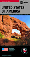
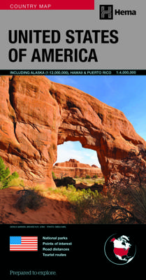
Wegenkaart - landkaart USA deluxe | Hema Maps

0

Verkopers met dit product

Verkoper
Bezorging
Prijs
DeZwerver.nl logo
DeZwerver.nl
2,95
21,95

Anderen bekeken ook

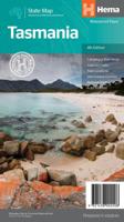
Wegenkaart - landkaart Tasmanië - Tasmania | Hema Maps
Op deze kaart staat Tasmanië in zijn geheel op 1 deel van de kaart. Goede, overzichtelijke, leesbare kaart van het hele eiland. Nationale Parken zijn er goed op te vinden en de afstanden worden weergegeven. Op de achterkant nog deelkaartjes van enkele steden en NP s. The fourth edition of Hema’s Tasmania State Map features Hema’s distinctive and informative maps fully, all of which have been field checked by Hema’s Map Patrol to ensure the best possible accuracy with the latest mapping data.    A fully indexed state map of Tasmania (TAS) at a scale of 1:500,000. Marked on the mapping are national parks, fuel locations as well as camping and rest areas.    The reverse side consists of:   a summary of the key things to see and do broken up into the North West, Launceston, Tamar and the North a table listing of National Parks and Reserves with key features and facilities (such as Camping and Caravan sites, BBQ, toilets and showers) Visitor centre listing Map of the area around Zeehan…
17,50
Wegenkaart - landkaart Australia - Australië | Hema Maps
Mooie, grote, duidelijke kaart van Australië met veel informatie. Oa bezinestations (ook in de outback) en een goed overzicht van de doorgaande (grote) wegen waardoor de kaart erg handig is van het plannen van uw route. Ook staan er afstanden op vermeld.   Verder staan er stadkaartjes op van het (centrum) van de belangrijkste Australische steden:   Adelaide, Brisbane, Canberra, Darwin, Hobart, Melbourne, Perth en Sydney   Hema’s iconic large map of Australia is ideal as a trip planning tool and travel companion. Marked on the map are localities, the major road network, distances and major national parks. The map also shows localities, the major road network, distances and major national parks. The visual appeal makes it perfect as a decorative map or an educational tool. On the reverse side is an overview of Australia's iconic touring regions featuring history, geology and landforms, nature, bucket-list attractions and iconic 4WD tracks.   Key Features Hema's iconic map of Austra…
17,50
Wegenkaart - landkaart Queensland state map | Hema Maps
Goede, overzichtelijke, leesbare kaart van de hele provincie. Nationale Parken zijn er goed op te vinden en de afstanden worden weergegeven. Op de achterkant nog deelkaartjes van enkele steden en NP s. A state map of Queensland accompanied by touring information and relevant regional and city maps. Marked on the map are national parks, points of interest, 24-hour fuel as well as camping and rest areas. On the reverse are maps of the Gold Coast, South East Queensland and Tropical North Queensland as well as CBD and throughroads maps of Brisbane. There is a full index included, as well as all national park information. Features: Points of interest 24-hour fuel National parks Camping areas Rest areas Fully indexed Comprehensive road detail Road identification numbering Scenic photographs
17,50
Wegenkaart - landkaart Adelaide and Region | Hema Maps
Mooie, duidelijk kaart van Adelaide en de omgeving van Adelaide. Schaal: deels 1:80.000 en deels 1:270000 Great for use in the car, Hema's State Maps clearly show highways, minor and secondary roads, national and state routes and fully-indexed cities, towns and localities. Detailed road distances are also shown. All of the maps are double-sided and come in an easy-to-fold format. They are all also available with a deluxe cover (celloglazed cardboard).
14,50
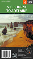
Wegenkaart - landkaart Melbourne to Adelaide | Hema Maps
Detailkaart van een deel van Australië. Zeer goed leesbaar, met naast de topografische details veel symbolen waarmee allerhande toeristische zaken worden aangeduid als campsites, nationale parken, attracties, wandelmogelijkheden etc. This touring map traverses Australia from Melbourne to Adelaide (1:900,000) and features an inset map of the Great Ocean Road (1:450,000). The latter map pinpoints significant locations along the route with tourist information attached and is accompanied by other useful information to illuminate the journey. Through-road maps of Melbourne to Adelaide are also included. Key Features City maps 24-hour fuel Camping areas Distance charts Tourist attractions Roadside rest areas
14,50
Wegenkaart - landkaart Melbourne to Sydney | Hema Maps
Detailkaart van een deel van Australië. Zeer goed leesbaar, met naast de topografische details veel symbolen waarmee allerhande toeristische zaken worden aangeduid als campsites, nationale parken, attracties, wandelmogelijkheden etc. A city to city map that stretches from Melbourne to Sydney (1:900,000) that is accompanied by through-road maps of Sydney and Melbourne. There is comprehensive tourist information for the trip via the Hume and Princes highways, going from Melbourne to Wodonga, Albury to Yass and Yass to Sydney.   Key Features  City maps 24-hour fuel Camping areas Distance charts Tourist attractions Roadside rest areas
17,50
Wegenkaart - landkaart New South Wales | Hema Maps
Erg mooie, handige en uitgebreide kaart van New South Wales. Great for travel planning, Hema's New South Wales state map clearly shows highways, minor and secondary roads, national and state routes and fully-indexed cities, towns and localities. Detailed road distances are also shown.   The flipside of the map features loads of insets covering various bits and pieces throughout New South Wales including a Sydney CBD and throughroads map, a Canberra CBD map, a Sydney region map, a map of the Blue Mountains National Park and a map of the area betwwen Katoomba and Wentworth Falls. There's also a list of information centres giving their address, phone number and website.   The map features:   Camping areas Rest areas 24 hour fuel locations Outback fuel stops Caravan parks National parks A full index Points of interest A distance grid
17,50

Klanten-reviews van Wegenkaart - landkaart USA deluxe | Hema Maps

Er zijn nog geen beoordelingen voor dit productBen jij de eerste die een review plaatst?

Meer over Wegenkaart - landkaart USA deluxe | Hema Maps

Verken gerelateerde categorieën

Webshop.nl maakt gebruik van cookies. Ga je verder op onze website, ga dan akkoord met het plaatsen van cookies en de verwerking van deze data door ons en vermelde partners.