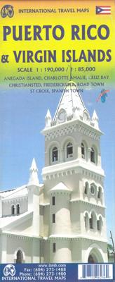
Wegenkaart - landkaart US Virgin Islands & Puerto Rico | ITMB

0
Puerto Rico: schaal 1:190.000 US Virgin Islands: schaal 1:50.000   We are really pleased with this new edition of Puerto Rico. We spent part of August, 2020, touring the island and geo-referencing its many highways. The island is bigger and more densely road-networked than we thought, so we'll have to complete the job on our next visit, but the ro...

Verkopers met dit product

Verkoper
Bezorging
Prijs
DeZwerver.nl logo
DeZwerver.nl
2,95
13,95

Anderen bekeken ook

Nieuw
Wegenkaart - landkaart Virgin Islands - Maagden eilanden | Borch
The soft-laminated map of the Virgin Islands includes: US Virgin Islands 1:80 000, St. Croix 1:80 000, Charlotte Amalie 1:15 000, Charlotte Amalie Historic District 1:7 500, Cruz Bay 1:15 000, Christiansted, Frederiksted 1:15 000, British Virgin Islands 1:80 000, Anegada 1:80 000, Road Town, The Valley (Spanish Town) 1:15 000, Lesser Antilles 1:7 000 000, Virgin Islands administrative / time zones; interesting statistics British / US Virgin Islands: conversion chart for temperatures, weights and measures; climate chart with temperatures, sunshine hours, precipitation and humidity; hotels, museums, markets and much more.   Virgin Islands is the name of two groups of small islands east of Puerto Rico which form the Virgin Islands archipelago. They lie between the Caribbean Sea and the Atlantic Ocean. One of the groups which consists of St. Croix, St. John and St. Thomas islands, together with many nearby islets, is called the U.S. Virgin Islands. The other group including Anegada, Jost …
11,50
Nieuw
Wegenkaart - landkaart South Pacific Cruising & Samoa | ITMB
Een overzichtskaart van de zuidelijke Stille Oceaan met de cruise routes tussen de verschillende eilanden aangegeven. Op de achterzijde een overzichtskaart van Samoa This is a new venture for ITMB. Cruising is a rapidly-growing segment of the travel industry, experiencing double-digit growth rates annually. Obviously, this is a thriving market. In conjunction with several cruise ship lines, we have prepared a map of the South Pacific Ocean, which extends southwards from Hawai'i to the southern tip of New Zealand and eastwards from central Australia/Papua New Guinea to the Pitcairn Islands. Thus, it does not include the popular South East Asia and China coast routes. We think this has to change at a time when 25,000,000 people are travelling by cruise ships. At the same time, we must keep coverage area relevant for those end users of the artwork. Even at 1:12M, most of the area covered is water, with island countries such as Fiji, Tonga, Kiribati, Tahiti, and the Cook Islands being vis…
13,95
Nieuw
Wegenkaart - landkaart Tahiti - French Polynesia | ITMB
Anyone who has visited Tahiti retains fond memories of a wonderful Polynesian paradise. This map shows the major islands of French Polynesia as a series of large insets on Side 1. An overall inset map showing the many islands is also shown, but for showing detail, one must expand the individual islands. The largest one is the volcanic Tahiti Nui, with the capital city of Pape’ete (or Papeete in English), for which a detailed inset map is included. Most visitors stay in the vicinity of Papeete, along the coast. We show several popular resorts. There is a good circular road around the island’s shoreline, but no roads in the interior. The island is joined to another, called Tahiti Iti, or Little Tahiti, and roads extend partway around this less-developed part of the combined island. Most of the other islands are rarely visited, although they have resorts, beaches, and a lifestyle of their own. Names like Huahine, Riatea, Tahaa, and Maiao may not be as familiar as they should be, but all …
14,95
Nieuw
Wegenkaart - landkaart Cayman Islands (Kaaiman Eilanden) & Jamaica | ITMB
Een degelijke kaart met aanduidingen van o.a. nationale parken, vliegveld, benzinepomp, dirt-roads en kleine plattegrond van verschillende steden. Als overzichtskaart goed te gebruiken. De kaart is aan twee zijden bedrukt, de ene zijde omvat de Cayman Islands (schaal 1:37.500 en 1:70.000). Op de andere zijde staat de kaart van Jamaica (schaal 1:250.000) en plattegronden van onder andere Kingston. We are pleased to announce the latest new Caribbean map to our growing series. The Caymans, for there are three major islands and numerous little shoals, remains a British colony, like the British Virgin Islands, the Turks and Caicos, and Bermuda. Tourism is the number one industry of the Cayman Islands, with dozens of hotels dotting the beachfronts, especially north of George Town. There are numerous dive sites for viewing tropical fish and we have shown about a hundred on the map, as well as every side street and gas station. One interesting place to visit is Hell, which is a frozen lava er…
13,95
Nieuw
Waterkaart Caribbean Cruising | ITMB
The Caribbean Sea is one of the most popular cruising destinations in the world. This colourful double-sided map starts just north of Orlando/Tampa in order to show the northernmost Bahamian islands and south as far as the Panama Canal at Colon and the coast of Venezuela. The map shows good detail for each island and the legal boundaries of each island nation. Side 1 concentrates on the western Caribbean, essentially the Bahamas, Cuba, Jamaica, and the Cayman Islands. Here’s a fun fact most of you won’t know: tiny Navassa Island between Haiti and Jamaica is claimed by both the USA and Haiti! Side 2 concentrates on the eastern islands of the Caribbean, such as Hispaniola (Haiti and the Dominican Republic), Puerto Rico and the US and British Virgin Islands, Turks & Caicos, and the Lesser Antilles chain of island countries, such as Antigua, Guadeloupe, Barbados, and Trinidad/Tobago, among others. Coverage then extends westward along the Venezuelan coastline to include the Dutch possessio…
14,95
Nieuw
Wegenkaart - landkaart Bermuda | ITMB
Een degelijke kaart met aanduidingen van o.a. nationale parken, vliegveld, benzinepomp, dirt-roads. Als overzichtskaart goed te gebruiken. Bermuda is a lovely mid-Atlantic island far off the coast of South Carolina. It is full of colonial architecture and an ‘island’ way of life. Tourism is a key ingredient of the colony’s lifeblood and the island is very popular with cruise ships. There is ample accommodation for longer-term visitors, good roads, and much history. The airport was built by the US Navy during WW2 and is still a US Naval Air Station, but shares the runway with civil aviation. The map includes an excellent inset of St. George’s, which still has its stocks close to the town hall, and another of Hamilton, the capital. This is where most cruise ships dock. For those with the time, the map shows the Railway Trail along the former route of the island’s now-defunct rail line. Lots to see; lots to do!   Map size: 27*39"   Legend Includes: Roads by classification, Rivers and Lak…
13,95
Nieuw
Wegenkaart - landkaart 92G Lower Mainland British Columbia - Richmond and New Westminster | ITMB
Goede wegenkaart van British Columbia met topografische uitsnede van Richmond en Westminster. Topographic/Recreation Map 92G&92G2 and G3 - With the 2010 Winter Olympics bearing down on us, this very timely map presents a lovely regional map showing all of the Olympic venues (the Games are being held in Vancouver, Richmond, UBC, Whistler, and the Callaghan Valley – not just in Vancouver). The area of coverage is from Everett (just north of Seattle) in the USA to north of Pemberton, and from Victoria in the west to Chilliwack in the east on the one side, and a detailed 1:50,000 topo map of the Richmond/New Westminster/Surrey/Langley outer urban areas of Metro Vancouver. Both maps are Government of Canada NTS maps, overlaid with touristic and recreational information by ITMB, which holds the copyright on behalf of the Queen (I love being able to say that). The Lower Mainland portion is particularly useful, in that it includes the east coast of Vancouver Island, from Victoria to Nanaimo a…
13,95
Nieuw
Wegenkaart - landkaart Jersey - Guernsey - Sark - Alderney (Kanaaleilanden) | ITMB
Goede detailkaart van alle kanaaleilanden. Het is zo gedetailleerd dat zelfs straatnamen er op staan. De kaart is ook nog eens geplastificeerd en daarmee scheur- en watervast.  ITMB is pleased to re-introduce the Channel Islands map area after a lengthy hiatus of preparing new artwork. The first version of this part of Europe was licensed artwork by a local firm in Jersey, and upon running out of copies of the printed map, we opted to prepare fresh artwork of our own to continue this interesting corner of the continent to continue to be available. The islands, collectively known in English as the Channel Islands, are one of those anomalies that make Europe so attractive. They are part of Great Britain, but not part of the UK; hence, they are not part of the EU. They are self-governing entities ‘owned’ by the Queen in her role of being Duchess of Normandy. This is, of course, merely a hereditary situation, but the islands were the personal possessions of William the Conqueror in 1066, …
14,50
Nieuw
Wegenkaart - landkaart Tasmania & Victoria | ITMB
Een degelijke wegenkaart van Tasmanie & Victoria, schaal 1:1.800.000, en Tasmanië, schaal 1:800.000 met aanduidingen van o.a. nationale parken, vliegveld, benzinepomp, dirt-roads. Als overzichtskaart goed te gebruiken. The island of Tasmania is Australia’s smallest state, but is packed with touristic delights. Hobart is the capital and a charming Victorian city in the south of the island. Much of the west coast is a large nature preserve with limited access and most development is close to the northern shore, centred on Devonport and its ferry connections with Melbourne, in Victoria State. Tasmania also administers several offshore islands, such as King, Flinders, and Bruny. We have included a Top Attractions listing for the reader to enjoy. The other side of the sheet is the Australian mainland state of Victoria, best known as the home of Melbourne and the beautiful coastal highway to Adelaide. A basic inset map of Melbourne is included, but the focus of the map is on the recreationa…
13,95
Nieuw
Wegenkaart - landkaart Guam - West Pacific Cruising | ITMB
Een degelijke kaart met aanduidingen van o.a. nationale parken, vliegveld, benzinepomp, dirt-roads. Als overzichtskaart goed te gebruiken. Certainly, this is the only map of Guam by any major cartographic publishing house. Here are some details: Guam is a north-south island considerably north of New Guinea, and forms part of the American-held group of islands known as the Northern Marianas. Its capital is Hagatna, and the main town is called Tamuning. The island has a well-developed international airport in the middle portion of the island, with a large US military airbase in the northeast corner. The vast majority of the island is touristic, and well worth a visit. The island was "discovered" by Ferdinand Magellan in 1521, and Hagatna is the oldest "European" city in the Pacific, dating from 1686. The town of Inarajan retains a decidedly Spanish appearance to this day. Other attractions include Tumon Beach and its many resorts, the Piti Underwater Observatory, and the famous Cocos Is…
13,95

Klanten-reviews van Wegenkaart - landkaart US Virgin Islands & Puerto Rico | ITMB

Er zijn nog geen beoordelingen voor dit productBen jij de eerste die een review plaatst?

Meer over Wegenkaart - landkaart US Virgin Islands & Puerto Rico | ITMB

Productomschrijving

Puerto Rico: schaal 1:190.000 US Virgin Islands: schaal 1:50.000   We are really pleased with this new edition of Puerto Rico. We spent part of August, 2020, touring the island and geo-referencing its many highways. The island is bigger and more densely road-networked than we thought, so we'll have to complete the job on our next visit, but the roads are now much more precisely shown accurately than was possible before satellite imagery. The map looks great on an Ipad screen as well. The map also shows updated inset maps of San Juan, Ponce, Mayaguez, Aguadilla, and Arecibo. Puerto Rico is part of the United States, so has all the benefits, but is internally self-governing. With this edition we are including a map of the other US colonial territory, the US Virgin Islands. The Danish West Indies was purchased from Denmark in 1917 and is an integral part of the USA, with all its benefits, but is, like Puerto Rico, neither fish nor fowl. It is internally self-governing and a great retirement location for Americans, but it retains much of its Danish heritage. The map includes insets of Charlotte Amalie, Frederiksted, Cruz Bay, and Christiansted. The ITMB map of the entire Virgin Islands area will continue to be marketed separately; this version is mostly for the convenience of cruise ship passengers visiting both 'countries'.   Legend Includes: Roads by classification, Main highways, Secondary roads, Ferry routes, Lakes and big rivers, Airports, Hotels, Churches, Viewpoints, Zoos and much more...

Verken gerelateerde categorieën

Webshop.nl maakt gebruik van cookies. Ga je verder op onze website, ga dan akkoord met het plaatsen van cookies en de verwerking van deze data door ons en vermelde partners.