webshop.nl
Categorieën
  Sluiten

Meer ITMB

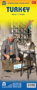
Wegenkaart - landkaart Turkije - Turkey | ITMB

Turkey is a fascinating country; so much potential, and seemingly unable to focus on progress as opposed to ideology. Touristically, the country is quite safe, but internal politics are as divided here as in Egypt (and seemingly every Muslim country) between secularists (if it is proper to call them that) who want a 'normal' country with a division...
13,95

Webshops met dit product

Webshop
Bezorging
Prijs

Anderen bekeken ook

Wegenkaart - landkaart Turkije - Turkey | ITMB
Turkey is a fascinating country; so much potential, and seemingly unable to focus on progress as opposed to ideology. Touristically, the country is quite safe, but internal politics are as divided here as in Egypt (and seemingly every Muslim country) between secularists (if it is proper to call them that) who want a 'normal' country with a division between secular and religious affairs and those wanting a more traditional religious society where religious values shape the society. Our first edition sold out in a little more than a year, which is pretty amazing in itself, and we have made major improvements to this edition to maintain its popularity. The biggest change is that we have more strongly emphasized the major road network, as most visitors stay on the well-travelled routes around the country, rather than taking back roads to small villages. The second change has been to increase the font size for major urban areas, to make them easier to read. Turkey is a very large country ge…
13,95
Wegenkaart - landkaart West Turkije - Turkey west | ITMB
Turkey is a big country. Most visitors concentrate on Istanbul and the Izmir Coast, which is a shame as there are so many other interesting parts of the country to visit. This map covers the western third of the country as a double-sided map, covering from the Greek/Bulgarian border south to the Mediterranean and east to Eregli and Antalya in the east. Naturally, at a better scale, roads and road conditions can be shown to better advantage, and the ferry routes from Istanbul make more sense. The topography is now showing as contouring more easily, and we have been able to add the next layer of villages. The scale is still not appropriate for showing minor roads and tracks, but we have included as many as we feel we can. The map is printed on durable plastic paper, so will stand up to the rigours of travel quite well. A basin inset map of Istanbul has been included as well.   Legend Includes: Road by classification, Motorways, Multilane Hwy, Main Roads, Rail Ways, Ferry Routes, National…
13,95
Wegenkaart - landkaart Egypt & Cairo | ITMB
Following the so-called Arab spring of a few years ago, northern Africa experienced much turbulence. Egypt experienced the overthrow of the government, the installation of a radical religious-oriented replacement, and the installation of military governance. Tourism plummeted. Most map publishers discontinued their maps of the country. Five years later, Egypt has stabilized and tourism is growing. We feel that the time is right to re-introduce our ITMB map of Egypt. This version focuses on the portions of the country that have been re-opened for tourism, which means from the Mediterranean coastline south to the Aswan Dam. The portion further south remains closed for the moment, as is the border crossing with Sudan. We have also been forced to leave off the Great Sand Sea and the Western Desert portions for the same reason of unrest, as the border areas with Libya remain very unstable. However, we have provided a large inset map of Egypt, covering everything, in the area of desert. We h…
13,95
Wegenkaart - landkaart Canada | ITMB
Een degelijke kaart met aanduidingen van o.a. nationale parken, vliegveld, benzinepomp, dirt-roads en kleine plattegrond van hoofdstad. Well, it’s about time, eh?!? ITMB, after only thirty years on the go, finally gets around to publishing a map of Canada. When we first started mapping, there was a pressing need for good maps of Central and South America, then of Africa, then etc etc and we never found time to concentrate on our own country until fairly recently. This map was prepared by Natural Resources Canada and is, as a result, as accurate a map as one could hope to have. We are very proud of it, and very pleased to be able to use such top-rate cartography. The map covers all of the land mass of Canada, from its southernmost point to the top of Ellesmere Island and from the Atlantic coast to the Pacific. It’s an excellent map, but I’m going to give one proviso. Canada is the second-largest country on the face of the planet and there is no way that a single-sided sheet can portray …
13,95
Wegenkaart - landkaart Afghanistan | ITMB
Een degelijke kaart met aanduidingen van o.a. nationale parken, vliegveld, benzinepomp, dirt-roads en kleine plattegrond van hoofdstad. Als overzichtskaart goed te gebruiken. Legend Includes: Roads by classification, silk road, airports, towns, villages, ruins, national parks, lakes, swamps, points of interest and other information It is a bit difficult to credit Afghanistan having touristic potential at the moment, but it is an extremely important country right now, and that justifies a very good map of the country. This is our third edition of this country and each one keeps getting better. We can’t justify sending a researcher into a combat zone to gather data, but we are thankful to those aid workers and soldiers who have added to our information base and helped make this map more useful. In this edition, we are showing some new roads, reflecting the reality that the country is succeeding in improving its infrastructure in spite of a very tense political situation. We have also pla…
13,95
Wegenkaart - landkaart Namibië | Infomap
Another InfoMap classic – now in its 13th edition and highly recommended!   Famous for its Namib desert, the oldest desert in the world, which straddle the western shore along the Atlantic, Namibia is country of intense beauty and seemingly unlimited space. It is a photographer’s paradise. Watch the afternoon shadows add drama to the dunes at Sossusvlei, walk through the ghost town of Kolmanskop, hike the Fish River Canyon, see the lunar landscape and Quiver trees near Keetmanshoop, experience a world transformed when the Etosha pan fills with water, or look out for the endangered cheetah of which Namibia has the highest population left in Africa.   The country is a hugely popular tourist destination that offers endless possibilities to travellers throughout all budgets and travel requirements. Tourism is one of the country’s main economic activities, with around one million tourists visiting Namibia each year. Given that the country’s population currently sits somewhere around 2 milli…
15,95
Wegenkaart - landkaart Slovenie - Slovenia & Croatian coast | ITMB
ITMB have visited Slovenia several times and find it to be an interesting and scenic part of Europe with modern and well-maintained hotels, restaurants and roads, with prices being much more affordable than in neighbouring countries to the west. As the country is not particularly large, we have limited our country coverage to one side of the sheet, with a detailed inset map of Ljubljana. The other side is a lovely map of the Dalmatian Coast. Now that Croatia is part of the EU, border limitations with the rest of western Europe have been removed and driving from Italy or Slovenia southward towards Dubrovnik is easy. The map shows the Pula Peninsula, the coastal islands of Cres, Brac, and Havar, and resort communities such as Zadar, Split, and medieval Dubrovnik. The new coastal motorway is mostly complete, but political difficulties are forcing an expensive tunneling project to by-pass part of Bosnia. Once completed, the highway will stretch to the Montenegrin border and become a major …
13,95

Klanten-reviews van Wegenkaart - landkaart Turkije - Turkey | ITMB

Er zijn nog geen beoordelingen voor dit productBen jij de eerste die een review plaatst?

Meer over Wegenkaart - landkaart Turkije - Turkey | ITMB

Productomschrijving

Turkey is a fascinating country; so much potential, and seemingly unable to focus on progress as opposed to ideology. Touristically, the country is quite safe, but internal politics are as divided here as in Egypt (and seemingly every Muslim country) between secularists (if it is proper to call them that) who want a 'normal' country with a division between secular and religious affairs and those wanting a more traditional religious society where religious values shape the society. Our first edition sold out in a little more than a year, which is pretty amazing in itself, and we have made major improvements to this edition to maintain its popularity. The biggest change is that we have more strongly emphasized the major road network, as most visitors stay on the well-travelled routes around the country, rather than taking back roads to small villages. The second change has been to increase the font size for major urban areas, to make them easier to read. Turkey is a very large country geographically and there is no way cartographically to overcome the spatial relationships of the east-west stretch to the north-south relative shortness. If we have erred, it is on the side of detail, but for anyone driving around the country, such detail is essential.    Legend Includes: Roads by classification, Railways, Feery routes, Dams, Gas stations, Airports, Border crossings, National parks, Churches, church ruins, Monasteries, Mosques, Palaces or castles, Mountain peaks, Monuments, Waterfalls, Caves, Ruins, Campsites, Hotels, Motels, Youth hostels, Viewpoints, Points of interest and much more...

Productspecificaties

Artikelnummer(s)
Brand
ITMB
Webshop.nl maakt gebruik van cookies. Ga je verder op onze website, ga dan akkoord met het plaatsen van cookies en de verwerking van deze data door ons en vermelde partners.