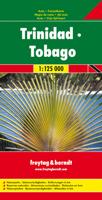
Wegenkaart - landkaart Trinidad & Tobago | Freytag & Berndt

0
Goede gedetailleerde wegenkaart van Trinidad & Tobago. Met natuurparken, Bezienswaardigheden. De afstand worden aangegeven in kilometers. Very clear map of the two islands with road information and place names easy to read. The map has the same geographic content as that published by Rough Guides, but with different colouring and the presentation ...

Verkopers met dit product

Verkoper
Bezorging
Prijs
DeZwerver.nl logo
DeZwerver.nl
2,95
14,95

Anderen bekeken ook

Wandelkaart - Wegenkaart - landkaart Liparische eilanden | Freytag & Berndt
Gedetailleerde wegenkaart en wandelkaart (géén wandelroutes ingetekend!) met uitgebreide legenda en plaatsnamenregister. Meer wegenkaart dan wandelkaart. Aeolian (Lipari) Islands at 1:20,000 from Freytag & Berndt on a double-sided map which presents on the reverse coverage of Italy south of Rome at 1:600,000 and shows ferry access to the islands from the mainland or Sicily.   On one side the islands are shown in a series of panels, with the three largest: Salina, Lipari and Vulcano together, and Alicudi, Filicudi, Panarea and Basiluzzo plus Stromboli as separate insets. Topography is shown by contours at 50m intervals enhanced by relief shading, with names of peaks, valleys, etc. All place names are in large, easy to read print.   Road network includes country tracks and a selection of hiking paths. Various places of interest and facilities are highlighted, including beaches, marinas, campsites, etc. Each individual inset has latitude and longitude lines at intervals of 1’.   Ferry po…
14,95
Wegenkaart - landkaart Dalmatische Kust | Freytag & Berndt
Uitstekende tweezijdige wegenkaart van een  groot deel van de Dalmatische kust van Kroatie. Zeer gedetailleerde kaart met topografische details, maar ook campings. Ideaal om deze eilanden per boot of auto / fiets te ontdekken. Alle bezienswaardigheden staan zeer goed aangegeven. Met register en enkele stadsplattegronden. Dalmatian Coast "Top 10 Tips" Map at 1:150,000 from Freytag & Berndt with a booklet containing an index, brief descriptions of region’s 10 most popular destinations, plus street plans of Dubrovnik’s Old Town and central Pula, Rijeka, Split, Sibenik and Zadar.   The map is double-sided and presents the region in three sections, as indicated on our area coverage image (NB. Istrian Peninsula is included). Topography is shown by relief shading with spot heights, with plenty of names of mountain and hill chains, etc. National parks and other protected areas are clearly marked.    Road network includes small local roads and selected cart tracks, and indicates motorway servi…
14,95
Wegenkaart - landkaart Deutschland - Duitsland | Freytag & Berndt
Gedetailleerde, eenzijdige landkaart van de Duitsland. De berijdbare wegen zijn goed weergeven, zowel de hoofdwegen als provinciale en lokale wegen; wegnummers worden vermeld. Afstanden tussen plaatsen zijn in kilometers op de kaart ingetekend, daarnaast worden ook op belangrijke plekken benzinepompen gemarkeerd. In het kaartbeeld wordt door middel van schaduw het reliëf weergegeven en soms enkele punten in het landschap met de daadwerkelijke hoogte. Provinciegrenzen zijn goed terug te vinden, nationale parken en reservaten ook. Met allerhande symbolen worden toeristische bezienswaardigheden weergegeven als monumenten, historisch belangrijke plekken en uitzichtpunten. In bepaalde plaatsen zijn hotels en campings te vinden, luchthavens, treinverbindingen en havens vindt u er ook op! Germany at 1:700,000 on a large, single-sided road map from Freytag & Berndt, with a separate extensive index booklet listing locations with postcodes and providing street plans of 18 town centres in the co…
14,95
Wegenkaart - landkaart Ierland | Freytag & Berndt
Goede tweezijdige wegenkaart van het hele land. Met register en enkele stadsplattegronden.   De berijdbare wegen zijn goed weergeven, zowel de hoofdwegen als provinciale en lokale wegen; wegnummers worden vermeld. Afstanden tussen plaatsen zijn in kilometers op de kaart ingetekend, daarnaast worden ook op belangrijke plekken benzinepompen gemarkeerd.   In het kaartbeeld wordt door middel van schaduw het reliëf weergegeven en soms enkele punten in het landschap met de daadwerkelijke hoogte. Provinciegrenzen zijn goed terug te vinden, nationale parken en reservaten ook. Met allerhande symbolen worden toeristische bezienswaardigheden weergegeven als monumenten, historisch belangrijke plekken en uitzichtpunten. In bepaalde plaatsen zijn hotels en campings te vinden, luchthavens, treinverbindingen en havens vindt u er ook op!Explore Ireland with this Freytag & Berndt double-sided road map. The best way to plan your trip, prepare your itinerary, and to travel independently in this country. …
14,95
Wegenkaart - landkaart Niederösterreich | Freytag & Berndt
Uitstekende overzichtskaart, tweezijdig, met register, met veel details, alle berijdbare wegen etc.    Top 10 Tips" Map in a series of detailed road maps at 1:150,000 from Freytag & Berndt, covering popular tourist regions of Italy and highlighting each area's top 10 sights, all with brief descriptions in the accompanying booklets which also provide street plan(s) of main town(s) in the region.   Relief is portrayed by hill-shading without distracting from other detail. Road network shows minor roads and selected cart tracks, and includes information indispensable for happy holiday driving: motorway service stations and motels, gradients on steep roads, restricted entry for cars or caravans and seasonal closures, routes not recommended for caravans, scenic roads and special tourist routes, etc. Railways, cable cars, and ferry connections also shown, as well as selected long--distance hiking trails.   Picturesque towns are highlighted and 10 selected places of interest are prominently …
14,95
Wegenkaart - landkaart Thailand | Freytag & Berndt
Gedetailleerde, tweezijdige landkaart van Thailand, prima geschikt voor planning en rondtrekken over alle eilanden. De berijdbare wegen zijn goed weergeven, zowel de hoofdwegen als provinciale en lokale wegen; wegnummers worden vermeld. Afstanden tussen plaatsen zijn in kilometers op de kaart ingetekend, daarnaast worden ook op belangrijke plekken benzinepompen gemarkeerd. In het kaartbeeld wordt door middel van schaduw het reliëf weergegeven en soms enkele punten in het landschap met de daadwerkelijke hoogte. Provinciegrenzen zijn goed terug te vinden, nationale parken en reservaten ook. Met allerhande symbolen worden toeristische bezienswaardigheden weergegeven als monumenten, historisch belangrijke plekken en uitzichtpunten. In bepaalde plaatsen zijn hotels en campings te vinden, luchthavens, treinverbindingen en havens vindt u er ook op! Thailand on a large, double-sided, indexed road map from Freytag & Berndt, with clear presentation of the countrys road network, its topography, …
14,95
Wegenkaart - landkaart Sudan and South Sudan | Gizi Map
Sudan and South Sudan as separate countries on an excellent indexed map at 1:2,500,000 from Gizi Maps with detailed presentation of the topography, administrative divisions, street plans of Khartoum and Juba, etc. Excellent presentation of the terrain in the publisher’s characteristic style provides a vivid picture of the region’s geography: bold altitude colouring with plenty of spot heights and names of peaks, mountain ranges, etc, plus additional graphics for flood plains, swamps, salt flats, deserts, lava fields, wadis and water wells. National parks or other protected areas and interesting natural sites are highlighted. The map indicates the boundary of the disputed Abyei area and shows the internal administrative boundaries and names of the provinces. Within North Sudan names of larger towns and of the provinces are also given in Arabic. Where appropriate, alternative versions of town names are provided (Khartoum/Al Khartum, Omdurman/Umm Durman, etc). The map shows the road n…
15,95
Wegenkaart - landkaart Dolomiti - Dolomieten - Lago di Garda - Venezia | Tabacco Editrice
Dolomites – Lake Garda - Venice region of north-eastern Italy on a road map at 1:200,000 from Tabacco with excellent presentation of the topography derived from the publishers’ highly regarded and popular hiking maps, plus on the reverse a panorama drawing of the mountains. Coverage extends from the Austrian border southwards to the A4 motorway including the whole of Lake Garda, Verona, Padua and Venice, plus east to Lienz/Pordenone.   The map provides a very clear picture of the region’s landscape through graphic relief for its exposed rocky areas, plus relief shading and contours at 100m intervals, and has plenty of names of individual groups, peaks, valleys, etc. Additional colouring indicates woodlands and boundaries of national parks and other protected areas are marked. Minor roads are drawn without generalizing their course, showing the twists and turns across the mountainous terrain. Driving distances are marked on main and many connecting routes. Railway lines are shown with …
9,95
Wegenkaart - landkaart Südtirol Alto Adige - Dolomiti - Zuid Tirol - Dolomieten | Tabacco Editrice
Heel duidelijke wegenkaart van Zuid Tirol. De kaart is goed leesbaar met mooie kleurstellin waardoor goed duidelijk wordt hoe en waar de bergbieden en nationale parken liggen.  The South Tyrol region of north-eastern Italy on a durable, waterproof and tear-resistant road map at 1:150,000 from Tabacco with excellent presentation of the topography derived from the publishers’ highly regarded and popular hiking maps, plus on the reverse a panorama drawing of the mountains. Coverage extends from the Austrian border to just past Trento and Feltre, and west/east from Bormio to well east of Belluno.   The map provides a very clear picture of the region’s landscape through graphic relief for its exposed rocky areas, plus relief shading and contours at 100m intervals, and has plenty of names of individual groups, peaks, valleys, etc. Additional colouring indicates woodlands and boundaries of national parks and other protected areas are marked. Minor roads are drawn without generalizing their c…
12,50
Wegenkaart - landkaart 33 Burgenland - Oostenrijk | Freytag & Berndt
Uitstekende overzichtskaart, tweezijdig, met register, met veel details, alle berijdbare wegen etc.    Top 10 Tips" Map in a series of detailed road maps at 1:150,000 from Freytag & Berndt, covering popular tourist regions of Italy and highlighting each area's top 10 sights, all with brief descriptions in the accompanying booklets which also provide street plan(s) of main town(s) in the region.   Relief is portrayed by hill-shading without distracting from other detail. Road network shows minor roads and selected cart tracks, and includes information indispensable for happy holiday driving: motorway service stations and motels, gradients on steep roads, restricted entry for cars or caravans and seasonal closures, routes not recommended for caravans, scenic roads and special tourist routes, etc. Railways, cable cars, and ferry connections also shown, as well as selected long--distance hiking trails.   Picturesque towns are highlighted and 10 selected places of interest are prominently …
14,95

Klanten-reviews van Wegenkaart - landkaart Trinidad & Tobago | Freytag & Berndt

Er zijn nog geen beoordelingen voor dit productBen jij de eerste die een review plaatst?

Meer over Wegenkaart - landkaart Trinidad & Tobago | Freytag & Berndt

Productomschrijving

Goede gedetailleerde wegenkaart van Trinidad & Tobago. Met natuurparken, Bezienswaardigheden. De afstand worden aangegeven in kilometers.

Very clear map of the two islands with road information and place names easy to read. The map has the same geographic content as that published by Rough Guides, but with different colouring and the presentation of the topography - here with vivid relief shading rather than with contours and altitude tinting, and without the bathymetric tinting over the surrounding sea. Altitudes for a few peaks are marked, and swamps and reefs are also shown.   The clear road detail includes minor roads and tracks, with intermediate driving distances marked on main routes and selected petrol stations. Internal administrative boundaries and names are clearly marked, and reserves and protected areas are shown. Symbols show airports, harbours and many other tourism features and landmarks e.g. golf courses, zoos, botanical gardens, waterfalls, beaches and watersport sites, volcanoes, campsites and other places of interest. Latitude and longitude lines are drawn at 5’ intervals and the multilingual map legend includes English

Productinformatie

    Verken gerelateerde categorieën

    Webshop.nl maakt gebruik van cookies. Ga je verder op onze website, ga dan akkoord met het plaatsen van cookies en de verwerking van deze data door ons en vermelde partners.