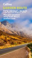
Wegenkaart - landkaart Garden Route | Collins

0
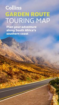
Full color, informative map of South Africa’s popular Garden Route. With detailed mapping and tourist information, this map is a perfect guide to traveling along the southern coast of South Africa.   Main features of this map include:   Clear comprehensive mapping Tourist routes, attractions and places of interest clearly marked Images of top sigh...

Verkopers met dit product

Verkoper
Bezorging
Prijs
DeZwerver.nl logo
DeZwerver.nl
2,95
19,95

Anderen bekeken ook

Wegenkaart - landkaart Garden Route | Collins
Full color, informative map of South Africa’s popular Garden Route. With detailed mapping and tourist information, this map is a perfect guide to traveling along the southern coast of South Africa.   Main features of this map include:   Clear comprehensive mapping Tourist routes, attractions and places of interest clearly marked Images of top sights along the route accompanied by textual descriptions Suggested itineraries Detailed index of places of interest and place names Essential for those planning an adventure along South Africa’s Garden Route.
19,95
Wegenkaart - landkaart The Great Ocean Road | Collins
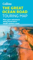
Full color, informative map of the popular Great Ocean Road. With detailed mapping, key tourist information and a suggested itinerary, this is a perfect guide for anyone traveling around Australia’s Great Ocean Road   Main features of this map include:   Clear comprehensive mapping Tourist routes, attractions and places of interest clearly marked Images of top sights along the route accompanied by textual descriptions Suggested itineraries Detailed index of places of interest and place names Essential for those planning an adventure along Australia’s Great Ocean Road.
19,95
Wegenkaart - landkaart Pocket Map NC500 | Collins
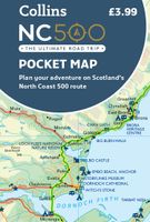
Handy little full colour map of the popular North Coast 500 route. A perfect guide for travelling around Northern Scotland. Detailed mapping and tourist information ideal for any road trip.   Main features of this map include: • Clear mapping • Tourist attractions located and described • Ideal for touring with castles, museums, gardens, monuments, mountains, golf courses, walks and camping/caravan sites all on the map • Photographs of the main attractions along the route • Index to places of interest and place names   Essential for those planning a trip on the North Coast 500.
7,95
Wegenkaart - landkaart National Park Pocket Map South Downs | Collins
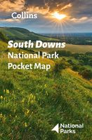
Handige kleine kaart van dit Nationaal Park. De kaart geeft een goed en helder overzicht van het gebied met alle plaatsen, doorgaande wandelpaden (alhoewel grof van schaal), bezienswaardigheden etc. Met een register en aanvullende tekst onder de kaart is het een mooi overzicht wat je waar kunt gaan doen. Handy little full colour map of South Downs National Park.Detailed mapping and visitor information to the National Park along with a selection of photographs. Map at a scale of 1:125 000 (1cm to 1.25km, 2.0 miles to 1 inch).This small map gives a great overview of the South Downs National Park, and is the perfect companion for exploring this beautiful area of South East England.• Clear, detailed mapping• Key park, tourist and travel information• Ideal for planning visits to the National Park• Index to help locate and plan your trip· Information on the South Downs Way, Miles Without Stiles routes, the Seven Sisters and other places of interest
7,95
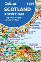
Wegenkaart - landkaart Pocket Map Scotland | Collins
Handy little full colour map of Scotland. Excellent value and very detailed for its size. Double-sided folded map with the Central Belt, southern Scotland and northern England on one side and northern Scotland including Orkney and Shetland on the reverse.   This map features:* Clear mapping at a scale of 8.7 miles to 1 inch* National Tourist Routes showing best routes through the most scenic areas* Top 100 places of interest* Park and Ride locations* Ideal companion to a sat-nav - it enables route planning and route sense-checking Essential for those planning a trip or who want an inexpensive and easy-to-use back up for a sat-nav.
7,95
Wegenkaart - landkaart Pocket Map Wild Atlantic Way | Collins
Handy full-colour map of Ireland’s Wild Atlantic Way with a high level of detail. Clear mapping of the full 2500 km (over 1500 miles) route, showing the road network and places of interest.   Clear, detailed Collins road mapping is presented in a handy format ideal for the pocket or handbag. It is excellent value and very detailed for its size, covering the whole of the Wild Atlantic Way.   Ideal for tourists, locals, hikers and adventurers. Places of interest marked, including famous film locations.   This map includes: • Clear mapping at a scale of 8.7 miles to 1 inch • National Tourist Routes showing best routes through the most scenic areas • Places of interest include film locations such as Star Wars • Tourist and signature locations clearly marked • Suggested itineraries • Detailed place names index • Ideal companion to a sat-nav – it enables route planning and route sense-checking
7,95
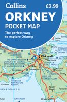
Wegenkaart - landkaart Pocket Map Orkney | Collins
Handy little full colour map of the Orkney Islands in Scotland. Detailed mapping and tourist information for Orkney mainland, Westray, Sanday, Stronsay, Shapinsay, Hoy, South Ronaldsay and the other islands. Excellent value and very detailed for its size. Main features of this map:   • Clear mapping at a scale of 2.7 miles to 1 inch • Tourist attractions located and described • Ideal for touring with sights, places to stay, cafe/restaurant, things to do all on the map • Transport links map showing how to get to and depart the islands • Index to places of interest and place names   Essential for those planning a trip around the Orkney Isles.
7,95
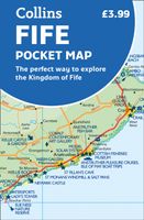
Wegenkaart - landkaart Pocket Map Fife | Collins
Handy little full colour map of the coastal Kingdom of Fife. Detailed mapping and tourist information from Dundee in the North to Edinburgh in the south and from Fife coast in the east to Stirling in the west.   Ancestral home of Scottish monarchs, world-famous for its golf and some of Scotland's best scenic attractions, the Kingdom of Fife has a distinct identity. Discover this unique area with this handy pocket map.   Main features of this map include: • Clear mapping at a scale of 2.3 miles to 1 inch / 1.5 km to 1 cm • Main tourist attractions located and described • Ideal for touring with sights, places to stay, cafe/restaurant, golf courses, things to do all on the map • Essential travel information • Index to places of interest and place names   Essential for those planning a trip around the mighty Kingdom of Fife.
7,95
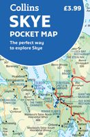
Wegenkaart - landkaart Pocket Map Skye | Collins
Handy little full colour Collins map of Skye with a high level of detail. Clear mapping of the Isle of Skye showing the road network, ferries and places of interest. Map at a scale of 1:175 000 (3 miles to 1 inch).   Clear, detailed, full colour Collins road mapping is presented in a handy format ideal for the pocket or handbag. It is excellent value and covers the whole of the Isle of Skye. This map includes:* Scotland route map* Caravan and camping sites* Tourist locations* Ferry links* Listing of major places to visit, with additional details for Dunvegan Castle, Old Man of Storr and Loch Coruisk* Detailed place names index
7,95
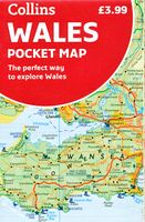
Wegenkaart - landkaart Pocket Map Wales | Collins
Kleine handzame kaart van Wales Handy little full colour map of Wales. Excellent value and very detailed for its size.   Key features of this map include: • Clear mapping at a scale of 3.95 miles to 1 inch • National Tourist Routes showing best routes through the most scenic areas • Top 100 places of interest • Park and Ride locations • Ideal companion to a sat-nav – it enables route planning and route sense-checking   Essential for those planning a trip or who want an inexpensive and easy-to-use back up for a sat-nav..
7,95

Klanten-reviews van Wegenkaart - landkaart Garden Route | Collins

Er zijn nog geen beoordelingen voor dit productBen jij de eerste die een review plaatst?

Meer over Wegenkaart - landkaart Garden Route | Collins

Productomschrijving

Full color, informative map of South Africa’s popular Garden Route. With detailed mapping and tourist information, this map is a perfect guide to traveling along the southern coast of South Africa.   Main features of this map include:   Clear comprehensive mapping Tourist routes, attractions and places of interest clearly marked Images of top sights along the route accompanied by textual descriptions Suggested itineraries Detailed index of places of interest and place names Essential for those planning an adventure along South Africa’s Garden Route.

Productinformatie

    Verken gerelateerde categorieën

    Webshop.nl maakt gebruik van cookies. Ga je verder op onze website, ga dan akkoord met het plaatsen van cookies en de verwerking van deze data door ons en vermelde partners.