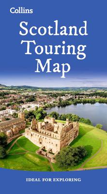
Wegenkaart - landkaart Touring Map of Scotland - Schotland | Collins

0
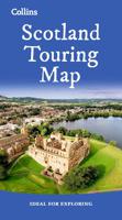
Best-selling map of Scotland. More than 1,000 places of tourist interest plotted and named on the map. The features have been plotted onto an up-to-date and attractive Collins map of Scotland.   A clear, easy to follow road map with colour classified roads. Ideal for tourists with hundreds of distinctive tourist symbols and tourist information cen...

Verkopers met dit product

Verkoper
Bezorging
Prijs
DeZwerver.nl logo
DeZwerver.nl
2,95
9,95

Anderen bekeken ook

Wegenkaart - landkaart Touring Map of Scotland - Schotland | Collins
Best-selling map of Scotland. More than 1,000 places of tourist interest plotted and named on the map. The features have been plotted onto an up-to-date and attractive Collins map of Scotland.   A clear, easy to follow road map with colour classified roads. Ideal for tourists with hundreds of distinctive tourist symbols and tourist information centres all shown.   This map includes: • The whole of Scotland on a double sided sheet at 5 miles to 1 inch • Over 25 categories of tourist information shown on the map including youth hostels, picnic sites and ferries as well as the more obvious tourist sites such as castles, wildlife parks and museums • Detailed town centre maps of Edinburgh, Glasgow, Aberdeen, Dundee, Inverness and Perth • New places of interest including Japanese Garden (near Dollar), Macallan Distillery Centre, Moat Brae (Dumfries) and Scottish Submarine Centre (Helensburgh) • Road updates include the new Dalry bypass, Maybole bypass under construction, A9 dualling section…
9,95
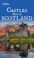
Wegenkaart - landkaart Castles map of Scotland - Schotland kastelen | Collins
Kaart waarop meer dan 700 kastelen in Schotland staan aangegeven. Discover Scotland's ancient monuments and castles. Explore Scotland’s ancient monuments with this pictorial map featuring over 700 castles and fortified houses. Includes an easy-to-use index listing visitor information and an attractive selection of photographs.   The map includes: • Over 700 castles and fortications • Index comprises map references, the age and type of each castle, public access details, Historic Scotland and National Trust for Scotland ownership, notable grounds and gardens, telephone numbers and websites • Highlights Scotland’s finest castles, castellated mansions and also the best castles for children • Attractive photographs of a selection of castles, together with a brief account of their history • A brief history of Scottish castles and information on architectural types and periods of construction • Internet links and suggested reading for further information   Scotland is a country …
13,95
Wegenkaart - landkaart Visitors map Scotland - Schotland | A-Z Map Company
xplore the whole of Scotland from Dumfries and Galloway in the South to the Orkney Islands in the North. With detailed road mapping and illustrated town plans of major cities, this feature rich, helpful tourist guide is ideal for touring around Scotland. Published at a clear 8.7 miles to 1 inch scale (5.51 cm to 1 km), this handy map is a detailed and informative exploration of what Scotland has to offer.   Highlights include: 8 inset street maps to major cities and popular destinations, including: Edinburgh, Glasgow, Stirling, and Cairngorms National Park, with detailed descriptions and places of interestLocations of visitor centres and tourist information sitesUseful key to map symbols making it a clear and easy readMore than 700 places of interest The perfect map for exploring Scotland whether you are a tourist or a local.
11,50
Wegenkaart - landkaart 3326 Adventure Map Scotland - Schotland | National Geographic
Wegenkaart van Schotland met vermelding van veel bezienswaardigheden, nationale parken en attrakties. Watervast en scheurvast. Juist door deze vermeldingen onderscheidt de kaart zich van andere wegenkaarten. National Geographic's Scotland AdventureMapis designed to meet the needs of adventure travelers with its durability and detailed, accurate information. The map includes the locations of cities and towns with a user-friendly index, a clearly marked road network complete with distances and designations for roads/highways, plus secondary routes for those seeking to explore off the beaten path.    AdventureMaps differ from a traditional road map because of the specialty content that they include. Each map contains hundreds of diverse and unique recreational, ecological, cultural and historic destinations - outside of the major tourist hubs. National Geographic AdventureMaps are the perfect companion to a guidebook, yet far easier to pack!    The Scotland AdventureMap is printed in the…
17,50
Wegenkaart - landkaart Pocket Map Scotland | Collins
Handy little full colour map of Scotland. Excellent value and very detailed for its size. Double-sided folded map with the Central Belt, southern Scotland and northern England on one side and northern Scotland including Orkney and Shetland on the reverse.   This map features:* Clear mapping at a scale of 8.7 miles to 1 inch* National Tourist Routes showing best routes through the most scenic areas* Top 100 places of interest* Park and Ride locations* Ideal companion to a sat-nav - it enables route planning and route sense-checking Essential for those planning a trip or who want an inexpensive and easy-to-use back up for a sat-nav.
7,95
Ik ben 18+
Wegenkaart - landkaart Whisky map of Scotland | Collins
Wegenkaart met meer dan 100 distilleerderijen en whisky gerelateerde locaties.   Discover where Scotland’s national drink is produced. All of Scotland’s operational whisky distilleries and whisky-related places of interest located on one map. Also includes an easy-to-use index listing visitor facilities, contact details and websites. The map includes:   • Over 100 distilleries and whisky-related places of interest • Insert map of malt whisky areas • A photographic guide to how whisky is made • Selection of labels of blended Scotch whisky brands • Did you know? Section with interesting facts • World maps of main export markets • Index lists visitor facilities, telephone numbers and websites   Scotch whisky is unique among national drinks – synonymous with Scotland, it cannot be produced elsewhere in the world.   Other titles in the series: Castles Map of Scotland, Tartans Map of Scotland, Scotland of Old Clans Map  
13,95
Wegenkaart - landkaart Scotland - Schotland | ITMB
Anyone who has been in this business for a few years remembers Ordnance Survey and their brilliantly detailed artwork. They should also remember that OS guarded this artwork religiously. That all changed when the then head of government in the UK, one soon-forgotten Gordon Brown, decreed that commercial OS artwork had to be discontinued and artwork had to be made more freely available to users. I expected an outpouring of new artwork by private UK firms. It did not happen; in fact, the range of travel maps decreased dramatically. However, OS artwork is still an excellent source of mapping artwork. This is a wonderful double-sided, detailed map of Scotland. It is both extremely detailed and accurate. We have added symbols for parks, historic sites, battlefields, country hotels, and anything else that we think would interest visitors. In order to portray Scotland to best scale advantage, the only inset included with this map are those of outlying islands, such as the Shetlands. ITMB als…
13,95
Wegenkaart - landkaart 9 Road Map Britain Scotland - Schotland | AA Publishing
Goede dubbelzijdige wegenkaart van Schotland met plaatsnamen index. Britain’s clearest mapping from the experts at the AA, in a handy foldable map. Fully updated, this map of Scotland combines clear design and an easy-to-read scale with more road detail to ensure that you never lose your way. The map includes information on toll points, service areas, road numbers, motorways, dual carriageways and wide and narrow local roads. National Parks, and places of interest are also highlighted. Caravan and camping sites pinpointed on the mapping. City and town plans Easy-to-read place index name. Part of a range of 9 regional sheet maps plus 1 map covering the whole of Britain. Map Series - 1 West Country & Wales. 2 Central Southern England. 3 South East England. 4 East Anglia. 5 Midlands & Central England. 6 Wales. 7 Northern England. 8 North England & Scottish Borders. 9 Scotland. 10 Britain.  
10,95
Wegenkaart - landkaart Planning Map Scotland - Schotland | Lonely Planet
Durable and waterproof, with a handy slipcase and an easy-fold format, Lonely Planet's Scotland Planning Map helps you get around with ease.   Get more from your map and your trip with images and information about top attractions, itinerary suggestions, a transport guide, planning information, themed lists and practical travel tips.   Durable and waterproof Easy-fold format and convenient size Handy slipcase Full colour and easy to use Before-you-go info Beautiful imagery Tailored itineraries Can't-miss regional highlights Detailed town index Transport planner Themed lists Covers Edinburgh, Glasgow, Highlands & Islands, Inverness & the Central Highlands, Orkney & Shetland, and more
10,95
Wegenatlas Scotland - Schotland | A-Z Map Company
Handzame gedetailleerde wegenatlas van Schotland. Navigate your way around Scotland with this detailed, full-colour and easy-to-use A-Z Road Atlas. From the border to the north coast, the mainland pages scale is 3.5 miles to 1 inch and the Western Isles, Shetland Islands and Orkney Islands scale is 4.5 miles to 1 inch.   Covering the entire country, this road atlas includes the following features: • Motorways with full junction detail, primary routes and destinations, A & B roads, under construction and proposed roads, service areas, tolls, mileages, national, county and unitary authority boundaries • Cairngorms and Loch Lomond & The Trossachs National Park boundaries • Selected places of interest and tourist information centres   20 city and town street maps are included for Aberdeen, Aviemore, Ayr, Dumfries, Dundee, Dunfermline, Edinburgh, Glasgow, Falkirk, Fort William, Hamilton, Inverness, Kilmarnock, Kirkcaldy, Motherwell, Oban, Paisley, Perth, St Andrews and Stirling. A…
13,50

Klanten-reviews van Wegenkaart - landkaart Touring Map of Scotland - Schotland | Collins

Er zijn nog geen beoordelingen voor dit productBen jij de eerste die een review plaatst?

Meer over Wegenkaart - landkaart Touring Map of Scotland - Schotland | Collins

Productomschrijving

Best-selling map of Scotland. More than 1,000 places of tourist interest plotted and named on the map. The features have been plotted onto an up-to-date and attractive Collins map of Scotland.   A clear, easy to follow road map with colour classified roads. Ideal for tourists with hundreds of distinctive tourist symbols and tourist information centres all shown.   This map includes: • The whole of Scotland on a double sided sheet at 5 miles to 1 inch • Over 25 categories of tourist information shown on the map including youth hostels, picnic sites and ferries as well as the more obvious tourist sites such as castles, wildlife parks and museums • Detailed town centre maps of Edinburgh, Glasgow, Aberdeen, Dundee, Inverness and Perth • New places of interest including Japanese Garden (near Dollar), Macallan Distillery Centre, Moat Brae (Dumfries) and Scottish Submarine Centre (Helensburgh) • Road updates include the new Dalry bypass, Maybole bypass under construction, A9 dualling sections • New stations of Robroyston and Kintore • Extensions shown to the Edinburgh tram network   Scale: 1:316,800 (5 miles to 1 inch).   There is a comprehensive index to both place names and places of tourist interest.

Productinformatie

    Verken gerelateerde categorieën

    Webshop.nl maakt gebruik van cookies. Ga je verder op onze website, ga dan akkoord met het plaatsen van cookies en de verwerking van deze data door ons en vermelde partners.