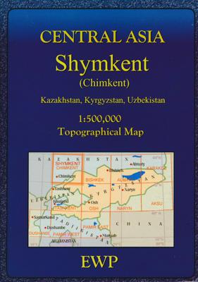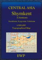
Wegenkaart - landkaart - Topografische kaart Topomaps Shymkent | EWP

0
An EWP topographic map of Shymkent (Chimkent) in Kazakhstan and Tazar, part of the Pamir and Tien Shan mountain ranges of Central Asia. This map at 1:500,000 has contours at 100m intervals with contour shading as well and shows a good number of lakes/reservoirs. The map also covers parts of Uzbekistan and Kyrgyzstan....

Verkopers met dit product

Webshop
Bezorging
Prijs
DeZwerver.nl logo
DeZwerver.nl
niet bekend
17,95

Anderen bekeken ook

Wegenkaart - landkaart Central Tien Shan | EWP
Overzichtskaart van de Tien Shan regio bij de Taklamakan woestijn in het grensgebied van Kazachstan,Kirgizië en west China. A map with concise information on access, visas, climate & weather, flora and fauna, mountaineering, glaciers and geomorphology. In English and German Tian Shan lies to the north and west of the Taklamakan Desert in the border region of Kazakhstan, Kyrgyzstan and the Xinjiang Uyghur Autonomous Region of western China. In the south it links up with the Pamir Mountains. It also extends into the Chinese province of Xinjiang and into the northern areas of Pakistan, where it joins the Hindu Kush.
19,95
Wandelkaart - Topografische kaart Fann Mountains | EWP
Het Fann-gebergte maakt deel uit van het westelijke Pamir-Alay-gebergte in de provincie Sughd in Tadzjikistan, tussen het Zarafshan-gebergte in het noorden en het Gissar-gebergte in het zuiden.    This is one of a series of topographic maps of the mountain ranges of Central Asia.  The map is at a scale of 1:100,000 (1cm = 1km) and contours are shown at 50m intervals with master contours every 200m.  There are two smaller maps on the reverse, one at 1:100,000 of the ridges, passes, summits and glaciers and one at 1:5,000,000 showing the area covered within the map in it's location within Central Asia.   The reverse of the map is the guide which includes the following:   Location Geology and Relief Climate Glaciation Rivers and lakes Altitude Zoning Mountains and Passes Fauna History Population and language Guides and Donkeys Accommodation and food Conservation and Rubbish/Garbage Countryside and Traditions Useful local works in Russian and Tajik Access, Visas and Permits Useful Contact…
19,95
Wegenkaart - landkaart Motomap Motorkaart Sardinië - Sardinie | Hallwag
Die schönsten Strecken mit Sehenswürdigkeiten und Herbergen. GPS-Daten: Gratis Download der Motorradtouren. Einzeln herausnehmbare Karten mit 16 Roadbooks Sardinia Motorbike Map Set from Hallwag with individual waterproof and tear-resistant maps for 16 day tours, plus an overview road map of the whole island. The tours are from 120 km to 260 km long, and each is prominently highlighted on a separate handy size, 24.5 x 23 cm map extract at 1:275,000, printed on waterproof and tear-resistant synthetic paper. Accompanying information indicates the degree of difficulty, distance and approximate timing, etc, and recommended accommodation. Also provided is a link to the website for downloading GPS coordinates. All the text is in German only.   The accompanying overview map shows all the tours together and covers not just Sardinia but also Corsica and mainland Italy from Turin and Piacenza in the north to Rome in the south, extending eastwards to Ravenna and Perugia. Road network is clearly …
19,50
Reisgids Kyrgyzstan - Kirgizië | Bradt Travel Guides
Voor vele landen net zo goed, zo niet beter dan de Planet. Beduidend soberder uitgevoerd, maar ook met veel informatie voor backpackers en met veel kaartmateriaal. Een aanrader! Following the break-up of the USSR, Kyrgyzstan soon earned a reputation as the most hospitable and least repressive of the newly emerged central Asian republics. Unlike some of its neighbours, it has actively encouraged foreign tourism and has pursued a policy of supporting community projects with an emphasis on adventure tourism. The Bradt guide details all the services and experiences the country offers including trekking, mountaineering, horseriding and wildlife-watching. Historical sites, cultural activities and background on the Kyrgystan people are all covered by this definitive guide. • Provides a invaluable resource for English-speaking expatriates. • Details the wide range of travel options within the country, including trekking and horseback tours, local buses, shared taxis and private taxi services.…
23,95
Wegenkaart - landkaart Canada West | Insight Guides
Insight Travel Map Canada West:This detailed travel map is all you need to plan your route and navigate your way around Canada West, and also includes area highlights, top attractions, places of interest, street plans, and a fabulous free app. * Travel Map Canada West is drawn to a scale of 1:4 million, and shows the entire country, complete with a comprehensive index* Ideal for planning your route, and on-the-road-exploring* Includes free app, with top travel tips, and additional area highlights* Outlines Top Attractions and places of interest, including national parks, nature reserves and heritage sites* Handy distance indicators, located in the margin, give distances to the nearest town and major locations* Shows roads, rail networks and ferry routes* Pictorial symbols allow for instant, easy recognition* Detailed topography, through the use of relief shading, with mountain ranges named, and peak heights given* Legend shown in eight languagesAbout Insight Guides: Insight Guides is …
11,50
Nieuw
Wegenkaart - landkaart 1 Sud-Norwegen Oslo - Stavanger - Bergen | Kümmerly & Frey
Uitstekende wegenkaart met een helder, duidelijk kaartbeeld van Noorwegen van de bekende Noorse kaartenmaker Cappelen Kart. Met toeristische informatie. The maps have bold, effective relief shading with numerous spot heights and names of geographical features such as mountain ranges, glaciers, valleys, waterfalls, etc, to indicate the country’s mountainous terrain. Colours show the vast forested areas and national parks are highlighted. Road network includes minor local roads, cart tracks, tolls, winter closures, steep gradients, etc. Railways, ferry connections and, in remote areas, hiking trails with walking times are also shown and local administrative boundaries are marked. The maps are particularly good at highlighting accommodation facilities, with an extensive range of symbols showing hotels, motels, campsites, youth hostels, etc., indicating different standards and categories. Other symbols show places of interest, viewpoints, bird colonies, etc. Latitude and longitude lines a…
14,75
Reisgids De zijderoute - Silk Road | Insight Guides
Een rijk geillustreerde reisgids met diepgaande teksten: één van de beste reisgidsen die er bestaan. Eerste deel bestaat uit een beschrijving van de unieke aspecten van de regio, daarna een deel echte reisgids en als afsluiting een deel met praktische informatie. De uitstekende informatie wordt vergezeld van prachtige foto's en heldere kaarten. Niet alleen om mee te nemen, maar ook om vooraf en zelfs achteraf weer in de stemming te komen. This Silk Road guidebook is ideal for travellers seeking inspirational guides and planning a more extended trip. It provides interesting facts about the Silk Road's people, history and culture and detailed coverage of the best places to see. This Silk Road travel book has the style of an illustrated magazine to inspire you and give a taste of the Silk Road. The book is printed on paper from responsible sources, and verified to meet FSC's strict environmental and social standards.   This Silk Road guidebook covers: China (Shaanxi, Ginsu, Xinjiang),…
25,95
Stadsplattegrond - Wegenkaart - landkaart Fleximap Prague - Praag | Insight Guides
Geplastificeerde kaart van Praag, met register. Voor de 'gewone' toerist een handige kaart, geen groot formaat, overzichtelijk met alle belangrijke plaatsen goed weergegeven.   Flexi Map Prague is a laminated, tear-resistant map which includes 3 maps, each accompanied by separate indexes. The main map depicts Prague at a scale of 1:12 500, the index has been categorized for ease of use. Streets are named along with public buildings and selected hotels.   A Prague Environs map can be found on the reverse and this shows the various routes into the city. A detailed Metro plan is located on the back cover for easy reference.   Also included is a map of western Czech Republic which is depicted at a scale of 1:900 000, in addition to the road and rail networks, this map provides a detailed picture of the topography through the use of relief shading with gradients given for steep ascents.    Flexi Map Prague also gives a list - with descriptions and some photographs - of 21 recommended sig…
9,95
Wegenkaart - landkaart Europe - Europa | National Geographic
• Waterproof • Tear-Resistant • Reference Map   Expertly researched and designed, National Geographic's Europe Flags & Facts Map is the authoritative map of Europe by which other reference maps are measured. The map side includeds a political map showing countries, cities and other landmarks and a physical map shows the landforms such as mountain ranges and rivers.   Clearly defined boundaries, major cities, and physical features Hundreds of place names carefully placed to maintain legibility in heavily populated areas Includes Europe including Russia and adjacent regions within Asia and Africa Detailed physical map of Europe with mountain ranges, plains, lakes, and rivers Flags and facts with detailed information about cultural and physcial attributes Printed in the U.S.A. on extremely durable, waterproof, and tear-resistant material This Reference Map is printed on durable synthetic paper, making it waterproof, tear-resistant and tough — capable of withstanding the rigors of any kin…
17,50

Klanten-reviews van Wegenkaart - landkaart - Topografische kaart Topomaps Shymkent | EWP

Er zijn nog geen beoordelingen voor dit productBen jij de eerste die een review plaatst?

Meer over Wegenkaart - landkaart - Topografische kaart Topomaps Shymkent | EWP

Productomschrijving

An EWP topographic map of Shymkent (Chimkent) in Kazakhstan and Tazar, part of the Pamir and Tien Shan mountain ranges of Central Asia. This map at 1:500,000 has contours at 100m intervals with contour shading as well and shows a good number of lakes/reservoirs. The map also covers parts of Uzbekistan and Kyrgyzstan.

Verken gerelateerde categorieën

Webshop.nl maakt gebruik van cookies. Ga je verder op onze website, ga dan akkoord met het plaatsen van cookies en de verwerking van deze data door ons en vermelde partners.