webshop.nl
Categorieën
  Sluiten

Meer ITMB

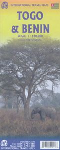
Wegenkaart - landkaart Togo en Benin | ITMB

0
Een degelijke kaart met aanduidingen van o.a. nationale parken, vliegveld, benzinepomp, dirt-roads en kleine plattegrond van hoofdstad. Als overzichtskaart goed te gebruiken. Togo and Benin. These two countries have developed an incredible tourism industry and are very popular with visitors. They are larger than one expects; small in comparison to ...

Webshops met dit product

Webshop
Bezorging
Prijs

Anderen bekeken ook

Wegenkaart - landkaart Togo en Benin | ITMB
Een degelijke kaart met aanduidingen van o.a. nationale parken, vliegveld, benzinepomp, dirt-roads en kleine plattegrond van hoofdstad. Als overzichtskaart goed te gebruiken. Togo and Benin. These two countries have developed an incredible tourism industry and are very popular with visitors. They are larger than one expects; small in comparison to neighbouring Nigeria, but large as countries go. This map is brand new artwork at a much more attractive scale than the previous version; printed double-sided with much more information than was available to us when the original map was being developed. We’ve also added a few capsule comments about interesting facts related to the two countries, and large inset maps of Lome and Porto Novo. The map is divided into a north half and south half, as most attractions are in the south. As with all ITM maps, this one shows physical features, road conditions, and petrol stations in more isolated parts of both countries. Legend Includes: Roads by class…
13,95
Wegenkaart - landkaart Bahrain & Qatar | ITMB
Een degelijke kaart met aanduidingen van o.a. nationale parken, vliegveld, benzinepomp, dirt-roads en kleine plattegrond van hoofdstad. Als overzichtskaart goed te gebruiken.  Schaal: - Bahrein 1:115.000 - Qatar 1:300.000 The northern portion of the United Arab Emirates consists of a small peninsula (Qatar) and an island (Bahrain). Although these countries are not geographically significant in relation to their neighbours, they are enormously wealthy, thanks to oil, and have aspirations of grandeur. Qatar hosted the FIFA World Cup of soccer in November 2022. This is significant. Qatar, as a destination country, is now 'on the map'. Its capital, Doha, is quite well developed, with three Metro subway lines, motorways, and a sophisticated city centre dominated by superb high-rise architecture. Just to the west, the island of Bahrain is just as wealthy, and just as likely to have ornate architecture, luxurious shopping arcades, and an extravagant lifestyle. Its capital, Manama, is growing …
13,95
Wegenkaart - landkaart US Virgin Islands & Puerto Rico | ITMB
Puerto Rico: schaal 1:190.000 US Virgin Islands: schaal 1:50.000   We are really pleased with this new edition of Puerto Rico. We spent part of August, 2020, touring the island and geo-referencing its many highways. The island is bigger and more densely road-networked than we thought, so we'll have to complete the job on our next visit, but the roads are now much more precisely shown accurately than was possible before satellite imagery. The map looks great on an Ipad screen as well. The map also shows updated inset maps of San Juan, Ponce, Mayaguez, Aguadilla, and Arecibo. Puerto Rico is part of the United States, so has all the benefits, but is internally self-governing. With this edition we are including a map of the other US colonial territory, the US Virgin Islands. The Danish West Indies was purchased from Denmark in 1917 and is an integral part of the USA, with all its benefits, but is, like Puerto Rico, neither fish nor fowl. It is internally self-governing and a great retireme…
13,95
Wegenkaart - landkaart Australia South & Northern Territory | ITMB
Australia was one of the first countries ITMB published, back in the 1980s, albeit a licensed version. Our own original artwork was completed in the mid-1990s, but until recently, we have not focused on sectional maps of the country based on individual states. In 2019, we published Brisbane and Queensland, and Sydney and New South Wales. Now, we are issuing the ‘middle’ states of South Australia and Northern Territory to provide better coverage of these important parts of Australia at a better scale than a country map could provide. South Australia can be thought of as having two parts; the fertile farming economy surrounding Adelaide in the south and the much more arid northern portion. The road network in the south tends to be well developed, with paved roads going more or less east-west to NSW and WA. Northerly roads tend to be gravel or dirt, such as the Birdville Track, and the north-westerly roads tend to pass through land ceded to aboriginals and require permits. Northern Territ…
13,95
Wegenkaart - landkaart Ierland | ITMB
As technology improves, we are able to produce more detailed maps than was previously possible. Such is the case with Ireland, a part of the world consisting of two countries divided by religion and history. Preparing a map of Ireland as a double-sided map means cutting the island into two geographic portions. Side 1 covers the northern half. This includes the portion known as Northern Ireland, or Ulster, and a fair portion of the Republic of Ireland, or Eire; essentially everything north of Dublin and west to Counties Mayo and Galway. Side 2 covers the southern half of the island from just north of Dublin to the outer tips of County Kerry. It also includes a nice inset map of central Dublin. Naturally, all motorways and roads are included, as are touristic attractions, camping/caravan sites, ferry terminals, and Top Attractions. This is a very detailed travel map of the island, printed on waterproof paper for durability. We had great fun driving around Ireland researching this map. It…
14,95
Wegenkaart - landkaart Western Canada | ITMB
Een degelijke kaart met aanduidingen van o.a. nationale parken, vliegveld, benzinepomp, dirt-roads. Als overzichtskaart goed te gebruiken. This is actually our second attempt at mapping the western portion of Canada; the first covered everything from northwestern Ontario to the Pacific Ocean and, while it was an excellent map, the scale that such a huge area covered necessitated severe problems. In this version, all of British Columbia, Alberta, and the Yukon have been mapped from fresh digital data and presented at 1:1.4T scale. This would have been impossible when we prepared the first map. The Northwest Territories portion had to be compressed in two ways; first, the scale is 1:2M; second, only the portion with roads is shown. This is still an extremely large area. One has to consider the actual size of Canada when designing a map. Most countries in Europe would fit into this area, which only covers 20% of Canada. The Fort McMurray forest fire of a year ago covered an area larger th…
13,95

Klanten-reviews van Wegenkaart - landkaart Togo en Benin | ITMB

Er zijn nog geen beoordelingen voor dit productBen jij de eerste die een review plaatst?

Meer over Wegenkaart - landkaart Togo en Benin | ITMB

Productomschrijving

Een degelijke kaart met aanduidingen van o.a. nationale parken, vliegveld, benzinepomp, dirt-roads en kleine plattegrond van hoofdstad. Als overzichtskaart goed te gebruiken. Togo and Benin. These two countries have developed an incredible tourism industry and are very popular with visitors. They are larger than one expects; small in comparison to neighbouring Nigeria, but large as countries go. This map is brand new artwork at a much more attractive scale than the previous version; printed double-sided with much more information than was available to us when the original map was being developed. We’ve also added a few capsule comments about interesting facts related to the two countries, and large inset maps of Lome and Porto Novo. The map is divided into a north half and south half, as most attractions are in the south. As with all ITM maps, this one shows physical features, road conditions, and petrol stations in more isolated parts of both countries. Legend Includes: Roads by classification, International Airports, Churches, Hotels, Points of Interest, Hospitals, Gas Stations, Ports, Telephones, Historic and Archaeological sites, Forests, National Parks, Rivers, Lakes, Swamps and more.

Productspecificaties

Artikelnummer(s)
Brand
ITMB
Webshop.nl maakt gebruik van cookies. Ga je verder op onze website, ga dan akkoord met het plaatsen van cookies en de verwerking van deze data door ons en vermelde partners.