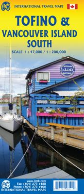
Wegenkaart - landkaart Tofino & Southern Vancouver Island | ITMB

0
Vancouver Island is one of the marvels of tourism in Canada. It is, in fact, so big that it needs to be explored in sections to reach its full potential. Tofino is the westernmost town on the island and is home to the great Pacific fleet of fishing boats. It is also the westernmost leg of the ten thousand kilometer-long Trans-Canada Highway, and t...

Verkopers met dit product

Verkoper
Bezorging
Prijs
DeZwerver.nl logo
DeZwerver.nl
2,95
13,95

Anderen bekeken ook

Wegenkaart - landkaart Tofino & Southern Vancouver Island | ITMB
Vancouver Island is one of the marvels of tourism in Canada. It is, in fact, so big that it needs to be explored in sections to reach its full potential. Tofino is the westernmost town on the island and is home to the great Pacific fleet of fishing boats. It is also the westernmost leg of the ten thousand kilometer-long Trans-Canada Highway, and the beginning of the Trans-Canada National Hiking Trail. Side 1 concentrates on the immediate surrounds of Tofino, Seven-Mile Beach, and Kennedy Lake. Side 2 covers the southern half of the large island, from Victoria north to Courtenay, and includes the Broken Islands region off the west coast, the West Coast Hiking Trail, Cathedral Grove old growth forest, the Gulf Islands, and all the ferry connections with Vancouver and various islands, as well as all the Backroads logging roads that are the main way to explore the interior of wonderful Vancouver Island.   Legend Includes: Roads by classification, Rivers and Lakes, National Park, Airports,…
13,95
Wegenkaart - landkaart Vancouver Island | ITMB
Deze kaart is niet waterproof maar van gewoon papier! Prima overzichtskaart van Vancouver Island waarmee je alle activiteiten kunt plannen. Alle campsites staan vermeld, maar ook picknickspots, waar het goed kanoën is en er is een register bijgevoegd. Folded road and travel map, in color. Scale 1:270,000. Distinguishes roads ranging from four lane highways to logging/dirt roads. Legend includes trails, ferry routes/terminals, railways, international/domestic airports, lighthouses, protected areas, military areas, glaciers, reefs/rock ledges, falls, rapids, campgrounds, points of interest, tourist information centres, museums, picnic grounds, fishing areas, canoeing/kayaking, hiking trails, golf courses, downhill skiing areas, rock climbing, beaches, hot springs, viewpoints, mines/abandoned mines. Includes inset map of Victoria. Indexed.
13,95
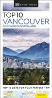
Reisgids Eyewitness Top 10 Vancouver and Vancouver Island | Dorling Kindersley
Kleine, rijk geillustreerde reisgids over Vancouver en Vancouver Island. Met alle hoogtepunten, bezienswaardigheden, activiteiten, praktische tips, eet & drink aanrader. Inclusief handige kaartjes. The world's bestselling pocket guidesBeautifully situated between the ocean and picturesque mountains, Vancouver offers the cultural vibrancy of a modern metropolis, as well as the opportunity to enjoy the breathtaking rugged coastline and wilderness of nearby Vancouver Island. Make the most of your trip to this coastal city with DK Eyewitness Top 10. Planning is a breeze with our simple lists of ten, covering the very best that Vancouver and Vancouver Island have to offer and ensuring that you don't miss a thing.   Best of all, the pocket-friendly format is light and easily portable; the perfect companion while out and about. Inside you'll find: -Up-to-date information following the COVID-19 outbreak, insider tips and advice for staying safe-Top 10 lists of Vancouver and Vancouver Islan…
13,50
Wegenkaart - landkaart 3128 Adventure Travel Map Vancouver Island | National Geographic
Wegenkaart van Vancouver Island met vermelding van veel bezienswaardigheden, nationale parken en attrakties. Watervast en scheurvast. Juist door deze vermeldingen onderscheidt de kaart zich van andere wegenkaarten. National Geographic's Vancouver Island Adventure Map provides global travelers with the perfect combination of detail and perspective in a highly functional travel tool. Cities and towns are clearly indicated and easy to find in the user-friendly index. A road network complete with distances and designations for roads, motorways, and expressways will help you find the route that's right for you. Secondary routes are also marked for those seeking to explore off the beaten path. Hundreds of points of interest and diverse and unique destinations are highlighted including national parks, nature reserves, World Heritage sites, archeological sites, ski areas, hot springs, beaches, museums, and more.   The south side of the print map shows Victoria the capital of British Columbia,…
17,50
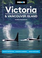
Reisgids Victoria & Vancouver Island | Moon Travel Guides
Uitstekende Amerikaanse reisgids van uitgever Moon. De gids is vergelijkbaar met Lonely Planet en Rough guide en is voor de backpacker - zelfstandige reiziger geschreven; toch is deze door de grote mate van details en achtergronden geschikt voor alle reizigers! De gids onderscheidt zich door gedegen en uitgebreide achtergrondinformatie over bijvoorbeeld natuur en cultuur. Steep mountains divide dense rainforests and rocky shores from thriving cities. Discover the rugged and the cosmopolitan with Moon Victoria & Vancouver Island. Inside you'll find: Strategic, flexible itineraries, from a long weekend in Victoria to two weeks exploring Vancouver Island, designed for outdoor adventurers, culture and history buffs, families, and more Must-see highlights and unique experiences: Complete one of the world's great coastal hikes on the West Coast Trail, or try your hand at stand-up paddleboarding through protected fjords. Surf off the wild coast of Tofino, or experience the thrill of hooking …
24,95
Wegenkaart - landkaart Southern Alberta & Southern British Columbia | ITMB
ITMB, being based in Vancouver, BC, understandably has a local/regional market for our map line. We have a map of Western Canada, as well as an atlas, a very nice map of BC itself, a map of the south half of BC, and a map of part of BC combined with Washington State. What we did not have, until now, was a map covering the most touristically-visited part of all of Canada – namely, the southern halves of both British Columbia and its neighbour, Alberta, with a small amount of Washington State, Idaho, and Montana (to assist those heading north and needing to know about border crossings). Therefore, ITMB is pleased to announce the release of Southern BC and Alberta. Side One covers BC from the US border (with a carry-on to Seattle) north to Prince George and east to the Alberta border, with a carry-on to Calgary. All of Vancouver Island, the Okanagan Valley, and the Rock Mountain National Parks of Banff and Jasper, are included. The map is rich with wilderness campsite (almost 1,000 are s…
13,95
Stadsplattegrond Vancouver & Greater Vancouver | ITMB
Stadsplattegrond van Vancouver met een extra inzet op kleinere schaal van het centrum. Met register. Waterproof! ITMB first published our own map of Vancouver six editions and twenty years ago. Each time we update, we're surprised at how much change has taken place. This is a double-sided map, with the city on one side and the metropolitan area on the other side. Like many North American cities, Vancouver consists of several separate urban areas that have merged together physically but not politically. Greater Vancouver's population is 2,500,000, most of which consists of residential areas. The 'regional' side is where the growth in population is taking place (about 100,000 people move to Vancouver each year) and this is where noticeable developments are taking place - the new South Perimeter Road following the Fraser River eastwards, the new Port Mann toll bridge, the new toll Golden Ears toll bridge across the Fraser. None of this will make sense to non-locals, but since most of our…
13,95
Wegenkaart - landkaart - Fietskaart Vanouver Island south - Victoria | ITMB
ITMB wegenkaarten en wandelkaarten kenmerken zich door het kleurgebruik waarbij zo de nadruk wordt gelegd op de natuurkundige aspecten van het land of de streek. Het soort landschap en de hoogte worden hierdoor zeer duidelijk zichtbaar. Natuurlijk vind je ook de 'gewone' zaken als wegennet, spoorwegen, vliegvelden, ferrys, toeristische bezienswaardigheden en nationale parken er op terug.. Vaak - maar niet op alle kaarten - staat op de achterzijde een stadsplattegrond van hoofdstad of belangrijkste stad in de regio.  Voorzijde: Vancouver Island zuidelijk gedeelte met schaal 1:270.000 Achterzijde: stadsplattegrond Victoria met schaal 1:10.000 Victoria is a brand new title for ITMB. The city is the capital of British Columbia (each of Canada’s provinces and territories has its own capital, in addition to Ottawa for the entire country). Located at the southern tip of Vancouver Island, Victoria was established as the colonial capital after the Oregon Treaty of 1846 forced the British to ab…
13,95
Stadsplattegrond Vancouver | Borch
Borch Vancouver is een duidelijke, geplastificeerde plattegrond van het centrum met informatie over openbaar vervoer en bezienswaardigheden. Inclusief straatnamenregister.   Our soft-laminated folded map of Vancouver shows: Vancouver Downtown 1:15 000, Greater Vancouver 1:125 000, Vancouver - Seattle Area 1:1 800 000, Granville Island 1:5 500, Victoria 1:30 000, Public Transport Vancouver, Canada administrative & time zones, Top 30 Sights. Borch Maps are easy to fold, durable and water-repellent with a wipeable surface. Borch Maps show hotels, museums, monuments, markets, public transport, top sights and points of interest, useful statistics, conversion charts for temperatures, weights and measurements, climate charts showing temperatures, sunshine hours, precipitation and humidity, overview maps, time zones, and much more...   Vancouver on the Pacific Rim, a major seaport city with an imposing skyline, ranked in 2012 as being the third most livable of all cities worldwide, after Melb…
9,95
Wegenkaart - landkaart Vancouver's North Shore Hiking Trails - Fraser Valley | ITMB
Our popular map showing the recreational hiking trails in the mountains within the urban area of Metro Vancouver, but outside of its urbanized limits, continues into its most recent printing with an additional government topo map on the reverse side showing the full extent of the mountainous expanse of the Coastal Range that comes right into Vancouver. We are truly blessed as a city to be located in a sheltered bay of the ocean, with towering mountains looking after us. Trails cut by early settlers, by Boy Scouts, and by hiking enthusiasts, have been enjoyed for decades. I first mapped these trails in the mid-1980s, and we have kept the information as accurate and up to date as possible for more than two decades and six editions. The addition of the regional map makes the map more useful to users, as it covers the Sunshine Coast, the mountains north of Whistler, and the wilderness roads throughout the entire region, as far east as Agassiz, which won’t mean much except to locals, but e…
13,95

Klanten-reviews van Wegenkaart - landkaart Tofino & Southern Vancouver Island | ITMB

Er zijn nog geen beoordelingen voor dit productBen jij de eerste die een review plaatst?

Meer over Wegenkaart - landkaart Tofino & Southern Vancouver Island | ITMB

Productomschrijving

Vancouver Island is one of the marvels of tourism in Canada. It is, in fact, so big that it needs to be explored in sections to reach its full potential. Tofino is the westernmost town on the island and is home to the great Pacific fleet of fishing boats. It is also the westernmost leg of the ten thousand kilometer-long Trans-Canada Highway, and the beginning of the Trans-Canada National Hiking Trail. Side 1 concentrates on the immediate surrounds of Tofino, Seven-Mile Beach, and Kennedy Lake. Side 2 covers the southern half of the large island, from Victoria north to Courtenay, and includes the Broken Islands region off the west coast, the West Coast Hiking Trail, Cathedral Grove old growth forest, the Gulf Islands, and all the ferry connections with Vancouver and various islands, as well as all the Backroads logging roads that are the main way to explore the interior of wonderful Vancouver Island.   Legend Includes: Roads by classification, Rivers and Lakes, National Park, Airports, Points of Interests, Highways, Main Roads, Zoos, Fishing, and much more...

Productinformatie

    Verken gerelateerde categorieën

    Webshop.nl maakt gebruik van cookies. Ga je verder op onze website, ga dan akkoord met het plaatsen van cookies en de verwerking van deze data door ons en vermelde partners.