webshop.nl
Categorieën
  Sluiten

Meer ITMB
Meer ITMB in Literatuur boeken

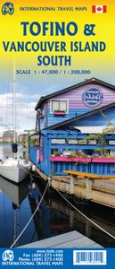
Wegenkaart - landkaart Tofino & Southern Vancouver Island | ITMB

Vancouver Island is one of the marvels of tourism in Canada. It is, in fact, so big that it needs to be explored in sections to reach its full potential. Tofino is the westernmost town on the island and is home to the great Pacific fleet of fishing boats. It is also the westernmost leg of the ten thousand kilometer-long Trans-Canada Highway, and th...
13,95

Webshops met dit product

Webshop
Bezorging
Prijs

Anderen bekeken ook

Wegenkaart - landkaart Tofino & Southern Vancouver Island | ITMB
Vancouver Island is one of the marvels of tourism in Canada. It is, in fact, so big that it needs to be explored in sections to reach its full potential. Tofino is the westernmost town on the island and is home to the great Pacific fleet of fishing boats. It is also the westernmost leg of the ten thousand kilometer-long Trans-Canada Highway, and the beginning of the Trans-Canada National Hiking Trail. Side 1 concentrates on the immediate surrounds of Tofino, Seven-Mile Beach, and Kennedy Lake. Side 2 covers the southern half of the large island, from Victoria north to Courtenay, and includes the Broken Islands region off the west coast, the West Coast Hiking Trail, Cathedral Grove old growth forest, the Gulf Islands, and all the ferry connections with Vancouver and various islands, as well as all the Backroads logging roads that are the main way to explore the interior of wonderful Vancouver Island.   Legend Includes: Roads by classification, Rivers and Lakes, National Park, Airports, …
13,95
Wegenkaart - landkaart - Fietskaart Vanouver Island south - Victoria |
ITMB wegenkaarten en wandelkaarten kenmerken zich door het kleurgebruik waarbij zo de nadruk wordt gelegd op de natuurkundige aspecten van het land of de streek. Het soort landschap en de hoogte worden hierdoor zeer duidelijk zichtbaar. Natuurlijk vind je ook de 'gewone' zaken als wegennet, spoorwegen, vliegvelden, ferrys, toeristische bezienswaardigheden en nationale parken er op terug.. Vaak - maar niet op alle kaarten - staat op de achterzijde een stadsplattegrond van hoofdstad of belangrijkste stad in de regio.  Voorzijde: Vancouver Island zuidelijk gedeelte met schaal 1:270.000 Achterzijde: stadsplattegrond Victoria met schaal 1:10.000 Victoria is a brand new title for ITMB. The city is the capital of British Columbia (each of Canada’s provinces and territories has its own capital, in addition to Ottawa for the entire country). Located at the southern tip of Vancouver Island, Victoria was established as the colonial capital after the Oregon Treaty of 1846 forced the British to aba…
13,95
Wegenkaart - landkaart 92G Lower Mainland British Columbia - Richmond
Goede wegenkaart van British Columbia met topografische uitsnede van Richmond en Westminster. Topographic/Recreation Map 92G&92G2 and G3 - With the 2010 Winter Olympics bearing down on us, this very timely map presents a lovely regional map showing all of the Olympic venues (the Games are being held in Vancouver, Richmond, UBC, Whistler, and the Callaghan Valley – not just in Vancouver). The area of coverage is from Everett (just north of Seattle) in the USA to north of Pemberton, and from Victoria in the west to Chilliwack in the east on the one side, and a detailed 1:50,000 topo map of the Richmond/New Westminster/Surrey/Langley outer urban areas of Metro Vancouver. Both maps are Government of Canada NTS maps, overlaid with touristic and recreational information by ITMB, which holds the copyright on behalf of the Queen (I love being able to say that). The Lower Mainland portion is particularly useful, in that it includes the east coast of Vancouver Island, from Victoria to Nanaimo an…
13,95
Wegenkaart - landkaart Canada | ITMB
Een degelijke kaart met aanduidingen van o.a. nationale parken, vliegveld, benzinepomp, dirt-roads en kleine plattegrond van hoofdstad. Well, it’s about time, eh?!? ITMB, after only thirty years on the go, finally gets around to publishing a map of Canada. When we first started mapping, there was a pressing need for good maps of Central and South America, then of Africa, then etc etc and we never found time to concentrate on our own country until fairly recently. This map was prepared by Natural Resources Canada and is, as a result, as accurate a map as one could hope to have. We are very proud of it, and very pleased to be able to use such top-rate cartography. The map covers all of the land mass of Canada, from its southernmost point to the top of Ellesmere Island and from the Atlantic coast to the Pacific. It’s an excellent map, but I’m going to give one proviso. Canada is the second-largest country on the face of the planet and there is no way that a single-sided sheet can portray …
13,95
Wegenkaart - landkaart 92G Lower Mainland British Columbia - Richmond
Goede wegenkaart van British Columbia met topografische uitsnede van Richmond en Westminster. Topographic/Recreation Map 92G&92G2 and G3 - With the 2010 Winter Olympics bearing down on us, this very timely map presents a lovely regional map showing all of the Olympic venues (the Games are being held in Vancouver, Richmond, UBC, Whistler, and the Callaghan Valley – not just in Vancouver). The area of coverage is from Everett (just north of Seattle) in the USA to north of Pemberton, and from Victoria in the west to Chilliwack in the east on the one side, and a detailed 1:50,000 topo map of the Richmond/New Westminster/Surrey/Langley outer urban areas of Metro Vancouver. Both maps are Government of Canada NTS maps, overlaid with touristic and recreational information by ITMB, which holds the copyright on behalf of the Queen (I love being able to say that). The Lower Mainland portion is particularly useful, in that it includes the east coast of Vancouver Island, from Victoria to Nanaimo an…
13,95
Wegenkaart - landkaart Alaska's Inside Passage | ITMB
Een degelijke kaart met aanduidingen van o.a. nationale parken, vliegveld, benzinepomp, dirt-roads en kleine plattegronden van Anchorage, Seattle, Vancouver en Victoria. Als overzichtskaart goed te gebruiken.    We recently released our USA Pacific Coast Map, covering the segment between San Diego and Vancouver. This map completes the mapping of the Pacific Ocean coastline by mapping the routes followed by cruise ships and Alaska Ferries heading north from Seattle and Vancouver to Alaska. This is a double-sided map, with Vancouver Island and the coastline as far north as Prince Rupert on one side (with inset maps of Seattle, Victoria, and Vancouver)on side 1, and the coastline north to Glacier Bay and an onward inset map to Anchorage (including an inset map of the city) on the second side. As the actual routes followed by the numerous cruise lines vary, we can't show their actual sailing routes, but they generally follow the coastline within viewing distance of either the mainland or c…
13,95
Wegenkaart - landkaart Western Canada | ITMB
Een degelijke kaart met aanduidingen van o.a. nationale parken, vliegveld, benzinepomp, dirt-roads. Als overzichtskaart goed te gebruiken. This is actually our second attempt at mapping the western portion of Canada; the first covered everything from northwestern Ontario to the Pacific Ocean and, while it was an excellent map, the scale that such a huge area covered necessitated severe problems. In this version, all of British Columbia, Alberta, and the Yukon have been mapped from fresh digital data and presented at 1:1.4T scale. This would have been impossible when we prepared the first map. The Northwest Territories portion had to be compressed in two ways; first, the scale is 1:2M; second, only the portion with roads is shown. This is still an extremely large area. One has to consider the actual size of Canada when designing a map. Most countries in Europe would fit into this area, which only covers 20% of Canada. The Fort McMurray forest fire of a year ago covered an area larger th…
13,95
Wegenkaart - landkaart Alaska's Inside Passage | ITMB
Een degelijke kaart met aanduidingen van o.a. nationale parken, vliegveld, benzinepomp, dirt-roads en kleine plattegronden van Anchorage, Seattle, Vancouver en Victoria. Als overzichtskaart goed te gebruiken.    We recently released our USA Pacific Coast Map, covering the segment between San Diego and Vancouver. This map completes the mapping of the Pacific Ocean coastline by mapping the routes followed by cruise ships and Alaska Ferries heading north from Seattle and Vancouver to Alaska. This is a double-sided map, with Vancouver Island and the coastline as far north as Prince Rupert on one side (with inset maps of Seattle, Victoria, and Vancouver)on side 1, and the coastline north to Glacier Bay and an onward inset map to Anchorage (including an inset map of the city) on the second side. As the actual routes followed by the numerous cruise lines vary, we can't show their actual sailing routes, but they generally follow the coastline within viewing distance of either the mainland or c…
13,95

Klanten-reviews van Wegenkaart - landkaart Tofino & Southern Vancouver Island | ITMB

Er zijn nog geen beoordelingen voor dit productBen jij de eerste die een review plaatst?

Meer over Wegenkaart - landkaart Tofino & Southern Vancouver Island | ITMB

Productomschrijving

Vancouver Island is one of the marvels of tourism in Canada. It is, in fact, so big that it needs to be explored in sections to reach its full potential. Tofino is the westernmost town on the island and is home to the great Pacific fleet of fishing boats. It is also the westernmost leg of the ten thousand kilometer-long Trans-Canada Highway, and the beginning of the Trans-Canada National Hiking Trail. Side 1 concentrates on the immediate surrounds of Tofino, Seven-Mile Beach, and Kennedy Lake. Side 2 covers the southern half of the large island, from Victoria north to Courtenay, and includes the Broken Islands region off the west coast, the West Coast Hiking Trail, Cathedral Grove old growth forest, the Gulf Islands, and all the ferry connections with Vancouver and various islands, as well as all the Backroads logging roads that are the main way to explore the interior of wonderful Vancouver Island.   Legend Includes: Roads by classification, Rivers and Lakes, National Park, Airports, Points of Interests, Highways, Main Roads, Zoos, Fishing, and much more...

Productspecificaties

Artikelnummer(s)
Brand
ITMB

Verken gerelateerde categorieën

Webshop.nl maakt gebruik van cookies. Ga je verder op onze website, ga dan akkoord met het plaatsen van cookies en de verwerking van deze data door ons en vermelde partners.