Wegenkaart - landkaart the isle of Skye | Footprint maps

0
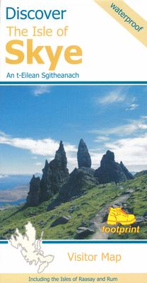
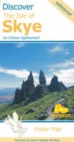
Goede heldere overzichtskaart van het eiland Skye. Als wegenkaart prima te gebruiken, wandelroutes vind je er niet op terug. De wegen staan er duidelijk op ingetekend met wegnmmers en in de steden benzinepompen. Met symbolen veel informatie met mooie plekken om te stoppen, restaurants, campings Visitor map of The Isle of Skye - based on OS data wi...

Verkopers met dit product

Verkoper
Bezorging
Prijs
DeZwerver.nl logo
DeZwerver.nl
2,95
13,95

Anderen bekeken ook

Wegenkaart - landkaart the isle of Skye | Footprint maps
Goede heldere overzichtskaart van het eiland Skye. Als wegenkaart prima te gebruiken, wandelroutes vind je er niet op terug. De wegen staan er duidelijk op ingetekend met wegnmmers en in de steden benzinepompen. Met symbolen veel informatie met mooie plekken om te stoppen, restaurants, campings Visitor map of The Isle of Skye - based on OS data with loads of additional information. 1:110,000. In the Discover series from Footprint maps. Printed on waterproof paper. Includes Raasay, Rona, Scalpay and Soay.
13,95
Wegenkaart - landkaart Discover the Shetlands Islands | Footprint maps
This map is the perfect companion to take for exploring the Shetland Islands. It is packed with lots of information on where to find the best that this group of islands has to offer visitors.   There is a wide range of wild landscapes: from magnificent coastlines with some of the finest beaches in Europe, to huge sea cliffs framing areas of windswept moorland.   There are also many important historic sites to visit, some of which are world famous spanning the long human occupation of the islands.
9,95
Wegenkaart - landkaart Discover the Orkney Islands | Footprint maps
A group of islands close to the north coast of Scotland, Orkney has a visible history spanning more than 5500 years. From the world’s best preserved Neolithic settlement at Skara Brae, through numerous Bronze Age stone circles and burial mounds, Iron Age brochs, Medieval churches and cathedrals, to the remains from more recent events during two World Wars, there is almost too much to see.   The scenery is outstanding. A wild coastline (the Old Man of Hoy is one one islands most iconic images) is backed by a surprisingly rich and fertile countryside. From Mainland (the largest and most populated island) ferries run regular services to a further twelve islands (and three more can be reached by causeway). Wildlife is abundant, particularly sea birds and mammals such as seals, dolphins and whales. Most of the islands are low lying with good road networks, making exploring by car, bicycle or foot easy.  
9,95
Wegenkaart - landkaart in your pocket Isle of Skye | Nicolson
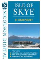
The Isle of Skye In Your Pocket is our new essential map for visiting Skye. The front has exceptionally clear road mapping of the whole island showing main tourist attractions, EV charge points and full index to places & tourist attractions. The reverse has detailed town maps of Portree and Broadford at 1:14,000, useful travel information and glorious full colour photographs of some of the famous sights - you will want to visit them and many more. Don't leave home without it!    Featuring:    Exceptionally clear, fully indexed road mapping Detailed town plans of Portree & Broadf ord EV charging points and tourist attractions shown Travel information and glorious full colour photographs
7,95
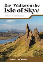
Wandelgids Day Walks on the Isle of Skye | Vertebrate Publishing
Day Walks on the Isle of Skye features 20 routes between 3.4 and 14.5 miles (5.5km and 23.3km) in length, spread across the Isle of Skye with one walk on the neighbouring Isle of Raasay. Researched and written by experienced and knowledgeable authors Helen and Paul Webster, founders of the Walkhighlands website, the walks explore the rugged mountains and wildlife-rich coastline of the islands.   The routes are split into four sections – Trotternish and the Braes; North-West Skye; Glen Brittle and Sligachan; and South Skye and the Isle of Raasay.   Together with stunning photography, each route features Ordnance Survey 1:25,000 maps, easy-to-follow directions, details of distance and navigation information, and refreshment stops and local information.
19,95
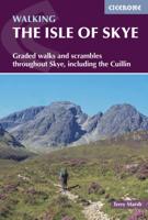
Wandelgids The Isle of Skye | Cicerone
Uitstekende wandelgids, sommige meerdaags, voor dit uitdagende wandelgebied in Schotland. This third edition of Terry Marsh’s walking and scrambling guide to Skye, the Hebrides, northwest Scotland, updated using digital mapping and GPS. 87 walks and scrambles in Sleat and South-East Skye, Strath, Minginish, Duirinish, Waternish and Trotternish for all abilities. Each route describes local historical and geological points of interest. The fame of Skye, the most scenically awe-inspiring of Scotland's many islands, is widespread; you either love it, or hate it. There is no neutrality. For walkers and climbers this is the Promised Land, a place of raw elemental forces, a land barely scratched by man. Over-riding everything hangs an indefinable, almost supernatural, charisma that evokes a deep and abiding affection among those privileged to share Skye's secrets. To go in search of those secrets there is no better way than on foot, and in this collection of walks, Terry Marsh visits all cor…
22,50
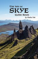
Reisgids Isle of Skye Guide Book | Charles Tait
The Isle of Skye is one of the most popular visitor destinations in Scotland and it was voted the fourth best island in the world by National Geographic. Being a relitavely small island, this guidebook has everything you'll need to experience the wonders of Skye. It covers all the main sites of interest, monuments, details of all of the best places to visit, walks and visitor attractions. It also includes a selection of 11 suggested day itineraries.   Charles does an excellent job at leaving nothing untouched when delving into the beauty that Skye has to offer. Some of the different sections covered range from Nature and Enviroment, Birds, Flora, Fauna, History, Archaeology and Culture. All sections are supported with Charles' own photography, with nearly 800 mostly new and unpublished photographs.   Charles Tait guide books   The Charles Tait guides for Scotland are chock full of information, which will both inspire you before your trip and enhance your experience whilst you're there…
24,95
Wandelgids Isle of Skye | Pocket Mountains
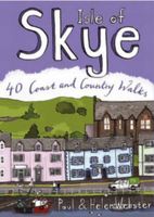
The Isle of Skye (or Ant-Eilean Sgitheanach in its native Gaelic tongue) occupies an almost mythical place in the minds of many Scots. Romantic castles, magnificent sea-scapes, the alpine peaks of the Cuillin Ridge, marching pipe bands, scattered white crofters' cottages and a bloody history; the island has all these and more. This book features 40 moderate walks that take in much of this celebrated landscape, but reveal hidden gems too.   In spite of its popularity Skye is still rich in undiscovered treasures, from coastal caves and arches, ruined villages cruelly cleared of their inhabitants, to fossilised dinosaur footprints and a rich array of wildlife. Written by Skye residents Paul and Helen Webster, these walks will reveal both the wild and gentler sides of this dramatic landscape.   Plaatsen in het boekje An Aird, An Corran, Ardnish, Armadale, Arnish, Bearreraig Bay, Bioda Buidhe, Boreraig, The Braes, Broadford, Brochel Castle, Brothers' Point, Burma Road, Caisteal Maol, Calum…
10,95
Wegenkaart - landkaart Pocket Map Isle of Wight | Collins
Handzame wegenkaart voor  Isle of Wight. Handy little full-colour map of the Isle of Wight. Detailed mapping and tourist information of the whole island.   With its stunning sea views and beautiful beaches, the Isle of Wight has a distinct identity. Discover this unique area with this handy pocket map.   Main features of this map include:   Clear mapping at a scale of 2.3 miles to 1 inch / 1.5 km to 1 cm Main tourist attractions located and described Places to stay, cafes/restaurants, golf courses are all highlighted on the map Essential travel information Index to places of interest and place names Essential for those planning a trip around the Isle of Wight.
7,95

Klanten-reviews van Wegenkaart - landkaart the isle of Skye | Footprint maps

Er zijn nog geen beoordelingen voor dit productBen jij de eerste die een review plaatst?

Meer over Wegenkaart - landkaart the isle of Skye | Footprint maps

Productomschrijving

Goede heldere overzichtskaart van het eiland Skye. Als wegenkaart prima te gebruiken, wandelroutes vind je er niet op terug. De wegen staan er duidelijk op ingetekend met wegnmmers en in de steden benzinepompen. Met symbolen veel informatie met mooie plekken om te stoppen, restaurants, campings

Visitor map of The Isle of Skye - based on OS data with loads of additional information. 1:110,000. In the Discover series from Footprint maps. Printed on waterproof paper. Includes Raasay, Rona, Scalpay and Soay.

Productinformatie

    Verken gerelateerde categorieën

    Webshop.nl maakt gebruik van cookies. Ga je verder op onze website, ga dan akkoord met het plaatsen van cookies en de verwerking van deze data door ons en vermelde partners.