webshop.nl
Categorieën
  Sluiten

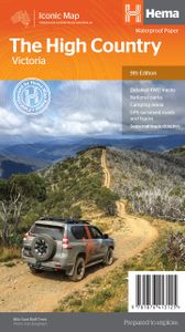
Wegenkaart - landkaart Iconic Map The High Country | Hema Maps

Detailkaart van een deel van Australië. Zeer goed leesbaar, met naast de topografische details veel symbolen waarmee allerhande toeristische zaken worden aangeduid als campsites, nationale parken, attracties, wandelmogelijkheden etc. This brand new edition of Hema’s best-selling High Country map, on durable waterproof paper, features our latest map...
15,95

Webshops met dit product

Webshop
Bezorging
Prijs

Anderen bekeken ook

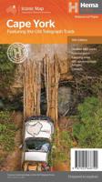
Wegenkaart - landkaart Iconic Map Cape York - Australia | Hema Maps
Detailkaart van een deel van Australië. Zeer goed leesbaar, met naast de topografische details veel symbolen waarmee allerhande toeristische zaken worden aangeduid als campsites, nationale parken, attracties, wandelmogelijkheden etc. Hema’s latest edition of its iconic Cape York map, on durable waterproof paper, combines Hema’s entire database of roads and 4WD tracks with touring points of interest and topographic information. Also included are camping areas, national parks, accommodation and distances.   It now features new inset maps for the CREB Track and Rinyirru (Lakefield) National Park as well as covering the full Old Telegraph Track.     Key Features Detailed 4WD tracks National parks Camping areas GPS surveyed roads & tracks New inset maps for the CREB Track and Rinyirru (Lakefield) National Park Waterproof paper
15,95
Wegenkaart - landkaart Explorer Map Nullarbor Plain - Eastern Map | Hema Maps
This map is part of Hema's new Nullarbor Plain Map Series (East and West) and covers Border Village to Port Pirie including the Eyre Peninsula.    Truly one of the worlds great adventure drives, Australia's semi-arid Nullarbor Plain stretches some 1,256 kilometres (781 miles) via the Eyre Highway and links the cities of Adelaide and Perth (or vice versa depending on your direction). The length of this journey is so large we needed to stretch it over two maps; East from Port Pirie to Border Village in South Australia and the Western sheet from Border Village to Kalgoorlie.    While all the key sites and facilities along the Eyre Highway are listed this map allows you to broaden your horizon and consider some of the other attractions off the Highway, including; the various Nullarbor caves, iconic beaches across the Great Australian Bight and thousands of kilometres of 4WD tracks (including Googs Track), all field-checked by the Hema Map Patrol for superior accuracy.   This map combines H…
15,95
Wegenkaart - landkaart Iconic Map The Kimberley - Gibb River road | Hema Maps
Detailkaart van een deel van Australië. Zeer goed leesbaar, met naast de topografische details veel symbolen waarmee allerhande toeristische zaken worden aangeduid als campsites, nationale parken, attracties, wandelmogelijkheden etc. A regional map of the Kimberley that features the iconic Gibb River Road. On the reverse are inset maps for Purnululu National Park, the Dampier Peninsula and the Parry Creek area. Detailed trip coverage and drive detail for the Gibb River Road is featured as well, with inset mapping covering the journey and corresponding text to guide explorers.   This edition of Hema’s best-selling Kimberley map features Hema's iconic mapping and detailed points of interest. It combines Hema’s entire database of remote roads and 4WD tracks with touring points of interest and topographic information.   Also included are national park information and relevant contact details for pre-trip planning and use on the road or track.   Key Features Waterproof paper Detailed 4WD …
15,95
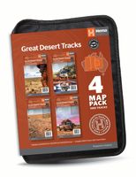
Wegenkaart - landkaart Great Desert Tracks 4 Map Pack | Hema Maps
Hema’s Great Desert Tracks Map Pack The Great Desert Tracks Map Pack presents Hema's iconic Great Desert Tracks series in a soft and durable map wallet. Explore the arid centre with these comprehensive maps that traverse Australia's desert regions — each map waterproof, tear proof and field-checked by the Hema Map Patrol to ensure the accuracy and detail necessary for desert travel. With complete coverage of the outback region of Australia's centre, the Great Desert Tracks Map Pack is the perfect navigation guide for every desert track and journey throughout Australia.   Included in each map pack:   • Great Desert Tracks Central Sheet     • Great Desert Tracks Eastern Sheet     • Great Desert Tracks Western Sheet     • Great Desert Tracks Simpson Desert     • Map Wallet     Great Desert Tracks Eastern Sheet: Oodnadatta Track, Birdsville Track, Simpson Desert, Strzelecki Track, Corner Country, Broken Hill, Lake Eyre, Plenty Highway, Sandover Highway, Channel Country, Hay Ri…
59,95
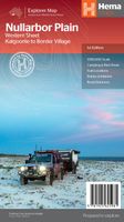
Wegenkaart - landkaart Explorer Map Nullarbor Plain - Western Map | Hema Maps
This map is part of Hema's new Nullarbor Plain Map Series and covers the area from Kalgoorlie to Border Village and its surrounds.   Truly one of the worlds great adventure drives, Australia's semi-arid Nullarbor Plain stretches some 1,256 kilometres (781 miles) via the Eyre Highway and links the cities of Adelaide and Perth (or vice versa depending on your direction). The length of this journey is so large we needed to stretch it over two maps; East from Port Pirie to Border Village in South Australia and the Western sheet from Border Village to Kalgoorlie.    While all the key sites and facilities along the Eyre Highway are listed this map allows you to broaden your horizon and consider some of the other attractions off the Highway, including; the various Nullarbor caves, iconic beaches across the Great Australian Bight and thousands of kilometres of 4WD tracks (including Old Coach Road (by permit)), all field-checked by the Hema Map Patrol for superior accuracy.   This map combines …
15,95
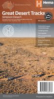
Wegenkaart - landkaart Great Desert Tracks Simpson Desert - Simpson woestijn | Hema Maps
Detailkaart van een deel van Australië. Zeer goed leesbaar, met naast de topografische details veel symbolen waarmee allerhande toeristische zaken worden aangeduid als campsites, nationale parken, attracties, wandelmogelijkheden etc. Hema's Great Desert Tracks maps are essential for anyone travelling in the Australian outback. The mapping features roads and 4WD tracks field-checked by the Hema Map Patrol, Points of Interest for remote area travellers and touring information for learning more about the region and planning your journey.   Discover the Simpson Desert with detailed mapping, relevant points of interest and essential touring information for the journey. One side of the map covers the desert at a scale of 1:500,000, while the other is at 1:1,000,000 for planning purposes. Marked on the mapping are roads and 4WD tracks checked by the Hema Map Patrol, distance markers, topographical relief and touring points of interest including 24-hour fuel, camping areas and caravan parks…
15,95
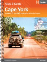
Wegenatlas Cape York Atlas & Guide | Hema Maps
A4 formaat, verschillende schalen / spiraal uitvoering With detailed coverage of The Tip, the coast from Cairns to Cooktown, Rinyirru (Lakefield) National Park, the Peninsula Developmental Road, Old Telegraph Track, Torres Strait and the Savannah Way, it ensures you won’t miss the ‘must-see’ attractions, but it also describes some of the lesser known areas favoured by the experts. Whether you just want to make it to The Tip or are looking for a serious 4WD adventure, this informative book is an indispensable companion.   The book features 15 4WD trips, explored and revised by travel journalist Ian Glover, with photography by Matt Williams. Each trip has a detailed map, plus all the information you need to plan the trip including trip grading, longest distance without fuel, permits and contact details.   This brand new edition of Hema’s best-selling outdoor guidebook for discovering Cape York now features 22 atlas pages in a stunning new cartographic style and also incorporates co…
45,95
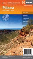
Wegenkaart - landkaart Pilbara and the Coral Coast | Hema Maps
Detailkaart van een deel van Australië. Zeer goed leesbaar, met naast de topografische details veel symbolen waarmee allerhande toeristische zaken worden aangeduid als campsites, nationale parken, attracties, wandelmogelijkheden etc. One of the last great frontiers in Australia, the Pilbara is real 4WD country. This map has been field-checked using Hema's GPS mapping system and includes tracks and roads that have never before appeared on maps. The information side of the map presents all the points of interest, the history, and all the important information a person needs to know in order to safely traverse this remote countryside. Detailed, indexed road map with cartography similar to Hema’s excellent coverage of Australia’s interior in the “Great Desert Tracks” series: road information distinguishes between tracks plotted by the publishers themselves with GPS and those complied from the country’s topographic survey data. Topography is shown by relief shading, with colours and graphic…
15,95
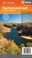
Wegenkaart - landkaart Iconic Map Top End and Gulf | Hema Maps
This regional waterproof map of the Top End and Gulf is ideal for discovering the northern parts of Australia's NT by 4WD. It includes a main map of the Darwin region, Judbarra / Gregory National Park, Nhulunbuy, Keep River National Park and Boodjamulla (Lawn Hill) National Park.   There is additional tourist information for Arnhem Land, the Roper River trek, Darwin region, Douglas-Daly district, Nature’s Way, Victoria Highway, Katherine Region and the Stuart Highway Region.   PRODUCT FEATURES   GPS surveyed roads and tracks Fuel stops Self-drive 4WD tracks Camping areas Historic sites Detailed National Park inset maps WHAT'S NEW IN THIS EDITION:   New edition, new layout New cartographic map specifications All inset maps are now provided in a better scale
15,95
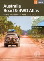
Wegenatlas Australia - Road en 4WD Atlas - Australie | Hema Maps
Gebonden versie, geen spriraalbinding leverbaar van deze atlas.  Schaal is variabel per kaart. Deze editie bevat meer kaarten dan ooit tevoren,met t verneiuwd klerugebruik en daardor nog beter leesbaar.. Met detailkaarten voor Australië's belangrijkstre 4WD bestemmingen: Cape York, Fraser Island, de Top End, de Kimberley, de Pilbara, Centraal-Australië, High Country Victoria en de Flinders Ranges. Zeer volledig met een handig coördinatenstelsel, afstandstabel, een gids voor de nationale parken, een lijst met geaccrediteerde informatiecentra en een volledige index zijn ook opgenomen om te helpen bij de planning extra excursies.  Featuring trusted Hema mapping for all of Australia, the perfect bound Hema Road & 4WD Atlas is the definitive travel guide for tourers and adventurers. Hema atlases feature more information useful to travellers, including 4WD tracks, campsites, caravan parks, rest areas, 24-hour fuel and points of interest.   The new edition contains more mapping than ever befo…
30,95

Klanten-reviews van Wegenkaart - landkaart Iconic Map The High Country | Hema Maps

Er zijn nog geen beoordelingen voor dit productBen jij de eerste die een review plaatst?

Meer over Wegenkaart - landkaart Iconic Map The High Country | Hema Maps

Productomschrijving

Detailkaart van een deel van Australië. Zeer goed leesbaar, met naast de topografische details veel symbolen waarmee allerhande toeristische zaken worden aangeduid als campsites, nationale parken, attracties, wandelmogelijkheden etc. This brand new edition of Hema’s best-selling High Country map, on durable waterproof paper, features our latest mapping and points of interest in a stunning new cartographic style. Featuring roads and 4WD tracks field-checked by the Hema Map Patrol for superior accuracy.   It combines Hema’s entire database of roads and 4WD tracks with touring points of interest and topographic information. Also included are seasonal track closures, camping areas, old townsites, huts, accommodation and distances.   What’s new in this edition:   Stunning new cartographic style with latest mapping, points of interest and facilities. Road and facility data field checked. 4WD track classifications. Key features:   4WD tracks Huts Camping areas Old townsites Seasonal track closures Road distances Accommodation
Webshop.nl maakt gebruik van cookies. Ga je verder op onze website, ga dan akkoord met het plaatsen van cookies en de verwerking van deze data door ons en vermelde partners.