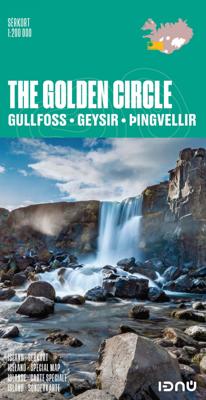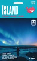
Wegenkaart - landkaart The golden Circle - Zuidwest IJsland | Ferdakort

0
Hele goede wegenkaart met veel topografische details, aangepast aan de toerist / reiziger met symbolen voor allerhande bezienswaardigheden en praktische zaken als campings en benzinepompen. Quality map of the most popular tourist route in South Iceland, Gullfoss - Geysir - Þingvellir, with pictures and information of the highlights of the tour lik...

Verkopers met dit product

Verkoper
Bezorging
Prijs
DeZwerver.nl logo
DeZwerver.nl
2,95
21,50

Anderen bekeken ook

Nieuw
Wegenkaart - landkaart IJsland | 2025 | Ferdakort
Goede wegenkaart van IJsland met naast de topografische details ook symbolen voor alle belangrijke toeristische zaken als benzinepompen, campings, winkels etc. Gemaakt door de IJslandse topografische dienst.   Overall map of Iceland – Place-name index and road distances This is a high quality, overall map of the country with contour shading. This map includes the latest information about Iceland´s road system and road numbers, as well as tourist-service information such as filling stations, accommodation, swimming pools, museums, golf courses, etc. Included with the map is a separate place-name index with over 3000 entries and a road-distance chart.
26,95
Nieuw
Wegenkaart - landkaart 3302 Adventure Map Iceland - IJsland | National Geographic
Wegenkaart van IJsland met vermelding van veel bezienswaardigheden, nationale parken en attrakties. Watervast en scheurvast. Juist door deze vermeldingen onderscheidt de kaart zich van andere wegenkaarten. National Geographic's Iceland Adventure Map is designed to meet the unique needs of adventure travelers—detailed, durable, and accurate. Iceland includes the locations of thousands of cities and towns with an index for easily locating them, plus a clearly marked road network complete with distances and designations for expressways, motorways, and more. Transportation within and beyond the country is made easier with the locations of airports, airfields, railroads, ferry routes, and lighthouses. What sets National Geographic Adventure Maps apart from traditional road maps are the hundreds of points of interest that highlight the diverse and unique destinations within Iceland. Outdoor activities abound on the island and activity symbols note popular locations to ski, golf, camp, fish,…
17,50
Nieuw
Wegenkaart - landkaart IJsland - Iceland Road Guide | Vegahandbokin
Toeristische kaart van IJsland inclusief handige app. High quality overall map of the country in the scale 1:500 000 with the latest official update about the road system.   Some unique features of this map are explanation of lcelandic place names, table of volcano activity, night & daylight scheme for each month, distance table and place name index.   How to drive in Iceland. Some facts about Iceland. Information and photos of 34 tourist attractions along with important tourist information such as accommodations, swimming pools, natural baths, museums, golf courses, filling stations etc.  
19,95
Natuurgids Botanical map Ijsland | Mal og Menning
The botanical map provides clear and accessible information on Iceland's main plants. It shows 78 flowering plants, together with distribution maps and information on size, habitat and season of flowering. The map also includes pictures of Iceland's principal cryptograms (spore-bearing plants), grasses, algae, lichens and fungi. The map's sources include Flowering Plants and Ferns of Iceland by Hörður Kristinsson. The watercolour illustrations areby Jón Baldur Hlíðberg, one of the authors of the Mál og menning Birdwatchers' Map. The botanical map is indispensable to all lovers of Icelandic nature, who wish to learn about Icelandic flora on their travels.
22,50
Reisgids Iceland - IJsland | Lonely Planet
De perfecte reisgids voor IJsland, zowel de georganiseerde als de zelfstandige reiziger. Naast een algemene inleiding van het land / streek vol met praktische informatie over hoe je er het beste kunt reizen: slapen, eten, vervoer, excursies ... alles kun je er in vinden. Discover popular and off the beaten track experiences from sailing among majestic icebergs in Iceland's most famous glacier lagoon, Jökulsárlón; to devouring lobster at the authentic small-town festival of Humarhátíð; and exploring Þingvellir National Park on horseback.   Build a trip to remember with Lonely Planet's Iceland Travel Guide:   Our classic guidebook format provides you with the most comprehensive level of information for planning multi-week trips Updated with an all new structure and design so you can navigate Iceland and connect experiences together with ease Create your perfect trip with exciting itineraries for extended journeys combined with suggested day trips, walking tours, and activities t…
24,95
Nieuw
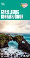
Wegenkaart - landkaart Snaefellsnes - Borgarfjordur (special map IJsland) | Ferdakort
Topografische overzichtskaart 1:200.000 Snæfellsnes / Borgarfjörður - special map in het westen van IJsland - Ferðakort ( vroeger Landmaelingar Íslands ) De wegenkaart laat de toeristisch interessante gebieden op het schiereiland Snaefellsnes en rond Borgarnes zien. Met verhard en onverhard wegennet hoogtelijnen, overnachtingsplekken, hutten voor wandelaars, campings, bezienswaardigheden etc. This high quality map shows the most popular tourist area in Iceland. The map includes photographs and information about the most visited places in the area. The map uses latest geographical data to produce an excellent up-to-date source of information on regional tourist attractions, roads, and services.
21,50
Nieuw
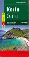
Wegenkaart - landkaart Corfu - Korfoe | Freytag & Berndt
Goede wegenkaart van Corfu, die ook behoorlijk veel detail weergeeft als het gaat om wandelpaden, fietsbare wegen en met veel symbolen voor toeristische bezienswaardigheden. De berijdbare wegen zijn goed weergeven, zowel de hoofdwegen als provinciale en lokale wegen; wegnummers worden vermeld. Afstanden tussen plaatsen zijn in kilometers op de kaart ingetekend, daarnaast worden ook op belangrijke plekken benzinepompen gemarkeerd. In het kaartbeeld wordt door middel van schaduw het reliëf weergegeven en soms enkele punten in het landschap met de daadwerkelijke hoogte. Provinciegrenzen zijn goed terug te vinden, nationale parken en reservaten ook. Met allerhande symbolen worden toeristische bezienswaardigheden weergegeven als monumenten, historisch belangrijke plekken en uitzichtpunten. In bepaalde plaatsen zijn hotels en campings te vinden, luchthavens, treinverbindingen en havens vindt u er ook op! Explore Corfu, the second largest of the Ionian Islands located in Greece; with this Fr…
14,95
Nieuw
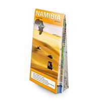
Wegenkaart - landkaart Namibia - Namibië | Tracks4Africa
Uitstekende dubbelzijdige wegenkaart van Namibië, gemaakt door gerenommeerde kaartenmaker Track4Africa in Afrika. Met afstanden en reistijden tussen steden en op alle wegen vermeld. GPS via hun website te downloaden. De kaart wordt door vrijwel elke reisorganisatie geadviseerd als je met een eigen auto in Namibië rond gaat rijden. The Tracks4Africa Namibia paper map is designed to be used in conjunction with the T4A GPS Map of Namibia. It is the largest available Namibia map at 1:1,000,000 scale, offering you the perfect trip planning tool for your next Namibian holiday.  This T4A paper map series are probably the first comprehensive country maps in the world, offering travel time information for the entire road network, be it on tar, gravel or sand!    Key features:    Large 1:1,000,000 scale  Travel times and distances included on the map  What you see on the paper map is exactly what you get on T4A GPS Maps  Comprehensive set of roads and tracks in nature reserves  Detailed in…
27,50
Nieuw
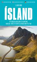
Wegenatlas IJsland met stadsplattegronden | Ferdakort
Super handige kleine wegenatlas van IJsland (schaal 1:500.000) met vooral een enorme hoeveelheid plattegronden van steden en dorpen, enkele themakaarten en een groot register. De kaarten zijn uitstekend leesbaar en de atlas in in een mooie ringband uitgevoerd.  Road Atlas of Iceland at 1:500,000 from Ferðakort, published in a handy 15x25cm spiral-bound format, with an index of over 3,000 entries, a comprehensive distance table, 46 street plans including Reykjavik and several thematic map sincluding cultural heritage and geology.   The whole of Iceland is covered at 1:500,000 with the road network distinguishing between paved and gravel roads, and showing which small local roads are maintained by the country’s government. Fords, locations of petrol stations, driving distances and car ferry routes are marked. National parks and other protected areas are highlighted and symbols mark locations of various places of interest: different types of tourist accommodations including campsites, re…
30,95
Nieuw
Wegenkaart - landkaart Sierra Nevada | National Geographic
&; Waterproof &; Tear-Resistant &; Travel Map   National Geographic's Sierra Nevada Destination Map strikes the perfect balance between map and guidebook and is an ideal resource for touring the rugged landscape of this culturally and geographically unique region of California and Nevada.   The front side of the print map reveals a detailed map of the region stretching from the Oregon border to California's Eldorado National Forest, bordered by the Sacramento Valley to the west and Nevada's Great Basin to the east. Modoc, Shasta-Trinity, Lassen, Plumas, and Humbolt-Toiyabe National Forests are also included on the map. The map features a comprehensive road network including scenic byways as well as areas of interest such as Indian Reservations, National Parks and Monuments, and Recreation Areas. Trails, historic sites, museums, cultural centers, scenic areas, state parks and other points of interest are also included. In addition, the map features beautiful photographs and inform…
17,50

Klanten-reviews van Wegenkaart - landkaart The golden Circle - Zuidwest IJsland | Ferdakort

Er zijn nog geen beoordelingen voor dit productBen jij de eerste die een review plaatst?

Meer over Wegenkaart - landkaart The golden Circle - Zuidwest IJsland | Ferdakort

Productomschrijving

Hele goede wegenkaart met veel topografische details, aangepast aan de toerist / reiziger met symbolen voor allerhande bezienswaardigheden en praktische zaken als campings en benzinepompen.

Quality map of the most popular tourist route in South Iceland, Gullfoss - Geysir - Þingvellir, with pictures and information of the highlights of the tour like the Blue lagoon. The map contains the latest information about Iceland's road system, including road distances and road numbers, as well as important travel-service information.

Verken gerelateerde categorieën

Webshop.nl maakt gebruik van cookies. Ga je verder op onze website, ga dan akkoord met het plaatsen van cookies en de verwerking van deze data door ons en vermelde partners.