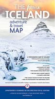
Wegenkaart - landkaart The fotoVUE Iceland Adventure and Travel Map | Fotovue

0
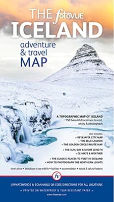
The fotoVUE Iceland Adventure and Travel Map is the essential map if you are visiting Iceland; featuring 150 of the most beautiful places to visit (all the locations in fotoVUE's Volumes 1 & 2 of Photographing Iceland by James Rushforth) including all the not-to-be-missed places and those not so well-known but just as magic. The essential classic ...

Verkopers met dit product

Verkoper
Bezorging
Prijs
DeZwerver.nl logo
DeZwerver.nl
2,95
22,95

Anderen bekeken ook

Reisfotografiegids Photographing Iceland Volume 1 | Fotovue
Explore and discover the beautiful places of Iceland with the most comprehensive and detailed guidebook to Iceland ever published. Featuring over 600 stunning images, and over 120 locations with detailed maps, sat-nav co-ordinates including what3words and smart phone scannable lat-long QR-codes. This beautiful travel and photo-location guidebook provides both inspiration and information to make your trip a reality.   Including information on car rental, vehicle insurance and driving advice, suggested itineraries from a long weekend to several weeks, with essays on Iceland's cultural history, cuisine, flora & fauna and advice on how to photograph the Aurora Borealis/Northern Lights. All the classic locations around Reykjavik and along the ring road are covered from roadside attractions, to multi-day overnight hikes; covering glaciers, waterfalls, geysers, hot springs, lava fields, craters, volcanoes, mountains, coast, beaches and cliffs, towns, churches, cultural sites, harbours and wi…
62,95
Wegenkaart - landkaart 3302 Adventure Map Iceland - IJsland | National Geographic
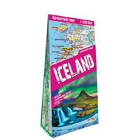
Wegenkaart van IJsland met vermelding van veel bezienswaardigheden, nationale parken en attrakties. Watervast en scheurvast. Juist door deze vermeldingen onderscheidt de kaart zich van andere wegenkaarten. National Geographic's Iceland Adventure Map is designed to meet the unique needs of adventure travelers—detailed, durable, and accurate. Iceland includes the locations of thousands of cities and towns with an index for easily locating them, plus a clearly marked road network complete with distances and designations for expressways, motorways, and more. Transportation within and beyond the country is made easier with the locations of airports, airfields, railroads, ferry routes, and lighthouses. What sets National Geographic Adventure Maps apart from traditional road maps are the hundreds of points of interest that highlight the diverse and unique destinations within Iceland. Outdoor activities abound on the island and activity symbols note popular locations to ski, golf, camp, fish,…
17,50
Nieuw
Wegenkaart - landkaart 3327 Adventure Map Western Balkans - Westelijke Balkan | National Geographic
Wegenkaart van de Westelijke Balkan met vermelding van veel bezienswaardigheden en attrakties. Watervast en scheurvast. Juist door deze vermeldingen onderscheidt de kaart zich van andere wegenkaarten. Landen: Slovenië, Kroatië, Bosnië Herzegovina, Montenegro, Albanië, Servië,  Kosovo, and Macedonië.   The Western Balkans region, an adventure playground and rising star of Europe, is loaded with Old World traditions, slow food culture, ancient towns, and rarely visited villages. The area stretches from the Adriatic Sea in the west, up and over mountain ranges, raging rivers, tectonic lakes, steep gorges, and thousands of miles of paths, trails, and routes. Discover eight countries—all with their special brand of Balkan magic: Slovenia, Croatia, Bosnia and Herzegovina, Montenegro, Albania, Serbia, Kosovo, and Macedonia.   National Geographic's Western Balkans Adventure Map will meet the needs of travelers with its detailed and accurate information. The map includes the locations of UNESC…
17,50
Nieuw
Wegenkaart - landkaart Melbourne and Region Map | Hema Maps
Handige kaart van zowel de stad Melbourne als het omliggende gebied. Description Melbourne & Region The Melbourne and Region map features a primary map of Greater Melbourne (1:115,000) that includes highways, major roads and local streets, as well as 24-hour fuel, parks and caravan parks. On the reverse is a Melbourne CBD map with accommodation, shopping and other places of interest pinpointed, along with train and tram network maps and a Melbourne Region map. Key Features Highways, major roads and local streets Points of interest Accommodation Travel Information Parks Caravan Parks 24 Hour Fuel Tram lines Railway stations Suburbs Suburbs Index Shopping centres Theatres/Cinemas Sporting venues Tram and Train network maps The cosmopolitan capital of Victoria, Melbourne is a city of distinct districts: each with its own particular appeal. For a different view of the city head to the observation deck at the Eureka Skydeck for 360° views. A cruise along the Yarra River provides yet anothe…
14,50
Wegenkaart - landkaart 3024 Adventure Map Cambodia - Cambodja | National Geographic
Mooie, heldere kaart van Cambodja,  gedrukt op scheurvast en watervast papier. National Geographic's Cambodia Adventure Map is designed to meet the needs of adventure travelers with its durability and detailed, accurate information. This map includes the locations of cities and towns with a user-friendly index, a clearly marked road network complete with distances and designations for roads/highways, plus secondary routes for those seeking to explore off the beaten path. Adventure Maps differ from a traditional road map because of the specialty content they include. Each map contains hundreds of diverse and unique recreational, ecological, cultural, and historic destinations — outside of the major tourist hubs. National Geographic Adventure Maps are the perfect companion to a guidebook, yet far easier to pack!   Cambodia is perhaps best know to international travelers as the home of the Angkor empire for six hundred years. Angkor Wat and Angkor Thom are part of the vast temple complex…
17,50
Nieuw
Wegenkaart - landkaart 110 Milos Kimolos | Road Editions
Gedetailleerde wegenkaart met aanduiding van de wandelwegen, lijst van hotels en toeristische informatie. Voor alle doeleinden een zeer geschikte kaart. Though not among the top ten most popular destinations in the Aegean, these are two beautiful islands with a unique character, ideal for quiet family holidays, and nature touring, as well as for the young crowd looking for exciting summer fun. This is the best, most updated and easy to read map available of Milos and Kimolos. As all ROAD maps, it was designed following careful and exhaustive onsite research. We used the most advanced technology to precisely map the entire road networks of these two islands, we measured the distances in kilometers from intersection to intersection with precision instruments, marked all country churches, monasteries, archaeological sites and castles on these islands, as we did the beaches and the roads leading to them, the altitudes of mountain peaks, the footpaths we were able to locate and record, the…
9,95
Wegenkaart - landkaart 3202 Adventure Map Egypt - Egypte | National Geographic
Wegenkaart van Egypte met vermelding van veel bezienswaardigheden, nationale parken en attrakties. Watervast en scheurvast. Juist door deze vermeldingen onderscheidt de kaart zich van andere wegenkaarten. National Geographic's Egypt Adventure Map is designed to meet the unique needs of adventure travelers with its detail, durability, and accuracy. The map includes the locations of thousands of cities and towns with an index for easily locating them, plus a clearly marked road network complete with distances and designations for expressways, major roadways, and more. Transportation within and beyond the country is made easier with the locations of airports, airfields, railroads, ferry routes, lighthouses, harbors, border crossings, and police control points.   What sets National Geographic Adventure Maps apart from traditional road maps are the hundreds of points of interest that highlight the diverse, unique, and exotic destinations within Egypt. In addition to typical sites of intere…
17,50
Nieuw
Wegenkaart - landkaart 3025 Adventure Map Myanmar - Birma | National Geographic
Mooie, heldere kaart van Myanmar, gedrukt op scheurvast en watervast papier.   National Geographic's Myanmar (Burma) Adventure Map is designed to meet the needs of adventure travelers with its durability and detailed, accurate information. This map includes the locations of cities and towns with a user-friendly index, a clearly marked road network complete with distances and designations for roads/highways, plus secondary routes for those seeking to explore off the beaten path. Adventure Maps differ from a traditional road map because of the specialty content they include. Each map contains hundreds of diverse and unique recreational, ecological, cultural, and historic destinations — outside of the major tourist hubs. National Geographic Adventure Maps are the perfect companion to a guidebook, yet far easier to pack!   Myanmar is a country with a varied landscape. From the highest peak, Hkakabo Razi, in the Hengduan Shan mountains on the border with China to the lowlands at the mouth …
17,50
Reisfotografiegids Photographing Scotland | Fotovue
PHOTOGRAPHING SCOTLAND is a photography-location and visitor guidebook. If you are a keen photographer who can¿t miss a sunrise or are on holiday using a mobile phone camera, this guidebook will take you to the most beautiful and photogenic places in Scotland. In this extensive photo-location and visitor guidebook, award winning Scottish photographer Dougie Cunningham explores and describes the most beautiful places in Scotland to visit and photograph. From Glencoe to Glen Torridon, Skye to Shetland, Callanish to Cairngorm, this guidebook reveals the islands and mountains, glens and lochs, rivers and coastline and visits ancient stone circles, fortified houses, medieval castles, crofts and peel towers. The classic views are included and many more lesser known and hidden gems amongst the Lowlands, Highlands and Islands of this spectacular country. Also included are photographic tours of Edinburgh and Glasgow, and a handy list of the best Scottish whiskey distilleries to visit. This boo…
41,50
Reisfotografiegids Photographing Iceland | Rocky Nook
★★★★★ Must have for visiting Iceland! Considered by many to be the world's top destination for amateur and professional landscape photographers, Iceland possesses unparalleled beauty, and the variety of spectacular landscapes found on this small island is astounding. Whether you're visiting Iceland as a destination in its own right or as a stopover on your way elsewhere, you're bound to have a unique and memorable experience. To help you make the most of your trip--no matter how long or short it is--Photographing Iceland provides you with five unique photography-focused tours that cover 37 must-see locations for you to photograph. Author, photographer, and Iceland expert Martin Schulz is your guide, providing you with background information on each location, detailed directions (including QR codes with Google Maps links), advice on gear and traveling, suggestions on the best time of year and day to visit each location, and the ideal angles from which to shoot. (Because who wants to en…
27,95

Klanten-reviews van Wegenkaart - landkaart The fotoVUE Iceland Adventure and Travel Map | Fotovue

Er zijn nog geen beoordelingen voor dit productBen jij de eerste die een review plaatst?

Meer over Wegenkaart - landkaart The fotoVUE Iceland Adventure and Travel Map | Fotovue

Productomschrijving

The fotoVUE Iceland Adventure and Travel Map is the essential map if you are visiting Iceland; featuring 150 of the most beautiful places to visit (all the locations in fotoVUE's Volumes 1 & 2 of Photographing Iceland by James Rushforth) including all the not-to-be-missed places and those not so well-known but just as magic. The essential classic locations are highlighted so that you don't miss them. Directions are provided by ///what3words and scannable lat-long QR-codes for easy navigation on your smart phone, plus a very clear colour topographic map; Iceland has 4G covering 95% of the country.   Marked on the map are facilities such as fuel (gas) stops, accommodation, restaurants, cafes, museums, off-licences (liquor stores) and attractions. Includes- A city map of Reykjavik and a detailed road map of the Golden Circle with all locations marked. - Details and graphs of day length, seasons, weather and climate.   The best times to visit. - Advice on how to photograph the Northern lights whether using a DSLR/Mirrorless camera or a smartphone. - Advice on driving including driving in bad weather, snow and river crossings.

Productinformatie

    Verken gerelateerde categorieën

    Webshop.nl maakt gebruik van cookies. Ga je verder op onze website, ga dan akkoord met het plaatsen van cookies en de verwerking van deze data door ons en vermelde partners.