webshop.nl
Categorieën
  Sluiten

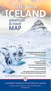
Wegenkaart - landkaart The fotoVUE Iceland Adventure and Travel Map | Fotovue

The fotoVUE Iceland Adventure and Travel Map is the essential map if you are visiting Iceland; featuring 150 of the most beautiful places to visit (all the locations in fotoVUE's Volumes 1 & 2 of Photographing Iceland by James Rushforth) including all the not-to-be-missed places and those not so well-known but just as magic. The essential classic l...
22,95

Webshops met dit product

Webshop
Bezorging
Prijs

Anderen bekeken ook

Wegenkaart - landkaart 3302 Adventure Map Iceland - IJsland | National Geographic
Wegenkaart van IJsland met vermelding van veel bezienswaardigheden, nationale parken en attrakties. Watervast en scheurvast. Juist door deze vermeldingen onderscheidt de kaart zich van andere wegenkaarten. National Geographic's Iceland Adventure Map is designed to meet the unique needs of adventure travelers—detailed, durable, and accurate. Iceland includes the locations of thousands of cities and towns with an index for easily locating them, plus a clearly marked road network complete with distances and designations for expressways, motorways, and more. Transportation within and beyond the country is made easier with the locations of airports, airfields, railroads, ferry routes, and lighthouses. What sets National Geographic Adventure Maps apart from traditional road maps are the hundreds of points of interest that highlight the diverse and unique destinations within Iceland. Outdoor activities abound on the island and activity symbols note popular locations to ski, golf, camp, fish, …
17,50
Reisfotografiegids Photographing Iceland Volume 1 | Fotovue
Explore and discover the beautiful places of Iceland with the most comprehensive and detailed guidebook to Iceland ever published. Featuring over 600 stunning images, and over 120 locations with detailed maps, sat-nav co-ordinates including what3words and smart phone scannable lat-long QR-codes. This beautiful travel and photo-location guidebook provides both inspiration and information to make your trip a reality.   Including information on car rental, vehicle insurance and driving advice, suggested itineraries from a long weekend to several weeks, with essays on Iceland's cultural history, cuisine, flora & fauna and advice on how to photograph the Aurora Borealis/Northern Lights. All the classic locations around Reykjavik and along the ring road are covered from roadside attractions, to multi-day overnight hikes; covering glaciers, waterfalls, geysers, hot springs, lava fields, craters, volcanoes, mountains, coast, beaches and cliffs, towns, churches, cultural sites, harbours and wil…
62,95
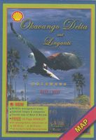
Wegenkaart - landkaart Okavango Delta - Tourist Map of the Okavango Delta and Linyanti Botswana - Veronica Roodt | Shell
Zeer bijzondere landkaart van de Okavango Delta en Linyanti. Uitermate handig zijn de GPS coördinaten van de meest belangrijke punten als campings of uitzichtpunten. De kaart is gebaseerd op een luchtfoto, waarbij alle details zijn ingetekend. The map: The map of the Okavango and Linyanti was compiled by using LANDSAT satellite images. The main reason for a tourist map of the area is to indicate the localities of the lodges as well as the wildlife management areas in which they occur. Tourists to the Okavango often visit more than one lodge and this will give them a good idea of where they have been. On the back of the map are enlargements of the different tourist areas, which shows more detail of the landscape. There are no GPS co-ordinates on the Okavango map as all the Wildlife areas consist of private concessions, which are not open to the general public. The roads in the private concessions have also not been indicated as this may mislead the self-driving public, making them think…
17,50
Wegenkaart - landkaart 3202 Adventure Map Egypt - Egypte | National Geographic
Wegenkaart van Egypte met vermelding van veel bezienswaardigheden, nationale parken en attrakties. Watervast en scheurvast. Juist door deze vermeldingen onderscheidt de kaart zich van andere wegenkaarten. National Geographic's Egypt Adventure Map is designed to meet the unique needs of adventure travelers with its detail, durability, and accuracy. The map includes the locations of thousands of cities and towns with an index for easily locating them, plus a clearly marked road network complete with distances and designations for expressways, major roadways, and more. Transportation within and beyond the country is made easier with the locations of airports, airfields, railroads, ferry routes, lighthouses, harbors, border crossings, and police control points.   What sets National Geographic Adventure Maps apart from traditional road maps are the hundreds of points of interest that highlight the diverse, unique, and exotic destinations within Egypt. In addition to typical sites of interes…
17,50
Wegenkaart - landkaart 3327 Adventure Map Western Balkans - Westelijke Balkan | National Geographic
Wegenkaart van de Westelijke Balkan met vermelding van veel bezienswaardigheden en attrakties. Watervast en scheurvast. Juist door deze vermeldingen onderscheidt de kaart zich van andere wegenkaarten. Landen: Slovenië, Kroatië, Bosnië Herzegovina, Montenegro, Albanië, Servië,  Kosovo, and Macedonië.   The Western Balkans region, an adventure playground and rising star of Europe, is loaded with Old World traditions, slow food culture, ancient towns, and rarely visited villages. The area stretches from the Adriatic Sea in the west, up and over mountain ranges, raging rivers, tectonic lakes, steep gorges, and thousands of miles of paths, trails, and routes. Discover eight countries—all with their special brand of Balkan magic: Slovenia, Croatia, Bosnia and Herzegovina, Montenegro, Albania, Serbia, Kosovo, and Macedonia.   National Geographic's Western Balkans Adventure Map will meet the needs of travelers with its detailed and accurate information. The map includes the locations of UNESCO…
17,50
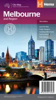
Wegenkaart - landkaart Melbourne and Region Map | Hema Maps
Handige kaart van zowel de stad Melbourne als het omliggende gebied. Description Melbourne & Region The Melbourne and Region map features a primary map of Greater Melbourne (1:115,000) that includes highways, major roads and local streets, as well as 24-hour fuel, parks and caravan parks. On the reverse is a Melbourne CBD map with accommodation, shopping and other places of interest pinpointed, along with train and tram network maps and a Melbourne Region map. Key Features Highways, major roads and local streets Points of interest Accommodation Travel Information Parks Caravan Parks 24 Hour Fuel Tram lines Railway stations Suburbs Suburbs Index Shopping centres Theatres/Cinemas Sporting venues Tram and Train network maps The cosmopolitan capital of Victoria, Melbourne is a city of distinct districts: each with its own particular appeal. For a different view of the city head to the observation deck at the Eureka Skydeck for 360° views. A cruise along the Yarra River provides yet another…
11,50
Wegenkaart - landkaart Adventure Map Myanmar - Birma | National Geographic
Mooie, heldere kaart van Myanmar, gedrukt op scheurvast en watervast papier.   National Geographic's Myanmar (Burma) Adventure Map is designed to meet the needs of adventure travelers with its durability and detailed, accurate information. This map includes the locations of cities and towns with a user-friendly index, a clearly marked road network complete with distances and designations for roads/highways, plus secondary routes for those seeking to explore off the beaten path. Adventure Maps differ from a traditional road map because of the specialty content they include. Each map contains hundreds of diverse and unique recreational, ecological, cultural, and historic destinations — outside of the major tourist hubs. National Geographic Adventure Maps are the perfect companion to a guidebook, yet far easier to pack!   Myanmar is a country with a varied landscape. From the highest peak, Hkakabo Razi, in the Hengduan Shan mountains on the border with China to the lowlands at the mouth o…
17,50
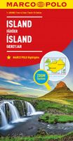
Wegenkaart - landkaart Iceland - IJsland | Marco Polo
Duidelijke wegenkaart van Marco Polo: alle wegen, zowel de verharde als belangrijke onverharde wegen zijn weergegeven.  Mooie toeristisch interessante wegen die de moeite waard zijn, zijn groen gearceerd. Veel toeristische informatie is toegevoegd zoals de nationale parken, campings, kastelen en vliegvelden. Afstanden tussen belangrijke steden en benzinestations staan ook op de kaart. Een plaatsnamenregister ontbreekt niet.   ---   This Marco Polo map features really easy to read cartography. Topography is highlighted with relief shading and loads of spot heights and the road network is clearly shown with roads ranging from motorways all the way through to minor secondary roads. The map also clearly indicates airports, places of interest, scenic/tourist routes, view points etc.   The map includes a booklet attached to the cover that contains some useful information and a very extensive index that covers locations, places of interest and geographical features. Also included are a distan…
13,95
Wegenkaart - landkaart 3024 Adventure Map Cambodia - Cambodja | National Geographic
Mooie, heldere kaart van Cambodja,  gedrukt op scheurvast en watervast papier. National Geographic's Cambodia Adventure Map is designed to meet the needs of adventure travelers with its durability and detailed, accurate information. This map includes the locations of cities and towns with a user-friendly index, a clearly marked road network complete with distances and designations for roads/highways, plus secondary routes for those seeking to explore off the beaten path. Adventure Maps differ from a traditional road map because of the specialty content they include. Each map contains hundreds of diverse and unique recreational, ecological, cultural, and historic destinations — outside of the major tourist hubs. National Geographic Adventure Maps are the perfect companion to a guidebook, yet far easier to pack!   Cambodia is perhaps best know to international travelers as the home of the Angkor empire for six hundred years. Angkor Wat and Angkor Thom are part of the vast temple complex …
17,50
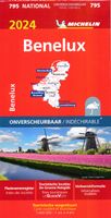
Wegenkaart - landkaart 795 Benelux 2024 | Michelin
Scheur- en watervast.   Zoals je van Michelin mag verwachten is deze kaart zeer overzichtelijk en heeft een duidelijk helder kaartbeeld. De kaart geeft uitgebreid toeristische informatie weer. Met stadsplattegrond van de hoofdstad.   Grote kracht van de Michelin kaarten is het uitstekende kaartbeeld. Ze maken gebruik van goede kleuren waardoor het zeer leesbaar is. Daarnaast staat er veel informatie op, ook toeristische details en bezienswaardigheden. Erg handig zijn de zogenaamde groene wegen: met een groene lijn geeft Michelin aan welke routes het mooist zijn om te rijden.   Daarnaast wordt een beperkt aantal campings weergegeven, helaas niet allemaal. Meestal betreft het de zgn. camping municipale ofwel de gemeentecampings.   Benelux at 1:400,000 from Michelin, with information on driving regulations in each country, a distance and journey time table, plus enlargements showing in greater detail road access to Amsterdam, Brussels and Luxembourg City. Coverage extends east to include …
12,95

Klanten-reviews van Wegenkaart - landkaart The fotoVUE Iceland Adventure and Travel Map | Fotovue

Er zijn nog geen beoordelingen voor dit productBen jij de eerste die een review plaatst?

Meer over Wegenkaart - landkaart The fotoVUE Iceland Adventure and Travel Map | Fotovue

Productomschrijving

The fotoVUE Iceland Adventure and Travel Map is the essential map if you are visiting Iceland; featuring 150 of the most beautiful places to visit (all the locations in fotoVUE's Volumes 1 & 2 of Photographing Iceland by James Rushforth) including all the not-to-be-missed places and those not so well-known but just as magic. The essential classic locations are highlighted so that you don't miss them. Directions are provided by ///what3words and scannable lat-long QR-codes for easy navigation on your smart phone, plus a very clear colour topographic map; Iceland has 4G covering 95% of the country.   Marked on the map are facilities such as fuel (gas) stops, accommodation, restaurants, cafes, museums, off-licences (liquor stores) and attractions. Includes- A city map of Reykjavik and a detailed road map of the Golden Circle with all locations marked. - Details and graphs of day length, seasons, weather and climate.   The best times to visit. - Advice on how to photograph the Northern lights whether using a DSLR/Mirrorless camera or a smartphone. - Advice on driving including driving in bad weather, snow and river crossings.
Webshop.nl maakt gebruik van cookies. Ga je verder op onze website, ga dan akkoord met het plaatsen van cookies en de verwerking van deze data door ons en vermelde partners.