webshop.nl
Categorieën
  Sluiten

Meer ITMB
Meer ITMB in Literatuur boeken

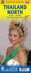
Wegenkaart - landkaart Thailand North - noord | ITMB

Een degelijke wegenkaart met aanduidingen van o.a. nationale parken, vliegveld, benzinepomp, dirt-roads. Als overzichtskaart goed te gebruiken.   The map actually goes from Bangkok north, and side one includes a very good inset map of Bangkok’s central area. Probably the most interesting spot on this side is the town of Kanchanaburi, which is withi...
13,95

Webshops met dit product

Webshop
Bezorging
Prijs

Anderen bekeken ook

Wegenkaart - landkaart Thailand North - noord | ITMB
Een degelijke wegenkaart met aanduidingen van o.a. nationale parken, vliegveld, benzinepomp, dirt-roads. Als overzichtskaart goed te gebruiken.   The map actually goes from Bangkok north, and side one includes a very good inset map of Bangkok’s central area. Probably the most interesting spot on this side is the town of Kanchanaburi, which is within easy striking distance of Bangkok. This was the site made famous by the war movie Bridge on the River Kwai (now Khwae) on the Japanese-built Burma Railway. The current bridge is not the original, but the Commonwealth Graves Cemetery is well worth a visit. The other side concentrates on the wilder portion of Thailand, the far north. All known points of interest have been included, including a lovely inset map of Chiang Mai, the focal point of the north. The rail line ends here, but if the city’s many temples and pagodas don’t overwhelm you, tours to nearby temple sites abound. The temple complex near Phrae, further to the east, are also show…
13,95
Wegenkaart - landkaart Thailand | ITMB
Een degelijke wegenkaart met aanduidingen van o.a. nationale parken, vliegveld, benzinepomp, dirt-roads. Als overzichtskaart goed te gebruiken. What can I say about Thailand that hasn t already been said? This is our eighth edition of this ever-popular title. It has a new ISBN, as we are gradually replacing our former prefix, but there is modest change on this map. The rail line into Vientiane, Laos, is now shown, and the inset map of Chiang Mai improved, as are insets for Bangkok and Pattaya. The transit map of Bangkok on the back cover has been updated to show the new MTR line. We have done our best to portray this wonderful country accurately, attractively, and beneficially for end users. This is a very good map.
13,95
Wegenkaart - landkaart Alaska's Inside Passage | ITMB
Een degelijke kaart met aanduidingen van o.a. nationale parken, vliegveld, benzinepomp, dirt-roads en kleine plattegronden van Anchorage, Seattle, Vancouver en Victoria. Als overzichtskaart goed te gebruiken.    We recently released our USA Pacific Coast Map, covering the segment between San Diego and Vancouver. This map completes the mapping of the Pacific Ocean coastline by mapping the routes followed by cruise ships and Alaska Ferries heading north from Seattle and Vancouver to Alaska. This is a double-sided map, with Vancouver Island and the coastline as far north as Prince Rupert on one side (with inset maps of Seattle, Victoria, and Vancouver)on side 1, and the coastline north to Glacier Bay and an onward inset map to Anchorage (including an inset map of the city) on the second side. As the actual routes followed by the numerous cruise lines vary, we can't show their actual sailing routes, but they generally follow the coastline within viewing distance of either the mainland or c…
13,95
Wegenkaart - landkaart Laos | ITMB
Een degelijke kaart van Laos met aanduidingen van o.a. nationale parken, vliegveld, benzinepomp, dirt-roads en kleine plattegronden van Vientiane, Luang Prabang we're very pleased to introduce you to this new, double-sided, map at a great scale, with fantastic detail. To me, the north side is the most interesting, covering the portion of Laos from Vientiane, the capital, to the Chinese border. Detailed inset maps of Vientiane and Louang Prabang, the temple city, are included on this side, as are bits of both Thailand and Vietnam. The south portion fills the other side of the sheet, including a goodly portion of Vietnam, showing all border crossings. Much of Thailand has had to be obscured, unfortunately, to make room for the place names index, but the immediate border areas are shown, including the rail line south from Vientiane. In an interesting departure from previous ITMB maps, the back cover consists of a detailed inset map of Vientiane at 1:16,000 scale, making it easy to use in …
13,95
Stadsplattegrond - Wegenkaart - landkaart Quito & Ecuador Central | IT
Een degelijke wegenkaart van Ecuador met aanduidingen van o.a. nationale parken, vliegveld, benzinepomp, dirt-roads en kleine plattegrond van hoofdstad. Als overzichtskaart goed te gebruiken. Finally, ITMB releases its long-awaited re-worked map of the wonderful South America city of Quito. The city is squeezed in between mountain ranges and, the entire city stretches from north (on the right-hand side of the map) to the south. The "bottom" of the map is, actually the eastern portion. A regional inset map clarifies the situation. The street network is clearly shown, along with the rapid line bus way and the city's Metro. The Old Town is perhaps the most interesting portion of the city for visitors and is on the left-hand portion of the map. The newer downtown is centered on La Carolina Park on the right-hand side of the map. This is where most of the shopping malls and hotels are located. The old airport is shown in part on the far right, but the new international airport is located fa…
13,95
Wegenkaart - landkaart England & Wales - Engeland | ITMB
Een degelijke kaart met aanduidingen van o.a. nationale parken, vliegveld, benzinepompen. ITMB publishes a map of Great Britain, but each portion of GB needs its own map to show roads and attractions in more detail. This is a brilliant map of both England and Wales, showing the entire 'country' in a double-sided format. The place names index is formidable, but England in particular is a series of little villages, so it has been very difficult to decide what to include and what to leave out. This map is showing motorways, divided carriageways, all A & B highways, railway lines, airports, historic sites and touristic attractions, parks and gardens, and just about everything that we could fit on to the page to provide users with a detailed, usable map. We have been able to fit all of southern England/Wales as far north as Chester/Lincoln on side A and with a little overlap, from those cities north to the well over the Scottish border, up to Perth/Dundee filling side B. The Isle of Man and…
13,95

Klanten-reviews van Wegenkaart - landkaart Thailand North - noord | ITMB

Er zijn nog geen beoordelingen voor dit productBen jij de eerste die een review plaatst?

Meer over Wegenkaart - landkaart Thailand North - noord | ITMB

Productomschrijving

Een degelijke wegenkaart met aanduidingen van o.a. nationale parken, vliegveld, benzinepomp, dirt-roads. Als overzichtskaart goed te gebruiken.   The map actually goes from Bangkok north, and side one includes a very good inset map of Bangkok’s central area. Probably the most interesting spot on this side is the town of Kanchanaburi, which is within easy striking distance of Bangkok. This was the site made famous by the war movie Bridge on the River Kwai (now Khwae) on the Japanese-built Burma Railway. The current bridge is not the original, but the Commonwealth Graves Cemetery is well worth a visit. The other side concentrates on the wilder portion of Thailand, the far north. All known points of interest have been included, including a lovely inset map of Chiang Mai, the focal point of the north. The rail line ends here, but if the city’s many temples and pagodas don’t overwhelm you, tours to nearby temple sites abound. The temple complex near Phrae, further to the east, are also shown, as is the highway leading to Chiang Rai in the far north.   Legend Includes: Roads by classification, Railways, Attractions, Hotels, Point of interest, Airports, Tourist information, Hospitals, Shopping centre, River, ferry, and much more.

Productspecificaties

Artikelnummer(s)
Brand
ITMB

Verken gerelateerde categorieën

Webshop.nl maakt gebruik van cookies. Ga je verder op onze website, ga dan akkoord met het plaatsen van cookies en de verwerking van deze data door ons en vermelde partners.