webshop.nl
Categorieën
  Sluiten

Meer ITMB

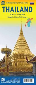
Wegenkaart - landkaart Thailand | ITMB

Een degelijke wegenkaart met aanduidingen van o.a. nationale parken, vliegveld, benzinepomp, dirt-roads. Als overzichtskaart goed te gebruiken. What can I say about Thailand that hasn t already been said? This is our eighth edition of this ever-popular title. It has a new ISBN, as we are gradually replacing our former prefix, but there is modest ch...
13,95

Webshops met dit product

Webshop
Bezorging
Prijs

Anderen bekeken ook

Wegenkaart - landkaart Thailand | ITMB
Een degelijke wegenkaart met aanduidingen van o.a. nationale parken, vliegveld, benzinepomp, dirt-roads. Als overzichtskaart goed te gebruiken. What can I say about Thailand that hasn t already been said? This is our eighth edition of this ever-popular title. It has a new ISBN, as we are gradually replacing our former prefix, but there is modest change on this map. The rail line into Vientiane, Laos, is now shown, and the inset map of Chiang Mai improved, as are insets for Bangkok and Pattaya. The transit map of Bangkok on the back cover has been updated to show the new MTR line. We have done our best to portray this wonderful country accurately, attractively, and beneficially for end users. This is a very good map.
13,95
Wegenkaart - landkaart Western Canada | ITMB
Een degelijke kaart met aanduidingen van o.a. nationale parken, vliegveld, benzinepomp, dirt-roads. Als overzichtskaart goed te gebruiken. This is actually our second attempt at mapping the western portion of Canada; the first covered everything from northwestern Ontario to the Pacific Ocean and, while it was an excellent map, the scale that such a huge area covered necessitated severe problems. In this version, all of British Columbia, Alberta, and the Yukon have been mapped from fresh digital data and presented at 1:1.4T scale. This would have been impossible when we prepared the first map. The Northwest Territories portion had to be compressed in two ways; first, the scale is 1:2M; second, only the portion with roads is shown. This is still an extremely large area. One has to consider the actual size of Canada when designing a map. Most countries in Europe would fit into this area, which only covers 20% of Canada. The Fort McMurray forest fire of a year ago covered an area larger th…
13,95
Wegenkaart - landkaart South Pacific Cruising & Samoa | ITMB
Een overzichtskaart van de zuidelijke Stille Oceaan met de cruise routes tussen de verschillende eilanden aangegeven. Op de achterzijde een overzichtskaart van Samoa This is a new venture for ITMB. Cruising is a rapidly-growing segment of the travel industry, experiencing double-digit growth rates annually. Obviously, this is a thriving market. In conjunction with several cruise ship lines, we have prepared a map of the South Pacific Ocean, which extends southwards from Hawai'i to the southern tip of New Zealand and eastwards from central Australia/Papua New Guinea to the Pitcairn Islands. Thus, it does not include the popular South East Asia and China coast routes. We think this has to change at a time when 25,000,000 people are travelling by cruise ships. At the same time, we must keep coverage area relevant for those end users of the artwork. Even at 1:12M, most of the area covered is water, with island countries such as Fiji, Tonga, Kiribati, Tahiti, and the Cook Islands being visi…
13,95
Wegenkaart - landkaart Western Canada | ITMB
Een degelijke kaart met aanduidingen van o.a. nationale parken, vliegveld, benzinepomp, dirt-roads. Als overzichtskaart goed te gebruiken. This is actually our second attempt at mapping the western portion of Canada; the first covered everything from northwestern Ontario to the Pacific Ocean and, while it was an excellent map, the scale that such a huge area covered necessitated severe problems. In this version, all of British Columbia, Alberta, and the Yukon have been mapped from fresh digital data and presented at 1:1.4T scale. This would have been impossible when we prepared the first map. The Northwest Territories portion had to be compressed in two ways; first, the scale is 1:2M; second, only the portion with roads is shown. This is still an extremely large area. One has to consider the actual size of Canada when designing a map. Most countries in Europe would fit into this area, which only covers 20% of Canada. The Fort McMurray forest fire of a year ago covered an area larger th…
13,95
Wegenkaart - landkaart Scotland - Schotland | ITMB
Anyone who has been in this business for a few years remembers Ordnance Survey and their brilliantly detailed artwork. They should also remember that OS guarded this artwork religiously. That all changed when the then head of government in the UK, one soon-forgotten Gordon Brown, decreed that commercial OS artwork had to be discontinued and artwork had to be made more freely available to users. I expected an outpouring of new artwork by private UK firms. It did not happen; in fact, the range of travel maps decreased dramatically. However, OS artwork is still an excellent source of mapping artwork. This is a wonderful double-sided, detailed map of Scotland. It is both extremely detailed and accurate. We have added symbols for parks, historic sites, battlefields, country hotels, and anything else that we think would interest visitors. In order to portray Scotland to best scale advantage, the only inset included with this map are those of outlying islands, such as the Shetlands. ITMB also…
13,95
Wegenkaart - landkaart Afghanistan | ITMB
Een degelijke kaart met aanduidingen van o.a. nationale parken, vliegveld, benzinepomp, dirt-roads en kleine plattegrond van hoofdstad. Als overzichtskaart goed te gebruiken. Legend Includes: Roads by classification, silk road, airports, towns, villages, ruins, national parks, lakes, swamps, points of interest and other information It is a bit difficult to credit Afghanistan having touristic potential at the moment, but it is an extremely important country right now, and that justifies a very good map of the country. This is our third edition of this country and each one keeps getting better. We can’t justify sending a researcher into a combat zone to gather data, but we are thankful to those aid workers and soldiers who have added to our information base and helped make this map more useful. In this edition, we are showing some new roads, reflecting the reality that the country is succeeding in improving its infrastructure in spite of a very tense political situation. We have also pla…
13,95
Wegenkaart - landkaart South Pacific Cruising & Samoa | ITMB
Een overzichtskaart van de zuidelijke Stille Oceaan met de cruise routes tussen de verschillende eilanden aangegeven. Op de achterzijde een overzichtskaart van Samoa This is a new venture for ITMB. Cruising is a rapidly-growing segment of the travel industry, experiencing double-digit growth rates annually. Obviously, this is a thriving market. In conjunction with several cruise ship lines, we have prepared a map of the South Pacific Ocean, which extends southwards from Hawai'i to the southern tip of New Zealand and eastwards from central Australia/Papua New Guinea to the Pitcairn Islands. Thus, it does not include the popular South East Asia and China coast routes. We think this has to change at a time when 25,000,000 people are travelling by cruise ships. At the same time, we must keep coverage area relevant for those end users of the artwork. Even at 1:12M, most of the area covered is water, with island countries such as Fiji, Tonga, Kiribati, Tahiti, and the Cook Islands being visi…
13,95
Wegenkaart - landkaart Thailand North - noord | ITMB
Een degelijke wegenkaart met aanduidingen van o.a. nationale parken, vliegveld, benzinepomp, dirt-roads. Als overzichtskaart goed te gebruiken.   The map actually goes from Bangkok north, and side one includes a very good inset map of Bangkok’s central area. Probably the most interesting spot on this side is the town of Kanchanaburi, which is within easy striking distance of Bangkok. This was the site made famous by the war movie Bridge on the River Kwai (now Khwae) on the Japanese-built Burma Railway. The current bridge is not the original, but the Commonwealth Graves Cemetery is well worth a visit. The other side concentrates on the wilder portion of Thailand, the far north. All known points of interest have been included, including a lovely inset map of Chiang Mai, the focal point of the north. The rail line ends here, but if the city’s many temples and pagodas don’t overwhelm you, tours to nearby temple sites abound. The temple complex near Phrae, further to the east, are also show…
13,95

Klanten-reviews van Wegenkaart - landkaart Thailand | ITMB

Er zijn nog geen beoordelingen voor dit productBen jij de eerste die een review plaatst?

Meer over Wegenkaart - landkaart Thailand | ITMB

Productomschrijving

Een degelijke wegenkaart met aanduidingen van o.a. nationale parken, vliegveld, benzinepomp, dirt-roads. Als overzichtskaart goed te gebruiken. What can I say about Thailand that hasn t already been said? This is our eighth edition of this ever-popular title. It has a new ISBN, as we are gradually replacing our former prefix, but there is modest change on this map. The rail line into Vientiane, Laos, is now shown, and the inset map of Chiang Mai improved, as are insets for Bangkok and Pattaya. The transit map of Bangkok on the back cover has been updated to show the new MTR line. We have done our best to portray this wonderful country accurately, attractively, and beneficially for end users. This is a very good map.

Productspecificaties

Artikelnummer(s)
Brand
ITMB
Webshop.nl maakt gebruik van cookies. Ga je verder op onze website, ga dan akkoord met het plaatsen van cookies en de verwerking van deze data door ons en vermelde partners.