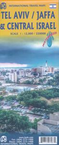
Wegenkaart - landkaart Tel Aviv - Jaffa en Centraal Israel | ITMB
Een kaart die naast het wegennet en plaatsen ook de nadruk legt op de natuurkundige aspecten van het land of gebied. Met kleur worden de verschillende hoogtelagen weergegeven, waardoor je een mooi beeld krijgt van het land. Met symbolen worden bijvoorbeeld benzinepompen aangeduid maar ook stranden. Grote plattegrond Tel Aviv op schaal 1:12.000 Op andere zijde kaart van Centraal Israel op schaal 1:220.000 This map resulted from our visit to Israel a couple of years ago. We got lost in Tel Aviv and wasted a lot of time trying to find our way to where we were staying. Although quite good maps of Tel Aviv exist, most are in Hebrew and are very "Israeli". We decided to do a map that combined the newish city of Tel Aviv with its older and more exotic neighbour, Jaffa, which is currently dominated by those of a non-Jewish orientation. Jaffa is the ancient port used by Phoenicians, Greeks, Romans, and traders plying the Silk Road to China. Its old town is quite compact and a treat to explore. …
13,95


