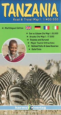
Wegenkaart - landkaart Tanzania - Rwanda - Burundi | Harms IC Verlag

0

Verkopers met dit product

Verkoper
Bezorging
Prijs
DeZwerver.nl logo
DeZwerver.nl
2,95
14,95

Anderen bekeken ook

Wegenkaart - landkaart Tanzania, Rwanda en Burundi | Nelles Verlag
Goede kaart van Tanzania, Rwanda en Burundi. Aan beide kanten bedrukt. Met veel toeristische aanduidingen als nationale parken en culturele bezienswaardigheden. Prima leesbare kaart. Pemba Island 1 : 500.000 Zanzibar Island (Unguja) 1 : 300.000 Arusha 1 : 18.000 Dar es Salaam 1 : 30.000 Zanzibar-Stonetown 1 : 11.100 Folded road and tourist map of Tanzania at 1:1 500 000 scale. Places of interest, national parks, beaches, lodges & camps are all highlighted and shaded-relief colouring clearly depicts the topography.   The map includes insets showing Dar es Salaam at 1:30 000, Zanzibar-Stonetown at 1:11 100, Arusha at 1:18 000, Pemba Island at 1:500 000, and Zanzibar Island (Unguja) at 1:300 000. The legend is in three languages including English.    
11,95
Wegenkaart - landkaart Rwanda & Burundi | ITMB
Een degelijke landkaart van Rwanda & Burundi met aanduidingen van o.a. nationale parken, vliegveld, benzinepomp, dirt-roads en kleine plattegrond van hoofdstad. Als overzichtskaart goed te gebruiken. The two central African countries of Rwanda and Burundi are gradually returning to prosperity. They are both very interesting countries, scenically attractive, and relatively untouched by modernism. Both have suffered serious unrest in the past, but have moved on and are determined to have a bright and happy future. The people are marvelous; one can’t express in a brief paragraph the warmth and friendliness of the ordinary people of both countries. This is really a part of Africa everyone should visit. It’s a very special place, and I’m pleased to introduce the latest edition of an excellent map for two of my favourite places. As with past editions, this is actually two completely separate maps, with Rwanda on one side and Burundi on the other. There are two different covers, so the map c…
13,95
Wegenkaart - landkaart Wandelkaart Lake Manyara en Tangarire NP - Tanzania | Harms IC Verlag
Toeristische kaart van Lake Manyara en Tangarire National Park  in drie talen (Duits, Frans en Engels). Helder en duidelijk leesbaar kaartbeeld met topografische informatie, alle wegen en de accommodaties als lodges en campsites.  Die Karte im Maßstab 1: 200.000 zeigt das Gebiet der benachbarten Nationalparks Lake Manyara und Tarangire in der Gesamtschau. Zahlreiche Symbole markieren Sehenswürdigkeiten, Hotels, Lodges, Camps, Campsites und andere Parkeinrichtungen. Straßen, Pisten und touristisch bedeutsame Karteninhalte wurden mit GPS neu vermessen.   Außerdem sind eine Detailkarte des Lake Manyara Nationalparks im Maßstab 1:100.000 sowie ein Stadtplan von Arusha enthalten.   Viersprachige Legende: Englisch, Deutsch, Französisch und Kisuaheli.
10,95
Wegenkaart - landkaart 3206 Adventure Map Tanzania - Rwanda - Burundi | National Geographic
Wegenkaart van Tanzania, Rwanda en Burundi met vermelding van veel bezienswaardigheden, nationale parken en attrakties. Watervast en scheurvast. Juist door deze vermeldingen onderscheidt de kaart zich van andere wegenkaarten. National Geographic's Tanzania, Rwanda, and Burundi Adventure Map is designed to meet the unique needs of adventure travelers with its durability and accurate information. This folded map provides global travelers with the perfect combination of detail and perspective, highlighting hundreds of points of interest and the diverse and unique destinations within the country. The map includes the locations of cities and towns with a user-friendly index, plus a clearly marked road network complete with distances and designations for major highways, main roads, and tracks and trails for those seeking to explore more remote regions.   The front side of the Tanzania map details the southern region of the country, from Zambia to the south, to the bordering country of Burun…
17,50
Wegenkaart - landkaart Serengeti - Masai-Mara - Ngorongoro | Harms IC Verlag
De kaart, aan beide zijden in vier kleuren gedrukt, toont het gebied van het ‘Greater Serengeti Ecosystem’ op een uniforme schaal van 1:125.000.   Daarnaast bevat het gedetailleerde kaarten van de Ngorongoro-krater en het Seronera-gebied (de kernzone van de Serengeti) op een schaal van 1:100.000, evenals een kaart met uitleg over de jaarlijkse dierenmigraties (migratie) en veel foto's.   Talrijke symbolen verwijzen naar attracties, hotels, kampen en andere faciliteiten in het nationale park.   Viertalige legende: Engels, Duits, Frans en Kiswahili. De kaart is gedrukt op waterdicht StonePaper om hulpbronnen te sparen en is daarom goed uitgerust voor de tropische zone. Het open formaat van 68 x 80 cm is gevouwen naar 11 x 22,5 cm.
13,95
Wegenkaart - landkaart Zanzibar - The spice island | Harms IC Verlag
 Gedetailleerde toeristenkaart, wegenkaart van Zanzibar met stadsplattegrond Stone Town en een kaart van Pemba. De kaart is geschikt voor gebruik met GPS. Im Maßstab 1:100.000 zeigt die Karte in detaillierter Darstellung die gesamte Region der berühmten Gewürzinsel „Sansibar“, einschließlich der Korallengärten und der vorgelagerten Inselwelt. Ergänzend enthält sie eine Karte der Insel Pemba im Maßstab 1:250.000, einen Stadtplan von Stone Town im Maßstab 1:10.000, dem historischen Zentrum der Hauptstadt und eine Übersichtskarte der Region. Zahlreiche Symbole verweisen auf Sehenswürdigkeiten, Hotels und Beach Resorts. Sämtliche Straßen, Pisten und touristisch interessanten Karteninhalte wurden mit GPS aufgenommen. Die Karte entstand in Zusammenarbeit mit den tansanischen Behörden und dem Institute of Marine Sciences, der Universität von Dar es Salaam.   Die Kartenrückseite bietet nützliche Reiseinformationen in drei Sprachen (Deutsch, Englisch und Italienisch) und gibt u.a. Auskunft übe…
10,95
Wegenkaart - landkaart Tansania - Tanzania | Reise Know-How Verlag
Tweetalige kaart (Engels en Duits) van Tanzania, inclusief Rwanda en Burundi. Door ingetekende lengte- en breedtegraden is het gebruik van GPS mogelijk. Met hoogtelijnen en uitgebreid wegennetwerk: daarnaast worden ook de afstanden tussen belangrijke plaatsen duidelijk leesbaar weergegeven. Het kleurgebruik is zodanig dat je een goede indruk krijgt van hoogteverschillen en soorten landschap. Natuurlijk staan de toeristische bezienswaardigheden duidelijk vermeld.Met centrumkaart van Dar Es Salaam.   Gedrukt op water- en scheurvast papier! Polyart is een synthetisch product vrij van giftige stoffen dus duurzaam. Het papier gaat echt lang mee.   Topography is indicated by altitude colouring with numerous spot heights and names of mountain ranges and passes. Salt lakes, swamps, seasonal rivers and glacier are also shown. Detailed presentation of the road network includes minor roads and tracks and railways are also shown.   Internal administrative units are presented with their boundaries…
11,50
Wegenkaart - landkaart Tanzania | ITMB
Uitstekende wegenkaart van Tanzania met zowel de toeristische informatie als Nationale Parken en bezienswaardigheden, maar ook de topografische details als plaatsen en wegen, spoorlijnen en rivieren, hoogten, lengte- en breedtegraden. An easy-to-use road and geographical map of Tanzania to plan your trip, to prepare your itinerary, and to travel independently in this African country. This double-sided map contains a place name index, inset maps of Dar es Salaam, Arusha and Stone Town. The legend is in English. Touristic information: places of interest, vistas, ruins and archaeological sites, museums, Unesco World Heritage sites, hotel/motel, campsites, ferry lines, ports, airports, national parks, petrol stations, hospitals and médical facilities, border crossing.
14,95
Wegenkaart - landkaart Tanzania | Freytag & Berndt
Prima wegenkaart - landkaart van Tanzania, nu met een nieuwe schaal van 1:1.300.000. Met uitgebreide legenda zodat campings, tankstations, bezienswaardigheden en dergelijke staan aangegeven. Explore Tanzania with this Freytag & Berndt road map. The best way to plan your trip, prepare your itinerary, and to travel independently in this country.   This map includes an index on the back, and touristic information on this map includes accommdation, international airports, museums, places of particular interest, antique sites and river/canal systems.
14,95
Wandelkaart Kilimanjaro National Park Map | Harms IC Verlag
Detailed 1:100 000 topographic map of the extended National Park area contains controus, coloured elevation layers and vegetation zones. To improve its 3D impression of the relief, it includes a quality hillshading. The map shows the official Kilimanjaro trekking routes, all GPS approved and captured by mountain guides, also various map symbols with tourist information - huts, viewpoints, points of interest and more. Uselful additions are city maps of Arusha and Moshi, a detailed 1:50 000 of the Kibo area and a general map of northern Tanzania. English, German, French and Kisuaheli Comprehensive guide in englisha and german describing the tekking/climbing routes, the geology and botany of the area - also coloured photos. Das gesamte Nationalparkgebiet wird im Maßstab 1:100.000 detailgetreu wiedergegeben. Die Geländeformen werden durch Höhenlinien, farbige Höhenschichten und eine Reliefschummerung ideal repräsentiert. Die Karte enthält sämtliche aktuelle Trekkingrouten auf den Mount Ki…
14,75

Klanten-reviews van Wegenkaart - landkaart Tanzania - Rwanda - Burundi | Harms IC Verlag

Er zijn nog geen beoordelingen voor dit productBen jij de eerste die een review plaatst?

Meer over Wegenkaart - landkaart Tanzania - Rwanda - Burundi | Harms IC Verlag

Productinformatie

    Verken gerelateerde categorieën

    Webshop.nl maakt gebruik van cookies. Ga je verder op onze website, ga dan akkoord met het plaatsen van cookies en de verwerking van deze data door ons en vermelde partners.