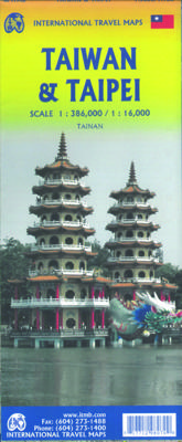
Wegenkaart - landkaart Taiwan and Taipei | ITMB

0
Een degelijke kaart met aanduidingen van o.a. nationale parken, vliegveld, benzinepomp, dirt-roads en kleine plattegrond van hoofdstad. Als overzichtskaart goed te gebruiken. Wegenkaart Taiwan en stadsplan Taipei   Combining a map of Taiwan with a street plan of Taipei. The map of the island shows the road and rail networks, indicating local airpo...

Verkopers met dit product

Verkoper
Bezorging
Prijs
DeZwerver.nl logo
DeZwerver.nl
2,95
14,50

Anderen bekeken ook

Nieuw
Wegenkaart - landkaart Taiwan | Nelles Verlag
Goede geplastificeerde wegenkaart van Taiwan. Aan beide kanten bedrukt. Met veel toeristische aanduidingen als nationale parken en culturele bezienswaardigheden. Prima leesbare kaart. Kaohsiung 1 : 30.000 Taichung 1 : 20.000 Tainan 1 : 20.000 Taipei 1 : 30.000 Folded road and tourist map of Taiwan at 1:400,000 scale. Places of interest, national parks, and beaches are all highlighted and shaded-relief colouring clearly depicts the topography.    The map includes insets shwoing Taipei at 1:30 000, Taichung at 1:20 000, Tainan at 1:20 000, and Kaohsiung at 1:30 000. The legend is in three languages including English.   For over 20 years Nelles maps have been renowned throughout the world for their quality, faithfulness to detail and up-to-dateness.    So that streets, ferry links, railway lines, etc are always up to date, Nelles are continuously upgrading their maps - with the help of their international team of correspondents. Roads are provided with an exact kilometerage. Sights are h…
11,95
Nieuw
Wegenkaart - landkaart Peru | ITMB
Een degelijke kaart met aanduidingen van o.a. nationale parken, vliegveld, dirt-roads en kleine plattegrond van hoofdstad. Als overzichtskaart goed te gebruiken. Peru at 1:1,500,000 on a double-sided, waterproof and tear-resistant, indexed map from ITMB, with large, clear street plans of central Lima and Cusco, highlighting accommodation, places of interest and various facilities. The map divides the country north/south, approximately along the line between the Cordillera Blanca and Cordillera Huyahuash, with very little overlap between the two sides. Topography is very effectively presented by altitude colouring, with spot heights and additional graphics for swamps and marshland, glaciers and volcanos. The map shows the country’s road network distinguishing between all-weather and seasonable roads and indicates driving distances on main routes. Railway lines, including the popular routes linking Cusco with Puno and Arequipa, are very clearly shown. The map also shows local airports a…
13,95
Nieuw
Wegenkaart - landkaart Kyrgyzstan - Kirgizië | Gizi Map
Met name door het kleurgebruik een mooie kaart: heel duidelijk wordt het landschap weergegeven. Daarnaast veel topografische details.   Kyrgyzstan at 1:750,000 from Gizi Map with excellent presentation of the country’s mountainous terrain through bold altitude colouring and plenty of names of mountain ranges, etc, road network indicating routes of the old Silk Road, plus a street plan of Bishkek and an administrative map of the country. All place names are in the Latin alphabet.   Topography is vividly shown by bold elevation colouring, with spot heights and graphics for swamps, salt flats and deserts, plus plenty of names of mountain ranges, peaks, valleys, etc. National parks are highlighted. The map shows internal provincial boundaries and also clearly indicates the country’s Uzbek and Tadjik enclaves. Road network includes selected local tracks and highlights routes which used to the part of the old Silk Road. Railway lines are included and local airports are marked. Symbols indic…
15,95
Wegenkaart - landkaart Mekong Delta & Southern Vietnam | ITMB
Een degelijke kaart met aanduidingen van o.a. nationale parken, vliegveld, benzinepomp en dirt-roads. Als overzichtskaart goed te gebruiken. Double-sided indexed map with street plans of central Ho Chi Min City, Da Lat and Can Tho. The main map at 1:800,000 shows the area’s road and rail networks and local airports. The Ho Chi Minh Trail is highlighted, as are national parks, nature reserves, beaches, numerous places of interest, fuel supplies, etc. Provincial boundaries are marked and names of administrative regions prominently shown. Topography is indicated by altitude colouring. Latitude and longitude lines are drawn at 30’ intervals. On the reverse, the Mekong Delta is shown in greater detail at 1:500,000 with many small waterways. The map also includes street plans of central Ho Chi Minh City, Can Tho and Da Lat, annotated with symbols showing accommodation, various facilities and places of interest. Further insets show Phu Quoc Island at 1:200,000 and, for travelers venturing fu…
13,95
Nieuw
Wegenkaart - landkaart Sudan and South Sudan | Gizi Map
Sudan and South Sudan as separate countries on an excellent indexed map at 1:2,500,000 from Gizi Maps with detailed presentation of the topography, administrative divisions, street plans of Khartoum and Juba, etc. Excellent presentation of the terrain in the publisher’s characteristic style provides a vivid picture of the region’s geography: bold altitude colouring with plenty of spot heights and names of peaks, mountain ranges, etc, plus additional graphics for flood plains, swamps, salt flats, deserts, lava fields, wadis and water wells. National parks or other protected areas and interesting natural sites are highlighted. The map indicates the boundary of the disputed Abyei area and shows the internal administrative boundaries and names of the provinces. Within North Sudan names of larger towns and of the provinces are also given in Arabic. Where appropriate, alternative versions of town names are provided (Khartoum/Al Khartum, Omdurman/Umm Durman, etc). The map shows the road n…
15,95
Nieuw
Wegenkaart - landkaart Ukraine - Moldova | Gizi Map
Kaart van Oekraïne met Moldavië, met een uitbreiding met de Krim in meer detail, plus plattegronden van het centrum van Kiev en Lviv. Wegennet is ingedeeld in zes typen, rij-afstanden aangegeven op hoofd-en secundaire routes, en verder worden grensovergangen weergegeven. Ukraine with Moldova on an indexed road map at 1:1,100,000 from Gizi Map, with an enlargement showing southern Crimea in greater detail, plus street plans of central Kiev and Lviv. All place names are shown transliterated into Latin alphabet, with those of major cities also given in their Cyrillic versions. Altitude colouring with relief shading indicates the mountainous regions, with the marshlands of northern Ukraine also marked. National parks and other protected areas are highlighted. Road network is graded into six types, driving distances are marked on main and secondary routes, and border crossings are shown. Railway lines, ferry routes on the Black Sea and Azov Sea, and local airports are included. Symbols hig…
15,95
Nieuw
Wegenkaart - landkaart 751 Thailand | Michelin
De Michelin kaart van Thailand is een overzichtelijke landkaart waarop de toeristische sites staan aangeduid. De kaart heeft een plaatsnamenregister en een stadsplattegrond van Bangkok. De plaatsnamen staan op de kaart en in de index in het Nederlands en in het Thais. Thailand at 1:370,000 on an indexed road map from Michelin with street plans of central Bangkok and an enlargement for the capital’s environs. All place names on the map are shown in both Thai and Latin alphabet and the index is in both scripts. Road network emphasizes main routes but also clearly presents local roads, all with road numbers easy to read. Driving distances are shown on primary routes and main connecting roads; steep gradients, viewpoints, toll barriers and border crossings are marked; scenic routes are highlighted. Railway lines are included and domestic airports are marked. Symbols indicate various places of interest.  Topography is shown by relief shading with colouring for forested areas. National park…
12,95
Wegenkaart - landkaart - Stadsplattegrond Estonia, Estland en Tallinn | ITMB
Goede wegenkaart van Estland met bezienswaardigheden, kilometers etc. daarop aangegeven. The map displays Estonia on one side and Tallin on the other, each showing a separate index. Road networks distinguish motorways, major and minor roads with intermediate distances on connecting roads. Railways and ferry routes are also shown, while symbols clearly indicate parking and international and domestic airports.   Topography is represented by altitude colouring and graphics locate rivers, lakes, national parks and reserves, Unesco World Heritage sites, scenic spots, hotsprings etc. Symbols mark locations of various places of interest including hotels, campsites, historic ruins, castles, beaches, ports etc. International and administrative boundaries are marked. Latitude and longitude lines are drawn at intervals of 20’.   The street plan of Tallin is a clearly laid out and extends from the Gulf of Tallin to Tallin international airport and the intercity bus station in the south, the Centr…
13,95
Nieuw
Wegenkaart - landkaart Ethiopia Ethiopië - Eritrea | ITMB
Een degelijke kaart met aanduidingen van o.a. nationale parken, vliegveld, benzinepomp, dirt-roads en kleine plattegrond van hoofdstad. Als overzichtskaart goed te gebruiken. This is the latest updating of one of the most interesting countries in Africa. There isn’t anything brilliantly innovative to report. We have tidied up the different layers of the artwork, have updated the road system, and have added more tourist information. We have also modernized the cover design and changed the ISBN – printed on paper, single-sided, inset map of Addis Ababa. Legend Includes: roads by classification, Airports, Ports, Gasolines, Polices, Post Offices, Bus Stations, Hospitals, Schools, Universities, Buildings, Point of Interests, Bridges, Lodgings, Campsites or Huts, Museums, and many more   Double-sided map from ITMB presenting on one side a road map of Ethiopia at 1:2,000,000 accompanied by a street plan of Addis Ababa, with on the reverse Eritrea at 1:900,000 with a plan of Asmara. Both roa…
13,95
Nieuw
Wegenkaart - landkaart 3 China centraal | Nelles Verlag
Goede wegenkaart van een deel van China. Aan beide kanten bedrukt. Met veel toeristische aanduidingen als nationale parken en culturele bezienswaardigheden. Prima leesbare kaart. Cental China at 1:1,750,000 from Nelles in a convenient format for use when travelling, with street plans of central Beijing and Shanghai. The map is double-sided, with an overlap between the sides, and provides coverage from just north of the capital, to include the local sections of the Great Wall, to Wenzhou and westwards to include Xian. All place names are in the Latin alphabet only with, where useful, their historical pre-Pinyin names (Peking, Tsingtao, etc).   Maps in the Nelles series for China present road and rail networks on a base with topography indicated by relief shading, with names of mountain ranges and peaks plus additional spot heights. Local airports are marked and the maps also show internal administrative boundaries with names of the provinces. Places of interest, including historical si…
11,95

Klanten-reviews van Wegenkaart - landkaart Taiwan and Taipei | ITMB

Er zijn nog geen beoordelingen voor dit productBen jij de eerste die een review plaatst?

Meer over Wegenkaart - landkaart Taiwan and Taipei | ITMB

Productomschrijving

Een degelijke kaart met aanduidingen van o.a. nationale parken, vliegveld, benzinepomp, dirt-roads en kleine plattegrond van hoofdstad. Als overzichtskaart goed te gebruiken.

Wegenkaart Taiwan en stadsplan Taipei   Combining a map of Taiwan with a street plan of Taipei. The map of the island shows the road and rail networks, indicating local airports and airfields, national parks and scenic areas, places of interest and beaches. The country’s administrative divisions are marked, with names of the provinces and provincial capitals shown in both Roman alphabet and Chinese. All other place names are in Roman alphabet only. Topography is shown by altitude colouring with spot heights. Brief descriptions are provided for main places of interest and a separate inset shows the route of the Taiwan Highspeed Railway.   On the reverse is an street plan of Taipei, highlighting places of interest, railway and metro stations, bus and ferry terminals, selected accommodation, etc. Street and district names are in Roman alphabet only, but metro and railway stations have names on both scripts. Also included is road map of the city’s environs, plus an inset with a street plan of Tainan, showing accommodation and places of interest.

Verken gerelateerde categorieën

Webshop.nl maakt gebruik van cookies. Ga je verder op onze website, ga dan akkoord met het plaatsen van cookies en de verwerking van deze data door ons en vermelde partners.