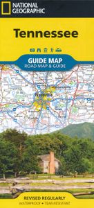
Wegenkaart - landkaart State Guide Map Tennessee | National Geographic
Makkelijk leesbare kaart aan 2 zijden bedrukt. De ene kan met informatie en beperkte stadsplattegronden, de andere met de daadwerkelijke kaart. De kaart is geplastificeerd en dus watervast! National Geographic's Tennessee Guide Map is the ultimate ultimate travel companion to "The Volunteer State," combining a comprehensive road map with an expertly research travel guide. The road network contains designations for free access and toll highways; U.S., state and country routes; paved and unpaved roads; and scenic byways. Mileage markers are shown on major highways and scenic routes have pinpointed wayside stops. An index of cities, towns and counties along with a chart of driving distances will aid in your finding your destination and planning your route. Found on the map are hundreds of points of interest, such as national and state parks, national forests, campgrounds, visitor centers, airports, hospitals, ski areas and much more. City inset maps provide extra detail of Knoxville, Ch…
12,95


