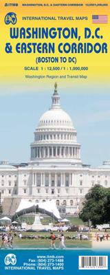
Wegenkaart - landkaart - Stadsplattegrond Washington D.C. & eastern corridor | ITMB

0
Stadsplattegrond van Washington D.C., 1:12.500, met een overzichtskaart van het gebied van Boston tot aan Washington DC, 1:1.000.000   This is one of the most-visited cities in the USA and one really NEEDS a map to uncover all the statues, memorials, and buildings of interest. Of course, hotels, shopping areas, transportation hubs, parks, etc are ...

Verkopers met dit product

Verkoper
Bezorging
Prijs
DeZwerver.nl logo
DeZwerver.nl
2,95
13,95

Anderen bekeken ook

Wegenkaart - landkaart - Stadsplattegrond Washington D.C. & eastern corridor | ITMB
Stadsplattegrond van Washington D.C., 1:12.500, met een overzichtskaart van het gebied van Boston tot aan Washington DC, 1:1.000.000   This is one of the most-visited cities in the USA and one really NEEDS a map to uncover all the statues, memorials, and buildings of interest. Of course, hotels, shopping areas, transportation hubs, parks, etc are also included. With this edition, we also have added a full-sheet map of the Eastern Corridor of the USA to the reverse side of the map. Starting with Boston in the north, through NYC and Philadelphia to Baltimore and on past DC to Richmond and Raleigh, the Eastern Corridor encompasses one-third of the population of the United States and a dozen States. The map shows road and rail connections, with motorways noted in blue and toll roads in green, and includes major historic and touristic sites within the area of coverage.   Legend Includes: Roads by classification, State Boundaries,State Highways, Main Roads, Secondary and other Roads,Hot spr…
13,95
Wegenkaart - landkaart Seattle & Washington State | ITMB
This is a new title for ITMB, in that it is the first time we have mapped the State of Washington. The actual area of the map includes Portland and northern Oregon and Vancouver and the border area with the USA. A small portion of Idaho is also shown. Wilderness campsites, parks such as Rainier, Olympic, and Baker, are shown. Seattle as a city, stretches far beyond the confines of a practical map in that it stretches from Everett to Tacoma. Our map covers from the University in the north to the Beacon Hill neighbourhood in the south and from the waterfront to Lake Washington. An inset map of the greater region is included. The rapid transit line is also included on the map and on the back cover. The reverse side of the sheet shows all the roads of Washington State in excellent Olympic, and Baker, state parks, touristic sites, beaches, ferry routes, native reserves, motorways, and even the ill-fated Hanford nuclear site are included. The map is printed on ITM waterproof paper for durab…
13,95
Wegenkaart - landkaart Washington State - British Columbia southwest | ITMB
Een degelijke kaart met aanduidingen van o.a. nationale parken, vliegveld, benzinepomp, dirt-roads en campsites. Als overzichtskaart goed te gebruiken. This map hopes to accomplish two goals; first, it is a detailed road and points of interest map for Washington State and adds to our growing range of State covered in detail, and second, it combines that portion of Canada's BC accessible to Americans heading north. The map has two covers so can be marketed either as a USA map title or a Canadian title. The front side covers all of Washington State, with a bit of Oregon and Idaho, and has a decent-sized inset map of downtown Seattle. The reverse side covers much-larger British Columbia - at least a portion of it, including all of Vancouver Island, all the roads from Vancouver eastwards to the Rockies and north to Kamloops, and hundreds of wilderness campsites in the interior. This side also includes insets of Victoria and downtown Vancouver. This map fills a gap in the travel map market…
13,95
Stadsplattegrond Washington D.C | Freytag & Berndt
Goede stadsplattegrond van Washington D.C. met openbaar vervoer, register. Stadsplattegrond met register. Helder kaartbeeld waarbij de naamgeving goed leesbaar is weergegeven. Met de toeristische bezienswaardigheden in symbolen weergeven: monumenten, musea, stadions e.a. Daarnaast handige zaken als postkantoren, parkeergarages en stations. Veelal ook met een openbaar vervoer of metro kaart als inzet Central Washington DC at 1:12,500 on street plan from Freytag & Berndt clearly showing locations of various government institutions, US and international organizations, numerous foreign embassies, cultural centres, educational establishments and other and places of interest. Metro and railway stations are prominently marked and for drivers access to and from highways is clearly laid out.   Coverage extends north beyond the Howard University Campus to the National Zoological Park; east across the Potomac to Arlington, including the National Cemetery, Fort Myer and the Pentagon; south to the…
13,95
Wegenkaart - landkaart 04 Southwest British Columbia & Northern Washington | Gem Trek Maps
Goede wegenkaart van British Columbia met Nationale Parken, Overnachtingsmogelijkheden, Ski gebieden en bezienswaardigheden. Gem Trek’s Southwest British Columbia & Northern Washington map meets the needs of visitors looking to explore the lower mainland of British Columbia and the northern section of Washington state.   All the major highways are shown, as well as national, provincial, and state parks and wilderness areas. The map also shows lesser-known back roads, and pinpoints the location of lodges, campgrounds and hot springs. Mileage charts on the front and back provide distances between major towns and cities.   The Southwest British Columbia & Northern Washington map covers all of Vancouver Island and extends west through the city of Vancouver and the Okanagan Valley to the Kootenays. South of the border, Washington state is covered from the Gulf Islands in the west to Spokane in the east, with coverage as far south as Mount Rainer National Park.   The Southwest British Colu…
9,95
Stadsplattegrond Washington DC | Borch
Borch Washington D.C. is een duidelijke, geplastificeerde plattegrond van het centrum met informatie over openbaar vervoer en bezienswaardigheden. Inclusief straatnamenregister.   Our soft-laminated folded map of Washington D.C. shows: Washington Downtown 1:15 000, The Mall 1:13 000, Washington and Region 1:200 000, Alexandria 1:25 000, Public Transport Washington D.C., Street System, Top 30 Sights and USA administrative and time zones. Borch maps are easy to fold, durable and water-repellent with a wipeable surface. Borch Maps show hotels, museums, monuments, markets, public transport, top sights and points of interest, useful statistics, conversion charts for temperatures, weights and measurements, climate charts showing temperatures, sunshine hours, precipitation and humidity, overview maps, time zones, and much more...   Washington "DC" (District of Columbia) is commonly referred to as "The District" or "DC". The capital city of the United States of America is named after the firs…
9,95
Wandelgids Walking Washington D.C. | National Geographic
Discover the best of Washington, D.C. with this handy guide, through 13 itineraries with step-by-step maps to help you explore its lively, eclectic neighborhoods. In a practical pocket format, the guide was written by an expert travel writer and enriched by the best images. The simple fact that Washington, D.C., is the capital of the United States makes it a powerful and attractive destination. Added to this is the opportunity to see dozens of commemorative monuments and museums, most of which can be visited for free. Washington, D.C., has a variety of historic neighborhoods, and a culinary scene that is gaining international acclaim.
19,95
Reisgids Virginia - Maryland, Including Washington D.C. (USA) | Moon Travel Guides
De Amerikaanse uitgever Moon is een vergelijkbare gids met uitgever Lonely Planet > veel praktische informatie met veel diepgang! Het feit dat het een Amerikaanse uitgever is, maken deze gidsen zeer aantrekkelijk voor de staten afzonderlijk. De Lonely Planet haalt dat nivo niet! From museums and monuments to sleepy mountain towns and beaches, history comes to life with Moon Virginia & Maryland. Inside you'll find: Strategic, flexible itineraries, including a two-week tour of the best of both states and a week on the eastern shore, with ideas for road-trippers, history buffs, claw-cracking crab lovers, and more Can't miss experiences and unique activities: Peep the changing leaves on Skyline Drive, raft down the Shenandoah River, hike a segment of the Appalachian Trail, or relax on the beach of the quaint (and car-free!) Tangier Island. Wander through world-class museums and marvel at the impressive monuments in Washington DC. Feast on oysters and beer in a historic tavern, hit the tre…
23,95
Wegenkaart - landkaart - Stadsplattegrond Poland east - Warsaw, Oost Polen en Warschau | ITMB
ITMB wegenkaarten en wandelkaarten kenmerken zich door het kleurgebruik waarbij zo de nadruk wordt gelegd op de natuurkundige aspecten van het land of de streek. Het soort landschap en de hoogte worden hierdoor zeer duidelijk zichtbaar. Natuurlijk vind je ook de 'gewone' zaken als wegennet, spoorwegen, vliegvelden, ferrys, toeristische bezienswaardigheden en nationale parken er op terug.. Vaak - maar niet op alle kaarten - staat op de achterzijde een stadsplattegrond van hoofdstad of belangrijkste stad in de regio.  Voorzijde: Oost Polen shcaal 1:650.000 Achterzijde: Warschau, schaal 1:9.000 This is, at the same time, our second edition updated map of Warsaw and a brand new title for ITMB, in that we have added a regional map of the eastern half of Poland to the second side of the map. This gives the end user two maps for the price of one by combining the many attractions of the city with its surrounding countryside. Anyone with a small amount of historical knowledge knows that Warsaw…
13,95
Wegenkaart - landkaart Zambia & Africa Eastern | ITMB
Een degelijke kaart met aanduidingen van o.a. nationale parken, vliegveld, benzinepomp, dirt-roads en kleine plattegrond van hoofdstad. Als overzichtskaart goed te gebruiken. Tourism to Zambia is at an all-time high, thanks to the utter collapse of neighbouring Zimbabwe. Why? Well, Victoria Falls is easily accessible from Liningstone, and Zambia has ramped up its tourism infrastructure to take advantage of the pent yp demand to see one of the great wonders of the world. Zambia is also proving to be a stable and reasonably democratic state, and progressing accordingly. This map updates everything we have been able to find about the country. Printed on paper, single-sided; Legend Includes: Roads by classification, international and national airports, ports, post offices, gas stations, hospitals, points of interests, mines, rivers, waterfalls, museums, information centres, campsites, hostels, and other information
13,95

Klanten-reviews van Wegenkaart - landkaart - Stadsplattegrond Washington D.C. & eastern corridor | ITMB

Er zijn nog geen beoordelingen voor dit productBen jij de eerste die een review plaatst?

Meer over Wegenkaart - landkaart - Stadsplattegrond Washington D.C. & eastern corridor | ITMB

Productomschrijving

Stadsplattegrond van Washington D.C., 1:12.500, met een overzichtskaart van het gebied van Boston tot aan Washington DC, 1:1.000.000


This is one of the most-visited cities in the USA and one really NEEDS a map to uncover all the statues, memorials, and buildings of interest. Of course, hotels, shopping areas, transportation hubs, parks, etc are also included. With this edition, we also have added a full-sheet map of the Eastern Corridor of the USA to the reverse side of the map. Starting with Boston in the north, through NYC and Philadelphia to Baltimore and on past DC to Richmond and Raleigh, the Eastern Corridor encompasses one-third of the population of the United States and a dozen States. The map shows road and rail connections, with motorways noted in blue and toll roads in green, and includes major historic and touristic sites within the area of coverage.   Legend Includes: Roads by classification, State Boundaries,State Highways, Main Roads, Secondary and other Roads,Hot springs, waterfalls, Cities, Nature sights, Airports, Point of Interests, Museums,Subways, Gas Stations, Medical Facilities, National Forests, Hotels, Border Crossing,Hospitals and much more

Productinformatie

    Verken gerelateerde categorieën

    Webshop.nl maakt gebruik van cookies. Ga je verder op onze website, ga dan akkoord met het plaatsen van cookies en de verwerking van deze data door ons en vermelde partners.