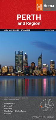
Wegenkaart - landkaart - Stadsplattegrond Perth and Region | Hema Maps

0
A map that has the Perth suburbs (1:80,000) and Perth city (1:15,000) maps on one side and the Perth region (1:750,000) and Fremantle (1:20,000) maps on the other. Included is a rail network map of Perth as well as points of interest and accommodation for both Fremantle and Perth.   Key Features: Perth CBD map Fremantle CBD map Suburban map...

Verkopers met dit product

Verkoper
Bezorging
Prijs
DeZwerver.nl logo
DeZwerver.nl
2,95
14,50

Anderen bekeken ook

Stadsplattegrond - Wegenkaart - landkaart Fleximap Perth | Insight Guides
Geplastificeerde centrumkaart van Perth, met register. Voor de 'gewone' toerist een handige kaart, geen groot formaat, overzichtelijk met alle belangrijke plaatsen goed weergegeven.    This laminated fleximap of Perth contains six maps, including Perth City, Perth environs, Perth Urban area, Fremantle, and an overview regional map. It also gives overviews of the top recommended sights and places to visit, as well as practical data, climate tables and local transport details. The key features include: detailed cartography highlights all the main tourist sights and provides valuable motoring information; informative text - essential facts about the destination are provided, plus handy tips for getting around...; ease of use - the durable maps fold very easily, even when it's raining; and laminated finish - you can write on the map with a non-permanent marker pen and wipe it off later.
9,95
Stadsplattegrond Brisbane and Region | Hema Maps
Mooie, duidelijk kaart van Brisbane  en de omgeving van Brisbane.   A map of the greater Brisbane region, Bribe Island to Coomera and west to Ipswich, on one side (1:100,000) and a lower scale overview of the city and surrounding regions on the reverse (1:300,000). There are also maps of Brisbane city and the Gold Coast inset, along with official ferry and rail maps. Includes caravan parks, 24-hour fuel, postcodes, accommodation and more.   Places of interest on this map include:   Anzac Memorial  Brisbane Botanic Gardens  Brisbane Convention & Exhibition Centre  Brisbane City Hall  Customs House  Gallery of Modern Art  King George Square  Old Government House  Old Windmill Observatory  Queensland Performance Arts Complex  Queen Street Mall  Queensland Art Gallery  Queensland Cultural Centre  Queensland Museum  Queensland University of Technology  Queensland Theatre Company  South Bank  St John's Cathedral  St Stephen's Cathedral  State Library of Queensland  Su…
14,50
Stadsplattegrond Canberra en omgeving | Hema Maps
Stadsplattegrond van Canberra met een omgevingskaart. Inclusief  register.   A map that has the Canberra suburbs (1:60,000) on one side and the Canberra city, Canberra region (1:850,000) and ACT (1:375,000) maps on the other.    Also included is an information section on Canberra's tourist attractions with necessary tourist attractions attached.   Features of this map include:   Highways,major roads and local streets Points of interest Accommodation Parks Caravan Parks 24Hour Fuel Railway stations Suburbs Suburbs Index Shopping centres Theatres/Cinemas Sporting venues CBD Map ACT Map
14,50
Stadsplattegrond Darwin en omgeving | Hema Maps
Stadsplattegrond van Darwin en de directe omgeving. Inclusief index. Offering maps of the region, suburbs and Darwin’s CBD. Containing the entire city with primary, secondary and tertiary road patterns, city centre distance markers on major roads and postcode and road numbering, these maps are easy and helpful to use, making them appropriate for a wide range of users. Easy to use CBD map Suburban map Regional map Postcodes Points of interest Fully indexed
14,50
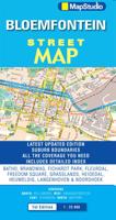
Wegenkaart - landkaart - Stadsplattegrond Bloemfontein | MapStudio
Uitgebreide stadsplattegrond van Bloemfontein  en directe omgeving. The Bloemfontein Street Map is a 1st edition street map providing coverage of Bloemfontein and surrounds, plus includes the latest interchange layouts, names and route numbers. The main map is at a 1:25 000 street-level scale and includes a detailed Bloemfontein map.   The map features reserves, parks and fields; golf courses, sports fields and stadiums; retail areas and shopping malls; intersection layouts, route numbers and interchange names; places of interest, historic sites and hotels; suburb names with boundaries; schools and sporting venue locations; a detailed index booklet with all street names and suburbs; industrial areas; hospitals and clinic locations; police station locations; wine estates and heritage sites; traffic light positions; bird sanctuaries; detailed sport symbols for sport venues; parks and public open-areas; post office and library locations.   Coverage Extent: Batho, Brandwag, Fichardt Park,…
7,95
Wegenkaart - landkaart - Stadsplattegrond Hong Kong & Region | ITMB
Plattegrond van Hong Kong met aan de ene kant Hong Kong op een schaal van 1:10.000 en op de achterkant de omgeving op een schaal van 1:60.000. De kaart is uitgevoerd met register en metrokaart. De kaart beslaat Hongkong tot aan Sham Shui Po, Ngau Tai Kok, Vitoria Peak  en Quarry Bay. De regiokaart gaat tot aan Shenzhen. Op deze kaart staan diverse campings en ook bushaltes, treinlijnen en de ferry's.   Legend Includes: Roads by classification, Points of Interest, Castles, Museums, Cathedrals, Churches, Abbeys, Theme Parks, Airports, Airstrips, Caravan Camps, Motorway Service Stations, Caves, Viewpoints, Zoos, Golf Courses, Lighthouses, National Parks, Rivers, Lakes, Waterfalls, Mountain Peaks, Ruins, Camping Sites, Tourist Information Centres, Skiing, Wildlife Reservation, and much more.
13,95
Wegenkaart - landkaart Gold Coast and region | Hema Maps
Goede, overzichtelijke, leesbare kaart van de hele provincie. Nationale Parken zijn er goed op te vinden en de afstanden worden weergegeven. Op de achterkant nog deelkaartjes van enkele steden en NP s.   Map of Gold Coast: CBD, City, Suburbs & Hinterland This map of the Gold Coast includes detailed mapping of the city (1:15,000) and suburbs (1:50,000), as well as a comprehensive overview of the surrounding Gold Coast Hinterland (1:100,000).   There’s plenty of useful visitor information marked on the mapping for staying in and getting around the Gold Coast, including fully updated roads, facilities and accommodation, as well as 2018 Commonwealth Games venues and temporary Park ‘n’ Ride locations.   Map Features: Perfect for Visitors Surfers Paradise, Coolangatta & Tweed Heads Gold Coast Hinterland Commonwealth Games Venues Commonwealth Games Park n Ride locations Public Transport Route Map 24-hour fuel Accommodation & POI Marked Fully Indexed Suburbs Index Street Index Tourist Attract…
14,50
Wegenkaart - landkaart - Stadsplattegrond Fleximap Dubai | Insight Guides
Geplastificeerde centrumkaart van Dubai, met register. Voor de 'gewone' toerist een handige kaart, geen groot formaat, overzichtelijk met alle belangrijke plaatsen goed weergegeven. Flexi Map Dubai is a laminated, tear-resistant map which includes 3 maps, each accompanied by separate indexes that are categorized for ease of use. The main map depicts Central Dubai at a scale of 1:15 000 and identifies places of interest, public buildings, selected hotels, parks and shopping areas. Both main and minor roads are named, car parks and one-way systems are clearly shown. The Dubai area is shown  at a scale of 1:100 000, Main roads are named, and numbered where applicable, and the Metro system is clearly marked.  An overview map of the United Arab Emirates, at a scale of 1:1 million, shows the road network with intermediate driving distances. Points of interest are shown as well as other features, such as, water springs, coral reefs, shipwrecks and offshore oilfields.   Flexi Map Dubai also g…
9,95

Klanten-reviews van Wegenkaart - landkaart - Stadsplattegrond Perth and Region | Hema Maps

Er zijn nog geen beoordelingen voor dit productBen jij de eerste die een review plaatst?

Meer over Wegenkaart - landkaart - Stadsplattegrond Perth and Region | Hema Maps

Productomschrijving

A map that has the Perth suburbs (1:80,000) and Perth city (1:15,000) maps on one side and the Perth region (1:750,000) and Fremantle (1:20,000) maps on the other. Included is a rail network map of Perth as well as points of interest and accommodation for both Fremantle and Perth.   Key Features:
  • Perth CBD map
  • Fremantle CBD map
  • Suburban map
  • Regional map
  • Rail map
  • 24 hour fuel
  • Caravan parks
  • Postcodes
  • POI
  • Fully indexed


Productinformatie

    Verken gerelateerde categorieën

    Webshop.nl maakt gebruik van cookies. Ga je verder op onze website, ga dan akkoord met het plaatsen van cookies en de verwerking van deze data door ons en vermelde partners.