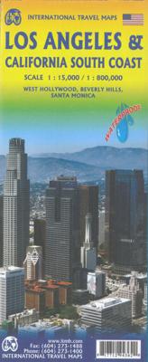
Wegenkaart - landkaart - Stadsplattegrond Los Angeles & California South Coast | ITMB

0
Dubbelzijdige kaart met aan de ene kant een plattegrond, 1 op 15.000, van Los Angeles. Aan de andere kant een degelijke kaart met aanduidingen van o.a. nationale parken, vliegveld, benzinepomp en campings van de zuidkust van Californië Als overzichtskaart goed te gebruiken.   Legend Includes: Roads by classification, Accommodation, Museum, Church,...

Verkopers met dit product

Verkoper
Bezorging
Prijs
DeZwerver.nl logo
DeZwerver.nl
2,95
13,95

Anderen bekeken ook

Wegenkaart - landkaart USA Pacific Coast Travel Reference Map | ITMB
Coverage is from Vancouver to Tijuana to Las Vegas, and information includes rest areas, parks, touristic attractions and the like, as well as detailed road information. There are no inset maps on this title, which also makes a very nice wall map of the west coast!   Legend Includes: International Boundary, State Boundary, County Boundary, Interstate Hwy, Freeway / UC, Toll Hwy / UC, Multilane Hwy / UC, US Divided Hwy, Two lane road / State Highway, Other Road / Track, Pacific Crest Trail, Ferry Route, Time Zone, Mountain peak (feet) State Park, National Forest, National Park, Exit Number and approx. distance between two exists (dist. in miles), Approx. Road Distance (in miles), Interstate Highway, United States Highway, State Highway, Historic Route 66, Large Urban area, State Capital, More than 250,000, 85,000 - 250,000, < 85,000, Town, River / Lake, Salt Lake, Indian reserve, Military property area, Rest Area, Lodge, Point of Interest, Natural Point of Interest, International Airpo…
13,95
Wegenkaart - landkaart USA Southwest - zuidwest | ITMB
Een degelijke kaart met aanduidingen van o.a. nationale parken, vliegveld, benzinepomp, dirt-roads. Als overzichtskaart goed te gebruiken   We're introducing a map of the US Southwest States, notably most of California and Nevada, Arizona, most of Utah, and the western third of New Mexico and Colorado. Our regional series is at 1:1M scale. This results in instances where the name of the map may differ from the common perception. In US parlance, the 'Southwest' is often thought to be Arizona and New Mexico, whereas in reality it is southern California, Nevada, and Arizona. If one includes New Mexico, the square sheet of paper has to go so far north that one ends up including Denver. This is our compromise and we'll figure out how to deal with Texas, New Mexico, Louisiana, and Oklahoma a bit further down the line. This double-sided map covers from Reno and Sacramento in the north to Tijuana and Deming NM in the south, and from the Pacific coastline in the west to Gallop NM and Grand Jun…
13,95
Wegenkaart - landkaart Sikkim & India Northeast | ITMB
Een degelijke kaart met aanduidingen van o.a. nationale parken, vliegveld, benzinepomp, dirt-roads en kleine plattegrond van Calcutta. Beschrijft de punt van India tussen Nepal en Buthan. De ene zijde van de kaart omvat Sikkim, schaal 1:135.000. De andere zijde van de kaart omvat Noordoost India, ten dele Nepal, Myanmar en China, schaal 1: 1.500.000. Kaart van Calcutta en Calcutta met omgeving.   Sikkim is an autonomous state between India and Chinese-controlled Tibet, much as Bhutan. It is a wonderful, mountainous country to visit, with reasonably good goads going far to the north, well into the Himalayas, and interesting temples/pagodas to see, as well as the fabulous Fam Rong Lho Wildlife Sanctuary. As anyone visiting this remote state needs to pass through the northeastern area of India to reach Sikkim, we have include a complete, detailed map of Bengal, Bihar, Meghalaya, and the Assam states as well as of the portion of Nepal abutting Sikkim, and an inset map of Kolkata. The map …
13,95
Wegenkaart - landkaart - Stadsplattegrond San Diego - California south | ITMB
Wegenkaart en stadsplattegrond in een kaart: aan de ene zijde San Diego stadsplattegrond en op de andere kant een kaart van het zuiden van Californië. San Diego on a clear, well presented street plan from ITMB, with a transit system diagram, a road map of the city and its environs, and a street plan of central Tijuana, plus on the reverse a road map of the US/Mexico border region extending east beyond El Paso and within USA north to Las Vegas.   On one side is an indexed street plan of San Diego, covering the city’s central districts (as indicated in our coverage image), including the downtown area, the Old Town for which an enlargement is provided, Balboa Park, University Heights, the Mission Bay Park with the SeaWorld, and the city’s international airport. The plan clearly shows the MTS and other public transit stations, highlights main traffic arteries and indicates one way streets. Also marked are recommended cycle routes. Streets are annotated with selected block numbers for easi…
13,95
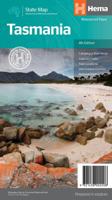
Wegenkaart - landkaart Tasmanië - Tasmania | Hema Maps
Op deze kaart staat Tasmanië in zijn geheel op 1 deel van de kaart. Goede, overzichtelijke, leesbare kaart van het hele eiland. Nationale Parken zijn er goed op te vinden en de afstanden worden weergegeven. Op de achterkant nog deelkaartjes van enkele steden en NP s. The fourth edition of Hema’s Tasmania State Map features Hema’s distinctive and informative maps fully, all of which have been field checked by Hema’s Map Patrol to ensure the best possible accuracy with the latest mapping data.    A fully indexed state map of Tasmania (TAS) at a scale of 1:500,000. Marked on the mapping are national parks, fuel locations as well as camping and rest areas.    The reverse side consists of:   a summary of the key things to see and do broken up into the North West, Launceston, Tamar and the North a table listing of National Parks and Reserves with key features and facilities (such as Camping and Caravan sites, BBQ, toilets and showers) Visitor centre listing Map of the area around Zeehan…
17,50
Wegenkaart - landkaart - Stadsplattegrond Thailand zuid South - Bangkok | ITMB
Duidelijke wegenkaart met op de ene zijde de kaart van Bangkok op een goede schaal met veel toeristische informatie. De andere kant heeft het hele zuiden van Thailand .   Bangkok is a very interesting city, with many temples, pagodas, and historic buildings. It is also an airline hub and, as a result of not being a member of IATA, is a bargain-lover city for lower-cost airfares. This updated edition includes the new airport, recently-completed transit lines, and additional information for embassies. In this edition, we have combined our city map with a travel map for the southern half of the country, which means the peninsula connecting to Malaysia and including the most-visited parts of Thailand, the beach resorts located in the vicinity of Phuket. We have also upgraded it to plastic paper, both for the tropical humidity and for durability.    Map size: 27*39"   Legend Includes: Roads by classification, motorway, expressway, provincial highway, river, national park, waterfall, touris…
13,95
Wegenkaart - landkaart Montana & Idaho | ITMB
Een degelijke kaart met aanduidingen van o.a. nationale parken, vliegveld, benzinepompen. ITMB is pleased to release two more state maps, this time of Montana on one side, and adjacent Idaho on the other side. Montana prides itself on being the ‘blue sky’ state. Due to its high elevation, the sky does appear to be a darker shade of blue than is common in areas closer to the ocean. The state is lightly populated, so much of its attractiveness rests with natural features, such as Glacier National Park on the Canadian border, and Yellowstone National Park on the Wyoming border. The state is also perfect camping country, and our map includes dozens of authorized campsites. It also includes the national heritage site of Little Big Horn, where Lt. Colonel Custer and the US 7th Cavalry were massacred after foolishly attacking a vastly larger encampment of Sioux and Cheyenne first nations people under the leadership of Sitting Bull. The second side of the map portrays the State of Idaho, an e…
13,95
Wegenkaart - landkaart - Stadsplattegrond Estonia, Estland en Tallinn | ITMB
Goede wegenkaart van Estland met bezienswaardigheden, kilometers etc. daarop aangegeven. The map displays Estonia on one side and Tallin on the other, each showing a separate index. Road networks distinguish motorways, major and minor roads with intermediate distances on connecting roads. Railways and ferry routes are also shown, while symbols clearly indicate parking and international and domestic airports.   Topography is represented by altitude colouring and graphics locate rivers, lakes, national parks and reserves, Unesco World Heritage sites, scenic spots, hotsprings etc. Symbols mark locations of various places of interest including hotels, campsites, historic ruins, castles, beaches, ports etc. International and administrative boundaries are marked. Latitude and longitude lines are drawn at intervals of 20’.   The street plan of Tallin is a clearly laid out and extends from the Gulf of Tallin to Tallin international airport and the intercity bus station in the south, the Centr…
13,95
Wegenkaart - landkaart Denver and Colorado | ITMB
Een degelijke kaart met aanduidingen van o.a. nationale parken, vliegveld, benzinepomp, dirt-roads en kleine plattegrond van hoofdstad. Als overzichtskaart goed te gebruiken. This is a brand new title for ITMB. Denver, the ‘mile-high’ city on the eastern slopes of the Rocky Mountains, is a vibrant, fairly modern city. It is the state capital, and the gold-coated dome of the legislative building highlights the wealth and strength of the state. The Denver Zoo is becoming one of the great attractions of the city, as are the Center for Performing Arts and the Museum of Science and Nature. Larimer Square is the focal point for entertainment, and Coors Field for sports. Our map shows a wide-ranging number of accommodations and eateries, and notes all points of interest. The State of Colorado map fills the reverse side of the sheet and, due to the positioning of the state’s boundaries, nicely fills the 40x28 sheet size of the map. Small portions of neighbouring states show around the edges, …
13,95
Wegenkaart - landkaart Cayman Islands (Kaaiman Eilanden) & Jamaica | ITMB
Een degelijke kaart met aanduidingen van o.a. nationale parken, vliegveld, benzinepomp, dirt-roads en kleine plattegrond van verschillende steden. Als overzichtskaart goed te gebruiken. De kaart is aan twee zijden bedrukt, de ene zijde omvat de Cayman Islands (schaal 1:37.500 en 1:70.000). Op de andere zijde staat de kaart van Jamaica (schaal 1:250.000) en plattegronden van onder andere Kingston. We are pleased to announce the latest new Caribbean map to our growing series. The Caymans, for there are three major islands and numerous little shoals, remains a British colony, like the British Virgin Islands, the Turks and Caicos, and Bermuda. Tourism is the number one industry of the Cayman Islands, with dozens of hotels dotting the beachfronts, especially north of George Town. There are numerous dive sites for viewing tropical fish and we have shown about a hundred on the map, as well as every side street and gas station. One interesting place to visit is Hell, which is a frozen lava er…
13,95

Klanten-reviews van Wegenkaart - landkaart - Stadsplattegrond Los Angeles & California South Coast | ITMB

Er zijn nog geen beoordelingen voor dit productBen jij de eerste die een review plaatst?

Meer over Wegenkaart - landkaart - Stadsplattegrond Los Angeles & California South Coast | ITMB

Productomschrijving

Dubbelzijdige kaart met aan de ene kant een plattegrond, 1 op 15.000, van Los Angeles. Aan de andere kant een degelijke kaart met aanduidingen van o.a. nationale parken, vliegveld, benzinepomp en campings van de zuidkust van Californië Als overzichtskaart goed te gebruiken.

  Legend Includes: Roads by classification, Accommodation, Museum, Church, Building, Points of tourist, Post Office, Police Station, School, Bicycle Route, Hiking Path, Road Barrier, Tourist Information, Hospital, Live Theatre, Cinema, Dept. Store, Bus Terminal, Pedestrian Street, Staircase, International Airport, State Park with Campsites, State Park without Campsites, Campsite, Wayside or Roadside Park, Rest Area, Lodge, Point of Interest, Domestic/Regional Airport, Information Center, Golf Course, Hot Spring, Port of Entry, Border Crossing, Gas Station, Service Area, University or College, Skiing, Lighthouse, Beach, Cave, and more.

Productinformatie

    Verken gerelateerde categorieën

    Webshop.nl maakt gebruik van cookies. Ga je verder op onze website, ga dan akkoord met het plaatsen van cookies en de verwerking van deze data door ons en vermelde partners.