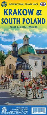
Wegenkaart - landkaart - Stadsplattegrond Krakow - Krakau - South Poland | ITMB

0
Een goede stadskaart van Krakow p de ene zijde en een deel van zuid Polen op de andere kant. ITMB's third map for Poland, concentrates on the central portion of the city, with a large inset of the central pedestrian area and with a regional inset map showing roads to Auschwitz (now called Oswiecim) and to Katowice. Legend includes inter-city rail ...

Verkopers met dit product

Verkoper
Bezorging
Prijs
DeZwerver.nl logo
DeZwerver.nl
2,95
13,95

Anderen bekeken ook

Wegenkaart - landkaart - Stadsplattegrond Poland east - Warsaw, Oost Polen en Warschau | ITMB
ITMB wegenkaarten en wandelkaarten kenmerken zich door het kleurgebruik waarbij zo de nadruk wordt gelegd op de natuurkundige aspecten van het land of de streek. Het soort landschap en de hoogte worden hierdoor zeer duidelijk zichtbaar. Natuurlijk vind je ook de 'gewone' zaken als wegennet, spoorwegen, vliegvelden, ferrys, toeristische bezienswaardigheden en nationale parken er op terug.. Vaak - maar niet op alle kaarten - staat op de achterzijde een stadsplattegrond van hoofdstad of belangrijkste stad in de regio.  Voorzijde: Oost Polen shcaal 1:650.000 Achterzijde: Warschau, schaal 1:9.000 This is, at the same time, our second edition updated map of Warsaw and a brand new title for ITMB, in that we have added a regional map of the eastern half of Poland to the second side of the map. This gives the end user two maps for the price of one by combining the many attractions of the city with its surrounding countryside. Anyone with a small amount of historical knowledge knows that Warsaw…
13,95
Wegenkaart - landkaart Sydney & Australia Southeast | ITMB
Plattegrond van Sydney, schaal 1:7.500, met aan de andere zijde een overzichtskaart van zuidoost Australië, schaal 1:2.000.000   Sydney is probably the best-known city in Australia and this map benefits from trips we have taken to ground-truth the information. It is attractive, pertinent, and easy to use as a map. As with many of our international city maps, we have re-worked this title into a double-sided map with the souteastern half of Australia on the reverse side. As with many of ITMB's map this edition is freshly printed on waterproof paper, more for its durability in the case of Australia than humidity.   Legend Includes: Roads by classification, International Airports, Airports, Ferry lines, Boat-Ferry docks, Railways, Railway stations, Bus terminals, Bicycle Trails, Foreshore trail systems, Pedestrian streets, Staircases, Small Nature reservesm Zoos, Fishing, Caves, Camps sites, Accomodation, Tourism information centers, Museums, Live Theatres, Cinemas, Post offices, Police S…
13,95
Stadsplattegrond - Wegenkaart - landkaart Quito & Ecuador Central | ITMB
Een degelijke wegenkaart van Ecuador met aanduidingen van o.a. nationale parken, vliegveld, benzinepomp, dirt-roads en kleine plattegrond van hoofdstad. Als overzichtskaart goed te gebruiken. Finally, ITMB releases its long-awaited re-worked map of the wonderful South America city of Quito. The city is squeezed in between mountain ranges and, the entire city stretches from north (on the right-hand side of the map) to the south. The "bottom" of the map is, actually the eastern portion. A regional inset map clarifies the situation. The street network is clearly shown, along with the rapid line bus way and the city's Metro. The Old Town is perhaps the most interesting portion of the city for visitors and is on the left-hand portion of the map. The newer downtown is centered on La Carolina Park on the right-hand side of the map. This is where most of the shopping malls and hotels are located. The old airport is shown in part on the far right, but the new international airport is located f…
13,95
Stadsplattegrond Streetwise London | Michelin
Handige stadsplattegrond van Londen in de vorm van een uitklapkaart, die aan twee zijden bedrukt is. Prettig leesbaar, helder kaartbeeld, met een register en een kleine kaart van het openbaar vervoer. Deze kaart is geplastificeerd. REVISED 2023Streetwise London Map is a laminated city center map of London, England. The accordion-fold pocket size travel map includes a London Underground map with tube lines & stations. Cover includes:Main London City Map 1:20,000London Underground Map - London Tube MapDimensions: 4" x 8.5" folded, 8.5" x unfoldedLondon is one of the most popular, populated and accessible cites on earth.   People love London. And why not? Londoners are charming and helpful, and their city operates on such a high dosage of civility that it could be considered an art form. London is an urban oasis where you can search out cutting edge design, cuisine, fashion, chic neighborhoods, or traditional culture.   When visiting London, be prepared to walk. Whether its basic window …
9,95
Stadsplattegrond Tokio & Kanto / Chubu | ITMB
Tokyo is one of the most populous cities in the world, so it is very difficult to capture all of it on one map sheet. The areas of touristic interest tend to exist in a relatively small portion of the metropolis, essentially from the Shibuya and Shinjuku shopping areas in the west to the Asakusa temple complex in the east. All the subway lines are shown, as well as stations. The rail lines passing through the city are numerous, but well-portrayed, including the monorail going to Haneda Airport and the main Shinkensen Terminal. The imperial palace is prominently shown, although not open for tourists. Tokyo tends to be a bit overwhelming, so having a good map is essential. This map includes an inset of the Narita International Airport and train routes into Tokyo, as well as a large inset showing the spaghetti-like network of subway/rail lines serving Tokyo. The reverse side of the sheet is essentially a detailed map of central Japan as far west as Nagoya and north to Yamagata, offering …
13,95
Wegenkaart - landkaart Saudi Arabia & Kuwait - Saudi Arabië en Koeweit | ITMB
Een degelijke kaart met aanduidingen van o.a. nationale parken, vliegveld, benzinepomp, dirt-roads en kleine plattegrond van hoofdstad. Als overzichtskaart goed te gebruiken. 1:390,000 / 1:1750000 Saudi Arabia remains a unique entity in today's world, steadfastly governing itself in splendid isolation and fighting hard to keep 'modern' influences at bay. However, it has modern trappings such as an excellent road system, even though women aren't allowed to drive, and modern cities, even though women won't be allowed to vote in local elections until 2015. The cities of Medina and Mecca are closed to infidels. Kuwait, its immediate neighbour to the north is an open society and is included on this map as a very large inset, with a separate inset of Kuwait City. Central Riyadh is also included as an inset map, showing mosques, hotels, banks, and shopping areas.   Legend Includes: Roads by classification, Railways, Capitals, International Airports, Domestic Airports, Border crossings, Railw…
13,95
Stadsplattegrond Singapore | Freytag & Berndt
Stadsplattegrond met register. Helder kaartbeeld waarbij de naamgeving goed leesbaar is weergegeven. Met de toeristische bezienswaardigheden in symbolen weergeven: monumenten, musea, stadions e.a. Daarnaast handige zaken als postkantoren, parkeergarages en stations. Veelal ook met een openbaar vervoer of metro kaart als inzet This city map of Singapore at 1: 15,000 by Freytag & Berndt clearly shows tourists attractions, public transport and feature a small inset of central Singapore and a useful index at the back. The map covers an area which extends from the Queenstown New Town district in the west to the Bedok Reservoir in the east and from Bishan metro station and MacRitchie Reservoir Park in the north to the northern part of Sentosa island in the south. The roads network is clearly represented and shows the main motorways reaching the city as well as main and secondary roads and symbols locate the car parks around the city. Colourful lines and symbols illustrate metro lines and st…
13,95
Wegenkaart - landkaart South Pacific Cruising & Samoa | ITMB
Een overzichtskaart van de zuidelijke Stille Oceaan met de cruise routes tussen de verschillende eilanden aangegeven. Op de achterzijde een overzichtskaart van Samoa This is a new venture for ITMB. Cruising is a rapidly-growing segment of the travel industry, experiencing double-digit growth rates annually. Obviously, this is a thriving market. In conjunction with several cruise ship lines, we have prepared a map of the South Pacific Ocean, which extends southwards from Hawai'i to the southern tip of New Zealand and eastwards from central Australia/Papua New Guinea to the Pitcairn Islands. Thus, it does not include the popular South East Asia and China coast routes. We think this has to change at a time when 25,000,000 people are travelling by cruise ships. At the same time, we must keep coverage area relevant for those end users of the artwork. Even at 1:12M, most of the area covered is water, with island countries such as Fiji, Tonga, Kiribati, Tahiti, and the Cook Islands being vis…
13,95
Wegenkaart - landkaart - Stadsplattegrond San Diego - California south | ITMB
Wegenkaart en stadsplattegrond in een kaart: aan de ene zijde San Diego stadsplattegrond en op de andere kant een kaart van het zuiden van Californië. San Diego on a clear, well presented street plan from ITMB, with a transit system diagram, a road map of the city and its environs, and a street plan of central Tijuana, plus on the reverse a road map of the US/Mexico border region extending east beyond El Paso and within USA north to Las Vegas.   On one side is an indexed street plan of San Diego, covering the city’s central districts (as indicated in our coverage image), including the downtown area, the Old Town for which an enlargement is provided, Balboa Park, University Heights, the Mission Bay Park with the SeaWorld, and the city’s international airport. The plan clearly shows the MTS and other public transit stations, highlights main traffic arteries and indicates one way streets. Also marked are recommended cycle routes. Streets are annotated with selected block numbers for easi…
13,95
Stadsplattegrond Streetwise Budapest | Michelin
REVISED 2023Streetwise Budapest Map is a laminated city center map of Budapest, Hungary. The accordion-fold pocket size travel map has an integrated metro map including lines & stations. Coverage includes:Main Budapest Map Front 1: 17,000Main Budapest Map Back 1:11,000Budapest City Center Map 1:11,000Millennium City Center Map 1:17,000Budapest Metro MapDimensions: 4" x 8.5" folded, 8.5" x 27" unfoldedPeople say Budapest is the Paris of Central Europe.   Maybe that statement is true because it combines a combination of western luxuries, architectural beauty, and cosmopolitan European traditions. But this baroque city is still connected to its Eastern European heritage with the steaming baths, incredibly complex language and lusty cuisine. Budapest straddles a curve in the river Danube which bisects two distinct parts.   The east side is known as Pest and the west side is known as Buda, hence Budapest. It's a very logical, well laid out city. Castle Hill is the premier destination for v…
9,95

Klanten-reviews van Wegenkaart - landkaart - Stadsplattegrond Krakow - Krakau - South Poland | ITMB

Er zijn nog geen beoordelingen voor dit productBen jij de eerste die een review plaatst?

Meer over Wegenkaart - landkaart - Stadsplattegrond Krakow - Krakau - South Poland | ITMB

Productomschrijving

Een goede stadskaart van Krakow p de ene zijde en een deel van zuid Polen op de andere kant.

ITMB's third map for Poland, concentrates on the central portion of the city, with a large inset of the central pedestrian area and with a regional inset map showing roads to Auschwitz (now called Oswiecim) and to Katowice. Legend includes inter-city rail lines w/ station, Krakow tram/street-car lines, parks, plazas, accommodations, churches, synagogues, points of interest, museums, police stations, shopping centres, hospitals, pedestrian streets, bike routes, bus stations. Indexed.

Productinformatie

    Verken gerelateerde categorieën

    Webshop.nl maakt gebruik van cookies. Ga je verder op onze website, ga dan akkoord met het plaatsen van cookies en de verwerking van deze data door ons en vermelde partners.