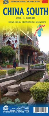
Wegenkaart - landkaart - Stadsplattegrond China South - Zuid | ITMB

0
Een degelijke wegenkaart met aanduidingen van o.a. nationale parken, vliegveld, benzinepomp, dirt-roads. Als overzichtskaart goed te gebruiken.   China is a very large country. While our map of the entire country is fine for general travel and sells well, China is too large to show areas in detail. This map concentrates on the part of China from S...

Verkopers met dit product

Verkoper
Bezorging
Prijs
DeZwerver.nl logo
DeZwerver.nl
2,95
13,95

Anderen bekeken ook

Wegenkaart - landkaart - Stadsplattegrond China South - Zuid | ITMB
Een degelijke wegenkaart met aanduidingen van o.a. nationale parken, vliegveld, benzinepomp, dirt-roads. Als overzichtskaart goed te gebruiken.   China is a very large country. While our map of the entire country is fine for general travel and sells well, China is too large to show areas in detail. This map concentrates on the part of China from Shanghai south and all the way west to Lhasa and includes Taiwan and Hainan Island. We are not trying to make any sort of political comment here, but geographically, both Tibet and Taiwan fall within the area of coverage and are both included for this reason alone. The map also includes insets of Hong Kong, Guangzhou and Shanghai   Legend Includes: Roads by classification, Points of Interest, National Parks, Airports, Golf Courses, Beaches, Campsites, Waterfalls, Viewpoints, Churches, Surfing/Scuba Diving Spots, Fishing Spots, Hospitals, harbours/Ports, Lighthouses, Museums, Monuments, Caves, Mosques, Mountain Peaks, Botanic Gardens, Wildlife …
13,95
Wegenkaart - landkaart - Stadsplattegrond Thailand zuid South - Bangkok | ITMB
Duidelijke wegenkaart met op de ene zijde de kaart van Bangkok op een goede schaal met veel toeristische informatie. De andere kant heeft het hele zuiden van Thailand .   Bangkok is a very interesting city, with many temples, pagodas, and historic buildings. It is also an airline hub and, as a result of not being a member of IATA, is a bargain-lover city for lower-cost airfares. This updated edition includes the new airport, recently-completed transit lines, and additional information for embassies. In this edition, we have combined our city map with a travel map for the southern half of the country, which means the peninsula connecting to Malaysia and including the most-visited parts of Thailand, the beach resorts located in the vicinity of Phuket. We have also upgraded it to plastic paper, both for the tropical humidity and for durability.    Map size: 27*39"   Legend Includes: Roads by classification, motorway, expressway, provincial highway, river, national park, waterfall, touris…
13,95
Wegenkaart - landkaart - Stadsplattegrond Kyoto & Japan West | ITMB
Dubbelzijdige kaart met aan de ene kant een plattegrond, 1 op 12.500, van Kyoto. Aan de andere kant een degelijke kaart met aanduidingen van o.a. nationale parken, vliegveld, benzinepomp en bezienswaardigheden van West Japan. Als overzichtskaart goed te gebruiken.   We are very pleased to see another updated edition of this very popular part of Japan coming out. Kyoto itself is rich in cultural heritage and has an excellent transit system for getting around. Regardless, one really needs a good map to find the temples and shrines. The map also includes an excellent inset map of Nara, a smaller city with an even greater concentration of temples and historic buildings. It is, however, the other side of the map, covering the western part of Japan that is the real value of this map. Stretching from Nagoya in the east past Kyoto and Osaka to Hiroshima and on to Fukuoka, this regional map is at an excellent scale to enable travellers to find their way around easily. All rail lines are includ…
13,95
Stadsplattegrond Shanghai & China zuidoost | ITMB
Goede stadsplattegrond van Shanghai. Met register en suburban treinsysteem. De echte buitenwijken van deze megastad staan er niet op. daarnaast een overzichtskaart van zuidoost China. This updated map of rapidly-changing Shanghai has been enhanced in this edition by being printed on ITM waterproof plastic paper and by the addition of a separate map on the reverse side of all of South East China. The regional map covers from Nanning to Beijing, so perhaps covers a wider area than just Fujian and Guangdong provinces, but this is a much more detailed map than anything we have attempted before, and is an excellent aid to anyone based in Shanghai and thinking of travelling to Xi’an, or Guilin, as well as closer destinations. The Shanghai side has been updated with the latest road and subway additions including, for the first time on any map, the route of the new MAGLEV line being built through the southern part of the city. Double-sided, on ITM plastic, Legend Includes: Roads/highways, pub…
13,95
Wegenkaart - landkaart - Stadsplattegrond Barcelona & Catalunya - Catalonië | ITMB
Een degelijke wegenkaart met aanduidingen van o.a. nationale parken, vliegveld, benzinepomp, dirt-roads. Als overzichtskaart goed te gebruiken.   This new edition of Barcelona not only updates an already excellent city map, it relates it to its surrounding hinterland. It is no secret that the area surrounding Barcelona, called Catalunya, has long harboured a strong desire to separate from Spain (the adjacent Basque region has also coveted independence for as long as I can remember). Our regional map extends beyond the strict boundaries of the province/pseudo independent state of Catalunya and is actually a very good map of the east coast of Spain as far south as Valencia, but lets not split hairs. This is an excellent map for anyone visiting the Barcelona area, showing the heart of the city in immaculate detail and providing ample mapping assistance for anyone travelling to nearby urban areas, comprising most of the touristic sights and places of interest.   Legend Includes: Roads by …
13,95
Wegenkaart - landkaart - Stadsplattegrond Washington D.C. & eastern corridor | ITMB
Stadsplattegrond van Washington D.C., 1:12.500, met een overzichtskaart van het gebied van Boston tot aan Washington DC, 1:1.000.000   This is one of the most-visited cities in the USA and one really NEEDS a map to uncover all the statues, memorials, and buildings of interest. Of course, hotels, shopping areas, transportation hubs, parks, etc are also included. With this edition, we also have added a full-sheet map of the Eastern Corridor of the USA to the reverse side of the map. Starting with Boston in the north, through NYC and Philadelphia to Baltimore and on past DC to Richmond and Raleigh, the Eastern Corridor encompasses one-third of the population of the United States and a dozen States. The map shows road and rail connections, with motorways noted in blue and toll roads in green, and includes major historic and touristic sites within the area of coverage.   Legend Includes: Roads by classification, State Boundaries,State Highways, Main Roads, Secondary and other Roads,Hot spr…
13,95
Wegenkaart - landkaart - Stadsplattegrond Toronto & Southern Ontario - Ontario zuid | ITMB
Overzichtskaart van het zuiden van Ontario - schaal 1:600.000 - met op de andere kant een grote plattegrond van Toronto op schaal 1:12.000 Legend Includes: Roads by classification, Accomodations, Museum, Churches, Buildings, Points of tourist, Public Interests, Post Offices, Police Stations, Schools, Live Theatres, Cinemas, Ruins, Bus Terminals, Ferry Terminals, Service Areas, Hospitals, Ports, Mines, RCMP, Major Airports, Secondary Airports, Camp Grounds, National Park and Equivalent Reserves, Ski, Picnic Sites, and much more.   Toronto is the largest city in Canada by far. Touristically, its attraction rests with its central core, from High Park in the west to the Don River in the east, and from the park-like islands in Lake Ontario to Bloor Street in the north. In this area, one finds remnants of the oldest portion of ‘muddy York’, the original fort built to deter American raiders (close to the exhibition grounds), Campbell House (at Queen & University), and the first public schoo…
13,95
Wegenkaart - landkaart - Stadsplattegrond Estonia, Estland en Tallinn | ITMB
Goede wegenkaart van Estland met bezienswaardigheden, kilometers etc. daarop aangegeven. The map displays Estonia on one side and Tallin on the other, each showing a separate index. Road networks distinguish motorways, major and minor roads with intermediate distances on connecting roads. Railways and ferry routes are also shown, while symbols clearly indicate parking and international and domestic airports.   Topography is represented by altitude colouring and graphics locate rivers, lakes, national parks and reserves, Unesco World Heritage sites, scenic spots, hotsprings etc. Symbols mark locations of various places of interest including hotels, campsites, historic ruins, castles, beaches, ports etc. International and administrative boundaries are marked. Latitude and longitude lines are drawn at intervals of 20’.   The street plan of Tallin is a clearly laid out and extends from the Gulf of Tallin to Tallin international airport and the intercity bus station in the south, the Centr…
13,95
Wegenkaart - landkaart - Stadsplattegrond Montreal & Southern Quebec | ITMB
Stadsplattegrond van Montreal met register. Op de achterzijde een kaart van het zuiden van Quebec. 1:12,500/1:850,000 on waterproof paper. In this third, updated, edition of Canada's third largest city, we have added a user-friendly bonus. As is common now to most of our city maps, we have included a regional map of the hinterland of the urban area, so buyers won't have to purchase a second map to explore the environs of the city being presented. In the case of Montreal, being in a huge geographic country, this means Southern Quebec which, because of its size, dictates a map of more than one to a million scale. In the European context this would be the equivalent of Paris and all of France as a 'regional' map of the surrounds of Paris - but that's France and this is Canada.   Montreal (or Mont Royale in its original) was a village called Hochelaga when the early French explorers arrived in the early 1600s. They established a trading fort and, generally speaking, maintained good relati…
13,95
Wegenkaart - landkaart - Stadsplattegrond Krakow - Krakau - South Poland | ITMB
Een goede stadskaart van Krakow p de ene zijde en een deel van zuid Polen op de andere kant. ITMB's third map for Poland, concentrates on the central portion of the city, with a large inset of the central pedestrian area and with a regional inset map showing roads to Auschwitz (now called Oswiecim) and to Katowice. Legend includes inter-city rail lines w/ station, Krakow tram/street-car lines, parks, plazas, accommodations, churches, synagogues, points of interest, museums, police stations, shopping centres, hospitals, pedestrian streets, bike routes, bus stations. Indexed.
13,95

Klanten-reviews van Wegenkaart - landkaart - Stadsplattegrond China South - Zuid | ITMB

Er zijn nog geen beoordelingen voor dit productBen jij de eerste die een review plaatst?

Meer over Wegenkaart - landkaart - Stadsplattegrond China South - Zuid | ITMB

Productomschrijving

Een degelijke wegenkaart met aanduidingen van o.a. nationale parken, vliegveld, benzinepomp, dirt-roads. Als overzichtskaart goed te gebruiken.   China is a very large country. While our map of the entire country is fine for general travel and sells well, China is too large to show areas in detail. This map concentrates on the part of China from Shanghai south and all the way west to Lhasa and includes Taiwan and Hainan Island. We are not trying to make any sort of political comment here, but geographically, both Tibet and Taiwan fall within the area of coverage and are both included for this reason alone. The map also includes insets of Hong Kong, Guangzhou and Shanghai   Legend Includes: Roads by classification, Points of Interest, National Parks, Airports, Golf Courses, Beaches, Campsites, Waterfalls, Viewpoints, Churches, Surfing/Scuba Diving Spots, Fishing Spots, Hospitals, harbours/Ports, Lighthouses, Museums, Monuments, Caves, Mosques, Mountain Peaks, Botanic Gardens, Wildlife Sanctuary, Zoos, Sports Fields, and much more.

Productinformatie

    Verken gerelateerde categorieën

    Webshop.nl maakt gebruik van cookies. Ga je verder op onze website, ga dan akkoord met het plaatsen van cookies en de verwerking van deze data door ons en vermelde partners.