Wegenkaart - landkaart - Stadsplattegrond Bloemfontein | MapStudio

0
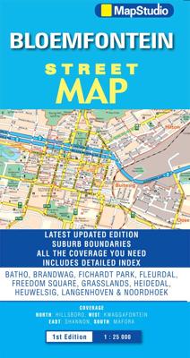
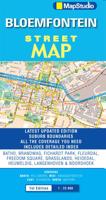
Uitgebreide stadsplattegrond van Bloemfontein  en directe omgeving. The Bloemfontein Street Map is a 1st edition street map providing coverage of Bloemfontein and surrounds, plus includes the latest interchange layouts, names and route numbers. The main map is at a 1:25 000 street-level scale and includes a detailed Bloemfontein map.   The map fea...

Verkopers met dit product

Verkoper
Bezorging
Prijs
DeZwerver.nl logo
DeZwerver.nl
2,95
7,95

Anderen bekeken ook

Nieuw
Stadsplattegrond Streetmap Cape Town - Kaapstad | MapStudio
Uitgebreide stadsplattegrond van Kaapstad en directe omgeving.    The Cape Town & Peninsula Street Map is the ideal travel companion to find your way around Cape Town.   Coverage includes:   North : Milnerton West : Hout Bay East : Jakes Gerwel (Vanguard Drive) South : Muizenberg   Great content which includes a detailed map of Cape Town CBD and Waterfront insert map.   The main map is in detailed 1: 25 000 street level scale, which depicts parks and reserves, golf courses, sports fields and stadiums, intersections, route numbers and interchange names. The map also includes places of interest, historical sites and hotels, suburb names and boundaries, schools and sporting venues, industrial areas, wine estates and heritage sites as well as bird sanctuaries and post offices and libaries.  
16,95
Nieuw
Wegenkaart - landkaart Sudan and South Sudan | Gizi Map
Sudan and South Sudan as separate countries on an excellent indexed map at 1:2,500,000 from Gizi Maps with detailed presentation of the topography, administrative divisions, street plans of Khartoum and Juba, etc. Excellent presentation of the terrain in the publisher’s characteristic style provides a vivid picture of the region’s geography: bold altitude colouring with plenty of spot heights and names of peaks, mountain ranges, etc, plus additional graphics for flood plains, swamps, salt flats, deserts, lava fields, wadis and water wells. National parks or other protected areas and interesting natural sites are highlighted. The map indicates the boundary of the disputed Abyei area and shows the internal administrative boundaries and names of the provinces. Within North Sudan names of larger towns and of the provinces are also given in Arabic. Where appropriate, alternative versions of town names are provided (Khartoum/Al Khartum, Omdurman/Umm Durman, etc). The map shows the road n…
15,95
Nieuw
Wandelkaart - Wegenkaart - landkaart Sint Maarten - St. Martin | Kasprowski Maps
Bijzonder gedetailleerde kaart (1:15000 !) van alleen het eiland Sint Maarten - Saint Martin. Zowel de wegen als ook de wandelpaden staan er op vermeld. Stranden, interessante plekken en bovendien de meeste duikplakken staan met diepte helder weergegeven op de kaart. Met stadsplattegronden van Philipsburg en Marigot.   The most recent edition of the first and only complete road map of the French-Dutch island of Saint-Martin/Sint Maarten renders all known roads and streets with their names; indicates hiking trails, biking routes and diving sites; maps restaurants and hotels; features insets of the Marigot and Philipsburg capitals, as well as Tintamarre Island. Street, hotel, and restaurant indexes are printed on the reverse side of the map.   NEW FEATURES:   Street and road additions, incl. Simpson Bay Causeway; Over 200 restaurants and hotels mapped and indexed; Tintamarre island inset; Biking routes; Birding and turtle nesting sites, other natural attractions; Snorkeling si…
18,50
Nieuw
Wegenkaart - landkaart 742 Maroc - Marokko | Michelin
Kaart van beroemde kaartenmakers en voor Marokko weer een hele goede. Uitermate goed leesbaar, prettig kleurgebruik. Onder Marokko-gangers staat deze kaart zeer goed bekend. Zoals je van Michelin mag verwachten is deze kaart zeer overzichtelijk en heeft een duidelijk helder kaartbeeld. De kaart geeft uitgebreid toeristische informatie weer. Met register, afstanden en reistijden. Wegen worden naar verschillende klasse ingedeeld en - mooi van Michelin - de interessante mooie routes worden gemarkeerd met een groene streep.    Hindernissen voor automobilisten met caravans zijn gemarkeerd: steile hellingen, bergpassen of een anderzins moeilijke route. Bezienswaardigheden als een kasteel, religieus gebouw, ruine of grot is door een symbool goed te vinden.   Morocco at 1:1,000,000 on a road map from Michelin, with enlargements showing in greater detail four of the country’s most visited areas, including the High Atlas around Marrakesh and Jbel Toubkal, plus an additional map of the whole cou…
12,95
Nieuw
Wegenkaart - landkaart 738 Roemenië - Roemenie | Michelin
Zoals je van Michelin mag verwachten is deze kaart zeer overzichtelijk en heeft een duidelijk helder kaartbeeld. De kaart geeft uitgebreid toeristische informatie weer. Met register, afstanden en reistijden. Wegen worden naar verschillende klasse ingedeeld en - mooi van Michelin - de interessante mooie routes worden gemarkeerd met een groene streep.    Hindernissen voor automobilisten met caravans zijn gemarkeerd: steile hellingen, bergpassen of een anderzins moeilijke route. Bezienswaardigheden als een kasteel, religieus gebouw, ruine of grot is door een symbool goed te vinden.   The Michelin national road map of Romania at 1:750,000 scale is best suited to trip & route planning. The map gives comprehensive coverage of national road networks showing major motorways, dual carriageways, national & regional main roads and some smaller local roads. Unsurfaced roads and tracks and some major footpaths are also shown. The map shows useful motoring information for motorways and major roads …
11,95
Nieuw
Wegenkaart - landkaart Deutschland - Duitsland | Freytag & Berndt
Gedetailleerde, eenzijdige landkaart van de Duitsland. De berijdbare wegen zijn goed weergeven, zowel de hoofdwegen als provinciale en lokale wegen; wegnummers worden vermeld. Afstanden tussen plaatsen zijn in kilometers op de kaart ingetekend, daarnaast worden ook op belangrijke plekken benzinepompen gemarkeerd. In het kaartbeeld wordt door middel van schaduw het reliëf weergegeven en soms enkele punten in het landschap met de daadwerkelijke hoogte. Provinciegrenzen zijn goed terug te vinden, nationale parken en reservaten ook. Met allerhande symbolen worden toeristische bezienswaardigheden weergegeven als monumenten, historisch belangrijke plekken en uitzichtpunten. In bepaalde plaatsen zijn hotels en campings te vinden, luchthavens, treinverbindingen en havens vindt u er ook op! Germany at 1:700,000 on a large, single-sided road map from Freytag & Berndt, with a separate extensive index booklet listing locations with postcodes and providing street plans of 18 town centres in the co…
14,95
Nieuw
Wegenkaart - landkaart Mauritania - Mauritanië en Westelijke Sahara | Gizi Map
Tweetalig Mauritania and Western Sahara with excellent topographic information on an indexed map with a street plan of central Nouakchot. Vivid altitude colouring with graphics for deserts, flood plains and salt flats shows the terrain. Oases, water wells and numerous spot heights are marked and the map provides plenty of names of geographical features: peaks, mountain chains and rock outcrops, plains, etc.    Road network shows distances on main roads and includes dirt tracks. The map also shows locations of local airfields and the route of the iron ore railway line from the mines at Zouérat to the coast. Symbols highlight various places of tourist interest including world heritage sites, forts and archaeological remains, national parks and protected areas, beaches, etc.   Names of main towns and important geographical features are also given in Arabic. Internal administrative boundaries are shown with names of the provinces. The map had latitude and longitude lines at intervals of 1…
15,95
Nieuw
Wegenkaart - landkaart Bonaire | Kasprowski Maps
Bijzonder gedetailleerde kaart (1:40000) van alleen het eiland Bonaire. Zowel de wegen als ook de wandelpaden staan er op vermeld. Stranden, interessante plekken en bovendien de meeste duikplakken staan met diepte helder weergegeven op de kaart. Met stadsplattegrond van Kralendijk. The most up-to-date and only complete road map of Bonaire ( Scale 1 : 28 000 ), as well as the Kralendijk urban area, spanning from Santa Barbara Crowns, through the airport, to Punt Vierkant (Scale 1 : 15 000). An inset of Rincon (Scale 1 : 12 000) is also included. All maps and insets come with thorough street indexes.   All of the official diving sites around Bonaire and Klein Bonaire are displayed, most of them with their GPS locations, as recorded by STINAPA, the island's official conservation foundation.   The map shows all the island's known roads and streets with their names, as well as an extensive set of biking routes and kayaking trails.   The map is sold folded, measuring 5 1/4" x 9 5/8" ( 13.5 …
18,50
Stadsplattegrond Streetmap Durban | MapStudio
Duidelijke dubbelzijdige plattegrond van Durban en omliggende wijken met een uitgebreide index. Te vinden op de kaart zijn o.a. spoorlijnen + stations, hotels, campings, bezienswaardigheden en natuurreservaten. Detailed map of Durban at 1 : 25 000 scale; Kloof to Merewent; Durban CBD in detail; Indexed street & suburb names; index indicating new + old street names; main routes with route numbers, freeways & interchanges; schools; sports fields; hospitals / clinics & municipal clinics; shopping malls; police stations & fire departments; parks & Reserves; industrial areas; places of interest; historical monuments; provincial heritage sites; museums/art galleries; includes Moses Mabhida soccer stadium position.    
11,50
Nieuw
Wegenatlas IJsland met stadsplattegronden | Ferdakort
Super handige kleine wegenatlas van IJsland (schaal 1:500.000) met vooral een enorme hoeveelheid plattegronden van steden en dorpen, enkele themakaarten en een groot register. De kaarten zijn uitstekend leesbaar en de atlas in in een mooie ringband uitgevoerd.  Road Atlas of Iceland at 1:500,000 from Ferðakort, published in a handy 15x25cm spiral-bound format, with an index of over 3,000 entries, a comprehensive distance table, 46 street plans including Reykjavik and several thematic map sincluding cultural heritage and geology.   The whole of Iceland is covered at 1:500,000 with the road network distinguishing between paved and gravel roads, and showing which small local roads are maintained by the country’s government. Fords, locations of petrol stations, driving distances and car ferry routes are marked. National parks and other protected areas are highlighted and symbols mark locations of various places of interest: different types of tourist accommodations including campsites, re…
30,95

Klanten-reviews van Wegenkaart - landkaart - Stadsplattegrond Bloemfontein | MapStudio

Er zijn nog geen beoordelingen voor dit productBen jij de eerste die een review plaatst?

Meer over Wegenkaart - landkaart - Stadsplattegrond Bloemfontein | MapStudio

Productomschrijving

Uitgebreide stadsplattegrond van Bloemfontein  en directe omgeving.

The Bloemfontein Street Map is a 1st edition street map providing coverage of Bloemfontein and surrounds, plus includes the latest interchange layouts, names and route numbers. The main map is at a 1:25 000 street-level scale and includes a detailed Bloemfontein map.   The map features reserves, parks and fields; golf courses, sports fields and stadiums; retail areas and shopping malls; intersection layouts, route numbers and interchange names; places of interest, historic sites and hotels; suburb names with boundaries; schools and sporting venue locations; a detailed index booklet with all street names and suburbs; industrial areas; hospitals and clinic locations; police station locations; wine estates and heritage sites; traffic light positions; bird sanctuaries; detailed sport symbols for sport venues; parks and public open-areas; post office and library locations.   Coverage Extent: Batho, Brandwag, Fichardt Park, Fleurdal, Freedom Square, Grasslands, Heidedal, Heuwelsig, Langenhoven & Noordhoek.

Verken gerelateerde categorieën

Webshop.nl maakt gebruik van cookies. Ga je verder op onze website, ga dan akkoord met het plaatsen van cookies en de verwerking van deze data door ons en vermelde partners.