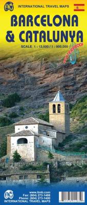
Wegenkaart - landkaart - Stadsplattegrond Barcelona & Catalunya - Catalonië | ITMB

0
Een degelijke wegenkaart met aanduidingen van o.a. nationale parken, vliegveld, benzinepomp, dirt-roads. Als overzichtskaart goed te gebruiken.   This new edition of Barcelona not only updates an already excellent city map, it relates it to its surrounding hinterland. It is no secret that the area surrounding Barcelona, called Catalunya, has long ...

Verkopers met dit product

Verkoper
Bezorging
Prijs
DeZwerver.nl logo
DeZwerver.nl
2,95
13,95

Anderen bekeken ook

Wegenkaart - landkaart 574 Aragon - Cataluna - Catalunya - Barcelona - Andorra - Zaragoza, Catalonië | Michelin
Zoals je van Michelin mag verwachten zijn het onmisbare overzichtskaarten van een uitstekende kwaliteit: een duidelijk en goed leesbaar kaartbeeld.  Vrijwel alle berijdbare wegen staan er op ingetekend, in kleur verschillend voor grote en kleine wegen. Andere weginformatie omvat bijvoorbeeld kilometer-afstanden, tolwegen, helling-aanduiding, winterafsluitingen, tankstations maar ook de bekende groene routes: de mooiste wegen om te rijden.   Daarnaast geeft de kaart toeristische informatie met symbolen weer: bezienswaardigheden als kastelen, kloosters, musea, maar ook campings (niet allemaal overigens). De kaart is voorzien van een 4-talige legenda.   Toch hebben de makers door een beperkt gebruik van symbolen geen drukke kaart gemaakt. De kracht zit hem dan ook in de combinatie van meer dan voldoende informatie en goede leesbaarheid.  Part of the orange regional series from Michelin, this Cataluna / Catalunya, Aragon, Andorra map shows this part of Spain in excellent detail. Primary &…
11,95
Wegenkaart - landkaart Mexico Central & Mexico City | ITMB
Goede wegenkaart met duidelijk kleurgebruik. Het betreft een deel van Mexico met op de achterkant een stadsplattegrond van het centrale deel van Mexico City. MC is the largest city in the Western Hemisphere, with a population of 28,000,000 (or twice as big as New York City!). It would be impractical to portray the entire urban area on one map and have it make sense, so we show the portion of greatest interest to visitors, from the Chapultepec Zoological Park in the west to the incredibly busy Tapo Bus Terminal in the east, and from the railway station in the north to the southern east-west motorway just south of the main hospital complex. Much of MC’s touristic interest is concentrated in the Zona Rosa, Reforma, and Zocalo segments of the city centre, and these are shown in detail, noting hotels, major restaurants, shopping areas, and points of interest.   The map also includes inset maps of the San Angel area just north of the university, an inset map of the greater Mexico City Feder…
13,95
Stadsplattegrond Barcelona | Borch
Borch Barcelona is een duidelijke, geplastificeerde plattegrond van het centrum met informatie over openbaar vervoer en bezienswaardigheden. Inclusief straatnamenregister.   Our soft-laminated folded map of Barcelona shows: Barcelona Centre 1:11 000, Royal Palace 1: 11 000, Parc Güell 1:11 000, Old Town 1:5 500, Barcelona and Region 1:150 000, Public Transport Barcelona, Top 30 Sights and Spain administrative. Borch maps are easy to fold, durable and water-repellent with a wipeable surface. Borch Maps show hotels, museums, monuments, markets, top sights and points of interest, useful statistics, conversion charts for temperatures, weights and measurements, climate charts showing temperatures, sunshine hours, precipitation and humidity, overview maps, time zones, and much more...   The city of Barcelona is situated on the beautiful Mediterranean coast and is bordered by the Serra de Collserola mountain ridge and the estuaries of the Llobregat and Besòs rivers. The capital city of "Cata…
9,95
Wegenkaart - landkaart Spain Mediterranean Coast | ITMB
Een degelijke overzichtskaart van het oosten en zuiden van Spanje. Spain is one of the most popular travel destinations in Europe. The country is extremely diverse, reflecting its history. The coastal areas of the Mediterranean were probably first settled by Phoenicians, then Greeks, then Romans, and then Arabs before being brought into a united Spain at the time Columbus was seeking a sponsor to fund his proposed journey to discover new lands to the west. This map focuses on the coast from the French border south through Catalunya all the way to the Straits of Gibraltar and Cadiz. The offshore islands of Mallorca, Ibiza, and Menorca are included, as is the North African Spanish enclave of Ceuta and the British enclave of Gibraltar. All road and rail lines are shown, including the new Cadiz to Madrid fast train. By the nature of mapping, a considerable amount of the interior is on the map as well, so this map is much more than just a coastal journey through Valencia and Murcia to reac…
13,95
Wegenkaart - landkaart - Stadsplattegrond Poland east - Warsaw, Oost Polen en Warschau | ITMB
ITMB wegenkaarten en wandelkaarten kenmerken zich door het kleurgebruik waarbij zo de nadruk wordt gelegd op de natuurkundige aspecten van het land of de streek. Het soort landschap en de hoogte worden hierdoor zeer duidelijk zichtbaar. Natuurlijk vind je ook de 'gewone' zaken als wegennet, spoorwegen, vliegvelden, ferrys, toeristische bezienswaardigheden en nationale parken er op terug.. Vaak - maar niet op alle kaarten - staat op de achterzijde een stadsplattegrond van hoofdstad of belangrijkste stad in de regio.  Voorzijde: Oost Polen shcaal 1:650.000 Achterzijde: Warschau, schaal 1:9.000 This is, at the same time, our second edition updated map of Warsaw and a brand new title for ITMB, in that we have added a regional map of the eastern half of Poland to the second side of the map. This gives the end user two maps for the price of one by combining the many attractions of the city with its surrounding countryside. Anyone with a small amount of historical knowledge knows that Warsaw…
13,95
Wegenkaart - landkaart Banff - Jasper national parks | ITMB
Gedetailleerde wegenkaart van deze 2 bekende nationale parken in Canada. Naast toerischtische informatie zjn de belangrijkste wandelpaden schetsmatig ingetekend en worden de campings weergegeven, hogtelijnen geven een goed beeld van de hoogteverschillen en bergern in het gebied.. Jasper staat op de ene kant en Banff op de andere zijde.  Banff is the first national park declared anywhere in the world, done at a time when the idea of reserving huge tracts of land for the enjoyment of future generations was an admirable, though unheard of, concept. The park in the Rocky Mountains of western Alberta remains as lovely and as enjoyable as it must have seemed to the early CPR railway surveyors searching for a route through the mountains to join the then-colony of British Columbia to Canada. Nowadays, the park is laced with roads and hiking trails, and the town of Banff within the park is severely pressed to maintain a balance between serving the needs of the millions of visitors each year an…
13,95
Stadsplattegrond - Wegenkaart - landkaart Cardiff & Wales | ITMB
Een dubbelzijdige kaart met aan de ene zijde een plattegrond van Cardiff, schaal 1:8.000 en op de andere zijde een wegenkaart, schaal 1:300.000, met aanduidingen van o.a. nationale parken, vliegveld, benzinepompen. ITMB finds the UK to be a never-ending source of maps needing to be prepared, such as this one of Cardiff and Wales. Cardiff is the capital of Wales, and is also an international access point to the UK; a map seems desirable. The city is based at the mouth of the River Taff, with most touristic points being concentrated in the harbour area, the city centre, and a concentration of eateries along Albany Road. Cardiff is shaped by two parallel motorways; the A4232close to the waterfront, and the A48 near the northern extremities. Both are included in our map, which also shows historic sites, hotels, and tourist amenities. The reverse side shows all of Wales as an entity, showing roads, rail lines, ferry crossing points, and access routes to England. It also shows historic site…
13,95
Wegenkaart - landkaart Tahiti - French Polynesia | ITMB
Anyone who has visited Tahiti retains fond memories of a wonderful Polynesian paradise. This map shows the major islands of French Polynesia as a series of large insets on Side 1. An overall inset map showing the many islands is also shown, but for showing detail, one must expand the individual islands. The largest one is the volcanic Tahiti Nui, with the capital city of Pape’ete (or Papeete in English), for which a detailed inset map is included. Most visitors stay in the vicinity of Papeete, along the coast. We show several popular resorts. There is a good circular road around the island’s shoreline, but no roads in the interior. The island is joined to another, called Tahiti Iti, or Little Tahiti, and roads extend partway around this less-developed part of the combined island. Most of the other islands are rarely visited, although they have resorts, beaches, and a lifestyle of their own. Names like Huahine, Riatea, Tahaa, and Maiao may not be as familiar as they should be, but all …
14,95
Wegenkaart - landkaart Cuba West | ITMB
Een degelijke wegenkaart met aanduidingen van o.a. nationale parken, vliegveld. Als overzichtskaart goed te gebruiken. his is a brand new title for ITMB and reflects the growing interest in travel to Cuba resulting from improved relations with the USA. Licenses to fly into the country from a dozen cities have already been approved; 60 more are awaiting approval. All are for flights into Havana and Varadero airports – in other words, the western half of the country. ITMB already has an exceptionally good map of the entire country. We also have a separate map of Havana. This map expands the scale and opens the information for the western half of the island nation as a double-sided map, with the portion west of Havana (La Habana) to Pinar del Rio province in the far west and south to the Isla de la Juventud (better known, but mis-named, as the Bay of Pigs Invasion Site). This side also has an excellent map of the Varadero beach resort area as an inset, and a map of greater Havana. The ot…
13,95
Wegenkaart - landkaart Wales & southwest England | ITMB
Een degelijke kaart met aanduidingen van o.a. nationale parken, vliegveld, benzinepompen. Finally, we have been able to create our own map of the lovely country of Wales. I use the word ‘country’ in its truest sense, as Wales was invaded and taken over by the English centuries ago. Regardless, the Welsh language and Welsh culture continue to flourish, although English is commonly spoken. We have visited Wales on several occasions and find that the attractions are so numerous that we could never see them all. There are too many castles to count, but some of the best preserved in the British Isles are in Wales, notable Caernarfon, but nearby Harlech is a World Heritage Site. St, David’s must be one of the smallest and loveliest cathedrals in the world, and Tintern Abbey ruins among the most poignant anywhere. We took Johnny to Abergavenny for lunch in March, not that it made any difference; he just pined for a McDonalds. This map is double-sided, with Wales on one side and the West Coun…
13,95

Klanten-reviews van Wegenkaart - landkaart - Stadsplattegrond Barcelona & Catalunya - Catalonië | ITMB

Er zijn nog geen beoordelingen voor dit productBen jij de eerste die een review plaatst?

Meer over Wegenkaart - landkaart - Stadsplattegrond Barcelona & Catalunya - Catalonië | ITMB

Productomschrijving

Een degelijke wegenkaart met aanduidingen van o.a. nationale parken, vliegveld, benzinepomp, dirt-roads. Als overzichtskaart goed te gebruiken.   This new edition of Barcelona not only updates an already excellent city map, it relates it to its surrounding hinterland. It is no secret that the area surrounding Barcelona, called Catalunya, has long harboured a strong desire to separate from Spain (the adjacent Basque region has also coveted independence for as long as I can remember). Our regional map extends beyond the strict boundaries of the province/pseudo independent state of Catalunya and is actually a very good map of the east coast of Spain as far south as Valencia, but lets not split hairs. This is an excellent map for anyone visiting the Barcelona area, showing the heart of the city in immaculate detail and providing ample mapping assistance for anyone travelling to nearby urban areas, comprising most of the touristic sights and places of interest.   Legend Includes: Roads by classification, Points of Interest, National Parks, Airports, Golf Courses, Beaches, Campsites, Waterfalls, Viewpoints, Fishing Spots, Hospitals, harbours/Ports, Zoos, and much more.   Plattegrond van Barcelona schaal 1:12.500 Wegenkaart Catalonië schaal 1:900.000

Verken gerelateerde categorieën

Webshop.nl maakt gebruik van cookies. Ga je verder op onze website, ga dan akkoord met het plaatsen van cookies en de verwerking van deze data door ons en vermelde partners.