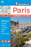
Wegenkaart - landkaart - Stadsplattegrond 106 Environ de Paris - Parijs | Michelin

0
Goede michelin wegenkaart van de omgeving van Parijs met stadsplattegrond van het centrum.   Speciale toeristische kaart, gemaakt voor een goed bezocht gebied en uitvergroot. Daardoor zeer prettig leesbaar met een hoog niveau wat we van Michelin al veel langer gewend zijn. Alle wegen staan er op, met verschillende kleuren voor de aparte soorten we...

Verkopers met dit product

Verkoper
Bezorging
Prijs
DeZwerver.nl logo
DeZwerver.nl
2,95
10,95

Anderen bekeken ook

Wegenkaart - landkaart - Stadsplattegrond 106 Environ de Paris - Parijs | Michelin
Goede michelin wegenkaart van de omgeving van Parijs met stadsplattegrond van het centrum.   Speciale toeristische kaart, gemaakt voor een goed bezocht gebied en uitvergroot. Daardoor zeer prettig leesbaar met een hoog niveau wat we van Michelin al veel langer gewend zijn. Alle wegen staan er op, met verschillende kleuren voor de aparte soorten wegen. Verder veel aandacht met symbolen voor de bezienswaardigheden in de regio, de bekende groene stroken naast de mooie wegen en ingetekende doorgaande wandelroutes als grande randonnees.   Chantilly, Chartres, Fontainebleau, Île-de-France, Meaux, Paris, Provins, Versailles
10,95
Wegenkaart - landkaart - Stadsplattegrond Barcelona & Catalunya - Catalonië | ITMB
Een degelijke wegenkaart met aanduidingen van o.a. nationale parken, vliegveld, benzinepomp, dirt-roads. Als overzichtskaart goed te gebruiken.   This new edition of Barcelona not only updates an already excellent city map, it relates it to its surrounding hinterland. It is no secret that the area surrounding Barcelona, called Catalunya, has long harboured a strong desire to separate from Spain (the adjacent Basque region has also coveted independence for as long as I can remember). Our regional map extends beyond the strict boundaries of the province/pseudo independent state of Catalunya and is actually a very good map of the east coast of Spain as far south as Valencia, but lets not split hairs. This is an excellent map for anyone visiting the Barcelona area, showing the heart of the city in immaculate detail and providing ample mapping assistance for anyone travelling to nearby urban areas, comprising most of the touristic sights and places of interest.   Legend Includes: Roads by …
13,95
Stadsplattegrond 83 Granada | Michelin
Uitstekende stadsplattegrond van Granada: zeer leesbaar, up-to-date, met register. Discover Granada by foot, car or bike using Michelin Granada City Plan (scale 1/ 8,500 cm). In addition to Michelin's clear and accurate mapping, this city plan will help you explore and navigate across Granada's different districts thanks to its full index, its comprehensive key showing places of interest and tourist attractions, as well as practical information on public transport leisure facilities, service stations and shops! For meetings, shopping trips or simply exploring, let MICHELIN CITY PLANS show you way! * Car parks, one-way and pedestrian streets, public transport * Practical information - from hospitals and service stations to entertainment and shops. * Comprehensive street index * Tourist sights, places and buildings of interest * Useful numbers and internet sites
9,95
Wegenkaart - landkaart - Stadsplattegrond Istanbul & Northwest Turkey | ITMB
Dubbelzijdige kaart van ITMB met aan een kant een wegenkaart  1:550.000 met aanduidingen van o.a. nationale parken, vliegveld, benzinepomp, dirt-roads. Als overzichtskaart goed te gebruiken. Aan de andere kant een overzichtelijke stadsplattegrond 1: 11.000 met stratenindex en aanduiding van toeristische informatie en culturele instellingen zoals musea, monumenten, schouwburgen en sportaccomodaties. Daarnaast bevaten de meeste kaarten een heldere aanduiding van het openbaarvervoer (opstappunten van metro), parkeergelegenheden, postkantoren en andere praktische informatie. Istanbul is one of the most interesting cities in Europe. It is loaded with interesting places to see and places to go. The map shows all major touristic sites (my favourite is Constantine s Column), the ferry routes that criss cross the Bosphorus, and the transit lines that move everyone around the city. We have made a significant change to the regional map on the second side of the sheet; in this edition, we provide…
13,95
Stadsplattegrond Streetwise Venice | Michelin
(Edition Updated 2023) Streetwise Venice Map is a laminated city center map of Venice, Italy. The accordion-fold pocket size travel map shows water bus lines. Coverage includes:Main Venice, Italy Map 1:8,400Murano Island Map 1:22,000Giudecca Island Map 1:12,000Venice Water Bus MapDimensions: 4' x 8.5" folded, 8.5" x 27" unfoldedVenice: Prince of the Adriatic, Queen of romantics, King of canals and palaces.   Venice is pure Italian opera. The pocket size map of Venice is laminated for durability and accordion folding for effortless use. To enhance your visit to Venice, pick up a Michelin Green Guide Venice and the Veneto, full of suggested itineraries, highlighting three-star attractions, options for entertainment, shopping, staying, dining and including detailed information on places you shouldn't miss (Grand Canal, Piazza San Marco, St Mark's Basilica, Doges Palace, Academia).   For a selection of the best restaurants and hotels, try the MICHELIN Guide Main Cites Europe. For driving …
9,95

Klanten-reviews van Wegenkaart - landkaart - Stadsplattegrond 106 Environ de Paris - Parijs | Michelin

Er zijn nog geen beoordelingen voor dit productBen jij de eerste die een review plaatst?

Meer over Wegenkaart - landkaart - Stadsplattegrond 106 Environ de Paris - Parijs | Michelin

Productomschrijving

Goede michelin wegenkaart van de omgeving van Parijs met stadsplattegrond van het centrum.   Speciale toeristische kaart, gemaakt voor een goed bezocht gebied en uitvergroot. Daardoor zeer prettig leesbaar met een hoog niveau wat we van Michelin al veel langer gewend zijn. Alle wegen staan er op, met verschillende kleuren voor de aparte soorten wegen. Verder veel aandacht met symbolen voor de bezienswaardigheden in de regio, de bekende groene stroken naast de mooie wegen en ingetekende doorgaande wandelroutes als grande randonnees.   Chantilly, Chartres, Fontainebleau, Île-de-France, Meaux, Paris, Provins, Versailles

Productinformatie

    Verken gerelateerde categorieën

    Webshop.nl maakt gebruik van cookies. Ga je verder op onze website, ga dan akkoord met het plaatsen van cookies en de verwerking van deze data door ons en vermelde partners.