Productomschrijving
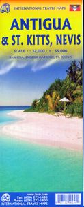
Gedetailleerde kaart van de eilanden St. Kitts - Nevis - Antigua met ook Barbuda - English Harbour - St. John's. Naast de wegenkaart ligt er ook veel nadruk op de hoogteverschillen op de eilanden. Our latest version of Antigua is also a new title for ITMB, in that we are combining the Caribbean island nation with nearby St. Kitts and Nevis, with a small inset map for the lovely island of Barbuda. Side 1 is a very expansive and detailed map of Antigua, with a good inset map of St. John’s, the capital. At the southern end of the island is Nelson’s Dockyard, a historical remnant that serviced British naval ships for centuries, and is well-worth a visit. Map size: 27*39" This map is also available in digital format and flat map. Please contact map@itmb.com if you would want to place an order or for more information. Legend Includes: Roads by classification, Rivers and Lakes, National Park, Airports, Points of Interests, Highways, Main Roads, Zoos, Fishing, and much more...

