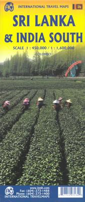
Wegenkaart - landkaart Sri Lanka & South India | ITMB

0
Een degelijke kaart met aanduidingen van o.a. nationale parken, vliegveld, benzinepomp, dirt-roads en kleine plattegrond van hoofdstad. Geplastificeerd. Folded, indexed, road map of Sri Lanka, showing all major and many minor roads, cities and towns, at a scale of 1:450,000. Map shows railroads, ferries, places of interest, national parks, beaches...

Verkopers met dit product

Verkoper
Bezorging
Prijs
DeZwerver.nl logo
DeZwerver.nl
2,95
13,95

Anderen bekeken ook

Wegenkaart - landkaart Sri Lanka & South India | ITMB
Een degelijke kaart met aanduidingen van o.a. nationale parken, vliegveld, benzinepomp, dirt-roads en kleine plattegrond van hoofdstad. Geplastificeerd. Folded, indexed, road map of Sri Lanka, showing all major and many minor roads, cities and towns, at a scale of 1:450,000. Map shows railroads, ferries, places of interest, national parks, beaches, hotels, major dive sites, and seaports. Also includes inset of central Colombo. Legend is in English.    
13,95
Wegenkaart - landkaart India South | ITMB
Een degelijke kaart met aanduidingen van o.a. nationale parken, vliegveld, benzinepomp, dirt-roads en kleine plattegrond van Mumbai. Als overzichtskaart goed te gebruiken. Gedrukt op watervast papier wat de levensduur van deze kaart ten goede komt! India is a very large country! It also has an unusual diamond shaped physical appearance that makes it hard to map. The north is also very different from the south, so we decided to expand our data base for India and publish a map covering India from Hyderabad and Mumbai south to the southern tip of the country. As the country economically modernizes, it becomes better known. As a country, India is fascinating and a great travel experience. I well remember visiting the temple city of Tiruchirappalli many years ago and travelling by local trains (an experience that tends to sear itself on to ones memory cells!) Interesting-sounding names fill the map: Madurai, Kochi, Bangalore, Nagpur, and Pune; the map reeks of adventure and exoticism!  
13,95
Wegenkaart - landkaart Mexico South | ITMB
Een degelijke wegenkaart met aanduidingen van o.a. nationale parken, vliegveld, benzinepomp, dirt-roads. Als overzichtskaart goed te gebruiken (De kaart beschrijft Mexico ten Zuiden van Tampico). Folded road and travel map in color. Scale 1:1,200,000. Distinguishes 5 types of roads, ranging from expressways to tracks. Legend shows international/provincial borders, international/domestic airports, airstrips, railways, trails, points of interest, archaeological sites, beaches, caves, gas stations, reefs, National Parks, swamps/mangroves. Map includes extensive index. Shown are also parts of Belize and Guatemala.  
13,95
Wegenkaart - landkaart Zuid Afrika - South Africa | ITMB
Uitstekende wegenkaart van Zuid Afrika met zowel de toeristische informatie als Nationale Parken en bezienswaardigheden, maar ook de topografische details en afstanden. Gedrukt op 'waterproof' papier. Double-sided map of South Africa printed on waterproof and tear-resistant synthetic paper, with plans of Cape Town, Johannesburg and Pretoria. The map divides the country east/west with a small overlap between the two sides. Elevation tinting in feet shows the general relief. Mountain passes are marked, but there are no spot heights. Road network includes selected local tracks, gives driving distances on major and secondary roads and indicates border crossings. Railways, major ferry connections and local airports are also shown. National parks and protected areas are marked and symbols highlight various places of interest, campsites or huts, rest houses and other tourist accommodation, beaches and diving sites, etc. Presentation of Lesotho and Swaziland is the same as for South Africa. L…
13,95
Wegenkaart - landkaart Paraguay & Bolivia South | ITMB
Een degelijke kaart met aanduidingen van o.a. nationale parken, vliegveld, benzinepomp, dirt-roads en kleine plattegrond van hoofdstad. Als overzichtskaart goed te gebruiken. Technically, this is a new title for ITMB, in that it is not merely an updating of a previous edition, but it is still a map of Paraguay, basically, so we count it as an updated edition with part of Bolivia included. Expanding the area of coverage benefits visitors combining Paraguay and Bolivia into one trip. The first side covers Bolivia from La Paz south to the Paraguayan border, with inset maps of Potosi and Santa Cruz. The second side concentrates on Paraguay itself, with inset maps of Asuncion, the Asuncion region, and northern Paraguay. Small bits of bordering countries also are included. Road connections within Paraguay have been shown to good advantage. Both countries, being land-locked, are somewhat isolated, making travel to them something more adventuresome than visits to neighbouring countries. Howev…
13,95
Wegenkaart - landkaart Namibia - Namibië | ITMB
Een degelijke kaart met aanduidingen van o.a. nationale parken, vliegveld, benzinepomp, dirt-roads en kleine plattegrond van hoofdstad. Als overzichtskaart goed te gebruiken. The former German colony and mandated territory of South-west Africa has emerged as a major touristic destination. Following our recent research trip to the country, we have made numerous changes to the map – upgrading roads that have been paved, changing our Caprivi Strip information, and re-doing our inset map of Windhoek. Printed on paper, single-sided; Folded road and travel map. Scale 1:1,600,000. Distinguishes roads ranging from highways to tracks (seasonal). Legend includes points of interest, internet cafes, restricted access roads, railroads, international/domestic airports, aerodromes, lodging, rest houses, guest farms, campsites, ruins historic/archaeological), museums, vistas, hot springs, caves, forts, shipwrecks, gas stations, medical facilities, missions, national parks/reserves, salt pans, restric…
13,95
Wegenkaart - landkaart South America - Zuid Amerika | ITMB
Een degelijke kaart met aanduidingen van o.a. nationale parken, vliegveld, benzinepomp, dirt-roads en kleine plattegrond van hoofdstad. Als overzichtskaart goed te gebruiken. ITMB is very pleased to release a new, digitally-prepared, double-sided map of South America. It covers the entire continent in great detail and has been able to capture the information on the 'old' map, while using the expanded scale of the new map to add and enhance countless details that were crammed on to the earlier editions or for which there was inadequate room to include. This is the most detailed continental map of this part of the world ever published. Legend Includes: Railways, ferry routes, roads by classification, international and domestic airports, rivers, lakes, points of interest, archaeological sites, beaches, lighthouses, mines, glaciers, volcanoes, national parks and other information.  
13,95
Wegenkaart - landkaart Canada | ITMB
Een degelijke kaart met aanduidingen van o.a. nationale parken, vliegveld, benzinepomp, dirt-roads en kleine plattegrond van hoofdstad. Well, it’s about time, eh?!? ITMB, after only thirty years on the go, finally gets around to publishing a map of Canada. When we first started mapping, there was a pressing need for good maps of Central and South America, then of Africa, then etc etc and we never found time to concentrate on our own country until fairly recently. This map was prepared by Natural Resources Canada and is, as a result, as accurate a map as one could hope to have. We are very proud of it, and very pleased to be able to use such top-rate cartography. The map covers all of the land mass of Canada, from its southernmost point to the top of Ellesmere Island and from the Atlantic coast to the Pacific. It’s an excellent map, but I’m going to give one proviso. Canada is the second-largest country on the face of the planet and there is no way that a single-sided sheet can portray…
13,95
Wegenkaart - landkaart South East Asia - Zuid Oost Azië | ITMB
  Een degelijke kaart met aanduidingen van o.a. nationale parken, vliegveld, benzinepomp en dirt-roads. Als overzichtskaart goed te gebruiken. Met Laos, Cambodja, Vietnam, Thailand, Maleisië, Filipijnen en Indonesië.   The part of the world from southern China, through the Indo-Chinese peninsula, and sweeping through the Indonesian archipelago to the hundreds of islands comprising the Philippines, is a fascinating part of the world to map. Countless cultures interact in this vast region - the mountain people along the Vietnamese/Laotian border, the fisherman of coastal regions and islands, the lovely and gentle Balinese, and the business-like Javanese. This is an extremely important part of the world - touristically attractive, economically thriving, and scenically unbeatable. This latest edition will be useful for anyone visiting the region. It is detailed, printed double-sided. This map has proven to be a better seller than expected, necessitating a review. We keep the same cover, s…
13,95
Wegenkaart - landkaart Queensland | ITMB
Een degelijke wegenkaart van Queensland met aanduidingen van o.a. nationale parken, vliegveld, benzinepomp, dirt-roads en kleine plattegrond van hoofdstad. Als overzichtskaart goed te gebruiken. We complete our series of regional maps covering Australia with this map of Queensland, which nicely fills a double-sided sheet with only small portions of adjoining states showing. The map also includes a large inset map of central Brisbane. At this scale, the road/rail network of this part of Australia becomes very clear. The first side concentrates on the northern portion of the state, and the other side, the more densely-developed southern half. The map includes a listing of the state’s top attractions, and notes al major touristic attractions. Although gas/petrol stations are commonly found, we have included some gas symbols in remoter parts of Queensland to encourage drivers to venture into roads less travelled. All states and territories of Australia are now available from ITMB as separ…
13,95

Klanten-reviews van Wegenkaart - landkaart Sri Lanka & South India | ITMB

Er zijn nog geen beoordelingen voor dit productBen jij de eerste die een review plaatst?

Meer over Wegenkaart - landkaart Sri Lanka & South India | ITMB

Productomschrijving

Een degelijke kaart met aanduidingen van o.a. nationale parken, vliegveld, benzinepomp, dirt-roads en kleine plattegrond van hoofdstad. Geplastificeerd.

Folded, indexed, road map of Sri Lanka, showing all major and many minor roads, cities and towns, at a scale of 1:450,000. Map shows railroads, ferries, places of interest, national parks, beaches, hotels, major dive sites, and seaports. Also includes inset of central Colombo. Legend is in English.


Productinformatie

    Verken gerelateerde categorieën

    Webshop.nl maakt gebruik van cookies. Ga je verder op onze website, ga dan akkoord met het plaatsen van cookies en de verwerking van deze data door ons en vermelde partners.