Wegenkaart - landkaart Spitsbergen ( Svalbard ) | Ocean Explorer Maps
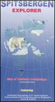
The Spitsbergen Explorer is the ideal map to accompany cruising amongst these dramatic islands. The Svalbard Archipelago was a pioneer destination for Arctic tourism, and the Explorer contains essential details on the flora and fauna that have attracted visitors since the mid-19th century. Featuring: Illustrated biographies of 27 noted explorers.. Color photos and introductory text on plants & wildlife. Map showing protected areas. Diagram charting the rising & setting of the midnight sun.
19,95

