Wegenkaart - landkaart Spitsbergen Svalbard | ITMB

0
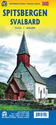
North of Norway exists one of the northernmost communities in the world, an archipelago of islands called Svalbard in Norwegian, and better known as Spitsbergen in English. Until now, it has only been available in map format from the Norwegian Arctic Institute, and then only with difficulty. Side one shows the various islands as an entity. There i...

Verkopers met dit product

Verkoper
Bezorging
Prijs
DeZwerver.nl logo
DeZwerver.nl
2,95
13,95

Anderen bekeken ook

Wegenkaart - landkaart Spitsbergen Svalbard | ITMB
North of Norway exists one of the northernmost communities in the world, an archipelago of islands called Svalbard in Norwegian, and better known as Spitsbergen in English. Until now, it has only been available in map format from the Norwegian Arctic Institute, and then only with difficulty. Side one shows the various islands as an entity. There is only one town of any size in the islands, called Longyearbyen, although there is a more northerly town called Pyramiden and an isolated community on the west coast called Alesund. This is true high Arctic adventure travel; one does not come here unprepared! Most of the islands are uninhabited and largely ice-covered. Edge Island, for example, is a large nature reserve, and Prins Karl Forland is a national park. We have translated land area names into English and placed the Norwegian names in brackets, but have tried leaving the Norwegian names in place wherever possible to assist with local usage. This is one of those ‘off the beaten path’ …
13,95
Reisgids Spitsbergen - Svalbard | Bradt Travel Guides
Voor vele landen net zo goed, zo niet beter dan de Planet. Beduidend soberder uitgevoerd, maar ook met veel informatie voor backpackers en met veel kaartmateriaal. Een aanrader! Engels. Veel informatie over de geschiedenis en het natuurleven van Spitsbergen; een van de weinige goede gidsen over Spitsbergen. The Bradt guide to Svalbard (Spitsbergen), including Franz Josef Land and Jan Mayen, is a unique, standalone guidebook to this evocative Arctic archipelago, a place that is plunged into darkness for four months each year and where there are 4,000 snow scooters for a population of just 2,500. This new sixth edition has been thoroughly updated throughout and offers new material on everything from adventure tours to accommodation, environmental change to restaurants. Also covered are the restoration of Barentsburg and the opening of Svalbard's historic mines to visitors.   Newly updated and amended, this edition reflects important recent changes in the archipelago, making it the perfe…
27,95
Wegenkaart - landkaart Spitsbergen ( Svalbard ) | Ocean Explorer Maps
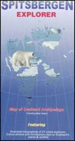
The Spitsbergen Explorer is the ideal map to accompany cruising amongst these dramatic islands. The Svalbard Archipelago was a pioneer destination for Arctic tourism, and the Explorer contains essential details on the flora and fauna that have attracted visitors since the mid-19th century. Featuring: Illustrated biographies of 27 noted explorers.. Color photos and introductory text on plants & wildlife. Map showing protected areas. Diagram charting the rising & setting of the midnight sun.
19,95
Reisinspiratieboek - Fotoboek Life on Svalbard | Spitsbergen | Dorling Kindersley
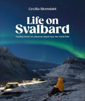
Join Cecilia Blomdahl in Longyearbyen, Svalbard, the world's northernmost town. Located in the Arctic Ocean near the North Pole, Svalbard is a unique archipelago that boasts stunning wintry landscapes, endangered Arctic animals, and awe-inspiring natural phenomena. Since 2015, Cecilia has called this beautiful and remote location home. Along with her partner, Christoffer, and her dog, Grim, she has adjusted to life at the top of the world--where polar bears roam free and northern lights shine bright. With evocative text and spectacular photography, Cecilia shares the joys and challenges of adapting to an inhospitable climate. Her story begins in the darkness of polar night, and the allure of her remote location is revealed gradually as sunlight returns months later. Through personal stories and firsthand advice, Cecilia offers insight for anyone seeking to thrive in unusual living conditions. Whatever your location, Life on Svalbard will give you a deeper understanding of why people c…
34,95
Wegenkaart - landkaart Norway - Noorwegen | ITMB
Norway is one of the most popular countries for visitors in Europe. We spent an interesting time researching this map in Norway, travelling all the way north to Nordkapp, a trip that took a week. We were actually on a cruise ship for much of the travel time. We also discovered a bookstore in Narvik that sells travel maps and obtained valuable research material there. Norway, as a country, is one of the prime travel destinations in the world – lots of wide open spaces, all the mod-cons, and fantastic scenery. Obviously, Nordkapp is a huge attraction, being the most northerly part of Europe one can access, but Norway has lots of other attractions. Roads in Norway tend to be of a very good quality, but are mostly two-laned and winding. There are coastal ferries joining isolated communities from south to north, and lots of ferries for car crossings of fiords. We took a local ferry from Alesund into the interior of Stor Fiord. It took all day to make the trip, but it was a great experience…
14,95
Wegenkaart - landkaart Tahiti - French Polynesia | ITMB
Anyone who has visited Tahiti retains fond memories of a wonderful Polynesian paradise. This map shows the major islands of French Polynesia as a series of large insets on Side 1. An overall inset map showing the many islands is also shown, but for showing detail, one must expand the individual islands. The largest one is the volcanic Tahiti Nui, with the capital city of Pape’ete (or Papeete in English), for which a detailed inset map is included. Most visitors stay in the vicinity of Papeete, along the coast. We show several popular resorts. There is a good circular road around the island’s shoreline, but no roads in the interior. The island is joined to another, called Tahiti Iti, or Little Tahiti, and roads extend partway around this less-developed part of the combined island. Most of the other islands are rarely visited, although they have resorts, beaches, and a lifestyle of their own. Names like Huahine, Riatea, Tahaa, and Maiao may not be as familiar as they should be, but all …
14,95
Wegenkaart - landkaart Nunavut - Northwest Territories | ITMB
The far north of Canada, north of 60 degrees, consists of three territories; the Yukon, the Northwest Territories, and Nunavut. Until now, there has never been a proper map of the territory that was carved off from the NWT a quarter century ago. With only 30,000 people and a scattering of settlements, Nunavut is larger than western Europe in area. This map took us years to prepare, using 1:250,000 government topo maps as a base and tracing thousands of little lakes. The traditional passageway of the fabled Northwest Passage is also shown. The most northerly civilian community in the world is on the map – Grise Bay, as well as Alert, the most remote place on earth. Originally, the NWT covered all of northwestern North America west of the Louisiana Purchase and the Loyalist colonies, and north of the Spanish provinces (essentially north of current day Sactamento). Political changes have reduced its size over the past century and a half to the region of Canada north of the 60th parallel …
13,95
Wegenkaart - landkaart Guam - West Pacific Cruising | ITMB
Een degelijke kaart met aanduidingen van o.a. nationale parken, vliegveld, benzinepomp, dirt-roads. Als overzichtskaart goed te gebruiken. Certainly, this is the only map of Guam by any major cartographic publishing house. Here are some details: Guam is a north-south island considerably north of New Guinea, and forms part of the American-held group of islands known as the Northern Marianas. Its capital is Hagatna, and the main town is called Tamuning. The island has a well-developed international airport in the middle portion of the island, with a large US military airbase in the northeast corner. The vast majority of the island is touristic, and well worth a visit. The island was "discovered" by Ferdinand Magellan in 1521, and Hagatna is the oldest "European" city in the Pacific, dating from 1686. The town of Inarajan retains a decidedly Spanish appearance to this day. Other attractions include Tumon Beach and its many resorts, the Piti Underwater Observatory, and the famous Cocos Is…
13,95
Wegenkaart - landkaart Atlantic Canada | ITMB
The first edition was published in 2000 using artwork under licence. This edition uses original ITMB artwork. Side 1 covers Nova Scotia, New Brunswick, and Prince Edward Island as well as Quebec s Magdalen Islands at a scale of 1:800,000. This side also includes the Top 10 Attractions of the three provinces. The second side is devoted to the Canadian Province of Newfoundland and Labrador, with the much smaller island portion being a half-page inset at 1:150,000 scale and the larger mainland portion being at 1:1,700,000. The northernmost tip of Quebec/Labrador belongs to Nunavut. St. Pierre et Miquelon, a French overseas possession just south of Newfoundland Island, is also included, as well as the map s only urban inset, historic St. John s, one of North America s oldest cities. The map also includes a listing of 9 Top Attractions. ITMB also publishes maps of the individual provinces, but the advantage of this regional map is that it combines together four interesting parts of Canada …
13,95

Klanten-reviews van Wegenkaart - landkaart Spitsbergen Svalbard | ITMB

Er zijn nog geen beoordelingen voor dit productBen jij de eerste die een review plaatst?

Meer over Wegenkaart - landkaart Spitsbergen Svalbard | ITMB

Productomschrijving

North of Norway exists one of the northernmost communities in the world, an archipelago of islands called Svalbard in Norwegian, and better known as Spitsbergen in English. Until now, it has only been available in map format from the Norwegian Arctic Institute, and then only with difficulty. Side one shows the various islands as an entity. There is only one town of any size in the islands, called Longyearbyen, although there is a more northerly town called Pyramiden and an isolated community on the west coast called Alesund. This is true high Arctic adventure travel; one does not come here unprepared! Most of the islands are uninhabited and largely ice-covered. Edge Island, for example, is a large nature reserve, and Prins Karl Forland is a national park. We have translated land area names into English and placed the Norwegian names in brackets, but have tried leaving the Norwegian names in place wherever possible to assist with local usage. This is one of those ‘off the beaten path’ type of travel destinations, such as appeal to Linblad Explorer ships. We actually include a list of Top Attractions! This is the most northerly land mass in the world, and Alesund is its most northerly urban area. The second side of the map is also uniquely interesting. It focuses on the far north of Norway, from Bodo all the way to Nordkapp and east to Norway’s border with Russia. Northernmost Sweden and Finland are included as well, but the map really emphasizes how large Norway is. Rail lines, and there are some, are shown with a red/white line going as far as Narvik (from Sweden) and Bodo (from Oslo). This is a really exotic title, but one every map store should carry!   Legend Includes: Meseum, Lighthouse, Info Centre, Bank, Airport, Post Office, Monument, School, Point of Interest, Library, Tower, Cinema, Hotel, Notable Building, Restaurant, Harbour, Viewpoint, Police, etc.

Productinformatie

    Verken gerelateerde categorieën

    Webshop.nl maakt gebruik van cookies. Ga je verder op onze website, ga dan akkoord met het plaatsen van cookies en de verwerking van deze data door ons en vermelde partners.