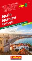
Wegenkaart - landkaart Spanje en Portugal - Spanien | Hallwag

0
Prima kaart van heel Spanje op 1 kant bedrukt met plaatsnamen index. Met distoguide: een afstanden tabel op schuifkaart die de afstanden geeft tussen de belangrijkste plaatsen. Hallwag road maps are renowned for their up-to-date information, clear layout and convenience. Full of new ideas to make travel even easier. Distoguide – the integrated mil...

Verkopers met dit product

Verkoper
Bezorging
Prijs
DeZwerver.nl logo
DeZwerver.nl
2,95
15,50

Anderen bekeken ook

Wegenkaart - landkaart België, Luxemburg | Hallwag
Zeer goede, gedetailleerde en up-to-date autokaart van België en Luxemburg. Met afstandentabel en uitgebreide legenda en index. Hallwag road maps are renowned for their up-to-date information, clear layout and convenience. See for yourself the benefits of the Hallwag international map collection, with new ideas to make travel even easier. The map also covers the north east of France. A range of symbols indicate information for tourists including: places of interests, viewpoints, natural curiosities, notable buildings and ruins, monuments, monasteries and churches, yearly and seasonal campsites, windmills, lighthouses and golf courses. The map includes extensive transportation detail, multiple language information (English, German, Italian, and French), and a complete multiple language index. There are also inset maps showing more detail of the major cities. Relief shading clearly shows the topography of the land. The map also includes Hallwag's Distoguide - the integrated mileage char…
14,50
Wegenkaart - landkaart 12 USA - Verenigde Staten | Hallwag
Goede duidelijke overzichtskaart van de USA, waarop de wegen met wegnummers eenvousig te volgen zijn. Nationale parken en National Reserves / Indianen-gebieden staan goed ingetekend. Daarnaast is een handige afstandentabel, waarbij duidelijk wordt hoe groot de USA wel niet is! Een ideale kaart voor iedereen die de USA gaat doorkruisen. Hallwag road maps are renowned for their up-to-date information, clear layout and convenience. See for yourself the benefits of the Hallwag international map collection, with new ideas to make travel even easier.    A range of symbols indicate information for tourists including: places of interests, viewpoints, natural curiosities, notable buildings and ruins, monuments, monasteries and churches, yearly and seasonal campsites, windmills, lighthouses and golf courses.    The map includes extensive transportation detail, multiple language information (English, German, Italian, and French), and a complete multiple language index. Relief shading clearly sho…
14,95
Wegenkaart - landkaart Frankrijk | Hallwag
Prima kaart van heel Frankrijk op 1 kant bedrukt met plaatsnamen index. Met distoguide: een afstanden tabel op schuifkaart die de afstanden geeft tussen de belangrijkste plaatsen. STRASSENKARTEN MIT DISTOGUIDE Aktuelle Information, übersichtliche Darstellung, einfache Handhabung: das Markenzeichen der Hallwag-Strassenkarten. Das internationale Programm mit neuen Ideen für besseres Reisen bietet Ihnen überzeugende Vorteile. Distoguide - der eingebaute «Kilometerzähler» - auf der Aussenseite des Kartendeckels. Für den einfachen und schnellen Zugriff. Sehr praktisch für Planung und Reise! Mit Leichtigkeit lassen sich auf dem im Kartendeckel integrierten Distanzenschieber über 2000 Entfernungen ablesen. Massstab: 1 : 1 000 000
14,50
Wegenkaart - landkaart Deutschland Nord - Duitsland Noord | Hallwag
Goede overzichtelijke wegenkaart van de noordelijke helft van Duitsland met register en afstandentabel. The Hallwag road map is a good clear map which includes places of interest marked on the map. The map also includes a distoguide which is an integrated mileage chart on the outer map cover. This allows you to read off more than 2000 distances by using the sliding mileage chart. Detailed touring map of northern Germany extending just south of Koln and Dresden. Separate plans present road access to and main routes across Berlin, Dortmund, Dusseldorf, Bremen, Duisburg/Essen, Leipzig, Dresden, Hamburg, Hanover and Koln
14,50
Wegenkaart - landkaart South Africa Namibia Botswana - Zuid Afrika Namibië Bostwana | Marco Polo
Duidelijke wegenkaart van Marco Polo: alle wegen, zowel de verharde als belangrijke onverharde wegen zijn weergegeven.  Mooie toeristisch interessante wegen die de moeite waard zijn, zijn groen gearceerd. Veel toeristische informatie is toegevoegd zoals de nationale parken, campings, kastelen en vliegvelden. Afstanden tussen belangrijke steden staan ook op de kaart. Een plaatsnamenregister ontbreekt niet.   ---   This Marco Polo map of South Africa features really easy to read cartography. Topography is highlighted with relief shading and loads of spot heights and the road network is clearly shown with roads ranging from motorways all the way through to minor secondary roads. The map also clearly indicates airports, places of interest, scenic/tourist routes, view points etc.   The map includes a booklet attached to the cover that contains some useful information and a very extensive index that covers locations, places of interest and geographical features. Also included are a distance…
14,95
Wegenkaart - landkaart Portugal | Marco Polo
Duidelijke wegenkaart van Marco Polo: alle wegen, zowel de verharde als belangrijke onverharde wegen zijn weergegeven.  Mooie toeristisch interessante wegen die de moeite waard zijn, zijn groen gearceerd. Veel toeristische informatie is toegevoegd zoals de nationale parken, campings, kastelen en vliegvelden. Afstanden tussen belangrijke steden en benzinestations staan ook op de kaart. Een plaatsnamenregister ontbreekt niet.   ---   This Marco Polo map features really easy to read cartography. Topography is highlighted with relief shading and loads of spot heights and the road network is clearly shown with roads ranging from motorways all the way through to minor secondary roads. The map also clearly indicates airports, places of interest, scenic/tourist routes, view points etc.   The map includes a booklet attached to the cover that contains some useful information and a very extensive index that covers locations, places of interest and geographical features. Also included are a dista…
14,95
Wegenkaart - landkaart Duitsland zuid - Deutschland sud | Hallwag
Goede overzichtelijke wegenkaart van de zuidelijke helft van Duitsland met register en afstandentabel. Mit Download-Code für gratis Kartenversion auf Smartphone!   Mit E-Distoguide® via QR-Code. Die Vernetzung von Print und Web für noch mehr Flexibilität.  Über 2000 Entfernungsangaben sind jetzt mittels QR-Code direkt mit dem Handy überall abrufbar!   Strassenkarte mit Transitplänen, Ortsindex, touristische Informationen und Sehenswürdigkeiten. Aktuelle Information, übersichtliche Darstellung, einfache Handhabung: das Markenzeichen der Hallwag-Strassenkarten. Das internationale Programm mit neuen Ideen für besseres Reisen bietet Ihnen überzeugende Vorteile.    
14,50
Wegenkaart - landkaart Kanada - Canada | Marco Polo
Marco Polo Canada Map: the ideal map for your trip   Let the Marco Polo Canada Map guide you around this incredible country. Plan your great Canadian road trip with this highly durable, overview map of Canada. It folds away easily and is always on standby to help when you're stuck.   Perfect touring map - the scale is 1 : 4 000 000* ideal to help you tour the main highways by car, RV or campervan Easy to use - the super clear mapping in strong colours and clear text will help you navigate easily Includes 6 city maps - detailed street maps of Calgary, Montreal, Ottawa, Quebec, Toronto, Vancouver as well as maps of key National Parks including Jasper, Banff, Yoho, Kootenay and Waterton Lakes Canada highlights - major sights and key points of interest are marked on the map by numbered stars and these are listed in the index booklet with a brief description to help you pick the best places to see en route Extensive index - the thorough index is fully cross-referenced to the map to help yo…
14,95
Reisgids Spanje - Spanien | Baedeker Reisgidsen
Dreamlike beaches, unique landscapes and fascinating culture in historic villages and vibrant cities – travel the land of pilgrims and flamenco: Spain. A visit to the impressive city of Barcelona with its countless sights such as the Sagrada Familia or the Park Güell should not be missing from your Spain holiday. But even the lesser-known places such as Córdoba, Cáceres and Cuenca are true treasures that you should definitely visit during your trip through Spain. With our Baedeker Travel Guide Spain, we take you in six individual tour suggestions not only to the most beautiful cities such as the Spanish capital Madrid, Malaga, Bilbao, Seville and Valencia, but also lead you to magnificent coastal towns on the Costa Brava and a piece along the famous Camino de Santiago de Compostela as a destination . With our travel tips for your holiday planning, we show you where to experience the special and find the most beautiful sights, so that your individual round trip through Spain or your co…
31,50
Wegenkaart - landkaart Montenegro | Marco Polo
Duidelijke wegenkaart van Marco Polo: alle wegen, zowel de verharde als belangrijke onverharde wegen zijn weergegeven.  Mooie toeristisch interessante wegen die de moeite waard zijn, zijn groen gearceerd. Veel toeristische informatie is toegevoegd zoals de nationale parken, campings, kastelen en vliegvelden. Afstanden tussen belangrijke steden en benzinestations staan ook op de kaart. Een plaatsnamenregister ontbreekt niet.   ---   This Marco Polo map features really easy to read cartography. Topography is highlighted with relief shading and loads of spot heights and the road network is clearly shown with roads ranging from motorways all the way through to minor secondary roads. The map also clearly indicates airports, places of interest, scenic/tourist routes, view points etc.   The map includes a booklet attached to the cover that contains some useful information and a very extensive index that covers locations, places of interest and geographical features. Also included are a dista…
14,95

Klanten-reviews van Wegenkaart - landkaart Spanje en Portugal - Spanien | Hallwag

Er zijn nog geen beoordelingen voor dit productBen jij de eerste die een review plaatst?

Meer over Wegenkaart - landkaart Spanje en Portugal - Spanien | Hallwag

Productomschrijving

Prima kaart van heel Spanje op 1 kant bedrukt met plaatsnamen index. Met distoguide: een afstanden tabel op schuifkaart die de afstanden geeft tussen de belangrijkste plaatsen.

Hallwag road maps are renowned for their up-to-date information, clear layout and convenience. Full of new ideas to make travel even easier. Distoguide – the integrated mileage chart - on the outer map cover. Quick and easy to use. Extremely practical for planning and travel. Simply read off more than 2000 distances on the sliding mileage chart integreated in the map cover. Publisher: Hallwag Scale: 1:1.000 000

Strassenkarte Spanien, PortugalStrassenkarte mit Transitplänen, Ortsindex, touristische Informationen und Sehenswürdigkeiten.Aktuelle Information, übersichtliche Darstellung, einfache Handhabung: das Markenzeichen der Hallwag-Strassenkarten. Das internationale Programm mit neuen Ideen für besseres Reisen bietet Ihnen überzeugende Vorteile. Massstab: 1 : 1 000 000


Productinformatie

    Verken gerelateerde categorieën

    Webshop.nl maakt gebruik van cookies. Ga je verder op onze website, ga dan akkoord met het plaatsen van cookies en de verwerking van deze data door ons en vermelde partners.