webshop.nl
Categorieën
  Sluiten

Meer ITMB

Wegenkaart - landkaart Southern Quebec - Zuid Quebec | ITMB

Een degelijke kaart met aanduidingen van o.a. nationale parken, vliegveld, benzinepomp, dirt-roads en kleine plattegrond van hoofdstad. Als overzichtskaart goed te gebruiken. La Belle Province has a lot in common with Ontario. It is a huge political entity, with most of the land mass unusable due to permafrost. Almost all the roads and settlements ...
13,95

Webshops met dit product

Webshop
Bezorging
Prijs

Anderen bekeken ook

Wegenkaart - landkaart Southern Quebec - Zuid Quebec | ITMB
Een degelijke kaart met aanduidingen van o.a. nationale parken, vliegveld, benzinepomp, dirt-roads en kleine plattegrond van hoofdstad. Als overzichtskaart goed te gebruiken. La Belle Province has a lot in common with Ontario. It is a huge political entity, with most of the land mass unusable due to permafrost. Almost all the roads and settlements are in the southern half of the province, so we expanded the scale of our artwork and created a map that will be of greater practical use for visitors than one of the entire province. Even so, the distances are formidable (say it in French; it sounds much more dramatic!) Side one concentrates on the region north of Montreal, and includes the Canadian Shield region of Abitibi. The second side follows the St. Lawrence River eastward to Quebec City, where one can continue eastward on the north shore for hundreds of kilometers or cross over an enormous bridge to the south shore and do essentially the same; ending up in the picturesque Gaspe Penin…
13,95
Wegenkaart - landkaart Southern Ontario | ITMB
Een degelijke kaart met aanduidingen van o.a. nationale parken, vliegveld, benzinepomp, dirt-roads en kleine plattegrond van hoofdstad. Als overzichtskaart goed te gebruiken. The Canadian province of Ontario is intimidatingly large. It is also mostly tundra with extremely few settlements and few roads; in fact, the geographic centre of Ontario is about 1,500 kms north of the nearest road. The very first map I prepared, at age 10, was of Ontario; and it took me six weeks to trace all the lakes. My point is that the developed portion of the province is a much smaller wedge of fertile ground south of the mineral belt of the Great Canadian Shield. This double-sided map focusses on the area south of Sudbury and North Bay and expands the scale to a much more useful purpose for most users. Imagine Detroit in the southwest corner of the map, with Highway 401 joining it to London and Toronto and a branch motorway cutting across to Buffalo. Add in the Bruce Peninsula and the major routes north t…
13,95
Wegenkaart - landkaart Calgary & Southern Alberta | ITMB
This is a brand new title for ITMB. Calgary is the focus of Canada’s oil industry, the largest city in Alberta, and a major travel hub for international flights. It is the destination of choice for Europeans planning to travel around Western Canada. The city was founded due to the rail line being pushed westward to meet the line being constructed from Vancouver eastward, creating North America’s only trans-continental rail line. The annual Stampede Rodeo held there each July is a highlight of the city’s busy program. The second side of the map covers the southern half of the Province of Alberta and a bit of BC, with an excellent inset map of the town of Banff, and another of the Province’s capital, Edmonton. This map would be perfect for the short-term visitor wishing to explore from the American border to the top of Jasper National Park, and from western Saskatchewan to British Columbia; excellent road coverage, and all attractions noted.   Legend Includes: Port of Entry, University, …
13,95
Wegenkaart - landkaart - Stadsplattegrond Montreal & Southern Quebec |
Stadsplattegrond van Montreal met register. Op de achterzijde een kaart van het zuiden van Quebec. 1:12,500/1:850,000 on waterproof paper. In this third, updated, edition of Canada's third largest city, we have added a user-friendly bonus. As is common now to most of our city maps, we have included a regional map of the hinterland of the urban area, so buyers won't have to purchase a second map to explore the environs of the city being presented. In the case of Montreal, being in a huge geographic country, this means Southern Quebec which, because of its size, dictates a map of more than one to a million scale. In the European context this would be the equivalent of Paris and all of France as a 'regional' map of the surrounds of Paris - but that's France and this is Canada.   Montreal (or Mont Royale in its original) was a village called Hochelaga when the early French explorers arrived in the early 1600s. They established a trading fort and, generally speaking, maintained good relatio…
13,95
Wegenkaart - landkaart Québec | ITMB
Een degelijke kaart met aanduidingen van o.a. nationale parken, vliegvelden en grote wegen. Als overzichtskaart goed te gebruiken. Tweezijdig. La Belle Province is historically rich, linguistically unique in North America, and attractive for tourism. It is a very large area of land, forcing us to portray the northern portion at a different scale than the more populated southern portion. The map extends to Ottawa in the west and includes most of New Brunswick in the east, as well as all the border areas with the USA to the south. Due to the size of Quebec, the focus of this map is concentrated on providing road information to get around, parks and geographic features, and symbols portraying ski resort areas, urban areas, and road numbers. A basic inset showing the major routes around Montreal is an added feature.   Legend Includes: Roads by classification, Points of Interest, Mines, Museums, Airports, National Parks, Rivers, Lakes, Mountain Peaks, Waterfalls, Border Crossings, Rest Area…
13,95
Wegenkaart - landkaart Cuba West | ITMB
Een degelijke wegenkaart met aanduidingen van o.a. nationale parken, vliegveld. Als overzichtskaart goed te gebruiken. his is a brand new title for ITMB and reflects the growing interest in travel to Cuba resulting from improved relations with the USA. Licenses to fly into the country from a dozen cities have already been approved; 60 more are awaiting approval. All are for flights into Havana and Varadero airports – in other words, the western half of the country. ITMB already has an exceptionally good map of the entire country. We also have a separate map of Havana. This map expands the scale and opens the information for the western half of the island nation as a double-sided map, with the portion west of Havana (La Habana) to Pinar del Rio province in the far west and south to the Isla de la Juventud (better known, but mis-named, as the Bay of Pigs Invasion Site). This side also has an excellent map of the Varadero beach resort area as an inset, and a map of greater Havana. The oth…
13,95

Klanten-reviews van Wegenkaart - landkaart Southern Quebec - Zuid Quebec | ITMB

Er zijn nog geen beoordelingen voor dit productBen jij de eerste die een review plaatst?

Meer over Wegenkaart - landkaart Southern Quebec - Zuid Quebec | ITMB

Productomschrijving

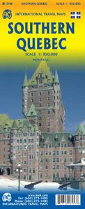
Een degelijke kaart met aanduidingen van o.a. nationale parken, vliegveld, benzinepomp, dirt-roads en kleine plattegrond van hoofdstad. Als overzichtskaart goed te gebruiken. La Belle Province has a lot in common with Ontario. It is a huge political entity, with most of the land mass unusable due to permafrost. Almost all the roads and settlements are in the southern half of the province, so we expanded the scale of our artwork and created a map that will be of greater practical use for visitors than one of the entire province. Even so, the distances are formidable (say it in French; it sounds much more dramatic!) Side one concentrates on the region north of Montreal, and includes the Canadian Shield region of Abitibi. The second side follows the St. Lawrence River eastward to Quebec City, where one can continue eastward on the north shore for hundreds of kilometers or cross over an enormous bridge to the south shore and do essentially the same; ending up in the picturesque Gaspe Peninsula! This is an easy to use map, with good detail and a lot of information as to camping sites, interesting points of view, access points from the USA, and roads leading far into the interior. It also includes an excellent inset map of central Montreal.

Productspecificaties

Artikelnummer(s)
Brand
ITMB
Webshop.nl maakt gebruik van cookies. Ga je verder op onze website, ga dan akkoord met het plaatsen van cookies en de verwerking van deze data door ons en vermelde partners.