webshop.nl
Categorieën
  Sluiten

Meer Hema Maps

Wegenkaart - landkaart South West Western Australia | Hema Maps

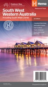
Hema's South West Western Australia Map features unequalled road and track information for this picturesque corner in Australia's largest state. A regional map for discovering South West Western Australia (WA). On the reverse side of the map are detailed inset maps of Nambung National Park, Avon Valley National Park, Lane Poole Reservation, the So...
15,95

Webshops met dit product

Webshop
Bezorging
Prijs

Anderen bekeken ook

Wegenkaart - landkaart South West Western Australia | Hema Maps
Hema's South West Western Australia Map features unequalled road and track information for this picturesque corner in Australia's largest state. A regional map for discovering South West Western Australia (WA). On the reverse side of the map are detailed inset maps of Nambung National Park, Avon Valley National Park, Lane Poole Reservation, the South West Corner, Stirling Range National Park, D, Entrecastreaux National Park and Albany Coast. Also included is tourist information for the Coral Coast, Perth, Avon Valley, the Great Southern Region, Peel, Blackwood River Valley, the Southern Forests, the Margaret River region and the Southern Coast.   The southwestern portion of Western Australia has a spectacular coastline, great surfing beaches, flowing rivers, tall forests, wineries, farms, quaint towns, bustling cities and numerous other attractions. While forest communities remain quiet, the coastal area from Bunbury to Margaret River and Augusta bursts at the seams on long weekends…
15,95
Wegenkaart - landkaart Explorer Map Mid West Western Australia - West
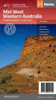
Mapping of Mid West Western Australia that has camping areas, national parks, fuel supplies and facility symbols marked on the map. On the reverse is region-specific touring information for Wildflower country, Goldfields, Batavia Coast, Geraldton to Kalbarri, Gascoyne and the Outback Coast, Carnarvon and the Blowhole Coast as well as the Great Eastern Highway, with detailed inset maps for Cape Range National Park, Kalbarri National Park, Francois Peron National Park, Kennedy Range National Park and Mount Augustus National Park also included.    Also featured are the Top 10 4WD Tracks, which include the Holland Track, Cave Hill Circuit, Jaurdi Station, Mount Elvire, Mundaring Powerlines Track, Stockyard Gully & Leseur National Park, Greenough River, Steep Point, Peron Peninsula and Kennedy Range National Park. Each track has a grading, map reference, permits and fees, distances, contact details, things to do and warnings.   Top 10 4WD Tracks Inset maps National parks Camping areas Fuel …
13,95
Wegenkaart - landkaart 3204 Adventure Map South Africa - Zuid Afrika |
Wegenkaart van Zuid Afrika met vermelding van veel bezienswaardigheden, nationale parken en attrakties. Watervast en scheurvast. Juist door deze vermeldingen onderscheidt de kaart zich van andere wegenkaarten. National Geographic’s South Africa Adventure Map is designed to meet the unique needs of adventure travelers—detailed, durable, and accurate. It includes the locations of thousands of major cities and towns with an index for easily locating them, plus a clearly marked road network complete with distances and designations for major highways, limited access highways, and more. Both paved and unpaved roads, tracks, and trails are marked for those adventurers who wish to explore less traveled routes.   What sets National Geographic Adventure Maps apart from traditional road maps are the hundreds of points-of-interest that highlight the diverse, unique, and exotic destinations within South Africa including national parks and reserves, sanctuaries, World Heritage sites, archeological s…
17,50
Reisgids USA West Coast | Insight Guides
Een rijk geillustreerde reisgids met diepgaande teksten: één van de beste reisgidsen die er bestaan. Eerste deel bestaat uit een beschrijving van de unieke aspecten van de regio, daarna een deel echte reisgids en als afsluiting een deel met praktische informatie. De uitstekende informatie wordt vergezeld van prachtige foto's en heldere kaarten. Niet alleen om mee te nemen, maar ook om vooraf en zelfs achteraf weer in de stemming te komen. This Insight Guide is a lavishly illustrated inspirational travel guide to the USA West Coast and a beautiful souvenir of your trip. Perfect for travellers looking for a deeper dive into the destination's history and culture, it's ideal to inspire and help you plan your travels. With its great selection of places to see and colourful magazine-style layout, this USA West Coast guidebook is just the tool you need to accompany you before or during your trip. Whether it's deciding when to go, choosing what to see or creating a travel plan to cover key pla…
24,95
Wegenkaart - landkaart 3204 Adventure Map South Africa - Zuid Afrika |
Wegenkaart van Zuid Afrika met vermelding van veel bezienswaardigheden, nationale parken en attrakties. Watervast en scheurvast. Juist door deze vermeldingen onderscheidt de kaart zich van andere wegenkaarten. National Geographic’s South Africa Adventure Map is designed to meet the unique needs of adventure travelers—detailed, durable, and accurate. It includes the locations of thousands of major cities and towns with an index for easily locating them, plus a clearly marked road network complete with distances and designations for major highways, limited access highways, and more. Both paved and unpaved roads, tracks, and trails are marked for those adventurers who wish to explore less traveled routes.   What sets National Geographic Adventure Maps apart from traditional road maps are the hundreds of points-of-interest that highlight the diverse, unique, and exotic destinations within South Africa including national parks and reserves, sanctuaries, World Heritage sites, archeological s…
17,50
Wegenkaart - landkaart SC7&SC8 Baviaanskloof to Addo | Tracks4Africa
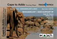
The Cape to Addo map series covers the southern parts of the Western Cape of South Africa in a series of eight highly detailed maps, printed on four sheets of A1 durable paper.   We start in Cape Town in the west and move along the southern coast through the Overberg, Winelands, Garden Route, Klein Karoo R62, Baviaanskloof to eventually arrive in the Addo National Park up to Gqeberha (Port Elizabeth) in the east.   The maps are highly detailed and well researched. Our map scale is 1:200 000 which allows us to show a lot of detail including minor gravel roads, hiking trails, farm boundaries and points of interest which are relevant to self-drive tourists.   The size of the paper is kept small enough to allow this to be the perfect road tripping map. We use Duraflex paper and print two maps per sheet of A1 paper, making this a four-sheet series. Each map sheet is individually packed in a plastic protective sleeve.   The maps are perfect for day drives, overlanding or just doing road trip…
29,95
Wandelatlas 3 Adventure Atlas South West Coast Path South Cornwall | A
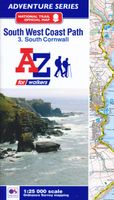
AZ heeft de meest gedetailleerde wandelkaarten van delen van het South West Coast Path  gebundeld in een atlasje. Daardoor is het heel handig qua formaat. De kaarten zelf zijn perfect voor het wandelen. Schaal 1:25.000 The perfect companion for those who love the great outdoors, the A-Z Adventure Series features OS 1:25000 mapping in a convenient book, complete with index.   The South West Coast Path is a National Trail along the Somerset, Devon, Cornwall and Dorset coasts. This stunning walk from Minehead, Somerset covers 630 miles to South Haven Point in Poole Harbour, passing through two World Heritage Sites (the Jurassic Coast and the Cornwall and West Devon Mining Landscape), Exmoor National Park, Land's End and many areas of outstanding natural beauty.   A series of five A-Z Adventure Atlases together cover the South West Coast Path:   SW Coast Path North Devon and Somerset SW Coast Path North Cornwall SW Coast Path South Cornwall SW Coast Path South Devon SW Coast Path Dorset Th…
12,95
Reisgids USA West Coast | Insight Guides
Een rijk geillustreerde reisgids met diepgaande teksten: één van de beste reisgidsen die er bestaan. Eerste deel bestaat uit een beschrijving van de unieke aspecten van de regio, daarna een deel echte reisgids en als afsluiting een deel met praktische informatie. De uitstekende informatie wordt vergezeld van prachtige foto's en heldere kaarten. Niet alleen om mee te nemen, maar ook om vooraf en zelfs achteraf weer in de stemming te komen. This Insight Guide is a lavishly illustrated inspirational travel guide to the USA West Coast and a beautiful souvenir of your trip. Perfect for travellers looking for a deeper dive into the destination's history and culture, it's ideal to inspire and help you plan your travels. With its great selection of places to see and colourful magazine-style layout, this USA West Coast guidebook is just the tool you need to accompany you before or during your trip. Whether it's deciding when to go, choosing what to see or creating a travel plan to cover key pla…
24,95
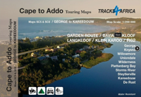
Wegenkaart - landkaart SC5&SC6 George to Kareedouw | Tracks4Africa
The Cape to Addo map series covers the southern parts of the Western Cape of South Africa in a series of eight highly detailed maps, printed on four sheets of A1 durable paper.   We start in Cape Town in the west and move along the southern coast through the Overberg, Winelands, Garden Route, Klein Karoo R62, Baviaanskloof to eventually arrive in the Addo National Park up to Gqeberha (Port Elizabeth) in the east.   The maps are highly detailed and well researched. Our map scale is 1:200 000 which allows us to show a lot of detail including minor gravel roads, hiking trails, farm boundaries and points of interest which are relevant to self-drive tourists.   The size of the paper is kept small enough to allow this to be the perfect road tripping map. We use Duraflex paper and print two maps per sheet of A1 paper, making this a four-sheet series. Each map sheet is individually packed in a plastic protective sleeve.   The maps are perfect for day drives, overlanding or just doing road trip…
29,95

Klanten-reviews van Wegenkaart - landkaart South West Western Australia | Hema Maps

Er zijn nog geen beoordelingen voor dit productBen jij de eerste die een review plaatst?

Meer over Wegenkaart - landkaart South West Western Australia | Hema Maps

Productomschrijving

Hema's South West Western Australia Map features unequalled road and track information for this picturesque corner in Australia's largest state. A regional map for discovering South West Western Australia (WA). On the reverse side of the map are detailed inset maps of Nambung National Park, Avon Valley National Park, Lane Poole Reservation, the South West Corner, Stirling Range National Park, D, Entrecastreaux National Park and Albany Coast. Also included is tourist information for the Coral Coast, Perth, Avon Valley, the Great Southern Region, Peel, Blackwood River Valley, the Southern Forests, the Margaret River region and the Southern Coast.   The southwestern portion of Western Australia has a spectacular coastline, great surfing beaches, flowing rivers, tall forests, wineries, farms, quaint towns, bustling cities and numerous other attractions. While forest communities remain quiet, the coastal area from Bunbury to Margaret River and Augusta bursts at the seams on long weekends.   The Southern Forests feature many opportunities for memorable encounters of the tree kind, and the region also has a stunning coastline. Almost the entire coast is within national parks and there are many great opportunities for four-wheel driving. To get a real taste for the vast wilderness protected by D’Entrecasteaux National Park, your best bet is by 4WD. Lake Jasper via Black Point is one of the favourite 4WD routes in the South West. The Great Southern area stretches from Denmark across to Albany and up to Mt Barker, taking in the Porongurup and Stirling ranges. Between Denmark and Albany is West Cape Howe National Park which offers to challenge 4WD tracks, fantastic camping at Shelley Beach, remnant karri forest and Western Australia’s most southerly point at Torbay Head.   Blessed with milder summer temperatures than Perth, the South West corner is popular in spring for the wildflowers. The winter months are often wet and windy, especially along the southern coast. Visitors should also be aware that total fire bans apply in many areas throughout the summer months.

Productspecificaties

Artikelnummer(s)
Brand
Hema Maps
Webshop.nl maakt gebruik van cookies. Ga je verder op onze website, ga dan akkoord met het plaatsen van cookies en de verwerking van deze data door ons en vermelde partners.