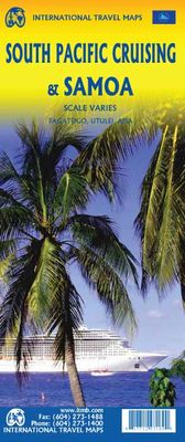
Wegenkaart - landkaart South Pacific Cruising & Samoa | ITMB

0
Een overzichtskaart van de zuidelijke Stille Oceaan met de cruise routes tussen de verschillende eilanden aangegeven. Op de achterzijde een overzichtskaart van Samoa This is a new venture for ITMB. Cruising is a rapidly-growing segment of the travel industry, experiencing double-digit growth rates annually. Obviously, this is a thriving market. In ...

Verkopers met dit product

Verkoper
Bezorging
Prijs
DeZwerver.nl logo
DeZwerver.nl
1 werkdag
0,03
13,95

Anderen bekeken ook

Wegenkaart - landkaart South Pacific Cruising & Samoa | ITMB
Een overzichtskaart van de zuidelijke Stille Oceaan met de cruise routes tussen de verschillende eilanden aangegeven. Op de achterzijde een overzichtskaart van Samoa This is a new venture for ITMB. Cruising is a rapidly-growing segment of the travel industry, experiencing double-digit growth rates annually. Obviously, this is a thriving market. In conjunction with several cruise ship lines, we have prepared a map of the South Pacific Ocean, which extends southwards from Hawai'i to the southern tip of New Zealand and eastwards from central Australia/Papua New Guinea to the Pitcairn Islands. Thus, it does not include the popular South East Asia and China coast routes. We think this has to change at a time when 25,000,000 people are travelling by cruise ships. At the same time, we must keep coverage area relevant for those end users of the artwork. Even at 1:12M, most of the area covered is water, with island countries such as Fiji, Tonga, Kiribati, Tahiti, and the Cook Islands being vis…
13,95
Wegenkaart - landkaart Guam - West Pacific Cruising | ITMB
Een degelijke kaart met aanduidingen van o.a. nationale parken, vliegveld, benzinepomp, dirt-roads. Als overzichtskaart goed te gebruiken. Certainly, this is the only map of Guam by any major cartographic publishing house. Here are some details: Guam is a north-south island considerably north of New Guinea, and forms part of the American-held group of islands known as the Northern Marianas. Its capital is Hagatna, and the main town is called Tamuning. The island has a well-developed international airport in the middle portion of the island, with a large US military airbase in the northeast corner. The vast majority of the island is touristic, and well worth a visit. The island was "discovered" by Ferdinand Magellan in 1521, and Hagatna is the oldest "European" city in the Pacific, dating from 1686. The town of Inarajan retains a decidedly Spanish appearance to this day. Other attractions include Tumon Beach and its many resorts, the Piti Underwater Observatory, and the famous Cocos Is…
13,95
Waterkaart Caribbean Cruising | ITMB
The Caribbean Sea is one of the most popular cruising destinations in the world. This colourful double-sided map starts just north of Orlando/Tampa in order to show the northernmost Bahamian islands and south as far as the Panama Canal at Colon and the coast of Venezuela. The map shows good detail for each island and the legal boundaries of each island nation. Side 1 concentrates on the western Caribbean, essentially the Bahamas, Cuba, Jamaica, and the Cayman Islands. Here’s a fun fact most of you won’t know: tiny Navassa Island between Haiti and Jamaica is claimed by both the USA and Haiti! Side 2 concentrates on the eastern islands of the Caribbean, such as Hispaniola (Haiti and the Dominican Republic), Puerto Rico and the US and British Virgin Islands, Turks & Caicos, and the Lesser Antilles chain of island countries, such as Antigua, Guadeloupe, Barbados, and Trinidad/Tobago, among others. Coverage then extends westward along the Venezuelan coastline to include the Dutch possessio…
14,95
Wegenkaart - landkaart Tahiti - French Polynesia | ITMB
Anyone who has visited Tahiti retains fond memories of a wonderful Polynesian paradise. This map shows the major islands of French Polynesia as a series of large insets on Side 1. An overall inset map showing the many islands is also shown, but for showing detail, one must expand the individual islands. The largest one is the volcanic Tahiti Nui, with the capital city of Pape’ete (or Papeete in English), for which a detailed inset map is included. Most visitors stay in the vicinity of Papeete, along the coast. We show several popular resorts. There is a good circular road around the island’s shoreline, but no roads in the interior. The island is joined to another, called Tahiti Iti, or Little Tahiti, and roads extend partway around this less-developed part of the combined island. Most of the other islands are rarely visited, although they have resorts, beaches, and a lifestyle of their own. Names like Huahine, Riatea, Tahaa, and Maiao may not be as familiar as they should be, but all …
14,95
Wegenkaart - landkaart USA Pacific Coast Travel Reference Map | ITMB
Coverage is from Vancouver to Tijuana to Las Vegas, and information includes rest areas, parks, touristic attractions and the like, as well as detailed road information. There are no inset maps on this title, which also makes a very nice wall map of the west coast!   Legend Includes: International Boundary, State Boundary, County Boundary, Interstate Hwy, Freeway / UC, Toll Hwy / UC, Multilane Hwy / UC, US Divided Hwy, Two lane road / State Highway, Other Road / Track, Pacific Crest Trail, Ferry Route, Time Zone, Mountain peak (feet) State Park, National Forest, National Park, Exit Number and approx. distance between two exists (dist. in miles), Approx. Road Distance (in miles), Interstate Highway, United States Highway, State Highway, Historic Route 66, Large Urban area, State Capital, More than 250,000, 85,000 - 250,000, < 85,000, Town, River / Lake, Salt Lake, Indian reserve, Military property area, Rest Area, Lodge, Point of Interest, Natural Point of Interest, International Airpo…
13,95
Stadsplattegrond - Wegenkaart - landkaart Dubrovnik & Croatian Coast Cruise | ITMB
Goede plattegrond van Dubrovnik, schaal 1:3.000. Met aan de achterzijde een wegenkaart, schaal 1:325.000, met als extra informatie routes van veerboten en cruiseschepen ingetekend.   The ancient port city of Dubrovnik, on the southern Croatian coastline, has evolved into a major tourist destination. The old walled city, normally entered through the famous Pile Gate, was so crowded with tourists when we arrived, that it took some time to get to the main street of Stradun. The city has completely recovered from the Montenegrin bombing during the breakup of Yugoslavia, with a few shellholes remaining just to show to tourists. The highlights of a visit are the Rector’s Palace, the Tvrdava fortress, and the cathedral. The map covers the urban area outside of the old town as well, as this is where most of the hotels and restaurants are located. The other side of the map shows the extensive coastline of Croatia in two parts – from the Italian border to Trogir, and from Split to the border wi…
13,95
Wegenkaart - landkaart - Fietskaart Vanouver Island south - Victoria | ITMB
ITMB wegenkaarten en wandelkaarten kenmerken zich door het kleurgebruik waarbij zo de nadruk wordt gelegd op de natuurkundige aspecten van het land of de streek. Het soort landschap en de hoogte worden hierdoor zeer duidelijk zichtbaar. Natuurlijk vind je ook de 'gewone' zaken als wegennet, spoorwegen, vliegvelden, ferrys, toeristische bezienswaardigheden en nationale parken er op terug.. Vaak - maar niet op alle kaarten - staat op de achterzijde een stadsplattegrond van hoofdstad of belangrijkste stad in de regio.  Voorzijde: Vancouver Island zuidelijk gedeelte met schaal 1:270.000 Achterzijde: stadsplattegrond Victoria met schaal 1:10.000 Victoria is a brand new title for ITMB. The city is the capital of British Columbia (each of Canada’s provinces and territories has its own capital, in addition to Ottawa for the entire country). Located at the southern tip of Vancouver Island, Victoria was established as the colonial capital after the Oregon Treaty of 1846 forced the British to ab…
13,95

Klanten-reviews van Wegenkaart - landkaart South Pacific Cruising & Samoa | ITMB

Er zijn nog geen beoordelingen voor dit productBen jij de eerste die een review plaatst?

Meer over Wegenkaart - landkaart South Pacific Cruising & Samoa | ITMB

Productomschrijving

Een overzichtskaart van de zuidelijke Stille Oceaan met de cruise routes tussen de verschillende eilanden aangegeven. Op de achterzijde een overzichtskaart van Samoa This is a new venture for ITMB. Cruising is a rapidly-growing segment of the travel industry, experiencing double-digit growth rates annually. Obviously, this is a thriving market. In conjunction with several cruise ship lines, we have prepared a map of the South Pacific Ocean, which extends southwards from Hawai'i to the southern tip of New Zealand and eastwards from central Australia/Papua New Guinea to the Pitcairn Islands. Thus, it does not include the popular South East Asia and China coast routes. We think this has to change at a time when 25,000,000 people are travelling by cruise ships. At the same time, we must keep coverage area relevant for those end users of the artwork. Even at 1:12M, most of the area covered is water, with island countries such as Fiji, Tonga, Kiribati, Tahiti, and the Cook Islands being visible, but without details. For those readers more familiar with Caribbean or Mediterranean cruising, the reason our focus on the South Pacific is due to the fact that this region of the world is the fastest-growing portion of cruise travel growth. The map of the South Pacific region fills one side of the map. The cruise routes at the moment are shown with red dashed lines. As several lines use the same routes, we have not designated the names of actively-operating lines. The ocean area includes hill shading for the deep trenches of the Pacific Ocean. By doing so, the blue of the water areas is softened by the grey of deep trenches. ITMB intends to prepare other cruising titles in the future. The reverse side of the artwork covers the two entities known collectively as Samoa, which has been included for two reasons. First, it is in the centre of the South Pacific and several cruise companies stop at Pago Pago. Second, the two Somoas form a unit that two main islands and two small islands, which have been portrayed at 1:160,000 scale. An inset map of the capital, Apia is included. American Samoa is one the those areas of the USA acquired during its expansion during the colonial era (Cuba, Hawai'i, Philippines, Puerto Rico, and Virgin Islands being other examples). The overseas territory, as the Americans prefer to call it, consists of half a dozen islands that are rather far apart from each other. The main urban area is Fagatogo in Pago Pago harbour on the only island with an airport, Tutuila. The residents are American citizens, but cannot vote, as in Puerto Rico and the US Virgin Islands, as it is a 'territory' and not a state.

Productinformatie

    Webshop.nl maakt gebruik van cookies. Ga je verder op onze website, ga dan akkoord met het plaatsen van cookies en de verwerking van deze data door ons en vermelde partners.