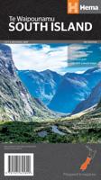
Wegenkaart - landkaart South Island (Zuider Eiland - Nieuw Zeeland) | Hema Maps

0
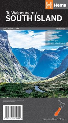
Uitstekende overzichtskaart met index, afstandstabel, nationale parken en toeristische informatie. Gedetailleerder dan de gehele Nieuw - Zeeland kaart. This map is easy to read and feature clear, easy to read cartography, reliefshading, National Parks, Points of Interest, Tourist Routes, Distance Grid and Walking Tracks. Printed one sided and comp...

Verkopers met dit product

Verkoper
Bezorging
Prijs
DeZwerver.nl logo
DeZwerver.nl
2,95
17,50

Anderen bekeken ook

Nieuw
Wegenkaart - landkaart Nieuw Zeeland - New Zealand - Aotearoa | Hema Maps
Folded, indexed road and tourist map of New Zealand, showing all major and many minor roads, cities, and towns in detail. Map shows highways, road numbers, distance chart, railways, scenic routes, places of particular interest, places of scenic beauty, national parks, and political boundaries. Reverse of map shows city insets of Auckland, Wellington, Christchurch, Rotorua, Dunedin, and Queenstown. Legend is in English. Heldere goed leesbare kaart van de kaartenmaker van Nieuw Zeeland: de HEMA maps.
17,50
Nieuw
Wegenkaart - landkaart North Island - New Zealand (Noorder Eiland - Nieuw Zeeland) | Hema Maps
Uitstekende overzichtskaart met index, afstandstabel, nationale parken en toeristische informatie. Op de achterzijde plattegronden van o.a. Auckland en Wellington. Gedetailleerder dan de gehele Nieuw - Zeeland kaart. A map of New Zealand’s North Island for touring and reference that has city and national park maps on the reverse. National parks Points of interest Relief shading Tourist routes Distance grid City and suburbs maps  
17,50
Nieuw
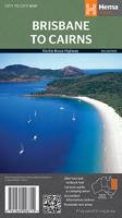
Wegenkaart - landkaart Brisbane to Cairns | Hema Maps
Detailkaart van een deel van Australië. Zeer goed leesbaar, met naast de topografische details veel symbolen waarmee allerhande toeristische zaken worden aangeduid als campsites, nationale parken, attracties, wandelmogelijkheden etc. An easy-to-follow map that shows both the coastal and inland routes from Brisbane to Cairns. Roadside rest areas, intermediate distances, and a quick-find distance chart are also shown. The map shows all the popular tourist destinations along the Queensland coast. Routes between Brisbane with Cairns in a series of touring maps connecting Australia’s main centres of population along some of the most spectacular routes such as the Great Ocean Road or the Savannah Way. The maps highlight 24-hour fuel supplies, roadside rest areas, camping facilities, places of interest, etc., and include distance charts and, in some titles, city maps. Road network indicates unsurfaced roads and tracks. The maps also show railway lines. There is no topographical information b…
17,50
Nieuw
Wegenkaart - landkaart 790 New Zealand - Nieuw Zeeland | Michelin
Zoals je van Michelin mag verwachten is deze kaart zeer overzichtelijk en heeft een duidelijk helder kaartbeeld. De kaart geeft uitgebreide toeristische informatie weer. De perfecte overzichtskaart!   This New Zealand map from Michelin is part of their red national map series. These are perfect for route planning as well as getting around by car once you're there. They clearly mark out major roads and also show many of the more important minor roads.    The map's simple folding design with durable paper cover, allows it to be read like a book and easily folded back together. Road numbers and intermediate distances are clearly displayed with the more scenic routes highlighted in green.   The map also features:   Political boundaries Regional and National Parks Important sights (points of interest, historic sites, etc.) Driving Times and Distances Road Safety Information A legend in multiple languages (Dutch, English, French, German and Spanish) Michelin New Zealand Map 790 is a new add…
12,95
Wegenkaart - landkaart Savannah Way - Cairns to Broome | Hema Maps
Detailkaart van een deel van Australië. Zeer goed leesbaar, met naast de topografische details veel symbolen waarmee allerhande toeristische zaken worden aangeduid als campsites, nationale parken, attracties, wandelmogelijkheden etc. Find out all you need to know about travelling the Savannah Way between Cairns and Broome. As well as providing a detailed road map for the entire length of the Savannah Way, this map includes handy advice on road conditions, average rainfall and safe driving tips. The useful information also highlights the features you pass in Queensland, Northern Territory and Western Australia. Routes between Cairns and Broome in Hema’s range of very popular touring maps showing roads connecting Australia’s main centres of population along some of the most spectacular routes such as the Great Ocean Road or the Savannah Way. The maps highlight 24-hour fuel supplies, roadside rest areas, camping facilities, places of interest, etc., and include distance charts and, in so…
17,50
Nieuw
Wegenkaart - landkaart New South Wales handy map | Hema Maps
Goede, tweezijdige overzichtelijke, leesbare kaart van de hele provincie. Nationale Parken zijn er goed op te vinden en de afstanden worden weergegeven.  New South Wales Map in a series of indexed touring road maps of Australia’s states from Hema, with each state available either on a single-sided map with additional information on the reverse, or as double-sided map in a more convenient smaller format. The map presents the road network from main highways, shown with their names, to minor roads and 4WD tracks, indicating unsealed routes and rough tracks. Driving distances are marked on many smaller local roads. Railway lines and local airports or airstrips are included. Symbols highlight roadside rest areas, 24h fuels supplies, as well as campsites and caravan parks, places of interest, etc. Colouring indicates national parks and other protected areas including marine parks, Aboriginal lands and restricted entry zones. The maps have a latitude/longitude grid at intervals varying from …
14,50
Nieuw
Wegenkaart - landkaart New South Wales | Hema Maps
Erg mooie, handige en uitgebreide kaart van New South Wales. Great for travel planning, Hema's New South Wales state map clearly shows highways, minor and secondary roads, national and state routes and fully-indexed cities, towns and localities. Detailed road distances are also shown.   The flipside of the map features loads of insets covering various bits and pieces throughout New South Wales including a Sydney CBD and throughroads map, a Canberra CBD map, a Sydney region map, a map of the Blue Mountains National Park and a map of the area betwwen Katoomba and Wentworth Falls. There's also a list of information centres giving their address, phone number and website.   The map features:   Camping areas Rest areas 24 hour fuel locations Outback fuel stops Caravan parks National parks A full index Points of interest A distance grid
17,50
Nieuw
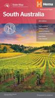
Wegenkaart - landkaart South Australia state map | Hema Maps
Mooie, duidelijke en uitgebreide kaart van South Australia. Great for travel planning, Hema's South Australia state map clearly shows highways, minor and secondary roads, national and state routes and fully-indexed cities, towns and localities. Detailed road distances are also shown.   The flipside of the map features loads of insets covering various bits and pieces throughout South Australia including an Adelaide CBD and throughroads map, an Adelaide region map, a map of the Barossa Valley and the Flinders Ranges National Park. There's also a list of information centres giving their address, phone number and website.   The map features:   Camping areas Rest areas 24 hour fuel locations Outback fuel stops Caravan parks National parks A full index Points of interest A distance grid
17,50
Nieuw
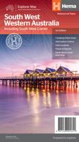
Wegenkaart - landkaart South West Western Australia | Hema Maps
Hema's South West Western Australia Map features unequalled road and track information for this picturesque corner in Australia's largest state. A regional map for discovering South West Western Australia (WA). On the reverse side of the map are detailed inset maps of Nambung National Park, Avon Valley National Park, Lane Poole Reservation, the South West Corner, Stirling Range National Park, D, Entrecastreaux National Park and Albany Coast. Also included is tourist information for the Coral Coast, Perth, Avon Valley, the Great Southern Region, Peel, Blackwood River Valley, the Southern Forests, the Margaret River region and the Southern Coast.   The southwestern portion of Western Australia has a spectacular coastline, great surfing beaches, flowing rivers, tall forests, wineries, farms, quaint towns, bustling cities and numerous other attractions. While forest communities remain quiet, the coastal area from Bunbury to Margaret River and Augusta bursts at the seams on long weekend…
17,50
Reisgids New Zealand's South Island - Nieuw Zeeland Zuidereiland | Lonely Planet
De perfecte reisgids voor zowel de georganiseerde als de zelfstandige reiziger. Naast een algemene inleiding van het land / streek vol met praktische informatie over hoe je er het beste kunt reizen: slapen, eten, vervoer, excursies ... alles kun je er in vinden. LET OP: deze reisgids gaat alleen over het Zuidereiland !! Lonely Planet’s New Zealand’s South Island is your passport to the most up-to-date advice on what to see and skip, and what hidden discoveries await you. Hike the Fox Glacier, visit glorious national parks or pick an adventure in Queenstown; all with your trusted travel companion. Get to the heart of the South Island and begin your journey now!   Inside Lonely Planet’s New Zealand’s South Island Travel Guide:     Up-to-date information - all businesses were rechecked before publication to ensure they are still open after 2020’s COVID-19 outbreak   Improved planning tools for family travellers - where to go, how to save money, plus fun stuff just for kids   W…
19,95

Klanten-reviews van Wegenkaart - landkaart South Island (Zuider Eiland - Nieuw Zeeland) | Hema Maps

Er zijn nog geen beoordelingen voor dit productBen jij de eerste die een review plaatst?

Meer over Wegenkaart - landkaart South Island (Zuider Eiland - Nieuw Zeeland) | Hema Maps

Productomschrijving

Uitstekende overzichtskaart met index, afstandstabel, nationale parken en toeristische informatie. Gedetailleerder dan de gehele Nieuw - Zeeland kaart.

This map is easy to read and feature clear, easy to read cartography, reliefshading, National Parks, Points of Interest, Tourist Routes, Distance Grid and Walking Tracks. Printed one sided and complete with index these are an ideal planning tool as well as an ideal travel companion.

This regional map of the South Island of New Zealand (NZ) is at a scale of 1:1,000,000 and shows points of interests, tourist routes, walking tracks and national parks for touring the island. On the reverse side are handy city maps of Christchurch, Picton, Nelson, Queenstown, Dunedin, Blenheim and Invercargill, and suburb maps of Christchurch and Dunedin. It also includes detailed maps of Fiordland, Kahurangi, Arthur’s Pass and Aoraki National Parks along with a distance grid.   PRODUCT FEATURES   • National parks • Topographic maps • Tourist routes • Distance grid • City and suburb maps

Verken gerelateerde categorieën

Webshop.nl maakt gebruik van cookies. Ga je verder op onze website, ga dan akkoord met het plaatsen van cookies en de verwerking van deze data door ons en vermelde partners.