webshop.nl
Categorieën
  Sluiten

Meer Hema Maps

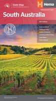
Wegenkaart - landkaart South Australia state map | Hema Maps

0
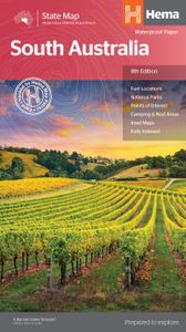
Mooie, duidelijke en uitgebreide kaart van South Australia. Great for travel planning, Hema's South Australia state map clearly shows highways, minor and secondary roads, national and state routes and fully-indexed cities, towns and localities. Detailed road distances are also shown.   The flipside of the map features loads of insets covering vario...

Webshops met dit product

Webshop
Bezorging
Prijs

Anderen bekeken ook

Wegenkaart - landkaart South Australia state map | Hema Maps
Mooie, duidelijke en uitgebreide kaart van South Australia. Great for travel planning, Hema's South Australia state map clearly shows highways, minor and secondary roads, national and state routes and fully-indexed cities, towns and localities. Detailed road distances are also shown.   The flipside of the map features loads of insets covering various bits and pieces throughout South Australia including an Adelaide CBD and throughroads map, an Adelaide region map, a map of the Barossa Valley and the Flinders Ranges National Park. There's also a list of information centres giving their address, phone number and website.   The map features:   Camping areas Rest areas 24 hour fuel locations Outback fuel stops Caravan parks National parks A full index Points of interest A distance grid
15,95
Wegenkaart - landkaart South Australia state handy map | Hema Maps
Duidelijke, handzame kaart van South Australia.  Great for using in the car, Hema's South Australia Handy Map clearly shows highways, minor and secondary roads, national and state routes and fully-indexed cities, towns and localities. Detailed road distances are also shown. The map splits the state in two, with half on one side of the map and half on the other. This results in a much smaller piece of paper which is far easier to manage in your car.   The map features:   Camping Areas Rest Areas 24 Hour Fuel Outback Fuel Caravan Parks National Parks Fully Indexed Points of Interest Distance Grid
11,50
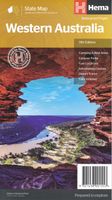
Wegenkaart - landkaart Western Australia state map | Hema Maps
Goede, overzichtelijke, leesbare kaart van de hele provincie. Nationale Parken zijn er goed op te vinden en de afstanden worden weergegeven. Op de achterkant nog deelkaartjes van enkele steden en NP s. A state map of Western Australia at a scale of 1:2,500,000. Marked on the map are national parks, points of interest, 24-hour fuel as well as camping and rest areas.    On the reverse side are national park maps of Leeuwin-Naturaliste, Cape Range, Nambung, Francois Peron, Purnululu, Walpole-Nornalup and Karijini.    Also included are CBD and throughroad maps of Perth. There is a full index included, as well as all national park information.   Points of interest 24-hour fuel National parks Camping areas Rest areas Fully indexed
15,95
Wegenkaart - landkaart South West Western Australia | Hema Maps
Hema's South West Western Australia Map features unequalled road and track information for this picturesque corner in Australia's largest state. A regional map for discovering South West Western Australia (WA). On the reverse side of the map are detailed inset maps of Nambung National Park, Avon Valley National Park, Lane Poole Reservation, the South West Corner, Stirling Range National Park, D, Entrecastreaux National Park and Albany Coast. Also included is tourist information for the Coral Coast, Perth, Avon Valley, the Great Southern Region, Peel, Blackwood River Valley, the Southern Forests, the Margaret River region and the Southern Coast.   The southwestern portion of Western Australia has a spectacular coastline, great surfing beaches, flowing rivers, tall forests, wineries, farms, quaint towns, bustling cities and numerous other attractions. While forest communities remain quiet, the coastal area from Bunbury to Margaret River and Augusta bursts at the seams on long weekends…
15,95
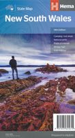
Wegenkaart - landkaart New South Wales | Hema Maps
Erg mooie, handige en uitgebreide kaart van New South Wales. Great for travel planning, Hema's New South Wales state map clearly shows highways, minor and secondary roads, national and state routes and fully-indexed cities, towns and localities. Detailed road distances are also shown.   The flipside of the map features loads of insets covering various bits and pieces throughout New South Wales including a Sydney CBD and throughroads map, a Canberra CBD map, a Sydney region map, a map of the Blue Mountains National Park and a map of the area betwwen Katoomba and Wentworth Falls. There's also a list of information centres giving their address, phone number and website.   The map features:   Camping areas Rest areas 24 hour fuel locations Outback fuel stops Caravan parks National parks A full index Points of interest A distance grid
15,95
Wegenkaart - landkaart New South Wales | Hema Maps
Erg mooie, handige en uitgebreide kaart van New South Wales. Great for travel planning, Hema's New South Wales state map clearly shows highways, minor and secondary roads, national and state routes and fully-indexed cities, towns and localities. Detailed road distances are also shown.   The flipside of the map features loads of insets covering various bits and pieces throughout New South Wales including a Sydney CBD and throughroads map, a Canberra CBD map, a Sydney region map, a map of the Blue Mountains National Park and a map of the area betwwen Katoomba and Wentworth Falls. There's also a list of information centres giving their address, phone number and website.   The map features:   Camping areas Rest areas 24 hour fuel locations Outback fuel stops Caravan parks National parks A full index Points of interest A distance grid
15,95
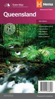
Wegenkaart - landkaart Queensland state map | Hema Maps
Goede, overzichtelijke, leesbare kaart van de hele provincie. Nationale Parken zijn er goed op te vinden en de afstanden worden weergegeven. Op de achterkant nog deelkaartjes van enkele steden en NP s. A state map of Queensland accompanied by touring information and relevant regional and city maps. Marked on the map are national parks, points of interest, 24-hour fuel as well as camping and rest areas. On the reverse are maps of the Gold Coast, South East Queensland and Tropical North Queensland as well as CBD and throughroads maps of Brisbane. There is a full index included, as well as all national park information. Features: Points of interest 24-hour fuel National parks Camping areas Rest areas Fully indexed Comprehensive road detail Road identification numbering Scenic photographs
15,95

Klanten-reviews van Wegenkaart - landkaart South Australia state map | Hema Maps

Er zijn nog geen beoordelingen voor dit productBen jij de eerste die een review plaatst?

Meer over Wegenkaart - landkaart South Australia state map | Hema Maps

Productomschrijving

Mooie, duidelijke en uitgebreide kaart van South Australia. Great for travel planning, Hema's South Australia state map clearly shows highways, minor and secondary roads, national and state routes and fully-indexed cities, towns and localities. Detailed road distances are also shown.   The flipside of the map features loads of insets covering various bits and pieces throughout South Australia including an Adelaide CBD and throughroads map, an Adelaide region map, a map of the Barossa Valley and the Flinders Ranges National Park. There's also a list of information centres giving their address, phone number and website.   The map features:   Camping areas Rest areas 24 hour fuel locations Outback fuel stops Caravan parks National parks A full index Points of interest A distance grid

Productspecificaties

Artikelnummer(s)
Brand
Hema Maps
Webshop.nl maakt gebruik van cookies. Ga je verder op onze website, ga dan akkoord met het plaatsen van cookies en de verwerking van deze data door ons en vermelde partners.