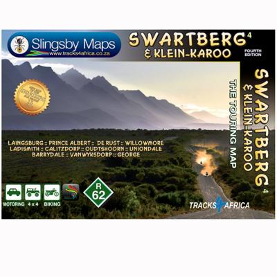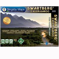
Wegenkaart - landkaart South Africa: Swartberg & Klein-Karoo | Slingsby Maps

0
All roads from National Highways to minor gravel roads are shown; the many classifications that indi- cate the quality of each road help you plan your route No less than 28 mountain passes are shown — all are public roads! Distances are clearly shown; comprehensive 4 x 4 information GPS coordinates in DD MM SS format are provided for every road-ju...

Verkopers met dit product

Verkoper
Bezorging
Prijs
DeZwerver.nl logo
DeZwerver.nl
2,95
29,95

Anderen bekeken ook

Wegenkaart - landkaart SC3-SC4 Swellendam to Mossel Bay | Tracks4Africa
The Cape to Addo map series covers the southern parts of the Western Cape of South Africa in a series of eight highly detailed maps, printed on four sheets of A1 durable paper.   We start in Cape Town in the west and move along the southern coast through the Overberg, Winelands, Garden Route, Klein Karoo R62, Baviaanskloof to eventually arrive in the Addo National Park up to Gqeberha (Port Elizabeth) in the east.   The maps are highly detailed and well researched. Our map scale is 1:200 000 which allows us to show a lot of detail including minor gravel roads, hiking trails, farm boundaries and points of interest which are relevant to self-drive tourists.   The size of the paper is kept small enough to allow this to be the perfect road tripping map. We use Duraflex paper and print two maps per sheet of A1 paper, making this a four-sheet series. Each map sheet is individually packed in a plastic protective sleeve.   The maps are perfect for day drives, overlanding or just doing road tri…
29,95
Wegenkaart - landkaart SC1-SC2 Cape Town to Montagu | Tracks4Africa
We start in Cape Town in the west and move along the southern coast through the Overberg, Winelands, Garden Route, Klein Karoo R62, Baviaanskloof to eventually arrive in the Addo National Park up to Gqeberha (Port Elizabeth) in the east.   The maps are highly detailed and well researched. Our map scale is 1:200 000 which allows us to show a lot of detail including minor gravel roads, hiking trails, farm boundaries and points of interest which are relevant to self-drive tourists.   The size of the paper is kept small enough to allow this to be the perfect road tripping map. We use Duraflex paper and print two maps per sheet of A1 paper, making this a four-sheet series. Each map sheet is individually packed in a plastic protective sleeve.   The maps are perfect for day drives, overlanding or just doing road trips in your sedan, 4WD or motorbike along our beautiful southern coast, Klein Karoo and parts of the proper Karoo. Mountain passes form a prominent feature in this area, and these …
29,95
Wegenkaart - landkaart SC5-SC6 George to Kareedouw | Tracks4Africa
The Cape to Addo map series covers the southern parts of the Western Cape of South Africa in a series of eight highly detailed maps, printed on four sheets of A1 durable paper.   We start in Cape Town in the west and move along the southern coast through the Overberg, Winelands, Garden Route, Klein Karoo R62, Baviaanskloof to eventually arrive in the Addo National Park up to Gqeberha (Port Elizabeth) in the east.   The maps are highly detailed and well researched. Our map scale is 1:200 000 which allows us to show a lot of detail including minor gravel roads, hiking trails, farm boundaries and points of interest which are relevant to self-drive tourists.   The size of the paper is kept small enough to allow this to be the perfect road tripping map. We use Duraflex paper and print two maps per sheet of A1 paper, making this a four-sheet series. Each map sheet is individually packed in a plastic protective sleeve.   The maps are perfect for day drives, overlanding or just doing road tri…
29,95
Wegenkaart - landkaart 743 Algerije - Tunesië | Michelin
Kaart van beroemde kaartenmakers en voor Algerije en Tunesie weer een hele goede. Uitermate goed leesbaar, prettig kleurgebruik. Zoals je van Michelin mag verwachten is deze kaart zeer overzichtelijk en heeft een duidelijk helder kaartbeeld. De kaart geeft uitgebreid toeristische informatie weer. Met register, afstanden en reistijden. Wegen worden naar verschillende klasse ingedeeld en - mooi van Michelin - de interessante mooie routes worden gemarkeerd met een groene streep.    Hindernissen voor automobilisten met caravans zijn gemarkeerd: steile hellingen, bergpassen of een anderzins moeilijke route. Bezienswaardigheden als een kasteel, religieus gebouw, ruine of grot is door een symbool goed te vinden. The Michelin National road map of Algeria & Tunisia at 1:1,000,000 scale is ideal for trip & route planning. The map gives comprehensive coverage of national road networks showing all major motorways, dual carriageways, national & regional main roads and some local roads. Also shows …
12,95
Wegenkaart - landkaart Zuid Afrika - South Africa | ITMB
Uitstekende wegenkaart van Zuid Afrika met zowel de toeristische informatie als Nationale Parken en bezienswaardigheden, maar ook de topografische details en afstanden. Gedrukt op 'waterproof' papier. Double-sided map of South Africa printed on waterproof and tear-resistant synthetic paper, with plans of Cape Town, Johannesburg and Pretoria. The map divides the country east/west with a small overlap between the two sides. Elevation tinting in feet shows the general relief. Mountain passes are marked, but there are no spot heights. Road network includes selected local tracks, gives driving distances on major and secondary roads and indicates border crossings. Railways, major ferry connections and local airports are also shown. National parks and protected areas are marked and symbols highlight various places of interest, campsites or huts, rest houses and other tourist accommodation, beaches and diving sites, etc. Presentation of Lesotho and Swaziland is the same as for South Africa. L…
13,95
Wegenkaart - landkaart SC7-SC8 Baviaanskloof to Addo | Tracks4Africa
The Cape to Addo map series covers the southern parts of the Western Cape of South Africa in a series of eight highly detailed maps, printed on four sheets of A1 durable paper.   We start in Cape Town in the west and move along the southern coast through the Overberg, Winelands, Garden Route, Klein Karoo R62, Baviaanskloof to eventually arrive in the Addo National Park up to Gqeberha (Port Elizabeth) in the east.   The maps are highly detailed and well researched. Our map scale is 1:200 000 which allows us to show a lot of detail including minor gravel roads, hiking trails, farm boundaries and points of interest which are relevant to self-drive tourists.   The size of the paper is kept small enough to allow this to be the perfect road tripping map. We use Duraflex paper and print two maps per sheet of A1 paper, making this a four-sheet series. Each map sheet is individually packed in a plastic protective sleeve.   The maps are perfect for day drives, overlanding or just doing road tri…
29,95
Wegenkaart - landkaart - Fietskaart Clare (Ierland) | Xploreit Maps
Mooie geplastificeerde en scheurvaste kaart van de County Clare met index. This Xploreit map is an essential companion for your next trip to County Clare. Whatever your location in the county, a quick scan of the map will reveal all the local attractions including the best drives, cycle routes and walks in the area.  It is fully revised and now includes the Clare section of the long-distance Euro Velo Atlantic Cycle Route. From Loop Head, with its famous lighthouse, you can follow West Clare’s wild and rugged coast as it rises to the spectacular Cliffs of Moher and meets The Burren, the unique limestone pavement of the northern uplands. East Clare has numerous walking and sightseeing opportunities also, with Lough Derg and Slieve Bernagh as highlights. Convenient and informative, this touring map will help you discover ancient megalithic tombs, imposing castles, sparkling lakes, golden beaches and the many charming towns and villages dotted around ‘The Banner County’. Topography is sh…
23,50
Wegenkaart - landkaart Pilbara and the Coral Coast | Hema Maps
Detailkaart van een deel van Australië. Zeer goed leesbaar, met naast de topografische details veel symbolen waarmee allerhande toeristische zaken worden aangeduid als campsites, nationale parken, attracties, wandelmogelijkheden etc. One of the last great frontiers in Australia, the Pilbara is real 4WD country. This map has been field-checked using Hema's GPS mapping system and includes tracks and roads that have never before appeared on maps. The information side of the map presents all the points of interest, the history, and all the important information a person needs to know in order to safely traverse this remote countryside. Detailed, indexed road map with cartography similar to Hema’s excellent coverage of Australia’s interior in the “Great Desert Tracks” series: road information distinguishes between tracks plotted by the publishers themselves with GPS and those complied from the country’s topographic survey data. Topography is shown by relief shading, with colours and graphi…
17,50
Wandelkaart South Africa: Silvermine & Hout Bay | Slingsby Maps
The map also includes:   The Constantia Winelands All sections of the Hoerikwaggo Trail are shown All approved paths, with detailed DDMMSS GPS coordinates for major junctions, are clearly marked with distances and approximate times for each path section 10 metre contours and delicate colour height shading bring the topography to life Additional info:   Silvermine and Hout Bay areas of the Cape Peninsula at 1:20,000 on a double-sided map printed on water-proof and tear-resistant synthetic paper.   The title is part of a series of high quality, detailed walking maps from Slingsby Maps, with excellent cartog- raphy and plenty of tourist information.   Contour lines are drawn at 10m intervals with additional altitude colouring. Roads indicate restricted access. Footpaths are highlighted and show waymarked routes and sections not recommended or dangerous. Sym- bols indicate information for visitors to the area: car parks, view points, signposts, public toilets, picnic areas, places of inte…
29,95
Wegenkaart - landkaart Costa Blanca Valencia | Marco Polo
Goede wegenkaart van een deel van Spanje,met schaal 1:200.000: meer details dan de Michelin wegenkaarten van Spanje. Deze kaarten hebben een register, een tabel met afstanden tussen steden, enkele centrumkaarten van de meest belangrijke steden, vermelding van o.a. campings aan de hand van symbolen alsmede de bezienswaardigheden. Ook benzinepompen worden bijvoorbeeld vermeld! The map boldly stresses main roads and motorways in strong colours and selected towns in large letters, but also shows minor roads and villages in considerable detail. Road information includes toll roads, traffic restrictions and seasonal closures, gradient marking for steep roads, scenic roads and special tourist routes, etc. Motorway services clearly indicate types of facilities available there. Railway network is shown with stations and includes tourist lines Picturesque towns or villages and sites worth visiting, including areas with interesting landscape, are given star rating, and other tourist information …
14,95

Klanten-reviews van Wegenkaart - landkaart South Africa: Swartberg & Klein-Karoo | Slingsby Maps

Er zijn nog geen beoordelingen voor dit productBen jij de eerste die een review plaatst?

Meer over Wegenkaart - landkaart South Africa: Swartberg & Klein-Karoo | Slingsby Maps

Productomschrijving

All roads from National Highways to minor gravel roads are shown; the many classifications that indi- cate the quality of each road help you plan your route No less than 28 mountain passes are shown — all are public roads! Distances are clearly shown; comprehensive 4 x 4 information GPS coordinates in DD MM SS format are provided for every road-junction All tourism facilities and accommodation establishments are shown in the out-of-town areas; there are insets of the major towns The map links to our maps of the Baviaanskloof, the Garden Route, Overberg and the Tankwa-Karoo Additional info:   Swartberg and Klein-Karoo region on a contoured and GPS compatible, double-sided, waterproof and   tear-resistant map at 1:160,000 from Slingsby Maps, with excellent topographic detail and plenty of tourist information, including street plans of ten main towns.   The map provides a very detailed picture of this mountainous terrain, with altitude colouring, shading, con- tours at 20m intervals and numerous spot heights. For GPS navigation important road junctions and various other features are annotated with waypoints and the map has latitude and longitude lines at 5’ intervals.   Road information is very finely graded, indicating road surface, private roads with public access, 4WD only tracks, cattle grids and game gates, locations of fuel supplies, etc. Also marked are routes found by publish- ers as enjoyable, or conversely as dull. Railway lines are shown with stations. For hikers the map indicates waymarked paths and shows other trails. A very wide range of symbols highlight various places of interest and tourist facilities: different types of accommodation from hotels to campsites, picnic places, farm stalls, wineries, restaurants, sport and recreational sites, animal viewing sites, etc.   The map also includes street plans of ten of the region’s main towns: Laingsburg, Ladismith, Van Wyksdorp, Calitzdrop, De Rust, Oudtshoorn, Schoemanshoek, Prince Albert, Uniondale and Willowmore, all annotated with accommodation and other tourist facilities of places of interest.

Verken gerelateerde categorieën

Webshop.nl maakt gebruik van cookies. Ga je verder op onze website, ga dan akkoord met het plaatsen van cookies en de verwerking van deze data door ons en vermelde partners.