webshop.nl
Categorieën
  Sluiten

Meer National Geographic

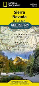
Wegenkaart - landkaart Sierra Nevada | National Geographic

0
&; Waterproof &; Tear-Resistant &; Travel Map   National Geographic's Sierra Nevada Destination Map strikes the perfect balance between map and guidebook and is an ideal resource for touring the rugged landscape of this culturally and geographically unique region of California and Nevada.   The front side of the print map reveals a detailed map...

Webshops met dit product

Webshop
Bezorging
Prijs

Anderen bekeken ook

Wegenkaart - landkaart Sierra Nevada | National Geographic
&; Waterproof &; Tear-Resistant &; Travel Map   National Geographic's Sierra Nevada Destination Map strikes the perfect balance between map and guidebook and is an ideal resource for touring the rugged landscape of this culturally and geographically unique region of California and Nevada.   The front side of the print map reveals a detailed map of the region stretching from the Oregon border to California's Eldorado National Forest, bordered by the Sacramento Valley to the west and Nevada's Great Basin to the east. Modoc, Shasta-Trinity, Lassen, Plumas, and Humbolt-Toiyabe National Forests are also included on the map. The map features a comprehensive road network including scenic byways as well as areas of interest such as Indian Reservations, National Parks and Monuments, and Recreation Areas. Trails, historic sites, museums, cultural centers, scenic areas, state parks and other points of interest are also included. In addition, the map features beautiful photographs and informat…
17,50
Wegenkaart - landkaart 3119 California - Nevada | National Geographic
Mooie kaart van de bekende kaartenmaker National Geographic. Veel details door kleurgebruik. De wegen zijn met kleuren verdeeld in drukke en minder drukke, de wegnummers zijn goed terug te vinden. De kaart onderscheidt zich van andere series door de hoeveelheid topografische details als counties, plaatsnamen en waterwegen en het bevat een register waarin het eenvoudig zoeken is. Daarnaast is de kaart gedrukt op scheur- en watervast papier. The United States California and Nevada Adventure Map will guide you through two of the most spectacular and diverse states in the country. California and Nevada contain Yosemite and Sequoia & Kings Canyon National Parks, Death Valley and the Mohave Desert, the Sierra Nevada Mountains, Lake Tahoe, and dozens of magnificent National Monuments, Forests, and Wilderness Areas. The map includes the cities of Los Angeles, San Francisco, San Diego, and Las Vegas as well as the breathtaking Pacific coast of California. It covers western Utah and Arizona, inc…
17,50
Wegenkaart - landkaart 3118 Pacific Northwest | National Geographic
Mooie kaart van de bekende kaartenmaker National Geographic. Veel details door kleurgebruik. De wegen zijn met kleuren verdeeld in drukke en minder drukke, de wegnummers zijn goed terug te vinden. De kaart onderscheidt zich van andere series door de hoeveelheid topografische details als counties, plaatsnamen en waterwegen en het bevat een register waarin het eenvoudig zoeken is. Daarnaast is de kaart gedrukt op scheur- en watervast papier. The United States Pacific Northwest Adventure Map will guide you through one of the most stunning regions in North America. The states of Washington, Oregon and Idaho contain Olympic, Mt. Rainier, Crater Lake, and North Cascades National Parks, Mt. Saint Helens and Mount Hood volcanoes, Columbia River Gorge, and dozens of magnificent National Monuments, Forests, and Wilderness Areas. The map includes the cities of Seattle, Portland, Boise, Spokane, and Eugene as well as Puget Sound and the spectacular Pacific coastline of Washington and Oregon. It co…
17,50
Wegenkaart - landkaart 3120 Rocky Mountains | National Geographic
Mooie kaart van de bekende kaartenmaker National Geographic. Veel details door kleurgebruik. De wegen zijn met kleuren verdeeld in drukke en minder drukke, de wegnummers zijn goed terug te vinden. De kaart onderscheidt zich van andere series door de hoeveelheid topografische details als counties, plaatsnamen en waterwegen en het bevat een register waarin het eenvoudig zoeken is. Daarnaast is de kaart gedrukt op scheur- en watervast papier. The United States Rocky Mountains Adventure Map will guide you through one of the most rugged and scenic regions in North America. Colorado, Utah, Wyoming, and Montana contain Yellowstone, Grand Teton, Glacier, Zion, Arches, Capitol Reef, Canyonlands, Mesa Verde, and Rocky Mountain National Parks along with dozens of magnificent National Monuments, Forests, and Wilderness Areas, the Continental Divide, and America’s greatest skiing, rafting, and climbing destinations. The map includes the cities of Denver, Salt Lake City, and Missoula, and Cheyenne a…
17,50
Wegenkaart - landkaart State Guide Map Tennessee | National Geographic
Makkelijk leesbare kaart aan 2 zijden bedrukt. De ene kan met informatie en beperkte stadsplattegronden, de andere met de daadwerkelijke kaart. De kaart is geplastificeerd en dus watervast! National Geographic's Tennessee Guide Map is the ultimate ultimate travel companion to "The Volunteer State," combining a comprehensive road map with an expertly research travel guide. The road network contains designations for free access and toll highways; U.S., state and country routes; paved and unpaved roads; and scenic byways. Mileage markers are shown on major highways and scenic routes have pinpointed wayside stops. An index of cities, towns and counties along with a chart of driving distances will aid in your finding your destination and planning your route.   Found on the map are hundreds of points of interest, such as national and state parks, national forests, campgrounds, visitor centers, airports, hospitals, ski areas and much more. City inset maps provide extra detail of Knoxville, Ch…
12,95
Wegenkaart - landkaart 3404 Adventure Map Peru | National Geographic
Wegenkaart van Peru met vermelding van veel bezienswaardigheden, nationale parken en attrakties. Watervast en scheurvast. Juist door deze vermeldingen onderscheidt de kaart zich van andere wegenkaarten. National Geographic's Peru Adventure Map is designed to meet the unique needs of adventure travelers—detailed, durable, and accurate. Peru includes the locations of thousands of towns and villages, plus a clearly marked road network complete with distances and designations for highways and roadways. Rough tracks that require four-wheel drive vehicles and paths are included for adventurers seeking to explore more remote regions.   What sets National Geographic Adventure Maps apart from traditional road maps are the hundreds of points of interest that highlight the diverse, unique, and exotic destinations within Peru including World Heritage sites, archeological sites, indigenous areas, churches, museums, and more. Users will find a variety of helpful travel aids on our map as well, inclu…
17,50
Wegenkaart - landkaart 3122 Northern Plains | National Geographic
Mooie kaart van de bekende kaartenmaker National Geographic. Veel details door kleurgebruik. De wegen zijn met kleuren verdeeld in drukke en minder drukke, de wegnummers zijn goed terug te vinden. De kaart onderscheidt zich van andere series door de hoeveelheid topografische details als counties, plaatsnamen en waterwegen en het bevat een register waarin het eenvoudig zoeken is. Daarnaast is de kaart gedrukt op scheur- en watervast papier. The United States Northern Plains Adventure Map will guide though a varied landscape, from the high dry plains of the western Dakota's, Nebraska and Kansas through the glacially carved lakes of northern Minnesota to edge of the Mississippi River in Iowa. South Dakota contains the dramatic Black Hills with Mt. Rushmore, North Dakota has Badlands and Theodore Roosevelt National Parks. Nebraska, Kansas, and Iowa are known for their huge skies, rolling farmlands, and sweeping vistas. Minnesota offers endless forests and lakes including those of Voyageurs…
17,50

Klanten-reviews van Wegenkaart - landkaart Sierra Nevada | National Geographic

Er zijn nog geen beoordelingen voor dit productBen jij de eerste die een review plaatst?

Meer over Wegenkaart - landkaart Sierra Nevada | National Geographic

Productomschrijving

&; Waterproof &; Tear-Resistant &; Travel Map   National Geographic's Sierra Nevada Destination Map strikes the perfect balance between map and guidebook and is an ideal resource for touring the rugged landscape of this culturally and geographically unique region of California and Nevada.   The front side of the print map reveals a detailed map of the region stretching from the Oregon border to California's Eldorado National Forest, bordered by the Sacramento Valley to the west and Nevada's Great Basin to the east. Modoc, Shasta-Trinity, Lassen, Plumas, and Humbolt-Toiyabe National Forests are also included on the map. The map features a comprehensive road network including scenic byways as well as areas of interest such as Indian Reservations, National Parks and Monuments, and Recreation Areas. Trails, historic sites, museums, cultural centers, scenic areas, state parks and other points of interest are also included. In addition, the map features beautiful photographs and information on the region's culture, heritage and outdoor adventures.   The reverse side of the map features a detailed map of the area stretching from California's Eldorado National Forest to Sequoia National Forest. Other areas of interest included on the map are Stanislaus, Humbolt-Toiyabe, Sequoia, Sierra, and Inyo National Forests, Yosemite National Park and Wilderness, John Muir Wilderness, Kings Canyon National Park, and Sequoia National Park. In addition, the map includes a chart of the region's National Parks and Monuments as well as travel tips, photographs and information on the natural beauty of the region and its changing landscapes.   Key Features: Chart of national parks and monuments highlighting services, recreation opportunities and contact information Colorful photographs featuring the region's diverse terrain Comprehensive road network, scenic byways, local infrastructure, and abundant natural, historical, and cultural places Beautiful photographs and valuable travel information aids travelers with pre-trip planning and on-the-ground adventures         Every Destination Map is printed on durable synthetic paper, making them waterproof, tear-resistant and tough &; capable of withstanding the rigors of any kind of travel. Map Scale = 1:543,000 Sheet Size = 25.5'' x 37.75'' Folded Size = 4.25'' x 9.25'

Productspecificaties

Artikelnummer(s)
Brand
National Geographic
Webshop.nl maakt gebruik van cookies. Ga je verder op onze website, ga dan akkoord met het plaatsen van cookies en de verwerking van deze data door ons en vermelde partners.