Wegenkaart - landkaart Seychelles - Seychellen | Borch

0
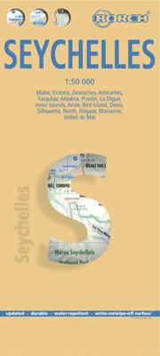
Mooie geplasticieerde kaart vande Seychellen. Deze kaart biedt een goed overzicht van het land met detailkaarten.   Our soft-laminated folded map of Seychelles shows: Bird Island, Denis, Arid, Fregate 1:25 000, Mahe, Silhouette, Praislin, La Digue, Marianne, Desroches, North 1:50 000, Inner Islands 1:750 000, Seychelles 1:4 500 000, Victoria 1:13 ...

Verkopers met dit product

Verkoper
Bezorging
Prijs
DeZwerver.nl logo
DeZwerver.nl
2,95
11,50

Anderen bekeken ook

Wegenkaart - landkaart Seychellen & Indische Oceaan | ITMB
Aan de ene kant een degelijke kaart van de Seychellen, schaal 1:45.000, met aanduidingen van o.a. nationale parken, vliegveld, benzinepomp, dirt-roads. As overzichtskaart goed te gebruiken. Aan de andere kant een overzicht van de Indische oceaan, schaal 1:10.000.000   This is actually two brand new maps in one.  This is a brilliant new map of the Seychelles archipelago and a first-ever map of the entire Indian Ocean. The islands of the Seychelles are too widely-spaced to portray except by as a series of ten insets. The main island is Mahe, which also houses the capital of Victoria (inset provided) and numerous resorts. Many of the islands have French names, reflecting the colonial to-and-fro that typified relations between Britain and France. Praslin, Curiuse, Falicite, La Digue, and Desroches are not names that bring immediate recognition, but they are the names of islands belonging to the Seychelles. The map shows dozens of resorts, as well as restaurants, touristic sites, historic …
13,95
Wegenkaart - landkaart Groot - Brittannië | Borch
Mooie geplasticieerde kaart van Groot - Brittanië. Deze kaart biedt een goed overzicht van het land met detailkaarten.   Our soft-laminated folded map of Great Britain shows: Scotland and Northern Ireland 1:800 000, England and Wales 1:800 000, Channel Crossings 1:800 000, Great Britain and Ireland administrative, Europe time zones. Borch Maps are easy to fold, durable and water-repellent with a wipeable surface. Borch Maps show hotels, museums, monuments, markets, public transport, top sights and points of interest, useful statistics, conversion charts for temperatures, weights and measurements, climate charts showing temperatures, sunshine hours, precipitation and humidity, overview maps, time zones, and much more...   "Great Britain", the largest island in Europe, is not one individual country, but the combination of Wales, England and Scotland. It also includes smaller islands such as the Hebrides, the Isle of Wight, Anglesy, the Isles of Scilly as well as the Shetland and Orkney …
11,50
Wegenkaart - landkaart Hawaiian Islands - Hawaiï | Borch
Mooie geplasticieerde kaart van Hawaiï. Deze kaart biedt een goed overzicht van deze eilanden met detailkaarten.   Our soft-laminated folded map of Hawaii shows: Hawaii (Big Island) 1:400 000, Kilauea Caldera 1:150 000, Hilo 1:70 000, Maui, Molokai / Lanai / Kahoolawe 1:200 000, Wailuku & Kahului 1:35 000, Hawaiian Islands 1:4 000 000, Niihau 1:400 000, Kauai / Oahu 1:200 000, Honolulu & Pearl Harbour 1:26 000, Honolulu Downtown 1:15 500, USA administrative & time zones. Borch Maps are easy to fold, durable and water-repellent with a wipeable surface. Borch Maps show hotels, museums, monuments, markets, public transport, top sights and points of interest, useful statistics, conversion charts for temperatures, weights and measurements, climate charts showing temperatures, sunshine hours, precipitation and humidity, overview maps, time zones, and much more...   Borne of fire and water barely 300 million years ago, the eight islands of the Hawaiian Archipelago together form the 50th US s…
11,50
Wegenkaart - landkaart Aruba | Borch
Mooie, geplastificeerde kaart van Aruba. Deze kaart biedt een goed overzicht van het land met detailkaarten.   Our soft-laminated folded map of Aruba shows: Aruba 1:50 000, Beaches 1:25 000, Oranjestad 1:10 000, San Nicolas 1:20 000, ABC Islands 1:1 000 000, Lesser Antilles 1:7 000 000, Lesser Antilles time zones. Borch maps are easy to fold, durable and water-repellent with a wipeable surface. Borch Maps show hotels, museums, monuments, markets, public transport, top sights and points of interest, useful statistics, conversion charts for temperatures, weights and measurements, climate charts showing temperatures, sunshine hours, precipitation and sea temperatures, overview maps, time zones, and much more...   Aruba is the westernmost of the "ABC" islands (Aruba, Bonaire, Curaçao) and approximately 30 km off the coast of Venezuela. Sun-aficionados know these islands are home to probably the most beautiful sand beaches of the Caribbean. Wind and water conditions are ideal for the inte…
11,50
Wegenkaart - landkaart Chile - Chili | Borch
Mooie geplasticieerde kaart van Chili. Deze kaart biedt een goed overzicht van het land met detailkaarten. Our soft-laminated folded map of Chile shows: Northern Chile, Central Chile, Southern Chile & Patagonia 1:2 000 000, Torres del Paine National Park 1:240 000, Robinson Crusoe Island 1:200 000, Easter Island (Rapa Nui) 1:160 000, Punta Arenas, Antofagasta, Iquique 1:15 000, Valparaiso 1:10 000, Arica 1:16 000, La Serena 1:13 000, Vina del Mar 1:22 000, Santiago 1:20 000 and Chile administrative & time zones. Borch Maps are easy to fold, durable and water-repellent with a wipeable surface. Borch Maps show hotels, museums, monuments, markets, public transport, top sights and points of interest, useful statistics, conversion charts for temperatures, weights and measurements, climate charts showing temperatures, sunshine hours, precipitation and humidity, overview maps, time zones, and much more...   The Republic of Chile is a long and narrow coastal strip on the western side of the S…
11,50
Wegenkaart - landkaart Virgin Islands - Maagden eilanden | Borch
The soft-laminated map of the Virgin Islands includes: US Virgin Islands 1:80 000, St. Croix 1:80 000, Charlotte Amalie 1:15 000, Charlotte Amalie Historic District 1:7 500, Cruz Bay 1:15 000, Christiansted, Frederiksted 1:15 000, British Virgin Islands 1:80 000, Anegada 1:80 000, Road Town, The Valley (Spanish Town) 1:15 000, Lesser Antilles 1:7 000 000, Virgin Islands administrative / time zones; interesting statistics British / US Virgin Islands: conversion chart for temperatures, weights and measures; climate chart with temperatures, sunshine hours, precipitation and humidity; hotels, museums, markets and much more.   Virgin Islands is the name of two groups of small islands east of Puerto Rico which form the Virgin Islands archipelago. They lie between the Caribbean Sea and the Atlantic Ocean. One of the groups which consists of St. Croix, St. John and St. Thomas islands, together with many nearby islets, is called the U.S. Virgin Islands. The other group including Anegada, Jost …
11,50
Wegenkaart - landkaart Spanje | Borch
Mooie geplasticieerde kaart van Spanje. Deze kaart biedt een goed overzicht van het land met detailkaarten.   Our soft-laminated folded map of Spain shows: Spain East 1:875 000, Spain West 1: 875 000, Canary Islands 1:1 875 000, Spain administrative and Europe time zones. Borch Maps are easy to fold, durable and water-repellent with a wipeable surface. Borch Maps show hotels, museums, monuments, markets, public transport, top sights and points of interest, useful statistics, conversion charts for temperatures, weights and measurements, climate charts showing temperatures, sunshine hours, precipitation and humidity, overview maps, time zones, and much more...   The Kingdom of Spain is the twelfth-largest economy in the world and was once the leading power and colonial empire in Europe. Spain has suffered its share of wars, invasions, inquisitions, and isolation, contributing to the rich and diverse culture that democratic Spain today represents. Its territory covers the central and eas…
11,50
Natuurgids A photographic field guide to the Wildlife of Seychelles - Seychellen | John Beaufoy
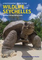
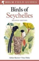
A Photographic Guide to the Wildlife of Seychelles covers the inner and outer islands of the Seychelles archipelago, and includes photographs of over 220 species of flora and fauna, including birds, mammals, butterflies, and other insects, reptiles, amphibians, fish, molluscs, and crustaceans, with descriptions, information about where to find them, and their conservation status. Although the Seychelles islands only amount to an area of 455 km2 and are spread across 115 islands in the Western Indian Ocean, they support a diverse catalogue of flowering plants, at least 100 of which are found nowhere else. The introduction covers the geography, historical background, and climate of Seychelles, as well as travel practicalities. The guide also features a selection of 16 of the best nature trails on Mahé, Praslin, Silhouette, La Digue, Curieuse, Aride, and Cousin Islands, with route maps and details of what can be seen.
24,95
Wegenkaart - landkaart Ecuador | Borch
Mooie geplasticieerde kaart van Ecuador. Deze kaart biedt een goed overzicht van het land met detailkaarten.   Our soft-laminated folded map of Ecuador shows: Ecuador West 1:1 000 000, Ecuador Est 1:2 000 000, Galapagos Islands1:1 300 000, Gran Quito 1:100 000, Quito 1:20 000, Cuenca 1:17 000, Guayaquil 1:18 000, Ecuador administrative and times zones. Borch maps are easy to fold, durable and water-repellent with a wipeable surface. Borch Maps show hotels, museums, monuments, markets, public transport, top sights and points of interest, useful statistics, conversion charts for temperatures, weights and measurements, climate charts showing temperatures, sunshine hours, precipitation and humidity, overview maps, time zones, and much more...   Dominated by the towering Andean range, Ecuador is a country of magnificent highlands, dramatic slopes, dense rainforests, fertile lowlands and tranquil sandy beaches. Its immense variety of landscapes and habitats support a unique flora and fauna …
11,50
Wegenkaart - landkaart India Noord | Borch
Mooie geplasticieerde kaart van het noorden van India. Deze kaart biedt een goed overzicht van het land met detailkaarten.   Our soft-laminated folded map of India North shows: India North 1:3 000 000, Delhi 1:30 000, Mumbai 1:30 000, Kolkata 1:30 000, Jaipur 1:30 000, Agra 1:30 000, Varanasi 1:30 000, Amritsar 1:30 000, Jodhpur 1:30 000, Udaipur 1:30 000, Bodhgaya 1:15 000 and India administrative and time zones. Borch maps are easy to fold, durable and water-repellent with a wipeable surface. Borch Maps show hotels, museums, monuments, markets, public transport, top sights and points of interest, useful statistics, conversion charts for temperatures, weights and measurements, climate charts showing temperatures, sunshine hours, precipitation and humidity, overview maps, time zones, and much more...   Northern India is bordered by Pakistan to the west, China, Nepal and Bhutan to the north, and Bangladesh and Myanmar to the east. Hindi and English are the two official languages. After…
11,50

Klanten-reviews van Wegenkaart - landkaart Seychelles - Seychellen | Borch

Er zijn nog geen beoordelingen voor dit productBen jij de eerste die een review plaatst?

Meer over Wegenkaart - landkaart Seychelles - Seychellen | Borch

Productomschrijving

Mooie geplasticieerde kaart vande Seychellen. Deze kaart biedt een goed overzicht van het land met detailkaarten.   Our soft-laminated folded map of Seychelles shows: Bird Island, Denis, Arid, Fregate 1:25 000, Mahe, Silhouette, Praislin, La Digue, Marianne, Desroches, North 1:50 000, Inner Islands 1:750 000, Seychelles 1:4 500 000, Victoria 1:13 000, Vallée de Mai 1:13 000 and Aldabra, Amirantes, Farquhar 1:2 500 000, Seychelles time zones. Borch Maps are easy to fold, durable and water-repellent with a wipeable surface. Borch Maps show hotels, museums, monuments, markets, public transport, top sights and points of interest, useful statistics, conversion charts for temperatures, weights and measurements, climate charts showing temperatures, sunshine hours, precipitation and humidity, overview maps, time zones, and much more...   The Republic of Seychelles is an archipelago of 115 granitic and coralline islands in the Indian Ocean, located east of Africa and northeast of Madagascar. Seychellois Creole, French, and English, are the main languages spoken by the local "Seychellois", who are predominantly Christian and mainly of French, African and Indian descent. The Seychelles are best known as the ultimate luxury island retreat in the Indian Ocean; Mahe, Praslin, La Digue and Silhouette being the best-known islands, with prestigious accommodation and unparalleled natural beauty - a waterbound paradise in all shades of blue and green, with tranquil beaches, untouched forests, pristine ecosystems, vibrant flora and fauna and countless opportunities for diving, sailing, fishing, trekking and island-hopping. Wedding, honeymoon and spa vacations are especially popular for those wishing to get away from it all. This is a luxurious, world-class destination you are guaranteed never to forget. The rainy season is in January and February, and the archipelago is located safely outside the cyclone belt.  

Productinformatie

    Verken gerelateerde categorieën

    Webshop.nl maakt gebruik van cookies. Ga je verder op onze website, ga dan akkoord met het plaatsen van cookies en de verwerking van deze data door ons en vermelde partners.