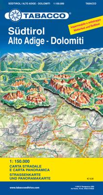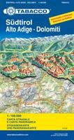
Wegenkaart - landkaart Südtirol Alto Adige - Dolomiti - Zuid Tirol - Dolomieten | Tabacco Editrice

0
Heel duidelijke wegenkaart van Zuid Tirol. De kaart is goed leesbaar met mooie kleurstellin waardoor goed duidelijk wordt hoe en waar de bergbieden en nationale parken liggen.  The South Tyrol region of north-eastern Italy on a durable, waterproof and tear-resistant road map at 1:150,000 from Tabacco with excellent presentation of the topography d...

Verkopers met dit product

Verkoper
Bezorging
Prijs
DeZwerver.nl logo
DeZwerver.nl
niet bekend
2,95
12,50

Anderen bekeken ook

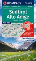
Wegenkaart - landkaart Südtirol Alto Adige - Dolomiti - Zuid Tirol - Dolomieten | Tabacco Editrice
Heel duidelijke wegenkaart van Zuid Tirol. De kaart is goed leesbaar met mooie kleurstellin waardoor goed duidelijk wordt hoe en waar de bergbieden en nationale parken liggen.  The South Tyrol region of north-eastern Italy on a durable, waterproof and tear-resistant road map at 1:150,000 from Tabacco with excellent presentation of the topography derived from the publishers’ highly regarded and popular hiking maps, plus on the reverse a panorama drawing of the mountains. Coverage extends from the Austrian border to just past Trento and Feltre, and west/east from Bormio to well east of Belluno.   The map provides a very clear picture of the region’s landscape through graphic relief for its exposed rocky areas, plus relief shading and contours at 100m intervals, and has plenty of names of individual groups, peaks, valleys, etc. Additional colouring indicates woodlands and boundaries of national parks and other protected areas are marked. Minor roads are drawn without generalizing their c…
12,50
Wegenkaart - landkaart Dolomiti - Dolomieten - Lago di Garda - Venezia | Tabacco Editrice
Dolomites – Lake Garda - Venice region of north-eastern Italy on a road map at 1:200,000 from Tabacco with excellent presentation of the topography derived from the publishers’ highly regarded and popular hiking maps, plus on the reverse a panorama drawing of the mountains. Coverage extends from the Austrian border southwards to the A4 motorway including the whole of Lake Garda, Verona, Padua and Venice, plus east to Lienz/Pordenone.   The map provides a very clear picture of the region’s landscape through graphic relief for its exposed rocky areas, plus relief shading and contours at 100m intervals, and has plenty of names of individual groups, peaks, valleys, etc. Additional colouring indicates woodlands and boundaries of national parks and other protected areas are marked. Minor roads are drawn without generalizing their course, showing the twists and turns across the mountainous terrain. Driving distances are marked on main and many connecting routes. Railway lines are shown with …
9,95
Wegenkaart - landkaart 354 Dolomieten - Trentino - Alto Adige | Michelin
De Michelin kaart is actueel, gedetailleerd, nauwkeurig, praktisch en internationaal.    De Lokale Michelin streekkaart biedt u: nauwkeurige en toeristische informatie over een streek of regio, een plaatsnamenregister om uw route gedetailleerd uit te stippelen, een nog waarheidsgetrouwere weergave van de topografie door het satellietbeeld en een selectie van de mooiste plekken.   From Michelin's yellow Local series of Europe maps comes this map of Dolomites, Trentino, Alto Adige at 1:200 000, showing excellent detail in this region of Italy. The map has the usual excellent road detail characteristic of Michelin maps, with everything from motorways down to rough tracks and footpaths marked out clearly. The number of lanes is indicated on most roads, with intermediate road distances, European route numbers and tolled roads also shown.   The map includes highly detailed relief shading that's derived from satellite photos, with plenty of spot heights also. View points, scenic routes, reli…
10,95
Wegenkaart - landkaart 611 Südtirol - Alto Adige - Bolzano - Dolomieten | Freytag & Berndt
Bijzonder gedetailleerde wegenkaart van Zuid-Tirol, Alto Adige & Bolzano met alle belangrijke aanduidingen en toeristische symbolen. Met register en aanduiding van campings en afstanden.   Goede wegenkaart van dit deel van Italië. Met register en enkele stadsplattegronden.   De berijdbare wegen zijn goed weergeven, zowel de hoofdwegen als provinciale en lokale wegen; wegnummers worden vermeld. De grotere doorgaande wandelpaden vind je zelfs terug op deze kaart! Afstanden tussen plaatsen zijn in kilometers op de kaart ingetekend, daarnaast worden ook op belangrijke plekken benzinepompen gemarkeerd.   In het kaartbeeld wordt door middel van schaduw het reliëf weergegeven en soms enkele punten in het landschap met de daadwerkelijke hoogte. Provinciegrenzen zijn goed terug te vinden, nationale parken en reservaten ook. Met allerhande symbolen worden toeristische bezienswaardigheden weergegeven als monumenten, historisch belangrijke plekken en uitzichtpunten. In bepaalde plaatsen zijn…
14,95
Wegenkaart - landkaart 03 Zuid Tirol Südtirol - Trentino | Marco Polo
Uitstekende deelkaart van Italie met als basis een bijna topografische ondergrond. Mooie wegen staan met groen weergegeven en groot voordeel boven de Michelin en Kummerley/Frey series is het feit dat er -weliswaar klein - campings op staan ingetekend. Zeer leesbare kaart, met register en alle noodzakelijke informatie. The series is particularly good for identifying geographical features: mountain and hill chains, valleys, national parks, etc. Picturesque towns and places of interest are given star rating, and other tourist information includes campsites and youth hostels, landmarks, recreational facilities etc. Latitude and longitude grid is drawn at intervals of 10'. Each title comes with a booklet which contains a street plan of the central area in the region’s main city, plus an extensive index of place names, including geographical features. Also provided are a table with distances and traveling times and main traffic and speed regulations. Map legend and all information include E…
14,95
Wegenkaart - landkaart Dolomieten / Noordoost-Italië | ITMB
The mountainous northern portion of Italy is one of today’s touristic highlights. This is a new title for ITMB and one that required considerable research to accomplish. It not only shows the roads and rail lines in the region, but hotels, castles/fortresses, museums, and a significant number of footpaths. This is the first new map of this important region, covering from Trento in the south to Sterzing-Vipiteno in the north. It also has a Top Attractions list to assist users. The reverse side is a more general map of northeastern Italy from the Slovenian border west to Brescia and from the Swiss border south to Siena, for the assistance of end users. This side has its own Top Attractions list and an outline of the area covered in better detail that is on the other side of the sheet.
12,50
Wegenkaart - landkaart Panoramakaart Tirol - Dolomieten - Gardameer | Freytag & Berndt
Tweezijdige panorama kaart van dit berggebied in Tirol, de Dolomieten en het Gardameer: door 3D afbeelding krijg je een mooi overzicht hoe de valleien lopen en de gebergtes liggen ten opzichte van elkaar.   Explore Tyrol and the Dolomites area with this Freytag&Berndt double-sided panoramic map. The best way to plan your trip, prepare your itinerary, and to travel independently in this part of Austria and Italy.    One side shows a road map of Tyrol, Northeast Italy and Southern Bavaria. The other side shows the same area with a panoramic view.    Touristic information: places of interest, nature reserves, scenic views, religious buildings, castles, monuments, ruins, antique sites, airports, camping, youth hostels.    The legend is in English, German, French, Italian, Dutch, Spanish, Czech, Slovak, Polish and Hungarian.
14,95
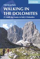
Wandelgids Walking in the Dolomites - Dolomieten | Cicerone
Uitstekende wandelgids van een gerenommeerde Engelse uitgever. De tochten zijn met zorg beschreven en voorzien van allerhande nuttige informatie. Guidebook to 25 multi day walks in the Dolomites mountains of northeast of Italy. The walks are mostly circular and 2 to 4 days long, and take in the Marmarole, Marmolada, Civet, Sella and Cortina Dolomites among others. Includes notes on accommodation, wildlife, transport, equipment, a glossary and other practical information. This guidebook describes 25 hut-to-hut treks in the Dolomites of northern Italy, covering 15 regions including Cortina, Sella, Sesto, Marmolada and Latemar. Ranging from 11.3km to 40.8km and from two to four days, the graded routes are suitable for walkers with a reasonable level of fitness and experience of mountain terrain, and some feature exposed sections which demand a good head for heights. They take advantage of the region's network of mountain refuges and efficient public transport system, with the majority of…
23,95
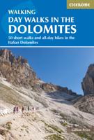
Wandelgids Day Walks in the Dolomites - Dolomieten | Cicerone
Uitstekende wandelgids van dit geweldige gebied. goed beschreven met veel praktische informatie om de route te kunnen lopen, inclusief redelijke kaarten.   Aanbevolen wandelkaarten bij deze gids: Wandelkaarten van de uitgever Tabacco Editrice op schaal 1:25.000. Per wandeling wordt het kaartnummer vermeld in de gids.   This guidebook describes 50 spectacular walks spanning the breadth of the Dolomites mountains in northeast Italy. Carefully selected to give walkers a taste of the unique character of the local area, each walk can be tackled in a single day, allowing visitors to travel light and return to their accommodation at day's end. Graded from easy to strenuous, there are walks for all abilities, ranging from 3km hour-long lake strolls and lift-assisted short walks to 20km full-day high-altitude hikes.   Most routes take in mountain huts offering refreshments and accommodation, and the guide includes notes on food and drink, history, folklore, nature and geology. A UNESCO Worl…
23,95
Sneeuwschoenwandelgids Ski Touring and Snowshoeing in the Dolomites - Dolomieten | Cicerone
Bijzondere gids van Cicerone: skitouren en sneeuwschoenwandelingen in de Dolomieten. Redelijk kaartmateriaal, goede beschrijvingen. Veel keuze in mogelijkheden van redlijke eenvoudige tot zware tochten.   Guidebook to 50 ski touring and snowshoeing routes in the Dolomites. The routes, which carry an Alpine (and when appropriate, a Volo/Toponeige) grading, range from 5km to 18km, taking between 2 and 7 hours to complete. The routes are based in and around areas such as Canazei, Arabba, Corvara and San Martino, taking in stunning scenery, quaint villages and enchanting mountain vistas.   Clear route descriptions are accompanied by 1:50K mapping and photo topos, together with information such as total ascent and descent (as well as aspect), expected duration of route and equipment required. Also provided is invaluable practical advice on things such as mountain safety and navigation, equipment, transport options to, from and around the Dolomites, ski passes, accommodation and more.   Reg…
26,50

Klanten-reviews van Wegenkaart - landkaart Südtirol Alto Adige - Dolomiti - Zuid Tirol - Dolomieten | Tabacco Editrice

Er zijn nog geen beoordelingen voor dit productBen jij de eerste die een review plaatst?

Meer over Wegenkaart - landkaart Südtirol Alto Adige - Dolomiti - Zuid Tirol - Dolomieten | Tabacco Editrice

Productomschrijving

Heel duidelijke wegenkaart van Zuid Tirol. De kaart is goed leesbaar met mooie kleurstellin waardoor goed duidelijk wordt hoe en waar de bergbieden en nationale parken liggen. 

The South Tyrol region of north-eastern Italy on a durable, waterproof and tear-resistant road map at 1:150,000 from Tabacco with excellent presentation of the topography derived from the publishers’ highly regarded and popular hiking maps, plus on the reverse a panorama drawing of the mountains. Coverage extends from the Austrian border to just past Trento and Feltre, and west/east from Bormio to well east of Belluno.   The map provides a very clear picture of the region’s landscape through graphic relief for its exposed rocky areas, plus relief shading and contours at 100m intervals, and has plenty of names of individual groups, peaks, valleys, etc. Additional colouring indicates woodlands and boundaries of national parks and other protected areas are marked. Minor roads are drawn without generalizing their course, showing the twists and turns across the mountainous terrain. Driving distances are marked on main and many connecting routes. Railway lines are shown with stations and mountain transport lines (cable car lines, chair lifts, etc) are included. The map is designed to present the topography of the region rather than its tourist sights, but it does indicate campsites. Latitude and longitude lines are drawn at 10’ and 20’ respectively. Where appropriate, both Italian and German place names are given. Map legend includes English.   On the reverse is a panorama drawing of the Dolomites, looking northwards from the Po plain and the motorway linking Lake Garda and Venice, with the Austrian and German Alps in the background. Annotated with names of mountain ranges, peaks, valleys, etc, the panorama also shows local town and villages and the region’s road network.

Productinformatie

    Verken gerelateerde categorieën

    Webshop.nl maakt gebruik van cookies. Ga je verder op onze website, ga dan akkoord met het plaatsen van cookies en de verwerking van deze data door ons en vermelde partners.