webshop.nl
Categorieën
  Sluiten

Meer ITMB
Meer ITMB in Literatuur boeken

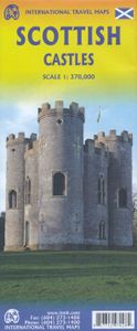
Wegenkaart - landkaart Scottisch Castles & Whisky Distilleries | ITMB

Een speciale versie van de ITMB wegenkaart van Schotland, naast de gebruikelijke aanduidingen van o.a. nationale parken en vliegvelden worden ook kastelen en whisky distilleerderijen op de kaart weergegeven. What does the word ‘Scotland’ mean to first-time visitors to the country? The history of the nation is fascinating and, being of Scottish ance...
13,95

Webshops met dit product

Webshop
Bezorging
Prijs

Anderen bekeken ook

Wegenkaart - landkaart Scottisch Castles & Whisky Distilleries | ITMB
Een speciale versie van de ITMB wegenkaart van Schotland, naast de gebruikelijke aanduidingen van o.a. nationale parken en vliegvelden worden ook kastelen en whisky distilleerderijen op de kaart weergegeven. What does the word ‘Scotland’ mean to first-time visitors to the country? The history of the nation is fascinating and, being of Scottish ancestry myself, the castles and battlefields that have shaped Scottish history for a thousand years is a big attraction. On this map, we have emphasized the top ‘must see’ castles, including my clan home, Eileen Donan (Mackenzie clan). These have been highlighted in blue and we would be happy to add more wonderful castles open to the public in future editions. The top whisky distilleries of the nation are actually a huge tourist attraction, with tours and sampling sessions and deserve emphasis for this reason alone! They are highlighted in magenta and, again, we would be happy to add more in the next edition – hic! For good measure, we have adde…
13,95
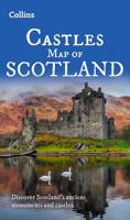
Wegenkaart - landkaart Castles map of Scotland - Schotland kastelen |
Kaart waarop meer dan 700 kastelen in Schotland staan aangegeven. Discover Scotland's ancient monuments and castles. Explore Scotland’s ancient monuments with this pictorial map featuring over 700 castles and fortified houses. Includes an easy-to-use index listing visitor information and an attractive selection of photographs.   The map includes: • Over 700 castles and fortications • Index comprises map references, the age and type of each castle, public access details, Historic Scotland and National Trust for Scotland ownership, notable grounds and gardens, telephone numbers and websites • Highlights Scotland’s finest castles, castellated mansions and also the best castles for children • Attractive photographs of a selection of castles, together with a brief account of their history • A brief history of Scottish castles and information on architectural types and periods of construction • Internet links and suggested reading for further information   Scotland is a country a…
13,95
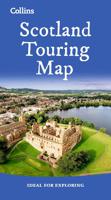
Wegenkaart - landkaart Touring Map of Scotland - Schotland | Collins
Best-selling map of Scotland. More than 1,000 places of tourist interest plotted and named on the map. The features have been plotted onto an up-to-date and attractive Collins map of Scotland.   A clear, easy to follow road map with colour classified roads. Ideal for tourists with hundreds of distinctive tourist symbols and tourist information centres all shown.   This map includes: • The whole of Scotland on a double sided sheet at 5 miles to 1 inch • Over 25 categories of tourist information shown on the map including youth hostels, picnic sites and ferries as well as the more obvious tourist sites such as castles, wildlife parks and museums • Detailed town centre maps of Edinburgh, Glasgow, Aberdeen, Dundee, Inverness and Perth • New places of interest including Japanese Garden (near Dollar), Macallan Distillery Centre, Moat Brae (Dumfries) and Scottish Submarine Centre (Helensburgh) • Road updates include the new Dalry bypass, Maybole bypass under construction, A9 dualling sections…
9,95
Wegenkaart - landkaart England & Wales - Engeland | ITMB
Een degelijke kaart met aanduidingen van o.a. nationale parken, vliegveld, benzinepompen. ITMB publishes a map of Great Britain, but each portion of GB needs its own map to show roads and attractions in more detail. This is a brilliant map of both England and Wales, showing the entire 'country' in a double-sided format. The place names index is formidable, but England in particular is a series of little villages, so it has been very difficult to decide what to include and what to leave out. This map is showing motorways, divided carriageways, all A & B highways, railway lines, airports, historic sites and touristic attractions, parks and gardens, and just about everything that we could fit on to the page to provide users with a detailed, usable map. We have been able to fit all of southern England/Wales as far north as Chester/Lincoln on side A and with a little overlap, from those cities north to the well over the Scottish border, up to Perth/Dundee filling side B. The Isle of Man and…
13,95
Wegenkaart - landkaart Southern Ontario | ITMB
Een degelijke kaart met aanduidingen van o.a. nationale parken, vliegveld, benzinepomp, dirt-roads en kleine plattegrond van hoofdstad. Als overzichtskaart goed te gebruiken. The Canadian province of Ontario is intimidatingly large. It is also mostly tundra with extremely few settlements and few roads; in fact, the geographic centre of Ontario is about 1,500 kms north of the nearest road. The very first map I prepared, at age 10, was of Ontario; and it took me six weeks to trace all the lakes. My point is that the developed portion of the province is a much smaller wedge of fertile ground south of the mineral belt of the Great Canadian Shield. This double-sided map focusses on the area south of Sudbury and North Bay and expands the scale to a much more useful purpose for most users. Imagine Detroit in the southwest corner of the map, with Highway 401 joining it to London and Toronto and a branch motorway cutting across to Buffalo. Add in the Bruce Peninsula and the major routes north t…
13,95
Wegenkaart - landkaart Scotland - Schotland | ITMB
Anyone who has been in this business for a few years remembers Ordnance Survey and their brilliantly detailed artwork. They should also remember that OS guarded this artwork religiously. That all changed when the then head of government in the UK, one soon-forgotten Gordon Brown, decreed that commercial OS artwork had to be discontinued and artwork had to be made more freely available to users. I expected an outpouring of new artwork by private UK firms. It did not happen; in fact, the range of travel maps decreased dramatically. However, OS artwork is still an excellent source of mapping artwork. This is a wonderful double-sided, detailed map of Scotland. It is both extremely detailed and accurate. We have added symbols for parks, historic sites, battlefields, country hotels, and anything else that we think would interest visitors. In order to portray Scotland to best scale advantage, the only inset included with this map are those of outlying islands, such as the Shetlands. ITMB also…
13,95

Klanten-reviews van Wegenkaart - landkaart Scottisch Castles & Whisky Distilleries | ITMB

Er zijn nog geen beoordelingen voor dit productBen jij de eerste die een review plaatst?

Meer over Wegenkaart - landkaart Scottisch Castles & Whisky Distilleries | ITMB

Productomschrijving

Een speciale versie van de ITMB wegenkaart van Schotland, naast de gebruikelijke aanduidingen van o.a. nationale parken en vliegvelden worden ook kastelen en whisky distilleerderijen op de kaart weergegeven. What does the word ‘Scotland’ mean to first-time visitors to the country? The history of the nation is fascinating and, being of Scottish ancestry myself, the castles and battlefields that have shaped Scottish history for a thousand years is a big attraction. On this map, we have emphasized the top ‘must see’ castles, including my clan home, Eileen Donan (Mackenzie clan). These have been highlighted in blue and we would be happy to add more wonderful castles open to the public in future editions. The top whisky distilleries of the nation are actually a huge tourist attraction, with tours and sampling sessions and deserve emphasis for this reason alone! They are highlighted in magenta and, again, we would be happy to add more in the next edition – hic! For good measure, we have added a list of the top ‘other’ attractions of Scotland, such as Loch Ness and Robert Burns’ birthplace. The joy of this map is that it is an excellent road/rail map of Scotland, based thematically, double-sided.

Productspecificaties

Artikelnummer(s)
Brand
ITMB

Verken gerelateerde categorieën

Webshop.nl maakt gebruik van cookies. Ga je verder op onze website, ga dan akkoord met het plaatsen van cookies en de verwerking van deze data door ons en vermelde partners.