webshop.nl
Categorieën
  Sluiten

Meer Collins
Meer Collins in Literatuur boeken

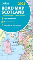
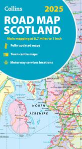
Wegenkaart - landkaart Scotland - Schotland road map 2025 | Collins

0
Explore Scotland with easy-to-read mapping from Collins. Full-color map of Scotland at 8.7 miles to 1 inch (1:550.000), with clear road network and administrative areas shown in color. The map covers the whole of Scotland and part of Northern England conveniently on one side, and is ideal for reference or route planning.   The map shows the road ne...

Webshops met dit product

Webshop
Bezorging
Prijs

Anderen bekeken ook

Wegenkaart - landkaart Scotland - Schotland road map 2025 | Collins
Explore Scotland with easy-to-read mapping from Collins. Full-color map of Scotland at 8.7 miles to 1 inch (1:550.000), with clear road network and administrative areas shown in color. The map covers the whole of Scotland and part of Northern England conveniently on one side, and is ideal for reference or route planning.   The map shows the road network in detail for easy route planning and has easily identifiable local council areas and boundaries.   The main features of this road map are:   Fully updated Administrative areas shown in color Clear, detailed road network and road distances Town and city names, rivers, railway lines and canals are clearly shown 7 city/town center street plans showing places of interest Index to place names Mileage chart Car ferry routes Key in English, French and German
11,50
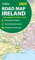
Wegenkaart - landkaart Ireland - Ierland road map 2025 | Collins
Explore Ireland with easy-to-read mapping from Collins. Full-color map of Ireland at 9 miles to 1 inch (1:570,240), with clear, detailed road network and counties and new administrative areas shown in color. This double-sided map covers the whole of Ireland, and is ideal for reference or route planning.   This map of Ireland shows the road network in detail. It is ideal for business users, with coloring of local council areas, but it is also perfect for tourists as a route planning map.   Main features include:   Fully updated New administrative areas shown in color Clear, detailed road network Town and city names, rivers, lakes, spot heights, railway lines and canals are clearly shown City/town centre street plans of Belfast, Cork, Dublin, Dún Laoghaire, Galway, Limerick, Londonderry/Derry and Waterford showing places of interest Full index to place names Mileage chart Car ferry routes Key in English, French and German Area of coverage Covers the whole of the Republic of Ireland and N…
11,50
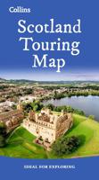
Wegenkaart - landkaart Touring Map of Scotland - Schotland | Collins
Best-selling map of Scotland. More than 1,000 places of tourist interest plotted and named on the map. The features have been plotted onto an up-to-date and attractive Collins map of Scotland.   A clear, easy to follow road map with colour classified roads. Ideal for tourists with hundreds of distinctive tourist symbols and tourist information centres all shown.   This map includes: • The whole of Scotland on a double sided sheet at 5 miles to 1 inch • Over 25 categories of tourist information shown on the map including youth hostels, picnic sites and ferries as well as the more obvious tourist sites such as castles, wildlife parks and museums • Detailed town centre maps of Edinburgh, Glasgow, Aberdeen, Dundee, Inverness and Perth • New places of interest including Japanese Garden (near Dollar), Macallan Distillery Centre, Moat Brae (Dumfries) and Scottish Submarine Centre (Helensburgh) • Road updates include the new Dalry bypass, Maybole bypass under construction, A9 dualling sections…
9,95
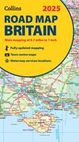
Wegenkaart - landkaart Road Map of Britain 2025 | Collins
Full-colour, double-sided road map of Great Britain at a scale of 8.7 miles to 1 inch. Northern England, Scotland and the Isle of Man are on one side with Southern England and Wales on the other.   With its easily identifiable counties and unitary authorities,this map is ideal for business users but it is also perfect for tourists for route planning.   Main features:   Fully updated Counties and local council areas shown in colour Clear, detailed road network Town and city names, rivers, railway lines and canals are clearly shown 16 city/town centre street plans Index to place names Mileage chart Car ferry routes Key in English, French and German
11,50
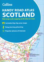
Wegenatlas Handy Road Atlas Scotland - Schotland | Collins
Handzame A% wegenatlas van Schotland met register en stadsplattegronden. Discover new places with handy road atlases from Collins. Your ideal companion for navigating around Scotland. It has extremely clear, route planning maps of Scotland, detailed city plans of the major cities and towns and fits neatly into your glovebox, briefcase or bag.   Main featuresClear, attractive route planning maps of the whole of Scotland supported by comprehensive, fully indexed city centre street maps of Aberdeen, Dundee, Edinburgh, Glasgow, Inverness and Perth. Scale of main maps: 1:625,000 (9.9 miles to 1 inch). Also includes* Places of tourist interest are highlighted* Attractive layer colouring showing land height* Road network fully classified and colour coded* Detailed street mapping of Edinburgh, including the Royal Mile with all its attractions clearly marked, Leith and Holyrood Park* Detailed street mapping of Glasgow, including the West End, city centre and M74 extension* Detailed street mappi…
9,95
Wegenkaart - landkaart 3326 Adventure Map Scotland - Schotland | Natio
Wegenkaart van Schotland met vermelding van veel bezienswaardigheden, nationale parken en attrakties. Watervast en scheurvast. Juist door deze vermeldingen onderscheidt de kaart zich van andere wegenkaarten. National Geographic's Scotland AdventureMapis designed to meet the needs of adventure travelers with its durability and detailed, accurate information. The map includes the locations of cities and towns with a user-friendly index, a clearly marked road network complete with distances and designations for roads/highways, plus secondary routes for those seeking to explore off the beaten path.    AdventureMaps differ from a traditional road map because of the specialty content that they include. Each map contains hundreds of diverse and unique recreational, ecological, cultural and historic destinations - outside of the major tourist hubs. National Geographic AdventureMaps are the perfect companion to a guidebook, yet far easier to pack!    The Scotland AdventureMap is printed in the …
17,50

Klanten-reviews van Wegenkaart - landkaart Scotland - Schotland road map 2025 | Collins

Er zijn nog geen beoordelingen voor dit productBen jij de eerste die een review plaatst?

Meer over Wegenkaart - landkaart Scotland - Schotland road map 2025 | Collins

Productomschrijving

Explore Scotland with easy-to-read mapping from Collins. Full-color map of Scotland at 8.7 miles to 1 inch (1:550.000), with clear road network and administrative areas shown in color. The map covers the whole of Scotland and part of Northern England conveniently on one side, and is ideal for reference or route planning.   The map shows the road network in detail for easy route planning and has easily identifiable local council areas and boundaries.   The main features of this road map are:   Fully updated Administrative areas shown in color Clear, detailed road network and road distances Town and city names, rivers, railway lines and canals are clearly shown 7 city/town center street plans showing places of interest Index to place names Mileage chart Car ferry routes Key in English, French and German

Productspecificaties

Artikelnummer(s)
Brand
Collins

Verken gerelateerde categorieën

Webshop.nl maakt gebruik van cookies. Ga je verder op onze website, ga dan akkoord met het plaatsen van cookies en de verwerking van deze data door ons en vermelde partners.