Wegenkaart - landkaart Scotland - Schotland | ITMB

0
Anyone who has been in this business for a few years remembers Ordnance Survey and their brilliantly detailed artwork. They should also remember that OS guarded this artwork religiously. That all changed when the then head of government in the UK, one soon-forgotten Gordon Brown, decreed that commercial OS artwork had to be discontinued and artwor...

Verkopers met dit product

Webshop
Bezorging
Prijs
DeZwerver.nl logo
DeZwerver.nl
2,95
13,95

Anderen bekeken ook

Wegenkaart - landkaart Visitors map Scotland - Schotland | A-Z Map Company
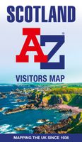
xplore the whole of Scotland from Dumfries and Galloway in the South to the Orkney Islands in the North. With detailed road mapping and illustrated town plans of major cities, this feature rich, helpful tourist guide is ideal for touring around Scotland. Published at a clear 8.7 miles to 1 inch scale (5.51 cm to 1 km), this handy map is a detailed and informative exploration of what Scotland has to offer.   Highlights include: 8 inset street maps to major cities and popular destinations, including: Edinburgh, Glasgow, Stirling, and Cairngorms National Park, with detailed descriptions and places of interestLocations of visitor centres and tourist information sitesUseful key to map symbols making it a clear and easy readMore than 700 places of interest The perfect map for exploring Scotland whether you are a tourist or a local.
11,50
Wegenkaart - landkaart Castles map of Scotland - Schotland kastelen | Collins
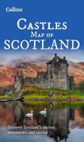
Kaart waarop meer dan 700 kastelen in Schotland staan aangegeven. Discover Scotland's ancient monuments and castles. Explore Scotland’s ancient monuments with this pictorial map featuring over 700 castles and fortified houses. Includes an easy-to-use index listing visitor information and an attractive selection of photographs.   The map includes: • Over 700 castles and fortications • Index comprises map references, the age and type of each castle, public access details, Historic Scotland and National Trust for Scotland ownership, notable grounds and gardens, telephone numbers and websites • Highlights Scotland’s finest castles, castellated mansions and also the best castles for children • Attractive photographs of a selection of castles, together with a brief account of their history • A brief history of Scottish castles and information on architectural types and periods of construction • Internet links and suggested reading for further information   Scotland is a country …
13,95
Nieuw
Wegenkaart - landkaart Brazilië | ITMB
Een degelijke kaart met aanduidingen van o.a. nationale parken, vliegveld, benzinepomp, dirt-roads en kleine plattegrond van hoofdstad. Als overzichtskaart goed te gebruiken. Brazil, or more properly, Brasil, is a difficult country to map as a country, in that most of the developed areas are in the relatively small extreme south of the country. The vast region of the Amazon Basin is lightly populated and is not easy to access. Our solution has been to portray the south portion on one side at a detailed scale, to enable such locations as Rio and Sao Paulo a better scale to help travellers, while mapping the north at a respectable but more limited scale on the That said, one still needs both sides of the map, as Brasilia, the capital, falls on the north side other side of the sheet. I should also note that roads north of Brasilia tend to be less well-paved than those in the south. The  shape of the country also presents mapping difficulties, in that little room is available for inset ma…
13,95
Wegenkaart - landkaart Touring Map of Scotland - Schotland | Collins
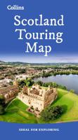
Best-selling map of Scotland. More than 1,000 places of tourist interest plotted and named on the map. The features have been plotted onto an up-to-date and attractive Collins map of Scotland.   A clear, easy to follow road map with colour classified roads. Ideal for tourists with hundreds of distinctive tourist symbols and tourist information centres all shown.   This map includes: • The whole of Scotland on a double sided sheet at 5 miles to 1 inch • Over 25 categories of tourist information shown on the map including youth hostels, picnic sites and ferries as well as the more obvious tourist sites such as castles, wildlife parks and museums • Detailed town centre maps of Edinburgh, Glasgow, Aberdeen, Dundee, Inverness and Perth • New places of interest including Japanese Garden (near Dollar), Macallan Distillery Centre, Moat Brae (Dumfries) and Scottish Submarine Centre (Helensburgh) • Road updates include the new Dalry bypass, Maybole bypass under construction, A9 dualling section…
9,95
Wegenkaart - landkaart Afrika noordwest - Africa northwest | ITMB
Een degelijke kaart met aanduidingen van o.a. nationale parken, vliegveld, benzinepomp, dirt-roads en kleine plattegrond van hoofdstad. Als overzichtskaart goed te gebruiken. This is the detailed map of Africa emanating from our continental data base and, at an scale better than Michelin's famous regional map, we feel that this version is a winner. First, it is printed double-sided with the western coastal segment on one side and the eastern half on the other. Second, we have been able to improve the accuracy of the road information enormously at the better scale, and third we are making progress in developing a new series of travel maps for Africa by publishing the first of what we hope will become a new regional map covering Africa from top to bottom, or from Cape to Cairo, as Uncle Cecil used to say. The coverage of this map is from Morocco in the west to the Libyan/Egyptian border and from Senegal and Liberia in the southwest to the Chad/Sudan border in the southeast. This is also…
13,95
Wegenkaart - landkaart North Coast Road Trip Map | Destination Earth
This North Coast road trip map is the essential tool that will guide you through the breathtaking landscapes, stunning coastal views, and enchanting villages of the North Coast 500 in Scotland. Designed by travel enthusiasts, for travel enthusiasts, our map is more than just a navigation tool. It's a gateway to adventure, a treasure trove of hidden gems, and a companion that will make your journey even more extraordinary. Featuring a detailed and easy-to-read layout, this Destination NC500 Map will assist you in planning and navigating your way along the 500-mile route. With precise mile markers, highlighted attractions, and recommended stopping points, this map will ensure you don't miss a single sight along the way.   NC500 A1 Map Features:     Exact Locations: All of the exact locations of over 110+ Sights and Attractions, as well as Accommodation, Restaurants, Campervan Water and Waste Facilities, Electric Vehicle Charging Points, Train Stations, Airports, and much more! Must-know…
13,-
Nieuw
Wegenkaart - landkaart Nunavut - Northwest Territories | ITMB
The far north of Canada, north of 60 degrees, consists of three territories; the Yukon, the Northwest Territories, and Nunavut. Until now, there has never been a proper map of the territory that was carved off from the NWT a quarter century ago. With only 30,000 people and a scattering of settlements, Nunavut is larger than western Europe in area. This map took us years to prepare, using 1:250,000 government topo maps as a base and tracing thousands of little lakes. The traditional passageway of the fabled Northwest Passage is also shown. The most northerly civilian community in the world is on the map – Grise Bay, as well as Alert, the most remote place on earth. Originally, the NWT covered all of northwestern North America west of the Louisiana Purchase and the Loyalist colonies, and north of the Spanish provinces (essentially north of current day Sactamento). Political changes have reduced its size over the past century and a half to the region of Canada north of the 60th parallel …
13,95
Wegenkaart - landkaart Africa Southern - zuidelijk Afrika | ITMB
met extra kaarten van Johannesburg - Kapstad - Victoria Falls - Okavango Delta   This map is the updated version of our previous map, which was called Southern Africa, covering the southernmost portion of Africa. It is also the most developed part of the continent, with the densest road network and number of urban areas on the continent. This edition was started a year ago and incorporates an innovative approach to data portrayal by essentially over-lapping our very detailed South Africa artwork over top of the southern Africa artwork. The result is a much more detailed regional map than was possible previously.   Legend Includes: Road by classification, Major Road, Highway, Railway, Ferry, Lake, River, National Park, Beach, Diving, World Heritage, Waterfall, Cave, Monument, Camping Site and much more...
13,95
Wegenkaart - landkaart 9 Road Map Britain Scotland - Schotland | AA Publishing
Goede dubbelzijdige wegenkaart van Schotland met plaatsnamen index. Britain’s clearest mapping from the experts at the AA, in a handy foldable map. Fully updated, this map of Scotland combines clear design and an easy-to-read scale with more road detail to ensure that you never lose your way. The map includes information on toll points, service areas, road numbers, motorways, dual carriageways and wide and narrow local roads. National Parks, and places of interest are also highlighted. Caravan and camping sites pinpointed on the mapping. City and town plans Easy-to-read place index name. Part of a range of 9 regional sheet maps plus 1 map covering the whole of Britain. Map Series - 1 West Country & Wales. 2 Central Southern England. 3 South East England. 4 East Anglia. 5 Midlands & Central England. 6 Wales. 7 Northern England. 8 North England & Scottish Borders. 9 Scotland. 10 Britain.  
10,95
Nieuw
Wegenkaart - landkaart Guyana Suriname & French Guiana | ITMB
Een degelijke wegenkaart met aanduidingen van o.a. nationale parken, vliegveld, benzinepomp, dirt-roads en kleine plattegrond van hoofdstad. Als overzichtskaart goed te gebruiken.   The focus of this map is on Guyana, reflecting the changes coming about as a result of the growing assertiveness of Brasil, which has repaved the highway north from Manaus on the Amazon to the border with Guyana (at Bomfin). The Guyanese are improving the road to Georgetown, shortening travel times for goods in both directions by weeks. This new bridge also enables travelers to pass north and south much more easily. We have also re-done the inset map of Georgetown to bring it up to date. We have also changed the regional map on the reverse side, which used to cover all three Guianas countries, and replaced it by one concentrating on the other two countries. The most significant change we've made is to re-name Surinam to the country's preferred name of Suriname. As we made relatively few changes to the artw…
13,95

Klanten-reviews van Wegenkaart - landkaart Scotland - Schotland | ITMB

Er zijn nog geen beoordelingen voor dit productBen jij de eerste die een review plaatst?

Meer over Wegenkaart - landkaart Scotland - Schotland | ITMB

Productomschrijving

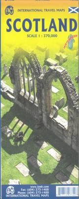
Anyone who has been in this business for a few years remembers Ordnance Survey and their brilliantly detailed artwork. They should also remember that OS guarded this artwork religiously. That all changed when the then head of government in the UK, one soon-forgotten Gordon Brown, decreed that commercial OS artwork had to be discontinued and artwork had to be made more freely available to users. I expected an outpouring of new artwork by private UK firms. It did not happen; in fact, the range of travel maps decreased dramatically. However, OS artwork is still an excellent source of mapping artwork. This is a wonderful double-sided, detailed map of Scotland. It is both extremely detailed and accurate. We have added symbols for parks, historic sites, battlefields, country hotels, and anything else that we think would interest visitors. In order to portray Scotland to best scale advantage, the only inset included with this map are those of outlying islands, such as the Shetlands. ITMB also publishes a separate, less detailed map of Scotland on one side with Edinburgh of the other side. The new Scotland map has also been upgraded to being printed on plastic paper for durability. It also makes a good umbrella for when the Scotch mist falls! By the way, our forthcoming map of England and Wales should be available in about two months.    Map size: 27*39"   Legend Includes: Roads by classification, Motorway, Divided Highway, Main Road, Ferry Route, Point of interest, Castle, Museums, Theme Park, Zoo, Golf course, National Park, and much more.

Verken gerelateerde categorieën

Webshop.nl maakt gebruik van cookies. Ga je verder op onze website, ga dan akkoord met het plaatsen van cookies en de verwerking van deze data door ons en vermelde partners.