webshop.nl
Categorieën
  Sluiten

Meer Tracks4Africa
Meer Tracks4Africa in Geschiedenis & politiek boeken

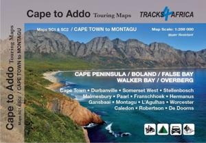
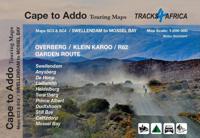
Wegenkaart - landkaart SC1&SC2 Cape Town to Montagu | Tracks4Africa

We start in Cape Town in the west and move along the southern coast through the Overberg, Winelands, Garden Route, Klein Karoo R62, Baviaanskloof to eventually arrive in the Addo National Park up to Gqeberha (Port Elizabeth) in the east.   The maps are highly detailed and well researched. Our map scale is 1:200 000 which allows us to show a lot of ...
29,95

Webshops met dit product

Webshop
Bezorging
Prijs

Anderen bekeken ook

Wegenkaart - landkaart SC3&SC4 Swellendam to Mossel Bay | Tracks4Afric
The Cape to Addo map series covers the southern parts of the Western Cape of South Africa in a series of eight highly detailed maps, printed on four sheets of A1 durable paper.   We start in Cape Town in the west and move along the southern coast through the Overberg, Winelands, Garden Route, Klein Karoo R62, Baviaanskloof to eventually arrive in the Addo National Park up to Gqeberha (Port Elizabeth) in the east.   The maps are highly detailed and well researched. Our map scale is 1:200 000 which allows us to show a lot of detail including minor gravel roads, hiking trails, farm boundaries and points of interest which are relevant to self-drive tourists.   The size of the paper is kept small enough to allow this to be the perfect road tripping map. We use Duraflex paper and print two maps per sheet of A1 paper, making this a four-sheet series. Each map sheet is individually packed in a plastic protective sleeve.   The maps are perfect for day drives, overlanding or just doing road trip…
29,95
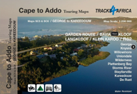
Wegenkaart - landkaart SC5&SC6 George to Kareedouw | Tracks4Africa
The Cape to Addo map series covers the southern parts of the Western Cape of South Africa in a series of eight highly detailed maps, printed on four sheets of A1 durable paper.   We start in Cape Town in the west and move along the southern coast through the Overberg, Winelands, Garden Route, Klein Karoo R62, Baviaanskloof to eventually arrive in the Addo National Park up to Gqeberha (Port Elizabeth) in the east.   The maps are highly detailed and well researched. Our map scale is 1:200 000 which allows us to show a lot of detail including minor gravel roads, hiking trails, farm boundaries and points of interest which are relevant to self-drive tourists.   The size of the paper is kept small enough to allow this to be the perfect road tripping map. We use Duraflex paper and print two maps per sheet of A1 paper, making this a four-sheet series. Each map sheet is individually packed in a plastic protective sleeve.   The maps are perfect for day drives, overlanding or just doing road trip…
29,95
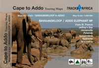
Wegenkaart - landkaart SC7&SC8 Baviaanskloof to Addo | Tracks4Africa
The Cape to Addo map series covers the southern parts of the Western Cape of South Africa in a series of eight highly detailed maps, printed on four sheets of A1 durable paper.   We start in Cape Town in the west and move along the southern coast through the Overberg, Winelands, Garden Route, Klein Karoo R62, Baviaanskloof to eventually arrive in the Addo National Park up to Gqeberha (Port Elizabeth) in the east.   The maps are highly detailed and well researched. Our map scale is 1:200 000 which allows us to show a lot of detail including minor gravel roads, hiking trails, farm boundaries and points of interest which are relevant to self-drive tourists.   The size of the paper is kept small enough to allow this to be the perfect road tripping map. We use Duraflex paper and print two maps per sheet of A1 paper, making this a four-sheet series. Each map sheet is individually packed in a plastic protective sleeve.   The maps are perfect for day drives, overlanding or just doing road trip…
29,95
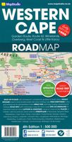
Wegenkaart - landkaart 10 Western Cape Road Map | MapStudio
Road map of the Western Cape Province with an enlargement for the Cape Peninsula and 27 street plans of the central areas in main towns. The map is annotated numerous places of interest, vineyards, etc. GPS coordinates are provides for main road junctions. This new edition Western Cape Road Map covers the whole of the Western Cape. It features easy-to-read full colour maps with GPS co-ordinates. The map provides tourist-friendly text, highlights places of interest and lists accommodation information. This map is perfect for scenic drives and includes information boxes on activities of interest.   Coverage includes the Garden Route & Route 62, South Western Cape, Winelands and Overberg, West Coast Flower Region and Little Karoo. The map features small detailed street plans of Cape Town CBD, Montagu, Barrydale, Ladismith, Oudtshoorn, Mossel Bay, Knysna, Plettenberg Bay, Humansdorp, George, Stellenbosch, Franschhoek, Paarl, Wellington, Hermanus, Swellendam, Robertson, Ceres, Tulbagh, Lang…
16,95
Stadsplattegrond Cape Town - Kaapstad | Borch
Borch Kaapstad is een duidelijke, geplastificeerde plattegrond van het centrum met informatie over openbaar vervoer en bezienswaardigheden. Inclusief straatnamenregister.   Our soft-laminated folded map of Cape Town shows: Cape Town 1:15 000, Cape Peninsula 1:140 000, Cape Town and Region 1:635 000, Garden Route 1:3 000 000, Robben Island 1:40 000, South Africa administrative & time zones, Public Transport Cape Town. Borch Maps are easy to fold, durable and water-repellent with a wipeable surface. Borch Maps show hotels, museums, monuments, markets, public transport, top sights and points of interest, useful statistics, conversion charts for temperatures, weights and measurements, climate charts showing temperatures, sunshine hours, precipitation and humidity, overview maps, time zones, and much more...   Cape Town, the legislative capital and second most populous city of South Africa and the provincial capital of the Western Cape, is also renowned as one of the world's most beautiful …
10,25
Wegenkaart - landkaart 01 Kaapstad - Cape Town and Surrounding Attract
Het overzicht is soms misschien een beetje onduidelijk. maar de details in de inzetten en delen van de kaart zijn prima en voldoen goed voor het rondrijden met een eigen auto. Double-sided map, with a general road map on one side, plus numerous street plans and descriptions of four special routes on the reverse. The main map covers an area within reach as day trips from Cape Town, extending east to Swellendam and north to Langebaan. Road classification includes unsurfaced roads, intermediate driving distances on main and secondary roads, toll routes with gates, and mountain passes. Railways are shown with local stations. An impression of relief is provided by elevation tinting (perhaps somewhat confusing for regular map users - the higher the altitude, the greener the colour!), spot heights for main peaks, and names of mountain ranges. Nature and forest reserves, plus salt pans and marshes are indicated. Symbols mark local airfields, historical sites, caravan parks, many wine estates, …
16,95
Wegenkaart - landkaart Zuid Afrika: kaapregio - Südafrika Kapregion |
Tweetalige kaart (Engels en Duits). Door ingetekende lengte- en breedtegraden is het gebruik van GPS mogelijk. Met hoogtelijnen en uitgebreid wegennetwerk: daarnaast worden ook de afstanden tussen belangrijke plaatsen duidelijk leesbaar weergegeven. Het kleurgebruik is zodanig dat je een goede indruk krijgt van hoogteverschillen en soorten landschap. Natuurlijk staan de toeristische bezienswaardigheden duidelijk vermeld.   Gedrukt op water- en scheurvast papier! Polyart is een synthetisch product vrij van giftige stoffen dus duurzaam. Het papier gaat echt lang mee.   Cape Region of South Africa, including the whole of the Garden Route, at 1:500,000 on a light, waterproof and tear-resistant, indexed road map with a street plan of Cape Town and a map of the Cape Peninsula, published by Reise Know-How as part of their highly acclaimed World Mapping Project.    The map is double-sided to provide the best balance between a good scale and a convenient size sheet, and divides the region ea…
15,95

Klanten-reviews van Wegenkaart - landkaart SC1&SC2 Cape Town to Montagu | Tracks4Africa

Er zijn nog geen beoordelingen voor dit productBen jij de eerste die een review plaatst?

Meer over Wegenkaart - landkaart SC1&SC2 Cape Town to Montagu | Tracks4Africa

Productomschrijving

We start in Cape Town in the west and move along the southern coast through the Overberg, Winelands, Garden Route, Klein Karoo R62, Baviaanskloof to eventually arrive in the Addo National Park up to Gqeberha (Port Elizabeth) in the east.   The maps are highly detailed and well researched. Our map scale is 1:200 000 which allows us to show a lot of detail including minor gravel roads, hiking trails, farm boundaries and points of interest which are relevant to self-drive tourists.   The size of the paper is kept small enough to allow this to be the perfect road tripping map. We use Duraflex paper and print two maps per sheet of A1 paper, making this a four-sheet series. Each map sheet is individually packed in a plastic protective sleeve.   The maps are perfect for day drives, overlanding or just doing road trips in your sedan, 4WD or motorbike along our beautiful southern coast, Klein Karoo and parts of the proper Karoo. Mountain passes form a prominent feature in this area, and these are indicated together with scenic route options. As with other Tracks4Africa maps, these maps include drive times over and above driving distances. Adventure bikers will be pleased to know that minor gravel roads are included together with various accommodation options.   The map has a relief background onto which farm boundaries, protected areas and other geographical features are shown.   For each town we indicate what basic services are offered, e.g. fuel, shops, camping accommodation. We also show the facilities and activities of the various nature reserves.   This Map – the SC1 & SC2 : Cape Town to Montagu is perfect for day trips in and around Cape Town or from the Winelands towns of Stellenbosch, Paarl and Franschhoek. It covers some of the most iconic tourism attractions in the Western Cape which include Cape Point and Table Mountain, Robben Island where Nelson Mandela was held prisoner during the apartheid era, the wine routes of the Cape, the whale watching along the coast of Hermanus and further east, the southernmost point of Africa at L’Agulhas and shark cage diving at Gansbaai.   Plan your trips with our driving times on each road and include scenic routes indicated on the map together with the various mountain passes of the Western Cape. The area boasts top-end destinations which include world-class restaurants and wine estates.   As the name suggests, these two maps, printed on either side of a single sheet of Duraflex paper, stretch from Cape Town in the west to Montagu in the east. The coastline forms the southern boundary and to the north towns such as Malmesbury and Worcester are included.   Key areas of interest include Cape Peninsula, Boland, Winelands, False Bay, Walker Bay and the Overberg region. Prominent towns on these maps include Cape Town, Durbanville, Somerset West, Stellenbosch, Malmesbury, Paarl, Franschhoek, Hermanus, Gansbaai, Montagu, L’Agulhas, Worcester, Caledon, Robertson and De Doorns.
Productspecificaties

Artikelnummer(s)
Brand
Tracks4Africa

Verken gerelateerde categorieën

Webshop.nl maakt gebruik van cookies. Ga je verder op onze website, ga dan akkoord met het plaatsen van cookies en de verwerking van deze data door ons en vermelde partners.