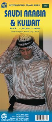
Wegenkaart - landkaart Saudi Arabia & Kuwait - Saudi Arabië en Koeweit | ITMB

0
Een degelijke kaart met aanduidingen van o.a. nationale parken, vliegveld, benzinepomp, dirt-roads en kleine plattegrond van hoofdstad. Als overzichtskaart goed te gebruiken. 1:390,000 / 1:1750000 Saudi Arabia remains a unique entity in today's world, steadfastly governing itself in splendid isolation and fighting hard to keep 'modern' influences ...

Verkopers met dit product

Verkoper
Bezorging
Prijs
DeZwerver.nl logo
DeZwerver.nl
2,95
13,95

Anderen bekeken ook

Wegenkaart - landkaart Saudi Arabia & Kuwait - Saudi Arabië en Koeweit | ITMB
Een degelijke kaart met aanduidingen van o.a. nationale parken, vliegveld, benzinepomp, dirt-roads en kleine plattegrond van hoofdstad. Als overzichtskaart goed te gebruiken. 1:390,000 / 1:1750000 Saudi Arabia remains a unique entity in today's world, steadfastly governing itself in splendid isolation and fighting hard to keep 'modern' influences at bay. However, it has modern trappings such as an excellent road system, even though women aren't allowed to drive, and modern cities, even though women won't be allowed to vote in local elections until 2015. The cities of Medina and Mecca are closed to infidels. Kuwait, its immediate neighbour to the north is an open society and is included on this map as a very large inset, with a separate inset of Kuwait City. Central Riyadh is also included as an inset map, showing mosques, hotels, banks, and shopping areas.   Legend Includes: Roads by classification, Railways, Capitals, International Airports, Domestic Airports, Border crossings, Railw…
13,95
Reisgids Oman, UAE & Arabian Peninsula - Saudi Arabië, Jemen, Kuwait. Quatar, Verenigde Arabische Emiraten, Bahrein en Oman | Lonely Planet
Deze gids beschrijft Saudi Arabië, Yemen, Bahrein, Kuwait, Qatar, Verenigde Arabische Emiraten en Oman. De perfecte reisgids voor zowel de georganiseerde als de zelfstandige reiziger. Naast een algemene inleiding van het land / streek vol met praktische informatie over hoe je er het beste kunt reizen: slapen, eten, vervoer, excursies ... alles kun je er in vinden. Zoals de titel wel doet vermoeden ligt de nadruk niet op Oman (slechts 96 blz) en Verenigde Arabische Emiraten. Voor Oman bevelen wij de Bradt Oman aan! The spectacular emptiness of the Arabian landscape provides a blank canvas upon which is projected a riot of cultural, religious, intellectual and trading wonders. Lonely Planet is your passport to Oman, UAE & Arabian Peninsula, with amazing travel experiences and the best planning advice.   Admire the beauty Abu Dhabi’s magnificent Sheikh Zayed Grand Mosque, browse priceless Islamic art in Doha, or dine at the top of Dubai’s Burj Khalifa; all with your trusted travel com…
27,95
Wegenkaart - landkaart Saudi-Arabien - Saudi Arabië | Reise Know-How Verlag
Tweetalige kaart (Engels en Duits). Door ingetekende lengte- en breedtegraden is het gebruik van GPS mogelijk. Met hoogtelijnen en uitgebreid wegennetwerk: daarnaast worden ook de afstanden tussen belangrijke plaatsen duidelijk leesbaar weergegeven. Het kleurgebruik is zodanig dat je een goede indruk krijgt van hoogteverschillen en soorten landschap. Natuurlijk staan de toeristische bezienswaardigheden duidelijk vermeld.   Gedrukt op water- en scheurvast papier! Polyart is een synthetisch product vrij van giftige stoffen dus duurzaam. Het papier gaat echt lang mee.   Topography is indicated by altitude colouring with numerous spot heights and names of mountain ranges and passes. Salt lakes, swamps, seasonal rivers and glacier are also shown. Detailed presentation of the road network includes minor roads and tracks and railways are also shown. Internal administrative units are presented with their boundaries and names. National parks and other protected areas are highlighted. A wide r…
18,50
Wegenkaart - landkaart Saudi-Arabië | Freytag & Berndt
Uitstekende kaart van Saudi Arabië. Met index, toeristische informatie en afstanden in kilometers. Dubbelzijdig.   De berijdbare wegen zijn goed weergeven, zowel de hoofdwegen als provinciale en lokale wegen; wegnummers worden vermeld. Afstanden tussen plaatsen zijn in kilometers op de kaart ingetekend, daarnaast worden ook op belangrijke plekken benzinepompen gemarkeerd.   In het kaartbeeld wordt door middel van schaduw het reliëf weergegeven en soms enkele punten in het landschap met de daadwerkelijke hoogte. Provinciegrenzen zijn goed terug te vinden, nationale parken en reservaten ook. Met allerhande symbolen worden toeristische bezienswaardigheden weergegeven als monumenten, historisch belangrijke plekken en uitzichtpunten. In bepaalde plaatsen zijn hotels en campings te vinden, luchthavens, treinverbindingen en havens vindt u er ook op!
14,95
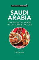
Reisgids Culture Smart! Saudi Arabia - Saoedi Arabië | Kuperard
De Cultuur Bewust!-gids geeft toeristen en zakenlieden belangrijke informatie met betrekking tot de cultuur van alledag in het land van bestemming. Anders dan in de gebruikelijke reisgidsen wordt de lezer in deze reeks bijgespijkerd op het gebied van omgangsvormen, normen en waarden, hoe zich te gedragen en wat verwacht mag worden op zakelijk en sociaal gebied. Het zijn beknopte zakformaatgidsen met interessante wetenswaardigheden over het dagelijks leven. Een must voor iedereen die naar het buitenland gaat voor vakantie, studie of werk.   Don't just see the sightsget to know the people.   From a distance, Saudi Arabia may seem a subdued, or even dull place; but for those who take a closer look it emerges as a fascinating country, not necessarily because of its political and economic importance, but because of its people. Reticent perhaps but, on closer acquaintance, charming and warm, the Saudis form a far less monolithic society than one might expect.   Divided by region, cree…
16,50
Wegenkaart - landkaart Philadelphia & Pennsylvania | ITMB
This map began as a result of a map conference held in Philadelphia a few years ago. Maps of the city at that time tended to concentrate on the entire spread-out urban area, resulting in the historic core, which was of interest mostly to visitors, crowded into a small portion of the map. Our map covers from the zoo and art gallery in the north to West Oregon St in South Phillie, so takes on much more than the historic area and the downtown, but does so at an excellent scale, so everything from the Liberty Bell to the University of Pennsylvania campus shows up clearly and easy to read. The other side of the map is also a brand new map for ITMB.     Legend Includes: Roads by classification, Airports, Aerodromes and small aircrafts, Ferrie routes, Bus terminals, Metro Stations, Railway stations, Gas stations, Car Parks, Border crossing, State parks with or without campsites, Hospitals, Shopping centres, Postoffices, Police stations, FireStations, Museums, Tourist information centers, Poi…
13,95
Wegenkaart - landkaart Bangladesh & India oost | ITMB
Een degelijke kaart met aanduidingen van o.a. nationale parken, vliegveld, benzinepomp, dirt-roads en kleine plattegrond van hoofdstad. Als overzichtskaart goed te gebruiken. I like Bangladesh. Sure, the government is too corrupt and the country gets schmucked every time there's a hurricane, but the people are friendly and hard-working and gradually improving their country. As a travel destination, Bangladesh has to be considered as part of a trip to India for most people, so in addition to updating and modernizing our artwork, we have added a map of the easternmost portion of India, showing access routes and sites of interest in both countries. One of the great treats of Bangladesh is to take a ferry from Dhaka to Khulna, a two-day trip. The map also includes an inset of Dhaka, the capital, although we had to show only a few of the thousands of mosques in the city.    Legend Includes: Roads by classification, Airports, Ferrie routes, Bus stations, Car parks, State boudaries, border c…
13,95
Wegenkaart - landkaart Mali | ITMB
Een degelijke kaart met aanduidingen van o.a. nationale parken, vliegveld, benzinepomp, dirt-roads en kleine plattegrond van hoofdstad. Als overzichtskaart goed te gebruiken.   Folded road and travel map in color. Scale 1:2,400,000. Distinguishes roads ranging from primary paved roads to other roads or tracks. Legend includes international airport/national airports, air fields, gasoline/petrol stations, post office, hospital/medical facilities, hotels, motels/lodging, resthouse or hostel, campsites or huts, museums, border crossings, no border crossings, points of interest, crafts/pottery, archaelogical sites, historic ruins or sites, mines, bus station, forts, mosques, churches/missions, oasis, caves, fishing ports, beaches, hiking/trekking. Includes inset map of Bamako and Timbuktu, road distance chart and extensive index.
13,95
Wegenkaart - landkaart Ghana | ITMB
Een degelijke kaart met aanduidingen van o.a. nationale parken, vliegveld, benzinepomp, dirt-roads en kleine plattegrond van hoofdstad. Als overzichtskaart goed te gebruiken. Folded road and travel map in color. Scale 1:500,000. Distinguishes roads ranging from motorways to other roads. Legend includes tracks, railroads, ferry routes, international airports, national airports, aerodromes/small aircrafts, gasoline/petrol stations, bus stations, hospitals/medical facilities, castles/forts, points of interest, ruins or archaeological sites, campsites and huts, museums, lodges, churches, mosques. Includes inset map of Cape Coast, Accra and Kumasi. Extensive index.
13,95

Klanten-reviews van Wegenkaart - landkaart Saudi Arabia & Kuwait - Saudi Arabië en Koeweit | ITMB

Er zijn nog geen beoordelingen voor dit productBen jij de eerste die een review plaatst?

Meer over Wegenkaart - landkaart Saudi Arabia & Kuwait - Saudi Arabië en Koeweit | ITMB

Productomschrijving

Een degelijke kaart met aanduidingen van o.a. nationale parken, vliegveld, benzinepomp, dirt-roads en kleine plattegrond van hoofdstad. Als overzichtskaart goed te gebruiken. 1:390,000 / 1:1750000

Saudi Arabia remains a unique entity in today's world, steadfastly governing itself in splendid isolation and fighting hard to keep 'modern' influences at bay. However, it has modern trappings such as an excellent road system, even though women aren't allowed to drive, and modern cities, even though women won't be allowed to vote in local elections until 2015. The cities of Medina and Mecca are closed to infidels. Kuwait, its immediate neighbour to the north is an open society and is included on this map as a very large inset, with a separate inset of Kuwait City. Central Riyadh is also included as an inset map, showing mosques, hotels, banks, and shopping areas.   Legend Includes: Roads by classification, Railways, Capitals, International Airports, Domestic Airports, Border crossings, Railway stations, Pedestrian overpasses, Bus terminals, Heli-pads, Hotels, Notable buildings, Police stations, Banks, Post offices, Embassies, Shopping centers, Hospitals, Libraries, Schools, Universities, Car parks, Car rental agencies, Gas station, Sea Ports, Lighthouses, Forts, Caves, Historical sites, Museums, Mosques, Lighthouses, Oil terminals, Oil fields, Coral, Sand, Swamp, Volcanoes, Points of interest, World Heritage Sites, Stadiums, Golf courses, Zoos, Live theatres and cinemas, Souks, Playing fields, Statues and much more...

Productinformatie

    Verken gerelateerde categorieën

    Webshop.nl maakt gebruik van cookies. Ga je verder op onze website, ga dan akkoord met het plaatsen van cookies en de verwerking van deze data door ons en vermelde partners.